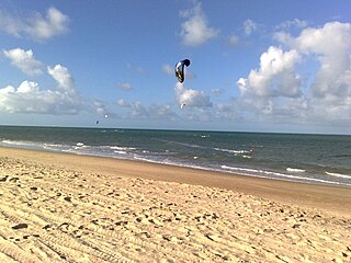
Caucaia is a Brazilian municipality in the state of Ceará As of 2015, it has a population of 353,932.

Curtești is a commune in Botoșani County, Romania. It is composed of seven villages: Agafton, Băiceni, Curtești, Hudum, Mănăstirea Doamnei, Orășeni-Deal and Orășeni-Vale.
Arquillinos is a municipality located in the province of Zamora, Castile and León, Spain. According to the 2004 census (INE), the municipality has a population of 161 inhabitants.
Berkenthin is an Amt in the district of Lauenburg, in Schleswig-Holstein, Germany. Its seat is in Berkenthin.
Parham, Ontario is located an hour north of Kingston, Ontario and two hours west of Canada’s capital, Ottawa, Ontario. It is located in Central Frontenac Township, which includes other small towns such as Godfrey, Sharbot Lake, Tichborne, and Hartington. Parham’s population is roughly 250, which classifies it as one of the smallest towns in the northern area.
Ayabaca District is one of ten districts of the province Ayabaca in Peru.
The Morse River is a river of the West Coast Region of New Zealand's South Island. It flows generally northwest from its source in the Strachan Range, reaching the Mahitahi River 14 kilometres south of Bruce Bay.
Anne Hill is the most prominent hill on Radian Ridge in the Royal Society Range of Victoria Land. It rises to 2,079 metres (6,820 ft) at the east side of Lava Tongue Pass. It was named after Anne C. Wright, a geologist with, firstly, the New Zealand Geological Survey field party in this area, 1977–78, then with United States Antarctic Research Program field parties, 1982–83, 1983–84, and 1985–86 seasons, with work at Ross Island, Minna Bluff, Mount Discovery, Mount Morning, and Mason Spur.

Arruiz Glacier is a tributary glacier in the Explorers Range of the Bowers Mountains in Victoria Land, Antarctica. It flows west-northwest from Stanwix Peak and enters Rennick Glacier north of Frolov Ridge. It was mapped by the United States Geological Survey from surveys and from U.S. Navy air photos, 1960–62, and named by the Advisory Committee on Antarctic Names for Lieutenant Alberto J. Arruiz, Argentine IGY observer, a Weather Central meteorologist at Little America V in 1958. The glacier lies on the Pennell Coast, a portion of Antarctica lying between Cape Williams and Cape Adare.
Brough Nunatak is a nunatak in the northwest part of Evans Piedmont Glacier, 4 nautical miles (7 km) west-southwest of Boney Point, Victoria Land. The USS Brough (DE-148) maintained an ocean weather station at 60°S170°E in support of aircraft flights between New Zealand and the Antarctic in Operation Deep Freeze II, III, and IV; three seasons, 1956–57 through 1958–59.
Whalers Bluff is a bluff rising sharply to 210 m east of Port Jebsen, Signy Island, in the South Orkney Islands. The name "Consulens Hat," of unknown origin, was applied to the highest point of the bluff on a 1913 chart by Norwegian whaling captain M. Thoralf Moe. The bluff was named in 1990 by the United Kingdom Antarctic Place-Names Committee (UK-APC) and calls to mind the earlier activities of whalers in this area.
Sverre Peak is a small peak 0.5 nautical miles (0.9 km) off the north end of Pettersen Ridge in the Conrad Mountains of Queen Maud Land. Discovered and photographed by the German Antarctic Expedition, 1938-39. Mapped by Norway from air photos and surveys by the Norwegian Antarctic Expedition, 1956–60, and named for Sverre Pettersen, steward with Norwegian Antarctic Expedition, 1957-58.
The Defile is a narrow ice-free passageway between the terminus of Suess Glacier and the talus-covered slope of Nussbaum Riegel in Taylor Valley, Victoria Land. It was charted and descriptively named by the British Antarctic Expedition, 1910–13, under Robert Falcon Scott.
Perplex Ridge is a ridge, rising over 915 m, composed of four rocky masses separated by small glaciers, extending 6 nautical miles (11 km) northeastward from Lainez Point along the northwest side of Pourquoi Pas Island, off the west coast of Graham Land. First sighted and roughly charted in 1909 by the French Antarctic Expedition under Charcot. It was surveyed in 1936 by the British Graham Land Expedition (BGLE) and in 1948 by the Falkland Islands Dependencies Survey (FIDS). So named by FIDS because of confusion in attempting to identify this ridge from earlier maps.
The Elgar Uplands are uplands rising to 1,900 metres (6,200 ft), between Tufts Pass to the north and Sullivan Glacier to the south, in the northern part of Alexander Island, Antarctica. They were first photographed from the air and roughly mapped by the British Graham Land Expedition in 1937. They were remapped from air photos taken by the Ronne Antarctic Research Expedition, 1947–48, by D. Searle of the Falkland Islands Dependencies Survey in 1960, and from U.S. Landsat imagery of February, 1975. They were named by the UK Antarctic Place-Names Committee after Sir Edward Elgar, the English composer (1857-1934).
Everson Ridge is a ridge extending from Jebsen Point to Tioga Hill on Signy Island. It was named by the UK Antarctic Place-Names Committee after Inigo Everson, a British Antarctic Survey biologist on Signy Island, 1965–66.
Stanwix Peak is a distinctive peak (2,240 m) which surmounts the south side of the head of Astapenko Glacier in the Bowers Mountains. The peak was used as a reference object by surveyor S. Kirkby, with the ANARE, 1962. Named by ANARE for Captain John Stanwix, helicopter pilot with the expedition.
Ring Rock is a rock lying 3.7 kilometres (2 nmi) southeast of Nost Island at the head of Holme Bay. Mapped by Norwegian cartographers from aerial photographs taken by the Lars Christensen Expedition, 1936–37, and named Ringoya. First visited in 1956 by an ANARE sledging party; they found that the term "rock" better describes this feature.


