| Bookham Knoll | |
|---|---|
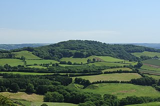
Horse Close Wood on Alton Common with Bookham Knoll behind. | |
| Highest point | |
| Elevation | 211 m (692 ft) [1] [2] |
| Prominence | 43 m (141 ft) [1] |
| Parent peak | Lewesdon Hill [1] |
| Listing | Tump |
| Coordinates | 50°50′25″N2°25′28″W / 50.84017°N 2.42454°W Coordinates: 50°50′25″N2°25′28″W / 50.84017°N 2.42454°W |
| Geography | |
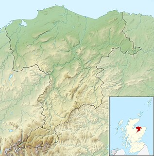
| Location | Dorset, England |
| Parent range | Dorset Downs |
| OS grid | ST702046 |
| Topo map | OS Landranger 194 |

Bookham Knoll is a rounded hill, 211 metres (692 ft) high, [1] about 1 kilometre southeast of the village of Buckland Newton in the county of Dorset in southern England. Its prominence of 43 metres (141 ft) qualifies it as one of the Tumps. [1] It is located within the Dorset Downs.

Buckland Newton is a village and civil parish in Dorset, England. It is situated in the West Dorset administrative district beneath the scarp slope of the Dorset Downs, 7 1⁄2 miles (12.1 km) south of Sherborne. In the 2011 census the civil parish had a population of 622. The village covers around 6000 acres.

Dorset is a county in South West England on the English Channel coast. The ceremonial county comprises the non-metropolitan county, which is governed by Dorset County Council, and the unitary authority areas of Poole and Bournemouth. Covering an area of 2,653 square kilometres (1,024 sq mi), Dorset borders Devon to the west, Somerset to the north-west, Wiltshire to the north-east, and Hampshire to the east. The county town is Dorchester which is in the south. After the reorganisation of local government in 1974 the county's border was extended eastward to incorporate the Hampshire towns of Bournemouth and Christchurch. Around half of the population lives in the South East Dorset conurbation, while the rest of the county is largely rural with a low population density.

England is a country that is part of the United Kingdom. It shares land borders with Wales to the west and Scotland to the north-northwest. The Irish Sea lies west of England and the Celtic Sea lies to the southwest. England is separated from continental Europe by the North Sea to the east and the English Channel to the south. The country covers five-eighths of the island of Great Britain, which lies in the North Atlantic, and includes over 100 smaller islands, such as the Isles of Scilly and the Isle of Wight.
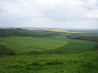
The hill is largely treeless farmland. It is bounded to the west by B3143, and on the other three sides by a minor road passing through the hamlets of Rew, Sharnhill Green and Bookham, after which it is named. To the east, beyond the lane, a tributary of the River Lydden rises below the col separating the knoll from Church Hill, the western spur of Ball Hill. The Wessex Ridgeway runs from east to west along the ridge formed by Ball and Church Hills and about a kilometre south of Bookham Knoll. [2]
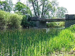
The River Lydden is a 15.25 miles (24.55 km) tributary of the River Stour that flows through Blackmore Vale in Dorset, England.

At 251 metres, Ball Hill is one of the highest hills in the county of Dorset, England, and is on the Wessex Ridgeway.

The Wessex Ridgeway is a long-distance footpath in southwest England. It runs 136 miles (219 km) from Marlborough in Wiltshire to Lyme Regis in Dorset, via the northern edge of Salisbury Plain and across Cranborne Chase. The footpath was opened in 1994.