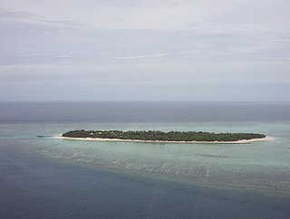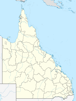
Hope Islands National Park is a national park in Queensland (Australia) 1,521 km north-west of Brisbane. The park consists of four islands: East Hope and West Hope, Snapper Island and Struck Island.

SS Yongala was a passenger steamship that was built in England in 1903 for the Adelaide Steamship Company. She sank in a cyclone off the coast of Queensland in 1911, with the loss of all 122 passengers and crew aboard.
Sir Charles Hardy Islands is in the reef of the same name adjacent to Pollard Channel & Blackwood Channel about 40 km east of Cape Grenville off Cape York Peninsula.
Magra Islet is off the coast of Queensland, Australia 15 km northeast of Cape Grenville in the Great Barrier Reef Marine Park. Situated on the north end of Cockburn reef, 2 1/2 km from Bootie Island; it is little more than a sandy shoal with little vegetation.
Pig Island is a small island in far north Queensland, Australia 19 km North East of Cape Grenville in the Great Barrier Reef Marine Park Queensland, Australia and is part of the Cockburn Islands Group. It is around 160 hectares or 1.6 square km in size.

Booby Island is located 45 km (28 mi) northwest of Muttee Heads at the tip of Cape York Peninsula in Queensland, Australia. This island is in the Torres Strait, 32 km (20 mi) west of Thursday Island and 23 km (14 mi) west of Prince of Wales Island. Booby Island is also known as Ngiangu by the Kaurareg people of the western Torres Strait, its traditional owners, named for the giant Ngiangu who was forced from a neighbouring island It has been called Booby Island by a number of European explorers, including Captain Cook, for the presence of the booby birds.
Neva was a three-masted barque launched in 1813. She made two voyages transporting convicts to Australia. On her second voyage carrying convicts she wrecked in Bass Strait on 13 May 1835. Her loss was one of the worst shipwrecks in Australian history; 224 people died.

Cape Grenville, is a small, east-facing promontory along the Queensland, Australia coast of Cape York Peninsula. It lies between Shelburne Bay to the north and Temple Bay to the south. The nearest significant settlement is Weipa, along the western coast of Cape York.

Elizabeth Reef, located at 29°57′25″S159°4′32″E, is a coral reef in the Coral Sea. The reef is separated by a deep oceanic pass, some 47 km wide, from nearby Middleton Reef, both of which are part of the underwater plateau known as the Lord Howe Rise. It is around 150 km from Lord Howe Island and 600 km from the New South Wales coast of Australia. The Environment, Sport and Territories Legislation Amendment Act 1997 included Elizabeth Reef in Australia's Coral Sea Islands Territory.

Loch Sloy was a Scottish sailing barque that operated between Great Britain and Australia from the late 19th century until 1899. Her name was drawn from Loch Sloy, a freshwater loch which lies to the north of the Burgh of Helensburgh, in the region of Argyll and Bute, Scotland. Ships Captains: 1877 - 1885 James Horne, 1885 – 1890 John McLean, 1890 – 1895 Charles Lehman, 1895 – 1896 James R. George, 1896 – 1899 William J. Wade, 1899 Peter Nicol.

The islands and reefs of the Capricorn and Bunker Group are situated astride the Tropic of Capricorn at the southern end of the Great Barrier Reef, approximately 80 kilometres east of Gladstone, which is situated on the central coast of the Gladstone Region, Queensland, Australia.

The Colony of Queensland was a colony of the British Empire from 1859 to 1901, when it became a State in the federal Commonwealth of Australia on 1 January 1901. At its greatest extent, the colony included the present-day State of Queensland, the Territory of Papua and the Coral Sea Islands Territory.
Sun was a brig built in 1819 at Sunderland and was condemned at the Cape of Good Hope in August 1822. She was repaired and began sailing east of the Cape. She was wrecked in May 1826 in the Torres Strait.

Charles Eaton was a barque, launched in 1833 for use as a merchant ship. Whilst under the command of Captain Fowle, she was wrecked in 1834 among the Torres Strait Islands, off the northern coast of Queensland, Australia, and her passengers and crew attacked and nearly all killed by Torres Strait Islanders on Mer Island. A cabin boy and small child survived and lived with the islanders until being rescued by Captain Lewis and crew on Isabella in June 1836, who also found skulls of some of the murdered people on a nearby island and took them back to Sydney for burial.
Deveron was launched at Sunderland in 1814. She initially traded with Argentina and then from 1822 with Van Diemen's Land. Her owner, William Wilson transferred her registry to Hobart. She traded with England, and between Hobart and Port Jackson. From 1830 she engaged in whaling off New Zealand. She was lost on 21 July 1833 while looking for whales off the Australian coast.


