
Westphalia is a region of northwestern Germany and one of the three historic parts of the state of North Rhine-Westphalia. It has an area of 20,210 square kilometres (7,800 sq mi) and 7.9 million inhabitants.

North Rhine-Westphalia, commonly shortened to NRW is a German state (Land) in Western Germany. With more than 17.9 million inhabitants, it is the most populous state of Germany. Covering an area of 34,084 square kilometres (13,160 sq mi), it is the fourth-largest German state by size. Apart from the city-states, it is also the most densely populated state in Germany.
Minden-Lübbecke is a Kreis (district) in the northeastern part of North Rhine-Westphalia, Germany. Neighboring districts are Diepholz, Nienburg, Schaumburg, Lippe, Herford, Osnabrück.
Höxter is a Kreis (district) in the east of North Rhine-Westphalia, Germany. Neighboring districts are Holzminden, Northeim, Kassel, Waldeck-Frankenberg, Hochsauerland, Paderborn, and Lippe.
Paderborn is a Kreis (district) in the east of North Rhine-Westphalia, Germany. Neighboring districts are Gütersloh, Lippe, Höxter, Hochsauerland, and Soest.
Lippe is a Kreis (district) in the east of North Rhine-Westphalia, Germany. Neighboring districts are Herford, Minden-Lübbecke, Höxter, Paderborn, Gütersloh, and district-free Bielefeld, which forms the region Ostwestfalen-Lippe.
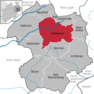
Paderborn is a city in eastern North Rhine-Westphalia, Germany, capital of the Paderborn district. The name of the city derives from the river Pader and Born, an old German term for the source of a river. The river Pader originates in more than 200 springs near Paderborn Cathedral, where St. Liborius is buried.

Lippstadt is a town in North Rhine-Westphalia, Germany. It is the largest town within the district of Soest. Lippstadt is situated about 60 kilometres east of Dortmund, 40 kilometres south of Bielefeld and 30 kilometres west of Paderborn.
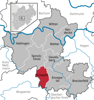
Schwelm is a town in the district of Ennepe-Ruhr-Kreis in the administrative region of Arnsberg within the state of North Rhine-Westphalia.

Ruppichteroth is a municipality in the Rhein-Sieg district, in the southern part of North Rhine-Westphalia, Germany. It is located approximately 30 kilometers east of Bonn.
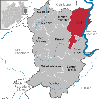
Höxter is a town in eastern North Rhine-Westphalia, Germany on the left bank of the river Weser, 52 km north of Kassel in the centre of the Weser Uplands. The main town's population is around 15,000, and with outlying centres, about 30,000. It is the seat of the Höxter district. Historical place names of Höxter are Hoxer and Huxaria.
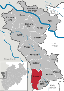
Straelen is a municipality in the district of Cleves, in North Rhine-Westphalia, Germany. It is located near the border with the Netherlands, approx. 10 km north-east of Venlo.

Rheda-Wiedenbrück is a city in the district of Gütersloh, in North Rhine-Westphalia, Germany.

Verl is a town in the district of Gütersloh in the state of North Rhine-Westphalia, Germany. It is approximately 15 km south of Bielefeld and 10 km east of Gütersloh.
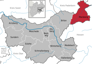
Marsberg is a town in the Hochsauerland district, in North Rhine-Westphalia, Germany.

Büren is a municipality in the district of Paderborn, in North Rhine-Westphalia, Germany.

Lichtenau is a municipality in the district of Paderborn, in North Rhine-Westphalia, Germany.

Altenbeken is a municipality in the district of Paderborn, in North Rhine-Westphalia, Germany.
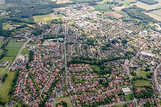
Ostbevern is a municipality in the district of Warendorf, in North Rhine-Westphalia, Germany.

Atteln is a village in the district of Paderborn, in North Rhine-Westphalia, Germany. Formerly an independent municipality, it is part of the town Lichtenau since 1975.


