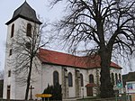
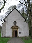
Goslar is a district in Lower Saxony, Germany. It is bounded by the districts of Göttingen, Northeim, Hildesheim and Wolfenbüttel, the city of Salzgitter, and by the states of Saxony-Anhalt and Thuringia (Nordhausen).

Bozhurishte is a town in western Bulgaria. It is the administrative center of Bozhurishte Municipality in Sofia Province; close to Kostinbrod and the capital Sofia. The old airport of Sofia, now a military one, is near the town. Bozhurishte was first mentioned in 1750. Its name is derived from the flower peony.

Altenau is a town and a former municipality in the district of Goslar, in Lower Saxony, Germany. Since 1 January 2015 it is part of the town Clausthal-Zellerfeld.

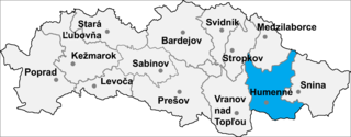
Rohožník is a small village and municipality in Humenné District in the Prešov Region of north-east Slovakia.

M/S Piłsudski was a medium-size ocean liner of the Polish Merchant Marine, named for Marshal Józef Piłsudski, a national hero of Poland. She was built in Italy for the enterprise called PTTO, later Gdynia-Ameryka Linie Zeglugowe, with part of the payment being shipments of coal from Poland. Launched in December 1934, her tonnage was 14,294 tons gross, with a length of 162 metres (531 ft) and a beam of 71 ft. She was propelled by two diesel engines driving two screws, giving a speed of 18 knots.

The Tampere Theatre is one of the two main active theatres in Tampere, Finland, along with the Tampere Workers' Theatre. The theatre was started in 1904.

The Judicial Arrondissement of Eupen is a judicial arrondissement located in the Walloon Province of Liège, in Belgium. It comprises the 9 municipalities of the German-speaking Community. It is not an administrative arrondissement. All of its municipalities are a part of the Administrative Arrondissement of Verviers, which is divided into two judicial arrondissements.
Onwaard is a former municipality in the Dutch province of South Holland. It was located east of the village of Melissant on the island Goeree-Overflakkee. The municipality contained no villages nor hamlets; only a few farms. It consisted of a number of small polders: Onwaard, Oud-Kraaijer, Kraaijenisse, and part of the Nieuw-Kraaijer polder.

Łapiguz is a village in the administrative district of Gmina Zamość, within Zamość County, Lublin Voivodeship, in eastern Poland. It lies approximately 5 kilometres (3 mi) north of Zamość and 74 km (46 mi) south-east of the regional capital Lublin.

Ostrówek is a village in the administrative district of Gmina Radomyśl nad Sanem, within Stalowa Wola County, Podkarpackie Voivodeship, in south-eastern Poland.

Nowe Żabno is a village in the administrative district of Gmina Nowa Sól, within Nowa Sól County, Lubusz Voivodeship, in western Poland. It lies approximately 5 kilometres (3 mi) south of Nowa Sól and 25 km (16 mi) south-east of Zielona Góra.

Kłanino is a village in the administrative district of Gmina Krokowa, within Puck County, Pomeranian Voivodeship, in northern Poland. It lies approximately 6 kilometres (4 mi) east of Krokowa, 13 km (8 mi) north-west of Puck, and 51 km (32 mi) north-west of the regional capital Gdańsk.

Kursztyn is a village in the administrative district of Gmina Gniew, within Tczew County, Pomeranian Voivodeship, in northern Poland. It lies approximately 7 kilometres (4 mi) north-west of Gniew, 25 km (16 mi) south of Tczew, and 55 km (34 mi) south of the regional capital Gdańsk.

Surzyki Wielkie is a village in the administrative district of Gmina Małdyty, within Ostróda County, Warmian-Masurian Voivodeship, in northern Poland. It lies approximately 11 kilometres (7 mi) south of Małdyty, 20 km (12 mi) north-west of Ostróda, and 49 km (30 mi) west of the regional capital Olsztyn.

Smólsko is a settlement in the administrative district of Gmina Resko, within Łobez County, West Pomeranian Voivodeship, in north-western Poland. It lies approximately 5 kilometres (3 mi) south of Resko, 21 km (13 mi) north-west of Łobez, and 66 km (41 mi) north-east of the regional capital Szczecin.
Īvande Parish is an administrative unit of Kuldīga Municipality, Latvia. The parish had a population of 399 on 1 July 2010 and covers an area of 71.11 km2.

Laukkai is the capital of Kokang in the northern part of Shan State, Burma. It is situated on the Salween River, which forms Burma's border with the People's Republic of China. It is about 10 miles away from Nansan, China. In Laukkai, the south-western dialect of Mandarin and Chinese characters are widely used, and the Chinese renminbi is in circulation. It is the main town of Laukkaing Township of the Kokang Self-Administered Zone. It is 117 miles and 7 furlongs from Lashio and 42 miles from Kongyan.

Gubavce is a village in the municipality of Medveđa, Serbia. According to the 2002 census, the village has a population of 36 people.

Kukavice is a village in the Republika Srpska, Bosnia and Herzegovina. According to the 1991 census, the village is located in the municipality of Rogatica.

Borovac is a village in the municipality of Sokolac, Bosnia and Herzegovina.


