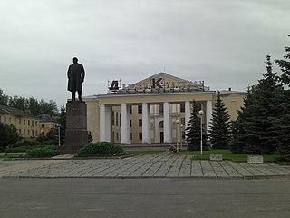
Leningrad Oblast is a federal subject of Russia. The oblast has an area of 84,500 square kilometres (32,600 sq mi) and a population of 2,000,997 ; up from 1,716,868 recorded in the 2010 Census. Leningrad Oblast is highly industrialized. Its administrative center and largest city is Gatchina.

Ivangorod is a town in Kingiseppsky District of Leningrad Oblast, Russia, located on the east bank of the Narva river which flows along the Estonia–Russia international border, 159 kilometers (99 mi) west of Saint Petersburg, 218 kilometers (135 mi) east of Tallinn, Estonia. The town's population was recorded as 9,854 (2010 Russian census); 11,206 (2002 Census); 11,833 (1989 Soviet census).
Krasny Bor is an urban locality in Tosnensky District of Leningrad Oblast, Russia, located 20 kilometers (12 mi) southeast of the center of St. Petersburg. Population: 5,033 (2010 Russian census); 4,877 (2002 Census); 5,791 (1989 Soviet census).

Slantsy is a town and the administrative center of Slantsevsky District in Leningrad Oblast, Russia, located on the Plyussa River, 192 kilometers (119 mi) west of St. Petersburg. Population: 33,485 (2010 Russian census); 37,371 (2002 Census); 43,087 (1989 Soviet census)..

Sinyavino is an urban locality in Kirovsky District of Leningrad Oblast, Russia, located several kilometers inland from the southern shore of Lake Ladoga, 58 kilometers (36 mi) east of St. Petersburg and 8 kilometers (5.0 mi) east from Kirovsk. Municipally it is incorporated as Sinyavinskoye Urban Settlement, one of the eight urban settlements in the district. Population: 3,784 (2010 Russian census); 3,611 (2002 Census); 1,949 (1989 Soviet census).

Mga is an urban locality in Kirovsky District of Leningrad Oblast, Russia. Population: 10,212 (2010 Russian census); 9,613 (2002 Census); 9,852 (1989 Soviet census).

Kirovsk is a town and the administrative center of Kirovsky District in Leningrad Oblast, Russia, located on the left bank of the Neva River, 33 kilometers (21 mi) east of St. Petersburg. Population: 25,650 (2010 Russian census); 24,361 (2002 Census); 23,655 (1989 Soviet census).

Vyborgsky District is an administrative and municipal district (raion), one of the seventeen in Leningrad Oblast, Russia. It is located in the northwest of the oblast on the Karelian Isthmus and borders with Priozersky District in the northeast, Vsevolozhsky District in the east, Kurortny District of the federal city of St. Petersburg in the south, Kymenlaakso and South Karelia regions of Finland in the northwest, and Lakhdenpokhsky District of the Republic of Karelia in the north. From the southwest, the district is limited by the Gulf of Finland. The area of the district is 7,475.472 square kilometers (2,886.296 sq mi). Its administrative center is the town of Vyborg. Population : 120,446 (2010 Russian census); 113,748 ; 108,571 (1989 Soviet census).

Kuznechnoye is an urban locality in the northern part of Priozersky District of Leningrad Oblast, located on the Karelian Isthmus. Population: 4,458 (2010 Russian census); 4,738 (2002 Census); 5,017 (1989 Soviet census).
Sovetsky is an urban locality in Vyborgsky District of Leningrad Oblast, Russia. It is situated on the eastern shore of the Gulf of Vyborg on the Karelian Isthmus. Population: 7,131 (2010 Russian census); 6,607 (2002 Census); 6,471 (1989 Soviet census).

Lebyazhye is an urban locality in Lomonosovsky District of Leningrad Oblast, Russia, located on the coast of the Gulf of Finland 25 kilometers (16 mi) west of Lomonosov and 30 kilometers (19 mi) east of Sosnovy Bor. Population: 4,729 (2010 Russian census); 5,600 (2002 Census); 5,340 (1989 Soviet census).

Ulyanovka is an urban locality in Tosnensky District of Leningrad Oblast, Russia, located approximately 40 kilometres (25 mi) southeast of the center of Saint Petersburg. Municipally it is incorporated as Ulyanovskoye Urban Settlement, one of the seven urban settlements in the district. Population: 11,601 (2010 Russian census); 9,244 (2002 Census); 9,595 (1989 Soviet census).

Kingiseppsky District is an administrative and municipal district (raion), one of the seventeen in Leningrad Oblast, Russia. It is located in the southwest of the oblast and borders with Ida-Viru County of Estonia in the west, Lomonosovsky District in the northeast, Volosovsky District in the east, and with Slantsevsky District in the south. In the north and northwest it is washed by the waters of the Gulf of Finland. The area of the district is 2,908 square kilometers (1,123 sq mi). Its administrative center is the town of Kingisepp. Population : 19,830 (2010 Russian census); 20,408 ; 34,081 (1989 Soviet census).. Including the entire district: 78,183 (2010 Russian census);.

Slantsevsky District is an administrative and municipal district (raion), one of the seventeen in Leningrad Oblast, Russia. It is located in the southwest of the oblast and borders with Ida-Viru County of Estonia in the west, Kingiseppsky District in the north, Volosovsky District in the northeast, Luzhsky District in the east, Plyussky District of Pskov Oblast in the south, and Gdovsky District, also of Pskov Oblast, in the southwest. The area of the district is 2,191.1 square kilometers (846.0 sq mi). Its administrative center is the town of Slantsy. Population : 10,038 (2010 Russian census); 10,480 ; 10,974 (1989 Soviet census).

Gdovsky District is an administrative and municipal district (raion), one of the twenty-four in Pskov Oblast, Russia. It is located in the northwest of the oblast and borders with Slantsevsky District of Leningrad Oblast in the north, Plyussky District in the east, Strugo-Krasnensky District in the southeast, and with Pskovsky District in the south. Lake Peipus forms the border with Estonia in the west. The area of the district is 3,400 square kilometers (1,300 sq mi). Its administrative center is the town of Gdov. Population: 12,792 (2010 Russian census); 17,715 ; 19,842 (1989 Soviet census). The population of Gdov accounts for 34.2% of the district's total population.

Pskovsky District is an administrative and municipal district (raion), one of the twenty-four in Pskov Oblast, Russia. It is located in the northwest of the oblast and borders with Gdovsky District in the north, Strugo-Krasnensky District in the northeast, Porkhovsky District in the east, Ostrovsky District in the south, and with Palkinsky and Pechorsky Districts in the southwest. Lake Peipus forms the border with Estonia in the west. The area of the district is 3,600 square kilometers (1,400 sq mi). Its administrative center is the city of Pskov. Population: 34,323 (2010 Russian census); 37,216 ; 37,557 (1989 Soviet census).

Vazhiny is an urban locality in Podporozhsky District of Leningrad Oblast, Russia, located on the right bank of the Svir River at the mouth of the Vazhinka River, several kilometers northwest of the town of Podporozhye. Municipally, it is incorporated as Vazhinskoye Urban Settlement, one of the four urban settlements in the district. Population: 2,754 (2010 Russian census); 2,941 (2002 Census); 3,956 (1989 Soviet census).
Priladozhsky is an urban locality in Kirovsky District of Leningrad Oblast, Russia, located 3 kilometres (1.9 mi) from the southern shore of Lake Ladoga, on the left bank of the Naziya River, 10 kilometres (6.2 mi) east of the town of Kirovsk. Municipally, together with the village of Naziya, it is incorporated as Priladozhskoye Urban Settlement, one of the eight urban settlements in the district. Population: 5,757 (2010 Russian census); 5,185 (2002 Census); 5,280 (1989 Soviet census).
Naziya is an urban locality in Kirovsky District of Leningrad Oblast, Russia, located on the left bank of the Lava River and on the right bank of the Kovra River, east of the town of Kirovsk. Municipally it is incorporated as Naziyevskoye Urban Settlement, one of the eight urban settlements in the district. Population: 4,858 (2010 Russian census); 5,755 (2002 Census); 7,712 (1989 Soviet census).

The Latvia–Russia border is the state border between Republic of Latvia and the Russian Federation. The length of the border is 214 kilometres (133 mi). Since 2004, it became an eastern part of external border of the European Union, Schengen Area and NATO.


