Hereford is a cathedral city, civil parish and the county town of Herefordshire, England. It lies on the River Wye, approximately 16 miles (26 km) east of the border with Wales, 24 miles (39 km) south-west of Worcester and 23 miles (37 km) north-west of Gloucester. With a population of 60,800, it is by far the largest settlement in Herefordshire.

Shropshire is a landlocked historic county in the West Midlands region of England. It is bordered by Wales to the west and the English counties of Cheshire to the north, Staffordshire to the east, Worcestershire to the southeast, and Herefordshire to the south. A unitary authority of the same name was created in 2009, taking over from the previous county council and five district councils, now governed by Shropshire Council. The borough of Telford and Wrekin has been a separate unitary authority since 1998, but remains part of the ceremonial county.

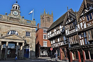
Ludlow is a market town in Shropshire, England. The town is significant in the history of the Welsh Marches and in relation to Wales. It is located 28 miles (45 km) south of Shrewsbury and 23 miles (37 km) north of Hereford, on the A49 road which bypasses the town. The town is near the confluence of the rivers Corve and Teme. The oldest part is the medieval walled town, founded in the late 11th century after the Norman conquest of England. It is centred on a small hill which lies on the eastern bank of a bend of the River Teme. Situated on this hill are Ludlow Castle and the parish church, St Laurence's, the largest in the county. From there the streets slope downward to the rivers Corve and Teme, to the north and south respectively. The town is in a sheltered spot beneath Mortimer Forest and the Clee Hills, which are clearly visible from the town.

Hay-on-Wye, often abbreviated in the community to just "Hay" Welsh: Y Gelli, is a market town and community in Powys, Wales; it was historically in the county of Brecknockshire. With over twenty bookshops, it is often described as "the town of books"; it is both the National Book Town of Wales and the site of the annual Hay Festival.

Powys is a county and preserved county in Wales. It is named after the Kingdom of Powys which was a Welsh successor state, petty kingdom and principality that emerged during the Middle Ages following the end of Roman rule in Britain.
The Welsh Marches is an imprecisely defined area along the border between England and Wales in the United Kingdom. The precise meaning of the term has varied at different periods.

The River Wye is the fourth-longest river in the UK, stretching some 250 kilometres from its source on Plynlimon in mid Wales to the Severn estuary. For much of its length the river forms part of the border between England and Wales. The Wye Valley is designated an Area of Outstanding Natural Beauty. The Wye is important for nature conservation and recreation, but is severely affected by pollution.

Kington is a market town, electoral ward and civil parish in Herefordshire, England. According to the Parish, the ward had a population of 3,240, while the 2011 Census registered a population of 2,626.

The River Teme rises in Mid Wales, south of Newtown, and flows southeast roughly forming the border between England and Wales for several miles through Knighton before entering England in the vicinity of Bucknell and continuing east to Ludlow in Shropshire. From there, it flows to the north of Tenbury Wells on the Shropshire/Worcestershire border on its way to join the River Severn south of Worcester. The whole of the River Teme was designated as an SSSI by English Nature in 1996.

Hereford and Worcester was an English non-metropolitan county created on 1 April 1974 by the Local Government Act 1972 from the areas of the former administrative county of Herefordshire, most of Worcestershire and the county borough of Worcester. An aim of the Act was to increase efficiency of local government: the two counties are among England's smaller and less populous counties, particularly after the same Act transferred some of Worcestershire's most urbanised areas to the West Midlands.

Herefordshire is a county in the West Midlands of England, governed by Herefordshire Council. It is bordered by Shropshire to the north, Worcestershire to the east, Gloucestershire to the south-east, and the Welsh counties of Monmouthshire and Powys to the west.

Sir William David Wiggin is a British Conservative Party politician, and a former Shadow Minister for Agriculture & Fisheries. He has been the Member of Parliament (MP) for North Herefordshire, previously Leominster, since the 2001 general election.

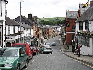
Knighton is a border market town and community in Powys, Wales and Shropshire, England, on the River Teme. It lies on the England–Wales border. The Teme is not navigable in its higher reaches and the border does not follow its course exactly. Originally an Anglo-Saxon settlement, Knighton is located on Offa's Dyke, the ancient earthwork that divided the two countries. It later became a Norman defensive border town.
The history of Herefordshire starts with a shire in the time of Athelstan (895–939), and Herefordshire is mentioned in the Anglo-Saxon Chronicle in 1051. The first Anglo-Saxon settlers, the Magonsætan, were a sub-tribal unit of the Hwicce who occupied the Severn valley. The Magonsætan were said to be in the intervening lands between the Rivers Wye and Severn. The undulating hills of marl clay were surrounded by the Welsh mountains to the west; the Malvern Hills to the east; the Clent Hills of the Shropshire borders to the north, and the indeterminate extent of the Forest of Dean to the south. The shire name first recorded in the Anglo-Saxon Chronicle was derived from "Here-ford", Old English for "Army crossing", the location for the city.
Shropshire was established during the division of Saxon Mercia into shires in the 10th century. It is first mentioned in 1006. After the Norman Conquest it experienced significant development, following the granting of the principal estates of the county to eminent Normans, such as Roger De Montgomery and his son Robert de Bellême.
Clun Forest is a remote, rural area of open pastures, moorland and mixed deciduous/coniferous woodland in the southwest part of the English county of Shropshire and also just over the border into Powys, Wales.

Eardisley is a village and civil parish in Herefordshire about 4.5 miles (7.2 km) south of the centre of Kington. Eardisley is in the Wye valley in the northwest of the county, close to the border with Wales.

The Hereford and Worcester Fire and Rescue Service (HWFRS) is the statutory fire and rescue service covering Herefordshire and Worcestershire in the West Midlands region of England. The service covers an area of 1,514 square miles (3,920 km2), and a population of around 780,000 people.

The England–Wales border, sometimes referred to as the Wales–England border or the Anglo-Welsh border, runs for 160 miles (260 km) from the Dee estuary, in the north, to the Severn estuary in the south, separating England and Wales.

Blott on the Landscape is a 1985 BBC TV series, adapted by Malcolm Bradbury from the 1975 Tom Sharpe novel of the same name. It was broadcast on BBC2 in six episodes of 50 minutes each between 6 February and 13 March 1985.


