
Kurla is a suburb of East Mumbai, India. It is the headquarters of the Kurla taluka of Mumbai Suburban district. The neighbourhood is named after the eponymous East Indian village that it grew out of. It falls under Zone 5, Ward 'L' of the Bombay Municipal Corporation. Its railway station, spelt as Coorla until 1890, is one of the busiest on the Mumbai suburban railway on the central and harbour railway lines of Mumbai as is the Lokmanya Tilak Terminus (LTT) for out-station passenger/express trains.

Simdega is a city in the Indian state of Jharkhand. Simdega is the administrative headquarters of the eponymous district and Subdivision. The city stands at an elevation of approximately 418 metres (1371 feet) above sea level and covers an area of 3,750 km2 (1,450 sq mi). Bounded in the north by Gumla, on the east by Ranchi and West Singhbhum, on the west by Jashpur Nagar, Chhattisgarh and on the south by Rourkela, Odisha. The distance between Rourkela and Simdega is 83 km. It is accessible by road through National Highways from Rourkela and Ranchi. The nearest railway station is Bano railway station.
Christianity is India's third-largest religion with about 26 million adherents, making up 2.3 percent of the population as of the 2011 census. The written records of the Saint Thomas Christians state that Christianity was introduced in the Indian subcontinent by Thomas the Apostle, who sailed to the Malabar region in the present-day Kerala state in 52 AD.

Whiteabbey is a townland in Newtownabbey, north of Belfast in County Antrim, Northern Ireland.
Ahmednagar district is the largest district of Maharashtra state in western India. The historical Ahmednagar city, is the headquarters of the district. Ahmednagar and Sangamner are largest cities in the district. It was the seat of the Ahmednagar Sultanate of late medieval period. This district is known for the towns of Shirdi associated with Sai Baba, Meherabad associated with Meher Baba, Shani Shinganapur with Shanidev, and Devgad with Lord Dattatreya. Ahmednagar district is part of Nashik Division. The district is bordered by Aurangabad district to the northeast, Nashik district to the northwest, Thane and Pune districts to the southwest, Solapur district to the south and Beed district to the southeast.

The First Ward of Houston, which is located inside the 610 Loop, is one of the city's historic wards. It was originally the center of the business district for the city, and was strategically located at the intersection of Buffalo Bayou and White Oak Bayou, near an area now known as Allen's Landing. It was one of the original four wards in Houston when it was created in 1840. It was defined as all area within the city limits of Houston north of Congress Street and west of Main Street.
Parassala (Malaynam:പാറശ്ശാല) is a small town located near the border of Kerala and Tamil Nadu.It comes under Thiruvananthapuram district at southern tip of Kerala. It is situated 34 km south of state capital Thiruvananthapuram in Kerala, bordering Tamil Nadu.
Uvari is a coastal village in Thisayanvilai Taluk, Tirunelveli district, Tamil Nadu, India. It is also called Karaichuthu Uvari. The total geographical area of the Uvari is around 3 km2 (1.2 sq mi).
Mazhuvannoor is a panchayat village in the Ernakulam district of Kerala, India. It is located in the Kunnathunad taluk. It is located near the town of Kolenchery. The panchayat headquarters are located at Airapuram.
Kallorkkad is a village in Ernakulam district, in the Indian state of Kerala. Most of its people are either farmers or engaged in small-scale business.
Mookkannoor is a village in the Ernakulam district in the Indian state of Kerala. The nearest city is Angamaly (6 km). The nearest airport is Cochin International Airport (13 km)
Onakkoor is a village in Ernakulam district in the Indian state of Kerala. The main attractions in the village are Onakkoor River and Onakkoor Temple. Other attractions include Edayan Lake and Onakkoor check dam. Famous writer George Onakkoor is associated with this village. The SH-42 Highway passes through Onakkoor. Piravom is the nearest town with markets and hospitals. The dominant religions are Hinduism and Christianity.

Cherukunnu is a census town in Kannur district in the Indian state of Kerala. Cherukunnu town is located on Valapattanam-Pappinisseri-Pazhayangadi main road, situated to the south of the Pazhayangadi in Kannur District in Kerala.
Euphrasia Eluvathingal was an Indian Carmelite nun of the Syro-Malabar Church, which is an Eastern Catholic Church in Kerala. Euphrasia is said to have had a vision of the Holy Family, at which point the illness she had long felt ceased. She was canonised as a saint by Pope Francis on 23 November 2014 in Vatican City. Since the beheading of St. John the Baptist is celebrated on August 29, the feast of St. Euphrasia is postponed to August 30 .
Christianity is a minority religion in Chhattisgarh, a state of India. Chhattisgarh is within the area of the Church of North India. The Roman Catholic Archdiocese of Raipur has its seat in the province. The suffragan dioceses with seat in Chhattisgarh are the Syro-Malabar Catholic Diocese of Jagdalpur, the Roman Catholic Diocese of Ambikapur, the Roman Catholic Diocese of Jashpur and the Roman Catholic Diocese of Raigarh. Jyotipur has several Protestant churches. Chhattisgarh is part of the newly formed Syro-Malankara Catholic Diocese of Gurgaon. Janjgir Mennonite Church was founded in the early 20th century. Dhamtari is the seat of the headquarters of the Mennonite Church in India and of Mennonite Higher Secondary Schools. Champa Christian Hospital was started by the Mennonite Mission USA in 1926. Believers Church of India is active in Chhattisgarh. Bilaspur has a Disciples of Christ Church. Jagdalpur has a Christ College. Many people in the state are Adivasi. Chhattisgarh has anti-conversion legislation.
Telugu Christians or Telugu Kraistava are a religious community who form the third-largest religious minority in the Indian states of Andhra Pradesh and Telangana. According to the Census of India, there are over a million Christians in Andhra Pradesh, constituting 1.51% of the state's population, although a decrease from the 1971 census figure which was 2%, as a result of low birth rates and emigration. Most Telugu Christians are Protestant, belonging to major Indian Protestant denominations such as the predominant Anglican Church of South India, Pentecostals such as Assemblies of God in India, India Pentecostal Church of God, The Pentecostal Mission, the Andhra Evangelical Lutheran Church, the Samavesam of Telugu Baptist Churches, the Salvation Army and several others. There also is a significant number of Roman Catholics and Evangelicals. Although the Franciscans of the Roman Catholic Church brought Christianity to the Deccan area in 1535, it was only after 1759 AD, when the Northern Circars came under the rule of the East India Company, that the region opened up to greater Christian influence. The first Protestant missionaries in Andhra Pradesh were Rev. Cran and Rev. Des Granges who were sent out by the London Missionary Society. They set up their station at Visakhapatnam in 1805 AD. Regions with significant populations of Telugu Christians include the erstwhile Northern Circars, the coastal belt and the cities of Hyderabad and Secunderabad. Telugu Christians have one of the highest literacy and work participation figures and most even male-to-female ratio figures among the various religious communities in the state.

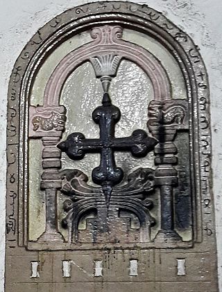
Malayattoor is a village in Aluva taluk around 15 km (9 mi) north-east of Angamaly in Ernakulam District in the state of Kerala in South India. The name 'Malayattoor' is an amalgamation of the words mala (mountain) arr (river), and oore (place).
The predominant religion of Nagaland is Christianity. The state's population is 1,978,502, as of 2011, out of which 87.93% are Christians. The 2011 census recorded the state's Christian population at 1,745,181, making it, with Meghalaya, Arunachal Pradesh, and Mizoram as the four Christian-majority states in India. The state has a very high church attendance rate in both urban and rural areas. Huge churches dominate the skylines of Kohima, Chümoukedima, Dimapur and Mokokchung.
Kuttoor is a village in Thiruvalla Taluk, Pathanamthitta district in the Indian state of Kerala.Kuttoor panchayathu which is under Thiruvalla assembly constituency and Pulikkizhu block panchayathu.

Biswanath is an administrative district in the state of Assam in India. It is one of newly created district in the year by 2015, declared by Assam Chief Minister Tarun Gogoi on 15 August 2015. The district is now part of Sonitpur district.

