This article needs additional citations for verification . (September 2012) (Learn how and when to remove this template message) |
Boridi | |
---|---|
Coordinates: 9°05′15″S147°38′16″E / 9.0874°S 147.6378°E | |
Country | Papua New Guinea |
Province | Central Province |
District | Kairuku-Hiri District |
LLG | Koiari Rural LLG |
Elevation | 5 m (16 ft) |
Population (2000) | |
• Total | 115 |
Languages | |
• Main languages | English, Tok Pisin, Koiari |
• Traditional language | Koiari |
Time zone | AEST (UTC+10) |
Location | 67 km (42 mi) NE of Port Moresby |
Climate | Cfb |
Boridi is a village in the Owen Stanley Range in Central Province, Papua New Guinea. [1]
Owen Stanley Range is the south-eastern part of the central mountain-chain in Papua New Guinea.
Papua New Guinea, officially the Independent State of Papua New Guinea, is an Oceanian country that occupies the eastern half of the island of New Guinea and its offshore islands in Melanesia, a region of the southwestern Pacific Ocean north of Australia. Its capital, located along its southeastern coast, is Port Moresby. The western half of New Guinea forms the Indonesian provinces of Papua and West Papua.
Boridi is a Koiari village; the Koiaris are famous for serving as carriers for the Australian Army during WWII, along the Kokoda Track (Papua New Guineans from Kokoda and to the west were aligned with the Japanese). It is a mountainous area thick with forest.
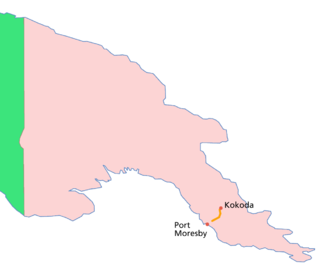
The Kokoda Track or Trail is a single-file foot thoroughfare that runs 96 kilometres (60 mi) overland – 60 kilometres (37 mi) in a straight line – through the Owen Stanley Range in Papua New Guinea. The track was the location of the 1942 World War II battle between Japanese and Allied – primarily Australian – forces in what was then the Australian territory of Papua.
Boridi is a remote village; not being along the Track, it misses out on the development that other track-side villages are experiencing with the increasing number of tourists. The nearest airstrip is in Milei, a 1-hour hike away for locals. There is no aid post (the nearest medical aid would be at Kagi or Efogi). There is a Seventh-day Adventist Church.
Efogi is a town in the Central Province of Papua New Guinea. It is served by air via Efogi Airport.
The Seventh-day Adventist Church is a Protestant Christian denomination which is distinguished by its observance of Saturday, the seventh day of the week in Christian and Jewish calendars, as the Sabbath, and its emphasis on the imminent Second Coming (advent) of Jesus Christ. The denomination grew out of the Millerite movement in the United States during the mid-19th century and it was formally established in 1863. Among its founders was Ellen G. White, whose extensive writings are still held in high regard by the church.
The village is set up around a large quadrangle which serves as a community sports field (soccer and volleyball are very popular); houses line the edge of the field. There are usually several buildings to a household: a kitchen, a building for sleeping, and usually a pitpit/drop toilet. Buildings are made out of bush materials; modern materials have not made their way up here yet, partly because they are expensive and the villagers have limited access to cash; and partly because the mountainous terrain makes it extremely difficult to transport large items.
The main cash crop is coffee. In previous years a coffee buyer from Port Moresby would charter a plane to Millea and locals would load it with bags of coffee beans, which would then be flown to Port Moresby to be sold. However, in 2006 there was no coffee buyer to fund the plane and so locals did not harvest the coffee. Recently rice has been introduced as another crop, but only a small amount is being grown at the moment. The community has a rice mill; what is harvested is used for food, or sold to people in nearby villages (there are no trade stores in the area; the nearest place to buy store goods is Port Moresby, two days and one night's hike away).
Coffee is a brewed drink prepared from roasted coffee beans, the seeds of berries from certain Coffea species. The genus Coffea is native to tropical Africa and Madagascar, the Comoros, Mauritius, and Réunion in the Indian Ocean. Coffee plants are now cultivated in over 70 countries, primarily in the equatorial regions of the Americas, Southeast Asia, Indian subcontinent, and Africa. The two most commonly grown are C. arabica and C. robusta. Once ripe, coffee berries are picked, processed, and dried. Dried coffee seeds are roasted to varying degrees, depending on the desired flavor. Roasted beans are ground and then brewed with near-boiling water to produce the beverage known as coffee.
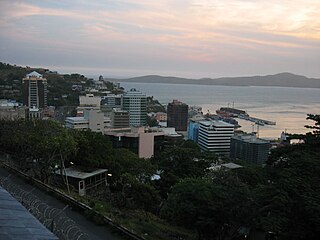
Port Moresby, also referred to as Pom City or simply Moresby, is the capital and largest city of Papua New Guinea and the largest city in the South Pacific outside of Australia and New Zealand. It is located on the shores of the Gulf of Papua, on the south-western coast of the Papuan Peninsula of the island of New Guinea. The city emerged as a trade centre in the second half of the 19th century. During World War II it was a prime objective for conquest by the Imperial Japanese forces during 1942–43 as a staging point and air base to cut off Australia from Southeast Asia and the Americas.
Transport in Papua New Guinea is in many cases heavily limited by the mountainous terrain. The capital, Port Moresby, is not linked by road to any of the other major towns and many highland villages can only be reached by light aircraft or on foot.
The economy of Papua New Guinea is largely underdeveloped. It is dominated by the agricultural, forestry, and fishing sector and the minerals and energy extraction sector. The agricultural, forestry, and fishing sector accounts for most of the labour force of Papua New Guinea, while the minerals and energy extraction sector is responsible for most of the export earnings.
Oro Province, formerly Northern Province, is a coastal province of Papua New Guinea. The provincial capital is Popondetta. The province covers 22,800 km2, and has 176,206 inhabitants. The province shares land borders with Morobe Province to the northwest, Central Province to the west and south, and Milne Bay Province to the southeast. The province is located within the Papuan Peninsula.
Tourism in Papua New Guinea is a fledgling industry but there are attractions for the potential visitor which include culture, markets, festivals, diving, surfing, hiking, fishing and the unique flora and fauna. Papua New Guinea receives an increasing number of visitors each year, with approximately 184,000 international arrivals in 2015.
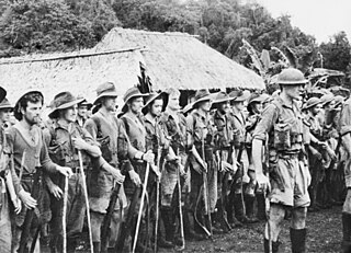
The Fuzzy Wuzzy Angels was the name given by Australian soldiers to Papua New Guinean war carriers who, during World War II, were recruited to bring supplies up to the front and carry injured Australian troops down the Kokoda trail during the Kokoda Campaign. "Fuzzy-Wuzzy" was originally used by British soldiers in the 19th century as a name for Hadendoa warriors on the Red Sea coast of the Sudan, and referred to their elaborate butter-matted hairstyles. The Fuzzy Wuzzy Angels were named for both their frizzy hair and helpful role.
The Kokoda Track campaign or Kokoda Trail campaign was part of the Pacific War of World War II. The campaign consisted of a series of battles fought between July and November 1942 in what was then the Australian Territory of Papua. It was primarily a land battle, between the Japanese South Seas Detachment under Major General Tomitarō Horii and Australian and Papuan land forces under command of New Guinea Force. The Japanese objective was to seize Port Moresby by an overland advance from the north coast, following the Kokoda Track over the mountains of the Owen Stanley Range, as part of a strategy to isolate Australia from the United States.
The Territory of New Guinea was an Australian administered territory on the island of New Guinea from 1920 until 1975. In 1949, the Territory and the Territory of Papua were established in an administrative union by the name of the Territory of Papua and New Guinea. That administrative union was renamed as Papua New Guinea in 1971. Notwithstanding that it was part of an administrative union, the Territory of New Guinea at all times retained a distinct legal status and identity until the advent of the Independent State of Papua New Guinea.
The New Guinea campaign of the Pacific War lasted from January 1942 until the end of the war in August 1945. During the initial phase in early 1942, the Empire of Japan invaded the Australian-administered territories of the New Guinea Mandate and Papua and overran western New Guinea, which was a part of the Netherlands East Indies. During the second phase, lasting from late 1942 until the Japanese surrender, the Allies—consisting primarily of Australian and US forces—cleared the Japanese first from Papua, then the Mandate and finally from the Dutch colony.
The Kapa Kapa Trail is a steep, little-used mountain trail that stretches from the Kapa Kapa village on the south coast of Papua New Guinea, across the extremely rugged Owen Stanley Range, to the vicinity of Jaure on the north side of the Peninsula. Also known as the Kapa Kapa-Jaure Track, the trail runs parallel to but 48 kilometres (30 mi) southeast of the more well-known and more accessible 96-kilometre-long (60 mi) Kokoda Track. The 210-kilometre-long (130 mi) Kapa Kapa Track is more than twice as long as the Kokoda Track and at its highest point, 10,100 feet (3,100 m), is more than 1,000 metres (3,300 ft) higher. Total ascent and descent is around 14,400 metres (47,200 ft). Because the track is very steep, difficult, and unimproved, it has been hiked by very few non-native individuals.
Isurava is a small town in Papua New Guinea, located in Oro Province, on the Kokoda Track. It is the site of the Battle of Isurava that occurred over the period 26 to 31 August 1942, as Australian forces were being pushed back toward Port Moresby by the advancing Japanese. The present site is to the north of the wartime village. It is the site of the Isurava Memorial, constructed in 2002 in remembrance of all those Australians and Papua New Guineans who fought and those who died on the Kokoda Track in 1942.
Airlines PNG Flight 4684(CG4682/TOK4684) was a scheduled domestic passenger flight, operated by Papua New Guinean airliner Airlines PNG, flying from Jacksons International Airport in Papua New Guinea's capital Port Moresby to Kokoda Airport in Oro Province, Papua New Guinea. On 11 August 2009, the aircraft operating the flight, a de Havilland Canada Twin Otter, crashed and exploded into a forest in Kokoda Valley, a popular trekking site in Papua New Guinea while carrying 13 people in bad weather. A search and rescue operation was conducted by authorities and found the wreckage of the crashed plane on the next day, 12 August 2009. The aircraft was pulverized, and searchers didn't find any signs of life. Papua New Guinean Search and Rescue Agency then announced that everyone on board were killed instantly in the crash.
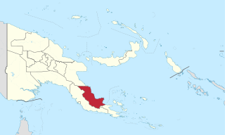
Kairuku-Hiri District is a district of Central Province in Papua New Guinea. It is one of the four administrative districts that make up the province, and surrounds the national capital, Port Moresby.
Koitaki is a village along the Kokoda Track in Papua New Guinea to the east of Port Moresby.
The Kokoda Track Foundation (KTF) is an international aid organisation working in Papua New Guinea. The foundation was established in 2003 and supports the indigenous people of that country. The Foundation provides education, health, and community service programmes such as disaster relief, microbusiness promotion and sustainable ecotourism.
During the Second World War, Allied logistics in Papua played a crucial role in bringing the Kokoda Track campaign to a successful conclusion. "The great problem of warfare in the Pacific", General Douglas MacArthur declared, "is to move forces into contact and maintain them. Victory is dependent upon solution to the logistic problem."
The Battle of Kokoda consisted of two engagements fought in late July – early August 1942. Forming part of the Kokoda Track campaign of the Second World War, the battle involved military forces from Australia, supported by the United States, fighting against Japanese troops from Major General Tomitaro Horii's South Seas Detachment who had landed around Buna and Gona in Papua mid-July 1942, with the intent of capturing Port Moresby to the south via the overland route.
The cuisine of Papua New Guinea are the traditional varied foods found in the eastern part of the New Guinea island. With 82% percent of the population being rural, and about 85% of the population depending on semi-subsistence agriculture, the cuisine is heavily based on agricultural crops, including yams, taro, rice and sago. Fruits such as pineapples, pawpaws, mangoes, passionfruit, and more are also abundantly grown in Papua New Guinea and etc. Though there are little influences from the cuisine of Southeast Asia, a nearby region, Papua New Guinea shares similarities in cuisine with surrounding Oceanian countries and the western half of New Guinea.