
Juan Bautista de Anza Bezerra Nieto was an expeditionary leader, military officer, and politician primarily in California and New Mexico under the Spanish Empire. He is credited as one of the founding fathers of Spanish California and served as an official within New Spain as Governor of the province of New Mexico.

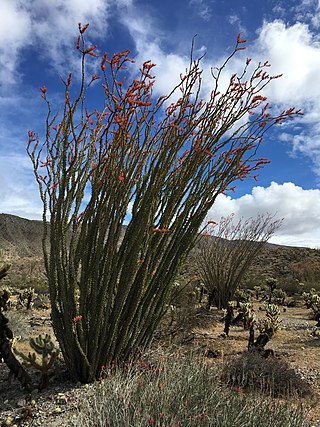
Anza-Borrego Desert State Park is a California State Park located within the Colorado Desert of southern California, United States. The park takes its name from 18th century Spanish explorer Juan Bautista de Anza and borrego, a Spanish word for sheep. With 585,930 acres (237,120 ha) that includes one-fifth of San Diego County, it is the largest state park in California and the third largest state park nationally.

The Santa Rosa Mountains are a short mountain range in the Peninsular Ranges system, located east of the Los Angeles Basin and northeast of the San Diego metropolitan area of southern California, in the southwestern United States.

The Simi Hills are a low rocky mountain range of the Transverse Ranges in eastern Ventura County and western Los Angeles County, of southern California, United States.

The Juan Bautista de Anza National Historic Trail is a 1,210-mile (1,950 km) trail extending from Nogales on the U.S.-Mexico border in Arizona, through the California desert and coastal areas in Southern California and the Central Coast region to San Francisco. The trail commemorates the 1775–1776 land route that Spanish commander Juan Bautista de Anza took from the Sonora y Sinaloa Province of New Spain in Colonial Mexico through to Las Californias Province. The goal of the trip was to establish a mission and presidio on the San Francisco Bay. The trail was an attempt to ease the course of Spanish colonization of California by establishing a major land route north for many to follow. It was used for about five years before being closed by the Quechan (Yuma) Indians in 1781 and kept closed for the next 40 years. It is a National Historic Trail administered by the National Park Service and was also designated a National Millennium Trail.

San Andreas Lake is a reservoir adjacent to the San Francisco Peninsula cities of Millbrae and San Bruno in San Mateo County, California. It is situated directly on the San Andreas Fault, which is named after the valley it is in.

San Mateo Creek is a perennial stream whose watershed includes Crystal Springs Reservoir, for which it is the only natural outlet after passing Crystal Springs Dam.

The Sawtooth Mountains Wilderness is a federal wilderness area of 32,136 acres (130.0 km2) located in the Sawtooth Mountains in eastern San Diego County, California. It is located in the Colorado Desert, 35 miles (56 km) south of Borrego Springs, near Anza Borrego Desert State Park.

The Santa Rosa Wilderness is a 72,259-acre (292.42 km2) wilderness area in Southern California, in the Santa Rosa Mountains of Riverside and San Diego counties, California. It is in the Colorado Desert section of the Sonoran Desert, above the Coachella Valley and Lower Colorado River Valley regions in a Peninsular Range, between La Quinta to the north and Anza Borrego Desert State Park to the south. The United States Congress established the wilderness in 1984 with the passage of the California Wilderness Act, managed by both the US Forest Service and the Bureau of Land Management. In 2009, the Omnibus Public Land Management Act was signed into law which added more than 2,000 acres (8.1 km2). Most of the Santa Rosa Wilderness is within the Santa Rosa and San Jacinto Mountains National Monument.

San Andrés Creek, now called San Andreas Creek, is a perennial stream that flows 5.9 miles (9.5 km) southeasterly along the San Andreas Fault from Sweeney Ridge in San Mateo County, California, providing the inflow to and outflow from San Andreas Reservoir, and then entering Lower Crystal Springs Reservoir, where it was a historic tributary to San Mateo Creek. San Mateo Creek then carries its waters over Crystal Springs Dam northeast to San Francisco Bay.

Palm Spring is a spring in Mesquite Oasis, a desert oasis amidst a mesquite thicket and a few palms, close to Carrizo Creek, within the Anza-Borrego Desert State Park in San Diego County, California.
San Felipe Creek is a stream in Imperial and San Diego Counties of California. It arises in the Volcan Mountains of San Diego County 33°11′57″N116°37′35″W, and runs eastward, gathering the waters of most of the eastern slope of the mountains and desert of the county in the San Sebastian Marsh before it empties into the Salton Sea. It is probably the last remaining perennial natural desert stream in the Colorado Desert region. In 1974, the San Felipe Creek Area was designated as a National Natural Landmark by the National Park Service.
Diana Lindsay is the founder and president of Sunbelt Publications, an independent publishing house that focuses on natural science, historical and cultural interests, and the San Diego region. She is also an award-winning author and photographer and has been writing about the Anza-Borrego region since the 1960s.
Borrego Valley Groundwater Basin, located in the very southern region of California, is one of the driest basins in the state. With climate change predicted to have strong effects into foreseeable future, the region is viewed with a skepticism in the sustainable use of water at current rates of consumption. Both natural and man-made geographic divisions within this basin allow for a closer inspection of the various management techniques implemented throughout the years, and provide a basis for what may be pursued for an uncertain future.
Yaqui Well is a historic spring located in Anza-Borrego Desert State Park in southeastern San Diego County, California in the United States about 21.4 mi (34.4 km) east of Warner Springs. The watering hole can be reached by a popular 1.64 mi (2.64 km) one-hour hiking trail starting at Tamarisk Grove Campground. The trail was described in the New York Times as a "flat, gentle hike—the kind that wraps around small, sloping hills, abuts a shallow canyon, and rewards its guests with an otherworldly view of the desert at the finale."
Box Canyon in Anza-Borrego Desert State Park in San Diego County, is a California Historical Landmark No. 472 listed on September 11, 1950. Box Canyon is a desert canyon and mountain pass on the Historic Southern Emigrant Trail. The US troops under General Stephen Watts Kearny and with US scout Kit Carson found Box Canyon and its pass in October 1846. On January 19, 1847, Kearny was the leader of a wagon train with Colonel Philip St. George Cooke and the Mormon Battalion that used Box Canyon to head west. The group used hand tool to widen and clear Box Canyon so the covered wagons could pass. The road through Box Canyon became the first road into Southern Alta California.

El Vado campsite in the Borrego Valley, Borrego Springs, California in San Diego County, is a California Historical Landmark No. 634 listed on March 3, 1958. The El Vado campsite was a desert camp for the Spanish Commander Juan Bautista de Anza and Father Francisco Garcés expedition of 1775 and 1776. The expedition camped for three days and two nights from December 20 to 22, 1775. At the campsite the expedition rested and watered its stock of mules, cattle, and horses.

La Cristianita Canyon, or La Christianita Canyon, Los Cristianitos Valley, Canyon of the Little Christians, La Cañada de los Bautismos is a canyon now on the Marine Corps Base Camp Pendleton in San Clemente, San Diego County. La Cristianita Canyon is a California Historical Landmark No. 562 listed on December 31, 1956. The site was a campsite for the Spanish Commander Juan Bautista de Anza and Father Francisco Garcés expedition of 1775 and 1776. The expedition camped at the site in July 1769. At the campsite was a spring where the expedition rested and watered its stock of mules, cattle, and horses.

Los Puertecitos Pass in Ocotillo Wells, California in San Diego County, is California Historical Landmark No. 635 listed on March 3, 1958. The Los Puertecitos is a desert pass used by the Spanish Commander Juan Bautista de Anza and Father Francisco Garcés expedition of 1775 and 1776. The expedition came through the pass on December 19, 1775. Near the pass on a flats east of the pass the expedition rested and watered its stock of mules, cattle, and horses.

Santa Catarina campsite in the Borrego Valley, Borrego Springs, California in San Diego County, is a California Historical Landmark No. 785 listed on March 3, 1958. The Santa Catarina campsite was a desert camp for the Spanish Commander Juan Bautista de Anza and Father Francisco Garcés expedition of 1775 and 1776. At the campsite the expedition rested and watered its stock of mules, cattle, and horses on March 14, 1774.


