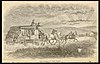
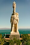
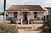
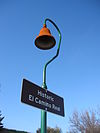
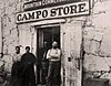
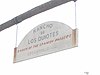
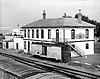
Image [1] Landmark name Location City or town Summary Adobe Chapel of The Immaculate Conception 49 Adobe Chapel of The Immaculate Conception 3950 Conde St. 32°45′06″N 117°11′39″W / 32.751633°N 117.194267°W / 32.751633; -117.194267 (Adobe Chapel of The Immaculate Conception ) San Diego Ballast Point Whaling Station 50 Ballast Point Whaling Station Naval Base Point Loma San Diego Restricted access Berkeley 1031 Berkeley Docked at 1306 North Harbor Dr. 32°43′07″N 117°10′22″W / 32.718647°N 117.172656°W / 32.718647; -117.172656 (Berkeley San Diego Camp Lockett 1045 Camp Lockett near Campo Rd. and Forest Gate Rd. 32°36′25″N 116°28′18″W / 32.606989°N 116.471579°W / 32.606989; -116.471579 (Camp Lockett ) Campo San Gregorio 673 San Gregorio Borrego Sink, Anza-Borrego Desert State Park 33°13′19″N 116°16′12″W / 33.222°N 116.270°W / 33.222; -116.270 (San Gregorio ) Borrego Springs Box Canyon 472 Box Canyon Anza-Borrego Desert State Park 33°00′54″N 116°26′31″W / 33.015°N 116.442°W / 33.015; -116.442 (Box Canyon ) Borrego Springs Butterfield Overland Mail Route 647 Butterfield Overland Mail Route Anza-Borrego Desert State Park , Blair Valley Borrego Springs Cabrillo National Monument 56 Cabrillo National Monument Point Loma 32°40′23″N 117°14′19″W / 32.673056°N 117.238611°W / 32.673056; -117.238611 (Cabrillo National Monument ) San Diego Camp Wright 482 Camp Wright State Hwy 79 33°23′23″N 116°47′39″W / 33.389728°N 116.794097°W / 33.389728; -116.794097 (Camp Wright ) Oak Grove Casa de Bandini 72 Casa de Bandini NE corner of Mason and Calhoun Sts., Old Town San Diego State Historic Park San Diego Casa de Carrillo 74 Casa de Carrillo Presidio Hills Golf Course 32°45′22″N 117°11′46″W / 32.756°N 117.196°W / 32.756; -117.196 (Casa de Carrillo ) San Diego Casa de Cota 75 Casa de Cota Twiggs and Congress Sts., Old Town 32°45′07″N 117°11′46″W / 32.752°N 117.196°W / 32.752; -117.196 (Casa de Cota ) San Diego Site of former Casa de Cota house Casa de Estudillo 53 Casa de Estudillo 4000 Mason St. 32°45′14″N 117°11′45″W / 32.753978°N 117.195781°W / 32.753978; -117.195781 (Casa de Estudillo ) San Diego Casa de Lopez 60 Casa de Lopez 3890 Twiggs St., Old Town 32°45′07″N 117°11′49″W / 32.7519°N 117.1969°W / 32.7519; -117.1969 (Casa de Lopez ) San Diego Casa de Machado y Silvas 71 Casa de Machado y Silvas Old Town San Diego State Historic Park San Diego Casa de Pedrorena de Altamirano 70 Casa de Pedrorena de Altamirano 2616 San Diego Ave, Old Town San Diego State Historic Park 32°45′14″N 117°11′47″W / 32.753767°N 117.196333°W / 32.753767; -117.196333 (Casa de Pedrorena de Altamirano ) San Diego Casa de Stewart 73 Casa de Stewart Congress and Mason Sts., Old Town San Diego State Historic Park 32°45′12″N 117°11′52″W / 32.7534°N 117.1977°W / 32.7534; -117.1977 (Casa de Stewart ) San Diego Also called Casa de Machado y Stewart Chapel of Santa Ysabel 369 Chapel of Santa Ysabel Santa Ysabel Asistencia 33°07′49″N 116°40′41″W / 33.130278°N 116.678056°W / 33.130278; -116.678056 (Chapel of Santa Ysabel ) Santa Ysabel Congress Hall 66 Congress Hall Vacant lot, south side of 2734 Calhoun St., Old Town San Diego State Historic Park 32°45′18″N 117°11′52″W / 32.755°N 117.1977°W / 32.755; -117.1977 (Congress Hall ) San Diego Demolished in 1939 Derby Dike 244 Derby Dike Presidio Park 32°45′34″N 117°11′46″W / 32.7595°N 117.1962°W / 32.7595; -117.1962 (Derby Dike ) San Diego El Camino Real 784 El Camino Real Mission San Diego de Alcalá 32°42′N 117°06′W / 32.7°N 117.1°W / 32.7; -117.1 (El Camino Real ) San Diego El Camino Real Mission Trail El Campo Santo 68 El Campo Santo On San Diego Ave. between Arista and Conde Sts. 32°45′05″N 117°11′36″W / 32.751467°N 117.193317°W / 32.751467; -117.193317 (El Campo Santo ) San Diego El Desembarcadero 64 El Desembarcadero 2900 block of Farragut Rd. 32°44′N 117°13′W / 32.73°N 117.21°W / 32.73; -117.21 (El Desembarcadero ) San Diego El Vado 634 El Vado Anza-Borrego Desert State Park 33°18′04″N 116°23′02″W / 33.301°N 116.384°W / 33.301; -116.384 (El Vado ) Borrego Springs Anza expedition campsite in 1775 Exchange Hotel 491 Exchange Hotel 2729 San Diego Ave., Old Town San Diego State Historic Park 32°45′14″N 117°11′49″W / 32.754°N 117.197°W / 32.754; -117.197 (Exchange Hotel ) San Diego Lost in 1872 fire Fort Guijarros 69 Fort Guijarros Naval Base Point Loma 32°40′12″N 117°14′31″W / 32.67°N 117.241944°W / 32.67; -117.241944 (Fort Guijarros ) San Diego Fort Rosecrans 62 Fort Rosecrans Naval Base Point Loma 32°40′37″N 117°14′41″W / 32.676944°N 117.244722°W / 32.676944; -117.244722 (Fort Rosecrans ) San Diego Fort Rosecrans National Cemetery 55 Fort Rosecrans National Cemetery Cabrillo Memorial Dr. 32°41′12″N 117°14′41″W / 32.68674°N 117.24476°W / 32.68674; -117.24476 (Fort Rosecrans National Cemetery ) San Diego Fort Stockton 54 Fort Stockton Presidio Park 32°45′34″N 117°11′31″W / 32.759383°N 117.191983°W / 32.759383; -117.191983 (Fort Stockton ) San Diego Gaskill Brothers' Stone Store 411 Gaskill Brothers' Stone Store State Hwy 94 32°36′32″N 116°28′26″W / 32.609°N 116.474°W / 32.609; -116.474 (Gaskill Brothers' Stone Store ) Campo Also called Gaskill’s Brothers Stone Store Giant Dipper 1044 Giant Dipper 3190 Mission Blvd. 32°46′17″N 117°15′06″W / 32.771382°N 117.251713°W / 32.771382; -117.251713 (Giant Dipper ) San Diego Hotel del Coronado 844 Hotel del Coronado 1500 Orange Ave. 32°40′51″N 117°10′42″W / 32.6809°N 117.1784°W / 32.6809; -117.1784 (Hotel del Coronado ) Coronado Hubert H. Bancroft Ranch House 626 Hubert H. Bancroft Ranch House One block E of Memory and Bancroft Dr 32°44′11″N 116°59′18″W / 32.736389°N 116.988333°W / 32.736389; -116.988333 (Hubert H. Bancroft Ranch House ) Spring Valley Julian 412 Julian Historic district 33°04′15″N 116°35′08″W / 33.070833°N 116.585556°W / 33.070833; -116.585556 (Julian ) Julian Kate O. Sessions Nursery 764 Kate O. Sessions Nursery Garnet Ave. and Pico St. 32°48′19″N 117°13′23″W / 32.8053°N 117.2231°W / 32.8053; -117.2231 (Kate O. Sessions Nursery ) San Diego La Cristianita 562 La Cristianita Marine Corps Base Camp Pendleton , Los Cristianitos Canyon 33°25′42″N 117°36′35″W / 33.428217°N 117.6097°W / 33.428217; -117.6097 (La Cristianita ) San Clemente La Playa 61 La Playa On left side of Rosecrans St., at entrance to Military Reserve, Point Loma 32°42′44″N 117°14′43″W / 32.712222°N 117.245278°W / 32.712222; -117.245278 (La Playa ) San Diego Las Flores Estancia 616 Las Flores Estancia Marine Corps Base Camp Pendleton 33°18′00″N 117°27′40″W / 33.299947°N 117.461067°W / 33.299947; -117.461067 (Las Flores Estancia ) San Clemente La Punta De Los Muertos 57 La Punta De Los Muertos Market St. and Pacific Hwy. 32°42′36″N 117°10′16″W / 32.71°N 117.170983°W / 32.71; -117.170983 (La Punta De Los Muertos ) San Diego Sailors, Dead Men's Point Leo Carrillo Ranch (Rancho de los Kiotes) 1020 Leo Carrillo Ranch (Rancho de los Kiotes) 6200 Flying L.C. Lane Carlsbad Los Puertecitos 635 Los Puertecitos State Hwy 78 33°08′24″N 116°06′18″W / 33.139917°N 116.104983°W / 33.139917; -116.104983 (Los Puertecitos ) Ocotillo Wells Mason Street School 538 Mason Street School 3966 Mason St., Old Town San Diego State Historic Park 32°45′12″N 117°11′50″W / 32.753435°N 117.197309°W / 32.753435; -117.197309 (Mason Street School ) San Diego Mission San Diego de Alcalá 242 Mission San Diego de Alcalá 10818 San Diego Mission Rd. 32°47′04″N 117°06′23″W / 32.784444°N 117.106389°W / 32.784444; -117.106389 (Mission San Diego de Alcalá ) San Diego Mission San Luis Rey de Francia 239 Mission San Luis Rey de Francia 4050 Mission Ave. 33°13′57″N 117°19′13″W / 33.232558°N 117.320176°W / 33.232558; -117.320176 (Mission San Luis Rey de Francia ) Oceanside Montgomery Memorial 711 Montgomery Memorial Coronado Ave. and Beyer Blvd. 32°34′43″N 117°04′08″W / 32.578717°N 117.068767°W / 32.578717; -117.068767 (Montgomery Memorial ) San Diego Mule Hill 452 Mule Hill Pomerado Rd. Escondido National City Santa Fe Rail Depot 1023 National City Santa Fe Rail Depot 900 West 23 St. National City Oak Grove Butterfield Stage Station 502 Oak Grove Butterfield Stage Station 33°23′26″N 116°47′42″W / 33.390433°N 116.7951°W / 33.390433; -116.7951 (Oak Grove Butterfield Stage Station ) Warner Springs Old Mission Dam 52 Old Mission Dam Mission Trails Regional Park 32°50′24″N 117°02′32″W / 32.84°N 117.042222°W / 32.84; -117.042222 (Old Mission Dam ) San Diego Old Point Loma Lighthouse 51 Old Point Loma Lighthouse Cabrillo National Monument 32°40′18″N 117°14′27″W / 32.671667°N 117.240833°W / 32.671667; -117.240833 (Old Point Loma Lighthouse ) San Diego Old Town San Diego State Historic Park 830 Old Town San Diego State Historic Park Old Town San Diego State Historic Park 32°45′17″N 117°11′50″W / 32.754658°N 117.197339°W / 32.754658; -117.197339 (Old Town San Diego State Historic Park ) San Diego Palm Spring 639 Palm Spring Anza-Borrego Desert State Park 32°55′08″N 116°13′05″W / 32.919°N 116.218°W / 32.919; -116.218 (Palm Spring ) Agua Caliente Springs Pedro Fages Trail 858 Pedro Fages Trail 1.7 mi SE on Sunrise Hwy 32°59′40″N 116°32′33″W / 32.994333°N 116.54245°W / 32.994333; -116.54245 (Pedro Fages Trail ) Julian Peg Leg Smith Monument 750 Peg Leg Smith Monument Anza-Borrego Desert State Park Agua Caliente Springs Plaza San Diego Viejo 63 Plaza San Diego Viejo Old Town San Diego State Historic Park 32°45′17″N 117°11′51″W / 32.7546°N 117.1975°W / 32.7546; -117.1975 (Plaza San Diego Viejo ) San Diego Also called Plaza de Las Armas Presidio of San Diego 59 Presidio of San Diego Presidio of San Diego 32°45′31″N 117°11′36″W / 32.758611°N 117.193333°W / 32.758611; -117.193333 (Presidio of San Diego ) San Diego Rancho Cañada de los Coches 425 Rancho Cañada de los Coches 13468 Old Hwy 80 32°50′N 116°51′W / 32.84°N 116.85°W / 32.84; -116.85 (Rancho Cañada de los Coches ) Lakeside Rancho Guajome 940 Rancho Guajome Guajome Regional Park 33°16′N 117°16′W / 33.26°N 117.27°W / 33.26; -117.27 (Rancho Guajome ) Vista Rancho Santa Fe 982 Rancho Santa Fe Rancho Santa Fe 33°01′26″N 117°12′00″W / 33.023889°N 117.2°W / 33.023889; -117.2 (Rancho Santa Fe ) Rancho Santa Fe Rancho Santa Margarita y Las Flores 1026 Rancho Santa Margarita y Las Flores Marine Corps Base Camp Pendleton 33°23′N 117°34′W / 33.39°N 117.57°W / 33.39; -117.57 (Rancho Santa Margarita y Las Flores ) San Diego Rockwell Field 818 Rockwell Field North Island San Diego San Antonio de Pala Asistencia 243 San Antonio de Pala Asistencia Mission on Pala Mission Rd. 33°21′40″N 117°04′45″W / 33.361111°N 117.079167°W / 33.361111; -117.079167 (San Antonio de Pala Asistencia ) Pala San Diego Barracks 523 San Diego Barracks Parking lot on N side of Market St. 32°42′42″N 117°10′12″W / 32.7116°N 117.1700°W / 32.7116; -117.1700 (San Diego Barracks ) San Diego San Diego State University 798 San Diego State University Entrance to service area of Viejas Arena San Diego San Felipe-Butterfield Stage Station 793 San Felipe-Butterfield Stage Station County Hwy. S2 33°06′07″N 116°29′02″W / 33.101867°N 116.483967°W / 33.101867; -116.483967 (San Felipe-Butterfield Stage Station ) San Pasqual Battlefield State Historic Park 533 San Pasqual Battlefield State Historic Park San Pasqual Battlefield State Historic Park 33°05′10″N 116°59′24″W / 33.086111°N 116.99°W / 33.086111; -116.99 (San Pasqual Battlefield State Historic Park ) Escondido Santa Catarina 785 Santa Catarina Anza-Borrego Desert State Park Borrego Springs Serra Palm 67 Serra Palm Presidio Park 32°45′34″N 117°11′46″W / 32.759433°N 117.196183°W / 32.759433; -117.196183 (Serra Palm ) San Diego Spanish Landing 891 Spanish Landing Spanish Landing Park 32°43′43″N 117°12′25″W / 32.7287°N 117.2070°W / 32.7287; -117.2070 (Spanish Landing ) San Diego Star of India 1030 Star of India Docked at 1306 North Harbor Dr. 32°43′14″N 117°10′25″W / 32.720417°N 117.173528°W / 32.720417; -117.173528 (Star of India San Diego USS Recruit 1042 USS Recruit In shopping center off of Laning Rd, at Tatnall Ln, San Diego 32°43′43″N 117°12′59″W / 32.728542°N 117.216396°W / 32.728542; -117.216396 (USS Recruit San Diego Vallecito Station 304 Vallecito Station Vallecito Stage Station County Park Agua Caliente Springs Warner's Ranch 311 Warner's Ranch On County Hwy S2 33°14′19″N 116°39′03″W / 33.238611°N 116.650833°W / 33.238611; -116.650833 (Warner's Ranch ) Warner Springs Whaley House 65 Whaley House 2482 San Diego Ave., Old Town 32°45′10″N 117°11′40″W / 32.752828°N 117.194486°W / 32.752828; -117.194486 (Whaley House ) San Diego