
Borrowfield is a settlement in Aberdeenshire, Scotland in proximity to Netherley. [1]
Borrowfield is a settlement in Aberdeenshire, Scotland in proximity to Netherley. [1]
Roman legions marched from Raedykes to Normandykes Roman Camp through the passing near Borrowfield as they sought higher ground to avoid the bogs of Red Moss and other low-lying mosses associated with the Burn of Muchalls. That march used the Elsick Mounth, an ancient trackways crossing the Mounth of the Grampian Mountains, [2] lying west of Netherley.
Patrick Tailzour was born here in the eighteenth century. The family included rich Jamaicans and Sir John Taylor, 1st Baronet. [3]

Kincardineshire or the County of Kincardine, also known as the Mearns, is a historic county, registration county and lieutenancy area on the coast of northeast Scotland. It is bounded by Aberdeenshire on the north and west, and by Angus on the south.

Kincardine and Deeside was formerly (1975–96) a local government district in the Grampian Region of Scotland. In 1996 it was included in the Aberdeenshire council area.
Maryculter or Kirkton of Maryculter is a village in the Lower Deeside area of Aberdeenshire, Scotland. The River Dee separates it from the town of Peterculter, and the B979 road runs through Maryculter. Maryculter House Hotel lies slightly north of the village along the south bank of the River Dee and to the west of Templars Park. The Old Mill Inn, a former coaching inn dating back to the 18th century lay at the mouth of the Crynoch Burn from 1797 until its demolition in February 2021 after being damaged by an extensive fire. At the edge of the village of Maryculter is a public forest land, known as the Oldman Wood, through which flows the Crynoch Burn. Also the children's theme park, StoryBook Glen, which also consists of a shop and restaurant is located near the old church which is still in use today as a Church of Scotland. Other notable vicinity buildings include the former Lairhillock Inn which closed in March 2020 and Muchalls Castle. Maryculter also has an animal sanctuary, Blaikiewell Animal Sanctuary.

Ury House is a large ruined mansion in Aberdeenshire, Scotland, built in the Elizabethan style in 1885 by Sir Alexander Baird, 1st Baronet. It is situated on the north-east coast about 1 mile (1.6 km) north of Stonehaven in the former county of Kincardineshire.
Red Moss is a wetland bog in Aberdeenshire, Scotland, located at the northwestern edge of the village of Netherley. The moss is designated a national Site of Special Scientific Interest by Scottish Natural Heritage, due to its biodiversity and undisturbed character. The elevation of Red Moss is 113 metres above mean sea level. The upland areas above Red Moss are characterised as agricultural and woodland parcels which are generally attractive and separated by ancient drystone walls or hedgerows.

Bridge of Muchalls is an entirely residential hamlet in Aberdeenshire, Scotland by the North Sea. It is next to the A92 dual carriageway about three miles north of Stonehaven and to the south of Muchalls Castle.
Netherley, Scotland is a village in Aberdeenshire, situated approximately five miles northwest of Stonehaven. Netherley is located in the Mounth area of the Grampian Highlands. At the eastern edge of Netherley is a significant wetland bog known as Red Moss. To the southwest of Netherley lie Meikle Carewe Hill and Curlethney Hill. At the south edge of Netherley is the peak of Craggie Cat.
The Causey Mounth is an ancient drovers' road over the coastal fringe of the Grampian Mountains in Aberdeenshire, Scotland. This route was developed as the main highway between Stonehaven and Aberdeen around the 12th century AD and it continued to function as the principal route connecting these two cities until the mid 20th century, when modern highway construction of the A90 road occurred in this area. There are extant paved and usable sections of this road over part of the alignment; however, many parts of the ancient route are no more than footpaths, and in some cases the road has vanished into agricultural fields. Constructed in the Middle Ages, the Causey Mounth was created as an elevated rock causeway to span many of the boggy areas such as the Portlethen Moss. A considerable portion of the alignment of the Causey Mounth is illustrated on the UK Ordnance Survey Map, although a large fraction of the route cannot be navigated by a conventional passenger vehicle.
Cammachmore is a hamlet in the coastal region near the North Sea in Aberdeenshire. It lies slightly west of the A92 road and the ancient Causey Mounth passes through the community. Historic Elsick House is situated due west of Cammachmore. Other nearby historic features include Gillybrands, Saint Ternan's Church, Muchalls Castle and the Lairhillock Inn.
Cairnie Burn is a stream that rises in the Mounth, or eastern range of the Grampian Mountains, north of Netherley, Aberdeenshire, Scotland. Cairnie Burn is a generally northeast flowing watercourse that is a tributary to the Crynoch Burn. Cairnie Burn rises in the eastern part of the Durris Forest, east of the Elsick Mounth passage.

Banchory-Devenick is a hamlet approximately two kilometres south of the city of Aberdeen, Scotland in the Lower Deeside area of Aberdeenshire. The hamlet should not be confused with the historic civil parish of the same name which spanned the River Dee until 1891, its northern part lying in Aberdeenshire and its southern part in Kincardineshire. In that year the northern part became part of the neighbouring parish of Peterculter, the southern part remaining as the parish of Banchory-Devenick. The hamlet of Banchory-Devenick is on the B9077 road, and the ancient Causey Mounth passes directly through it. An historic graveyard dating to 1157 AD is present within Banchory-Devenick. Other historic features in the vicinity include Saint Ternan's Church, Muchalls Castle and the Lairhillock Inn.
Craggie Cat is a hill landform in the Mounth of the Grampian Mountains at the southern edge of Netherley, Aberdeenshire, Scotland. The peak elevation of Craggie Cat is 198 metres according to the Ordnance Survey. This hill's southwestern flanks form the northwest boundary of the moorland of Curlethney Hill.

Durris Forest is a chiefly coniferous forest south of the River Dee approximately three kilometres west of Netherley in Aberdeenshire, Scotland. The A957 road forms the southwest boundary of Durris Forest, separating it from Fetteresso Forest. The Durris Forest includes several smaller named woodlands. The ancient route of Elsick Mounth crosses the Grampian Mounth within the Durris Forest. Notable natural features in the vicinity include Red Moss and Meikle Carewe Hill. Notable historic features in this area include Raedykes Roman Camp, Muchalls Castle and Maryculter House.
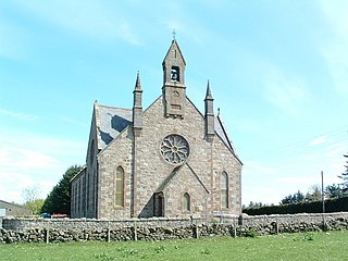
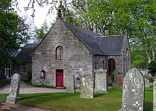
Cookney Parish Church, now business premises within a converted listed building, was a Christian place of worship in the village of Cookney, Aberdeenshire, Scotland.

The Elsick Mounth is an ancient trackway crossing the Grampian Mountains in the vicinity of Netherley, Scotland. This trackway was one of the few means of traversing the Grampian Mounth area in prehistoric and medieval times. The highest pass of the route is attained within the Durris Forest. Notable historical structures in the vicinity are Maryculter House, Lairhillock Inn and Muchalls Castle. Most of the lands through which the Elsick Mounth passes are within the Durris Forest; while this forest would have been a mixed deciduous forest in ancient times, currently it is managed as a coniferous monoculture with extensive amounts of clearfelling and subsequent replanting.
Mergie is a settlement in Aberdeenshire approximately six miles west of Stonehaven, Scotland. Situated in the former Kincardineshire slightly south of the Slug Road.
Cairn Mon Earn or Cairn-mon-earn is a hill in Aberdeenshire, Scotland.
Lochton is a settlement on the Slug Road in Aberdeenshire, Scotland. Roman legions marched from Raedykes to Normandykes Roman Camp somewhat east of Lochton, using higher ground evading the bogs of Red Moss and other low-lying areas including the Burn of Muchalls. That march used the nearby Elsick Mounth, an ancient trackways crossing the Mounth of the Grampian Mountains, lying westerly of Netherley.

Balfour, Aberdeenshire is a settlement on Royal Deeside in Aberdeenshire, Scotland. Balfour lies south of the River Dee.
Lower Deeside is a region along the River Dee in Aberdeenshire and Aberdeen in Scotland. The boundaries of this area are subject to interpretation, since the usage has altered through historic times; however, the area is generally associated with the communities of Durris, Maryculter and Banchory-Devenick in the historic district of Kincardineshire and the communities of Peterculter, Milltimber, Bieldside and Cults in Aberdeen.
57°01′49″N2°16′53″W / 57.0302°N 2.2815°W
| | This Aberdeenshire location article is a stub. You can help Wikipedia by expanding it. |