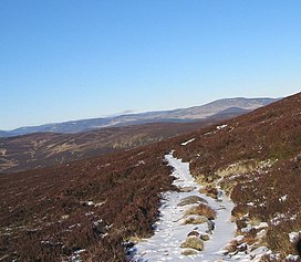
Ballater is a village in Aberdeenshire, Scotland, on the River Dee, immediately east of the Cairngorm Mountains. Situated at an elevation of 213 metres, Ballater is a centre for hikers and known for its spring water, once said to cure scrofula. It is home to more than 1400 inhabitants and has had a long connection with the British royal family.

The River Dee is a river in Aberdeenshire, Scotland. It rises in the Cairngorms and flows through southern Aberdeenshire to reach the North Sea at Aberdeen. The area it passes through is known as Deeside, or Royal Deeside in the region between Braemar and Banchory because Queen Victoria came for a visit there in 1848 and greatly enjoyed herself. She and her husband, Prince Albert, built Balmoral Castle there which replaced an older castle.

The Grampian Mountains is one of the three major mountain ranges in Scotland, that together occupy about half of Scotland. The other two ranges are the Northwest Highlands and the Southern Uplands. The Grampian range extends southwest to northeast between the Highland Boundary Fault and the Great Glen. The range includes many of the highest mountains in the British Isles, including Ben Nevis and Ben Macdui.
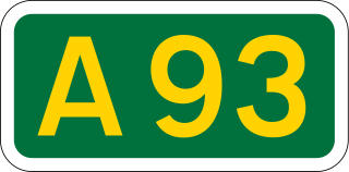
The A93 is a major road in Scotland and the highest public road in the United Kingdom. It runs north from Perth through Blairgowrie and Rattray, then through the Grampian Mountains by way of Glenshee, the Cairnwell Pass and Glen Clunie to Braemar in Aberdeenshire. At Braemar, the road then switches east down the strath of the River Dee before crossing the A90 and terminating in Aberdeen.
Braemar is a village in Aberdeenshire, Scotland, around 58 miles (93 km) west of Aberdeen in the Highlands. It is the closest significantly-sized settlement to the upper course of the River Dee, sitting at an elevation of 339 metres (1,112 ft).
The Five Glens of Angus are the five Highland glens located in the western portion of the Angus region of Scotland. The five glens from westernmost to easternmost are:
Inverey is a hamlet on Mar Lodge Estate, in Aberdeenshire, Scotland.
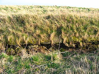
The Causey Mounth is an ancient drovers' road over the coastal fringe of the Grampian Mountains in Aberdeenshire, Scotland. This route was developed as the main highway between Stonehaven and Aberdeen around the 12th century AD and it continued to function as the principal route connecting these two cities until the mid 20th century, when modern highway construction of the A90 road occurred in this area. There are extant paved and usable sections of this road over part of the alignment; however, many parts of the ancient route are no more than footpaths, and in some cases the road has vanished into agricultural fields. Constructed in the Middle Ages, the Causey Mounth was created as an elevated rock causeway to span many of the boggy areas such as the Portlethen Moss. A considerable portion of the alignment of the Causey Mounth is illustrated on the UK Ordnance Survey Map, although a large fraction of the route cannot be navigated by a conventional passenger vehicle.
Cowie Castle is a ruined fortress in Aberdeenshire, Scotland. The site lies at the northern end of Stonehaven on the North Sea coast. To the immediate south is the Cowie Bridge crossing of the Cowie Water. Evidence of prehistoric man exists in the vicinity dating to the Iron Age in the form of ring cairns.

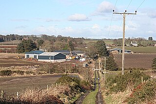
Banchory-Devenick is a village approximately two kilometres south of the city of Aberdeen, Scotland in the Lower Deeside area of Aberdeenshire. The village should not be confused with the historic civil parish of the same name which spanned the River Dee until 1891, its northern part lying in Aberdeenshire and its southern part in Kincardineshire. In that year the northern part became part of the neighbouring parish of Peterculter, the southern part remaining as the parish of Banchory-Devenick. The village of Banchory-Devenick is on the B9077 road, and the ancient Causey Mounth passes directly through the village. An historic graveyard dating to 1157 AD is present at the village of Banchory-Devenick. Other historic features in the vicinity include Saint Ternan's Church, Muchalls Castle and the Lairhillock Inn.

The Chapel of St. Mary and St. Nathalan is a ruined chapel overlooking the North Sea immediately north of Stonehaven, in the Mearns of Scotland, along the northern shoreline of Stonehaven Bay. The founding of this Christian place of worship is associated with St. Nathalan. who lived circa 650 AD. The structure is alternatively known as Cowie Chapel. The chapel is at the point where the Highland Boundary Fault meets the sea and so is on the dividing line between the highlands and lowlands of Scotland.

Cowie is an historic fishing village in Kincardineshire, Scotland. This village has existed since the Middle Ages, but in current times it is effectively subsumed into the town of Stonehaven. It had an estimated population of 2,720 in 2020.

Grim Brigs is a rocky headland on the North Sea at Muchalls, Scotland. Notable historic features in this vicinity include St. Ternan's Church, Muchalls Castle and Elsick House. Approximately one kilometre inland is the noted medieval drovers' road known as the Causey Mounth. The geology of Grim Brigs is associated with the harder rock formations north of the Highland Boundary Fault, which forms the boundary between the Scottish Highlands and Lowlands. This Highland Boundary Fault emerges at the North Sea approximately four kilometres south of Grim Brigs near the Chapel of St. Mary and St. Nathalan.

Càrn Aosda is a Scottish mountain situated 12.5 km south of the town of Braemar, in the county of Aberdeenshire. It stands near the summit of the Cairnwell Pass on the A93 road, in the midst of the Glenshee Ski Centre.

Càrn a' Gheòidh or Càrn Gheòidh is a mountain in the Mounth region of the Scottish Highlands. It lies 15 km south of the town of Braemar. Its summit stands on the border between the council areas of Perth and Kinross and Aberdeenshire.

Beinn a' Bhùird is a Munro in the Cairngorm mountain range of Scotland.

Hospitals in medieval Scotland can be dated back to the 12th century. From c. 1144 to about 1650 many hospitals, bedehouses and maisons Dieu were built in Scotland.

Clunie Water is a river of Aberdeenshire, Scotland. It is a tributary of the River Dee, joining the river at Braemar, among grey stone buildings. Callater Burn is a tributary of the Clunie; the confluence is at Auchallater. The river flows alongside the A93 road.