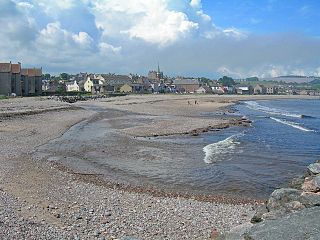
Stonehaven is a town in Scotland. It lies on Scotland's northeast coast and had a population of 11,602 at the 2011 Census. After the demise of the town of Kincardine, which was gradually abandoned after the destruction of its royal castle in the Wars of Independence, the Scottish Parliament made Stonehaven the successor county town of Kincardineshire. It is currently administered as part of the Aberdeenshire Council Area. Stonehaven had grown around an Iron Age fishing village, now the "Auld Toon", and expanded inland from the seaside. As late as the 16th century, old maps indicate the town was called Stonehyve, Stonehive, Timothy Pont also adding the alternative Duniness. It is known informally to locals as Stoney.

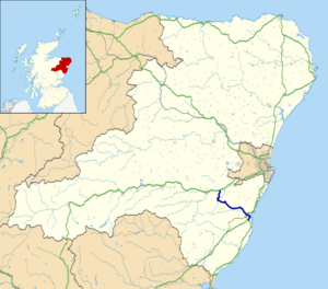
Kincardineshire, also known as the Mearns, is a historic county, registration county and lieutenancy area on the coast of northeast Scotland. It is bounded by Aberdeenshire on the north and west, and by Angus on the south.

The Mounth is the broad upland in northeast Scotland between the Highland Boundary and the River Dee, at the eastern end of the Grampians.
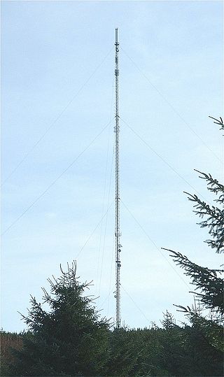
The Durris transmitting station is a broadcasting and telecommunications facility, situated close to the town of Stonehaven, within Durris Forest, within the area also known historically as Kincardineshire. It is owned and operated by Arqiva, and is the tallest structure in Scotland.

Catterline is a coastal village on the North Sea in Aberdeenshire, Scotland. It is situated about 5 miles (8.0 km) south of Stonehaven; nearby to the north are Dunnottar Castle and Fowlsheugh Nature Reserve. Other noted architectural or historic features in the general area include Fetteresso Castle, Fiddes Castle, Chapel of St. Mary and St. Nathalan and Muchalls Castle.

Ury House is a large ruined mansion in Aberdeenshire, Scotland, built in the Elizabethan style in 1885 by Sir Alexander Baird, 1st Baronet. It is situated on the north-east coast about 1 mile (1.6 km) north of Stonehaven in the former county of Kincardineshire.

Mackie Academy is a secondary school in Stonehaven, Aberdeenshire. As of 2015, Mackie Academy had roughly 1,170 pupils and 80 teaching staff. The feeder primary schools are Arduthie, Bervie, Catterline, Dunnottar, Glenbervie, Gourdon, Johnshaven, Kinneff, Lairhillock, and Mill O'Forest.
Carron Water is a river in Kincardineshire, Aberdeenshire, Scotland.
Crawton is a former fishing community on the southeast Aberdeenshire coast in Scotland, deserted since 1927.

Cowton Burn is a stream that rises in the Mounth, or eastern range of the Grampian Mountains, on some of the northwest slopes of the Durris Forest west of Netherley, Aberdeenshire, Scotland. The Grid Reference for the headwaters is NO 925 823); Cowton Burn is a tributary to the Cowie Water. The Cowton Burn is crossed by the A957 road slightly northwest of Rickarton House.
The Fetteresso Forest is a woodland that is principally coniferous situated in the Mounth range of the Grampian Mountains in Aberdeenshire, Scotland. The forest has a number of prominent mountain peaks including the Hill of Blacklodge and Craiginour peak. A good overlook for viewing the forest from the north side lies on an unnamed tarmack road which leads north from the Slug Road to the Raedykes Roman site. The Cowie Water flows through and drains much of the forest. To the north of the easternmost part of the forest is the archaeological site Raedykes Roman Camp, as well as Cowton Burn. The Slug Road runs along much of the northeast perimeter of Fetteresso Forest.

The Kirktown of Fetteresso is a well-preserved village near Stonehaven, Scotland. In the planning area of Kincardine and Mearns, Aberdeenshire, this village contains many very old stone residential structures as well as the Church of St. Ciarans and its associated graveyard. The Carron Water winds through the Kirktown of Fetteresso, and Fetteresso Castle, a listed building, lies at the northwestern verge. Some of the earliest area prehistory has been found nearby on the Fetteresso Estate grounds, where there have been archaeological finds from the Bronze Age.

Durris Forest is a chiefly coniferous forest south of the River Dee approximately three kilometres west of Netherley in Aberdeenshire, Scotland. The A957 road forms the southwest boundary of Durris Forest, separating it from Fetteresso Forest. The Durris Forest includes several smaller named woodlands. The ancient route of Elsick Mounth crosses the Grampian Mounth within the Durris Forest. Notable natural features in the vicinity include Red Moss and Meikle Carewe Hill. Notable historic features in this area include Raedykes Roman Camp, Muchalls Castle and Maryculter House.

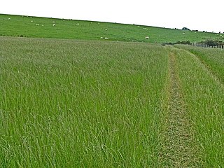
The Elsick Mounth is an ancient trackway crossing the Grampian Mountains in the vicinity of Netherley, Scotland. This trackway was one of the few means of traversing the Grampian Mounth area in prehistoric and medieval times. The highest pass of the route is attained within the Durris Forest. Notable historical structures in the vicinity are Maryculter House, Lairhillock Inn and Muchalls Castle. Most of the lands through which the Elsick Mounth passes are within the Durris Forest; while this forest would have been a mixed deciduous forest in ancient times, currently it is managed as a coniferous monoculture with extensive amounts of clearfelling and subsequent replanting.

Downie Point is a prominent headland located at the southern edge of Stonehaven Bay in Aberdeenshire, Scotland. From the Stonehaven Harbour, there is a panoramic view of this cliff landform, especially from the tip of Bellman's Head.

Balfour, Aberdeenshire is a settlement on Royal Deeside in Aberdeenshire, Scotland. Balfour lies south of the River Dee.
Bogjurgan Hill is an elevated landform at the southern verge of the Fetteresso Forest in Aberdeenshire, Scotland. Its top is at an elevation of 299 metres (981 ft) above sea level. Historical features in this region of Kincardineshire include Fetteresso Castle, Drumtochty Castle and Muchalls Castle.
Cryne Corse Mounth is an old droving road which ran south across the high ground from the Dee valley in Aberdeenshire, eastern Scotland. Much of the route is now afforested. It is one of a number of old tracks which passed over the Mounth, an eastern extension of the Grampian Mountains.