Botternell is a hamlet in the parish of North Hill, east Cornwall in the United Kingdom. The name means "Dornel's dwelling". Boturnell, also in Cornwall, has the same meaning. [1]
The earliest date for the village of Botternell is around the year.1160. By 1650, it consisted of two separate villages - higher and lower Bourtnell, (spelling varies).
By 1840, Botternel was no longer classified as a village. Today, Botternel consists of a farm of the same name and a small hamlet of five houses on the site. [2] [3] There is a bus stop in the hamlet. [4]

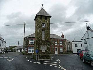
Crackington Haven is a coastal village in Cornwall, England, United Kingdom. It is in the civil parish of St Gennys at grid reference SX140972 at the head of a cove on the Atlantic coast. The village is seven miles (11 km) south-southwest of Bude and four miles (7 km) north-northeast of Boscastle.

Ludgvan is a civil parish and village in Cornwall, England, UK, 2 1⁄2 miles (4.0 km) northeast of Penzance. Ludgvan village is split between Churchtown, on the hill, and Lower Quarter to the east, adjoining Crowlas. For the purposes of local government, Ludgvan elects a parish council every four years; the local authority is Cornwall Council.

St Mabyn is a civil parish and village in Cornwall, England, United Kingdom. The village is situated three miles (5 km) east of Wadebridge. The parish includes a hamlet called Longstone to the east and many small manor houses, including Tregarden, Tredethy, Helligan Barton and Colquite, all built in the 16th and 17th centuries. The area of the parish is 4,101 acres (16.60 km2).
St Teath is a civil parish and village in north Cornwall, England, in the United Kingdom.

Mawnan is a civil parish in south Cornwall, England, United Kingdom. It is situated in the former administrative district of Kerrier and is bounded to the south by the Helford River, to the east by the sea, and to the west by Constantine parish. The population including Bareppa was 1,454 in the 2001 census, including Carnhell Green and rising slightly to 1,476 at the 2011 census.

Crowlas is a village in Cornwall, England, on the A30 about three miles east of Penzance. It forms a small conurbation with Ludgvan within the parish of the same name. The hamlet of Whitecross lies to the north. Details of the crosses at Crowlas and Whitecross are included in the article Ludgvan. There are many small businesses, Chinese Takeway, shop, Star Inn pub has good reputation for local beers. The Methodist Chapel in Chapel square is a modern friendly place that hosts many community activities. The local community radio station Coast FM broadcasts on 96.5 and 97.2 FM.

Perranzabuloe is a coastal civil parish and a hamlet in Cornwall, England, United Kingdom. Perranzabuloe parish is bordered to the west by the Atlantic coast and St Agnes parish, to the north by Cubert parish, to the east by St Newlyn East and St Allen parishes and to the south by Kenwyn parish. The hamlet is situated just over a mile (2 km) south of the principal settlement of the parish, Perranporth; the hamlet is also seven miles (11 km) south-southwest of Newquay. Other settlements in the parish include Perrancoombe, Goonhavern, Mount and Callestick. The parish population was 5,382 in the 2001 census, increasing to 5,486 at the 2011 census.

St Anthony-in-Meneage is a coastal civil parish and village in Cornwall, England, United Kingdom. The parish is in the Meneage district of the Lizard peninsula. In the 2001 census the parish had a population of 171, decreasing to 168 at the 2011 census.

Four Lanes is a village in west Cornwall, England, United Kingdom approximately 3 miles (4.8 km) south of Redruth at grid reference SW 689 386 in the civil parish of Carn Brea.

Otterham is a village and a civil parish in north Cornwall, England, United Kingdom. The village is situated approximately ten miles (16 km) south of Bude and six miles (9.7 km) north of Camelford.
Dobwalls and Trewidland is a civil parish in south-east Cornwall, England, United Kingdom.

Lanteglos-by-Fowey is a coastal civil parish in south Cornwall, England, United Kingdom. It is on the east side of the tidal estuary of the River Fowey which separates it from the town and civil parish of Fowey. The South West Coast Path runs along the southern coasts of the parish and much of the southern part of the parish lies in the Polruan to Polperro Site of Special Scientific Interest managed by the National Trust.

Devoran is a village in south Cornwall, England, United Kingdom. It is 4 miles (6.4 km) southwest of Truro at grid reference SW 793 392. Formerly an ecclesiastical parish, Devoran is now in the civil parish of Feock.

The River Ottery is a small river in northeast Cornwall, United Kingdom. The river is about twenty miles (32 km) long from its source southeast of Otterham to its confluence with the River Tamar at Nether Bridge, two miles (3.2 km) northeast of Launceston.
Crow's Nest is a village in Cornwall, England, UK. It is located within the civil parish of St Cleer, on the southeastern edge of Bodmin Moor, 3 miles (4.8 km) north of the town of Liskeard.

Trengune is a hamlet in Cornwall, England, United Kingdom. It is part of the civil parish of Warbstow and is located 1.5 miles north and 1 mile west of the village. The River Ottery passes through Trengune. The earliest record of Trengune was in 1356; the meaning is "farm at the downs".

St Giles on the Heath, sometimes hyphenated as St Giles-on-the-Heath, is a village and civil parish in the far west of Devon, England. It forms part of the local government district of Torridge. The village is in the east of the parish and lies on the A388 road about eight miles south of the town of Holsworthy.

Pancrasweek is a civil parish and hamlet in the far west of Devon, England forming part of the local government district of Torridge and lying about three miles north west of the town of Holsworthy.

Chivelstone is a civil parish in Devon, England. It comprises the villages of East Prawle and South Allington as well as the hamlets of Chivelstone and Lannacombe.The population of the parish taken at the 2011 census was 280.

Lowertown-by-Helston is a large hamlet in the civil parish of Sithney in Cornwall. The hamlet is one mile north of the centre of Helston. The hamlet is built around the River Cober. The hamlet used to be an industrial village, with mills, mines, train stations, shops and churches; all of which have been closed down. The hamlet used to be described as one of the "worst and dirtiest places you could imagine". Lowertown is now said to be one of the nicest places.
Coordinates: 50°32′44″N4°25′52″W / 50.5455°N 4.4312°W
| This Cornwall location article is a stub. You can help Wikipedia by expanding it. |