
Bottom Bay is located on the southeast coast of Barbados, between Cave Bay and Palmetto Bay. [1]
Bottom Bay is located on the southeast coast of Barbados, between Cave Bay and Palmetto Bay. [1]
Bottom Bay can be reached via bus, following from Bridgetown or from Saint Lawrence Gap in the direction

The Gulf of St. Lawrence is the outlet of the North American Great Lakes via the St. Lawrence River into the Atlantic Ocean. The gulf is a semi-enclosed sea, covering an area of about 226,000 square kilometres (87,000 sq mi) and containing about 34,500 cubic kilometres (8,300 cu mi) of water, which results in an average depth of 152 metres (499 ft).

The Gulf of Bothnia is the northernmost arm of the Baltic Sea. It is situated between Finland's west coast (Ostrobothnia) and Sweden's east coast. In the south of the gulf lie the Åland Islands, between the Sea of Åland and the Archipelago Sea.

Baffin Bay, located between Baffin Island and the west coast of Greenland, is defined by the International Hydrographic Organization as a marginal sea of the Arctic Ocean. It is sometimes considered a sea of North Atlantic Ocean. It is connected to the Atlantic via Davis Strait and the Labrador Sea. The narrower Nares Strait connects Baffin Bay with the Arctic Ocean. The bay is not navigable most of the year because of the ice cover and high density of floating ice and icebergs in the open areas. However, a polynya of about 80,000 km2 (31,000 sq mi), known as the North Water, opens in summer on the north near Smith Sound. Most of the aquatic life of the bay is concentrated near that region.

Dildo Island is an island in the Canadian province of Newfoundland and Labrador. It is the largest of three islands located at the entrance to Dildo Tip in the bottom of Trinity Bay, off the coast of the neighbouring town of Dildo. As of 2016, Dildo was home to approximately 1,200 people.
East Montlake Park is a park in the Montlake neighborhood of Seattle, Washington, USA. The park is bounded on the north by the Montlake Cut, on the east by Union Bay, on the south by Washington State Route 520, and on the west by East Park Drive E.

Saint Michael the Archangel Catholic Church is a parish of the Roman Catholic Church of Hawaiʻi in the United States. Located in Kailua-Kona on the Big Island of Hawaiʻi, 75-5769 Ali'i Drive, coordinates 19°38′13″N155°59′28″W. The church falls under the jurisdiction of the Diocese of Honolulu and its bishop. On June 17, 1839, Kamehameha III declared religious freedom in the Kingdom in the Edict of Toleration. A mission named after Saint Michael the Archangel was founded in 1840, the first Catholic Church on the island. The first services were in a small grass hut. Governor John Adams Kuakini gave the land South of Mokuʻaikaua Church to the Catholic mission in 1841. The present church was completed in 1850 under Father Joachim Merechel. He was buried inside the church in 1859. In 1940 Father Benno Evers constructed a grotto of coral from Kailua Bay over the site of the original well.
Bridport Football Club is a football club based in Bridport, Dorset, England. Affiliated to the Dorset County Football Association, they are currently members of the Western League Premier Division and play at St Mary's Field.
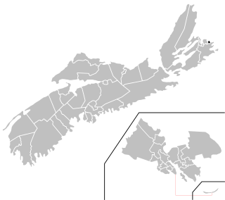
Glace Bay-Dominion is a provincial electoral district in Nova Scotia, Canada, that elects one member of the Nova Scotia House of Assembly.

Buccaneer Bay Provincial Park is a provincial park in British Columbia, Canada, located 17 km west of Sechelt on North Thormanby Island, offshore from the community of Halfmoon Bay.
Shuswap Lake Marine Provincial Park is an 896-hectare provincial park in British Columbia, Canada, comprising 991 ha. The Park has a variety of amenities including boat launch ramps, picnic areas, and 27 campsites around the perimeter of Shuswap Lake. The lake's name and that of the surrounding Shuswap Country is from the Shuswap people (Secwepemc), the most northern of the Salishan speaking people.
Belmont is a Canadian rural farming community located in the larger community of Lot 16 in central Prince County, Prince Edward Island. Lot 16 is actually three communities: Belmont, Central, and Southwest Lot 16, and is one of the last communities on Prince Edward Island to continue using their lot designation from the original Island survey by Samuel Holland in the 18th century.
Hengrove Athletic Football Club is a football club based in the Bristol suburb of Hengrove. Affiliated to the Somerset County FA, they are currently members of the Western League Division One and play at Norton Lane in Whitchurch.

Powerview-Pine Falls is a town in the Canadian province of Manitoba, with a population of 1,314 at the 2011 census, up 1.54% from 1,294 at the 2006 census and down 7.57% from 1,400 during the 2001 census.

Mulhurst Bay, or Mulhurst, is a hamlet in central Alberta, Canada within the County of Wetaskiwin No. 10. It is located 8 kilometres (5.0 mi) northwest of Highway 13A, approximately 38 kilometres (24 mi) southwest of Leduc.

Empire Bay was a 2,824 GRT collier. She was built by W Gray & Co Ltd, Hartlepool in 1940. She was owned by the Ministry of War Transport (MoWT) and managed by the Joseph Constantine Steamship Line Ltd. Empire Bay was sunk by German bombing off Middlesbrough on 15 January 1942.

Buff Bay is a settlement in Portland, Jamaica.
Old Harbour Bay is a settlement in Jamaica. It has a population of 8,537 as of 2009.

Edward F. Ricketts State Marine Conservation Area is one of four small marine protected areas located near the cities of Monterey and Pacific Grove, at the southern end of Monterey Bay on California’s central coast. The four areas together encompass 2.96 square miles (7.7 km2). Within SMCAs fishing and take of all living marine resources is prohibited except the recreational take of finfish by hook-and-line and the commercial take of giant and bull kelp under certain conditions.
Palmetto Bay is located on the southeast coast of Barbados, between Bottom Bay and Kitridge Bay.
Cave Bay is located on the southeast coast of Barbados, between Long Bay and Bottom Bay. It is located in Saint Phillip Parish. There is a dangerous undertow in the area, however, there are no lifeguards.
Coordinates: 13°8.184′N59°25.482′W / 13.136400°N 59.424700°W
| | This Barbados location article is a stub. You can help Wikipedia by expanding it. |