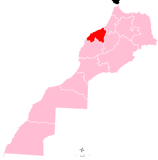
Mohammedia is a port city on the west coast of Morocco between Casablanca and Rabat in the region of Casablanca-Settat. It hosts the most important oil refinery of Morocco, the Samir refinery, which makes it the center of the Moroccan petroleum industry. It has a population of 208,612 according to the 2014 Moroccan census.

Oum Er-Rbia is a large, long and high-throughput river in central Morocco.
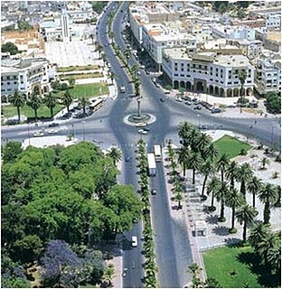
Settat is a city in Morocco between the national capital Rabat and Marrakesh. Settat is located 83.9 km by road south of the centre of Casablanca, roughly an hour's drive. It is the capital of Settat Province and is its largest city in both size and population. According to the 2014 Moroccan census, it had a population of 142,250 people, up from 116,570 people in the 2004 census. Settat is 370m above sea level, built on a plateau surrounded by foothills in all directions. The antiquities of Settat include the very old Ismailiya Kasbah distinguished by the statue of a steed which lies at the center of the city.
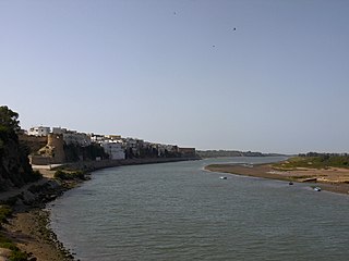
Azemmour or Azamor is a Moroccan city, lying at the Atlantic ocean coast, on the left bank of the Oum Er-Rbia River, 75 km southwest of Casablanca.

Beni Mellal is a Moroccan city located in the country's interior. It is the capital of the Béni Mellal-Khénifra Region and has a population of 192,676. It sits at the foot of Jbel Tassemit (2247m), and next to the plains of Beni Amir.

The Kingdom of Fez was the name given to the northern part of Morocco, from the founding of the country by the Idrisid dynasty in the 8th century until the establishment of the French and the Spanish protectorate. The kingdom had its capital at Fez (Fes).

Khenifra is a city in northern central Morocco, surrounded by the Atlas Mountains and located on the Oum Er-Rbia River. National Highway 8 also goes through the town. The population, as of a 2014 census, was 117,510.

The Middle Atlas is a mountain range in Morocco. It is part of the Atlas mountain range, a vast mountainous region with more than 100,000 km2, 15 percent of its landmass, rising above 2,000 metres. The Middle Atlas is the northernmost and second highest of three main Atlas Mountains chains of Morocco. To south, separated by the Moulouya and Um Er-Rbiâ rivers, lies the High Atlas. The Middle Atlas form the westernmost end of a large plateaued basin extending eastward into Algeria, also bounded by the Tell Atlas to the north and the Saharan Atlas to the south, both lying largely in Algeria. North of the Middle Atlas and separated by the Sebou River, lie the Rif mountains which are an extension of the Baetic System, which includes the Sierra Nevada in the south of Spain. The basin of the Sebou is not only the primary transportation route between Atlantic Morocco and Mediterranean Morocco but is an area, watered by the Middle Atlas range, that constitutes the principal agricultural region of the country.

The ZaianWar was fought between France and the Zaian confederation of Berber tribes in Morocco between 1914 and 1921. Morocco had become a French protectorate in 1912, and Resident-General Louis-Hubert Lyautey sought to extend French influence eastwards through the Middle Atlas mountains towards French Algeria. This was opposed by the Zaians, led by Mouha ou Hammou Zayani. The war began well for the French, who quickly took the key towns of Taza and Khénifra. Despite the loss of their base at Khénifra, the Zaians inflicted heavy losses on the French, who responded by establishing groupes mobiles, combined arms formations that mixed regular and irregular infantry, cavalry and artillery into a single force.

Water supply and sanitation in Morocco is provided by a wide array of utilities. They range from private companies in the largest city, Casablanca, the capital, Rabat, and two other cities, to public municipal utilities in 13 other cities, as well as a national electricity and water company (ONEE). The latter is in charge of bulk water supply to the aforementioned utilities, water distribution in about 500 small towns, as well as sewerage and wastewater treatment in 60 of these towns.

Ait Ourir is a town and municipality in Al Haouz Province, Marrakech-Tensift-Al Haouz, Morocco. At the time of the 2004 census, the commune had a total population of 20,005 people living in 3767 households.The town lies on the northern bank of the Ourika River, 29.8 kilometres (18.5 mi) by road to the northwest of Tighedouine and 33.3 kilometres (20.7 mi) east of the city centre of Marrakesh.

The Al Massira Dam is a gravity dam located 70 kilometres (43 mi) south of Settat on the Oum Er-Rbia River in Settat Province, Morocco. Completed in 1979, the dam provides water for the irrigation of over 100,000 hectares of farmland in the Doukkala region. The dam's hydroelectric power plant also generates 221 gigawatt-hours (800 TJ) on average annually. The power station was commissioned in 1980. Just to the north of the dam is a rip rap saddle dam to support water elevation in the reservoir. The dam's reservoir and wetlands were designated as a Ramsar site in 2005.
Ait Oum El Bekht is a town and rural commune in Béni Mellal Province, Béni Mellal-Khénifra, Morocco. At the time of the 2004 census, the commune had a total population of 9893 people living in 1807 households.

Oum Dreyga is a town in the disputed area of Western Sahara. It is administered by Morocco as a rural commune in Oued Ed-Dahab Province of the Dakhla-Oued Ed-Dahab region. At the time of the 2004 census, the commune had a total population of 3005 people living in 78 households.

Dar Oum Soltane is a small town and rural commune in Meknès Prefecture of the Fès-Meknès region of Morocco. At the time of the 2004 census, the commune had a total population of 6104 people living in 905 households.
Oum Rabia is a commune in Khénifra Province, Béni Mellal-Khénifra, Morocco. At the time of the 2004 census, the commune had a total population of 11,314 people living in 2033 households.
The Zayan barbel is a species of cyprinid fish endemic to Morocco found in the Oum Er-Rbia River basin.

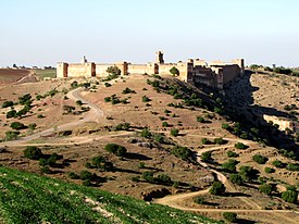
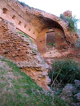
Kasbah Boulaouane is a kasbah in the town of Boulaouane, Morocco. It is situated on the rock which sits at the curve of Oum Er-Rbia River, overlooking the surrounding area. In the 20th century, an orientalist Edmond Doutté had provided a detailed description for the kasbah.
