Related Research Articles

The Kitsap Peninsula lies west of Seattle across Puget Sound, in Washington state in the Pacific Northwest. Hood Canal separates the peninsula from the Olympic Peninsula on its west side. The peninsula, a.k.a. "Kitsap", encompasses all of Kitsap County except Bainbridge and Blake Islands, as well as the northeastern part of Mason County and the northwestern part of Pierce County. The highest point on the Kitsap Peninsula is Gold Mountain. The U.S. Navy's Puget Sound Naval Shipyard, and Naval Base Kitsap are on the peninsula. Its main city is Bremerton.

Peggy's Cove is a small rural community located on the eastern shore of St. Margarets Bay in the Halifax Regional Municipality, which is the site of Peggys Cove Lighthouse.
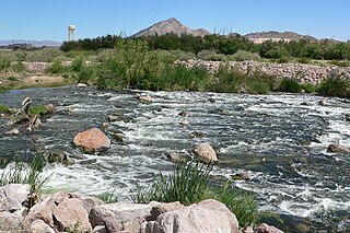
Las Vegas Wash is a 12-mile-long channel which feeds most of the Las Vegas Valley's excess water into Lake Mead. The wash is sometimes called an urban river, and it exists in its present capacity because of an urban population. The wash also works in a systemic conjunction with the pre-existing wetlands that formed the oasis of the Las Vegas Valley. The wash is fed by urban runoff, shallow ground water, reclaimed water used on parks and golf courses, and stormwater.
The Yeocomico River is a 1.1-mile-long (1.8 km) tidal tributary of the southern portion of the Potomac River in Virginia's Northern Neck. The Yeocomico forms the boundary between Westmoreland and Northumberland counties. Yeocomico is a Native American name roughly translated as "tossed to and fro by the waters." Others suggest it is an Algonquian word that means "four dwelling places" since the river has a branch on either side with each dividing into two large forks.

Las Vegas Bay is a bay at the western edge of Lake Mead in the U.S. state of Nevada. The bay is located within the Lake Mead National Recreation Area to the northeast of the city of Henderson, Nevada, near the junction of Lake Mead Drive and Lake Mead Boulevard. A public campground and boat access are available in Las Vegas Bay. Low water levels of Lake Mead have rendered the marina there inoperable, and it has moved to the Hemenway Boat Harbor, in the south end of the Boulder Basin. The launch ramp there has also been closed due to the water levels.

Nelson is a census-designated place in Clark County, Nevada, United States. The community is in the Pacific Standard Time zone. The location of Nelson is in El Dorado Canyon, Eldorado Mountains. The town is in the southeast region of the Eldorado Valley. As of the 2010 census it had a population of 37.

Pueblo Grande de Nevada,, is a complex of villages located near Overton, Nevada, and listed on the National Register of Historic Places.

Salt Point State Marine Conservation Area (SMCA) is a marine protected area that lies onshore from Fisk Mill Cove and south along Salt Point State Park in Sonoma County on California’s north central coast. The marine protected area covers 3.12 square miles. Salt Point SMCA prohibits the take of all living marine resources, except the recreational take of abalone and finfish.

The Hong Kong–Taiwan Economic and Cultural Co-operation and Promotion Council (ECCPC) represents the Government of Hong Kong in talks with Taiwan, through its counterpart, the Taiwan–Hong Kong Economic and Cultural Co-operation Council (ECCC).
Boulder Canyon, originally Devils Gate Canyon, is a canyon on the Colorado River, above Hoover Dam, now flooded by Lake Mead. It lies between Clark County, Nevada and Mohave County, Arizona. It heads at western end of the Virgin River Basin of Lake Mead, at about 36°09′05″N114°32′51″W. Boulder Canyon divides the Black Mountains into the Black Mountains of Arizona, and the Black Mountains of Nevada. Its mouth is now under the eastern end of the Boulder Basin of Lake Mead, between Canyon Point in Nevada and Canyon Ridge in Arizona. Its original mouth is now underneath Lake Mead between Beacon Rock and Fortification Ridge on the southern shore in Arizona.

Fortification Rock, once a landmark hill on the Colorado River before it was inundated, now known as Rock Island, southernmost and tallest of the Boulder Islands in Lake Mead, Clark County, Nevada. It has an elevation of 1284 feet. Fortification Rock appears on the 1861 Geological Map No. 1; Rio Colorado of the West, explored by 1st Lieut. Joseph C. Ives, which shows Fortification Rock, Ives Camp #59 and the course of the Colorado River from its mouth on the Gulf of California to Las Vegas Wash and the location of its features and other expedition camps along the way.
Halfway Wash, is a stream in Clark County and Lincoln County, Nevada. Its mouth is at its confluence with the Virgin River at an elevation of 1,306 feet (398 m). Its source is at an elevation of 3,560 feet (1,090 m), on the south slope of Davidson Peak at 36°53′09″N114°19′32″W in Lincoln County, Nevada.
California Wash is an arroyo tributary to the Muddy River, in Clark County, Nevada. Its mouth is at its confluence with the Muddy River over a mile southwest of Moapa and a mile and a half west of Glendale, Nevada. Its source is at an elevation of 3320 feet at the southwestern end of the Muddy Mountains, at 36°17′14″N114°48′09″W. From there it drains northeastward to its mouth on the Muddy River.
Toquop Wash is a stream in Clark County, and Lincoln County, Nevada. Its mouth is at its confluence with the Virgin River at an elevation of 1,470 feet (450 m) in Clark County. Its source is at 37°02′25″N114°18′49″W at an elevation of 2,920 feet (890 m), above Toquop Gap between the East Mormon Mountains and Tule Springs Hills, at the confluence of Garden Wash and Sams Camp Wash in Lincoln County.
Callville Wash is an ephemeral stream or wash in Clark County, Nevada. It was named for Callville the riverport settlement founded in 1866, at its mouth where it had its original confluence with the Colorado River.
Cottonwood Spring is a spring in the Black Mountains, between the west end of Pinto Valley and Callville Wash, at an elevation of 2205 feet.
Boulder Wash is an ephemeral stream or wash in Clark County, Nevada. Its mouth is at its confluence with the Boulder Wash Cove of Lake Mead at an elevation 1,276 feet / 389 meters at when Lake Mead is at its full level. Currently as the reservoir is at a much lower level its mouth is found at approximately 36°10′07″N114°33′07″W. Its source is at 36°13′36″N114°31′22″W at an elevation of 2,841 feet / 866 meters in the Black Mountains. It flows down a canyon into the upper Pinto Valley southwestward before turning southeastward to Boulder Wash Cove.
West End Wash is an ephemeral stream or wash in Clark County, Nevada. Its mouth is at its confluence with the Callville Wash of Lake Mead at an elevation 1,250 feet / 381 meters at when Lake Mead is at its full level. Currently as the reservoir is at a much lower level its mouth is found at approximately 36°08′24″N114°42′57″W. Its source is at 36°15′55″N114°43′58″W at 3,083 feet / 940 meters in the Gale Hills.
Gale Hills, formerly considered part of the Muddy Range (1879), and later the South Muddy Mountains (1980s), are a range of hills southwest of the Muddy Mountains and about three miles north of the Boulder Basin of Lake Mead, in Clark County, Nevada. It is bounded on the east by Callville Wash; on the south by the Black Mesa lava flows; on the northwest by the valley of Gypsum Wash. Its highpoint is at 36°15′32″N114°43′12″W which lies at 3,756 feet / 1,145 meters.
Gypsum Wash is an ephemeral stream or wash in Clark County, Nevada. Gypsum Wash was originally a tributary of Las Vegas Wash before the formation of Lake Mead which submerged their confluence under Las Vegas Bay. Due to the lowering of the reservoir over recent years Gypsum Wash is once again a tributary of Las Vegas Wash, now exposed at 36°07′04″N114°50′54″W at an elevation of 1085 feet. When Las Vegas Bay is at its full level, Gypsum Wash flows into Lower Gypsum Wash Cove at 36°07′43″N114°51′26″W at an elevation of 1,204 feet / 367 meters.
References
Coordinates: 36°09′54″N114°32′59″W / 36.16500°N 114.54972°W
| | This Clark County, Nevada state location article is a stub. You can help Wikipedia by expanding it. |