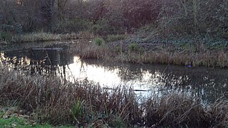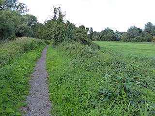
The River Wandle is a right-bank tributary of the River Thames in south London, England. With a total length of about 9 miles (14 km), the river passes through the London boroughs of Croydon, Sutton, Merton and Wandsworth, where it reaches the Thames. A short headwater – the Caterham Bourne – is partially in Surrey, the historic county of the river's catchment. Tributaries of the Wandle include Carshalton Ponds and Norbury Brook.
Bourne Park may refer to:

Bixley Heath is a 5.1-hectare (13-acre) biological Site of Special Scientific Interest on the eastern outskirts of Ipswich in Suffolk. It is also a Local Nature Reserve owned and managed by Ipswich Borough Council.

Gillespie Park is a 3.4 hectare Local Nature Reserve and Site of Metropolitan Importance for Nature Conservation in Highbury in the London Borough of Islington. It also hosts the Islington Ecology Centre, which provides environmental education for schools and organises walks and talks for adults. It is owned and managed by Islington Council. The site is protected by Fields in Trust through a legal "Deed of Dedication" safeguarding the future of the space as public recreation land for future generations to enjoy.

Barking Woods is a 98.7-hectare (244-acre) biological Site of Special Scientific Interest in six separate blocks north-east of Ipswich in Suffolk. Part of it is a 20-hectare (49-acre) nature reserve called Bonny Wood, which is owned and managed by the Suffolk Wildlife Trust.

Alderman Canal East is a 1.6 hectare Local Nature Reserve in Ipswich in Suffolk. It is owned by Ipswich Borough Council and managed by the Greenways Countryside Project.

Alderman Canal West is a one hectare Local Nature Reserve in Ipswich in Suffolk. It is owned by Ipswich Borough Council and managed by the Greenways Countryside Project.

Bobbits Lane is a 16.1 hectares Local Nature Reserve in Ipswich in Suffolk. It is owned by Ipswich Borough Council and managed by the Greenways Countryside Project.

Bramford Meadows is a nine hectare Local Nature Reserve in Bramford, on the western outskirts of Ipswich in Suffolk. It is owned by Bramford Parish Council and managed by Bramford Openspaces Ltd.

Bridge Wood is a 31 hectare Local Nature Reserve on the southern outskirts of Ipswich in Suffolk, England. It is owned and managed by Ipswich Borough Council, and is part of Orwell Country Park.

Millennium Wood is a 3.8 hectare Local Nature Reserve on the southern outskirts of Ipswich in Suffolk. It is owned by Suffolk County Council and managed by the Greenways Countryside Project.

Pipers Vale is a 19.7 hectare Local Nature Reserve on the southern outskirts of Ipswich in Suffolk. It is owned and managed by Ipswich Borough Council.

Spring Wood is a 5.5 hectare Local Nature Reserve east of Belstead, on the southern outskirts of Ipswich in Suffolk. It is owned and managed by Ipswich Borough Council.

Stoke Park Wood is a 2.2 hectare Local Nature Reserve in Ipswich in Suffolk. It is owned and managed by Ipswich Borough Council.

The Dales Open Space is a 5.9 hectare Local Nature Reserve in Ipswich in Suffolk. It is owned and managed by Ipswich Borough Council.

Sandlings is a 5.7 hectare Local Nature Reserve in Rushmere St Andrew, on the eastern outskirts of Ipswich in Suffolk. It is owned by East Suffolk council, and managed by the council together with Rushmere St Andrew Parish Council and the Greenways Countryside Project.

Mill Stream Nature Reserve is a 4.7 hectare Local Nature Reserve in Rushmere St Andrew on the eastern outskirts of Ipswich in Suffolk. It is owned by Suffolk Coastal District Council and managed by the council together with Rushmere St Andrew Parish Council and the Greenways Countryside Project.

Lucas Marsh is a 1.5 hectare Local Nature Reserve in Oadby in Leicestershire. It is part of Brock's Hill Country Park, and is owned by Oadby and Wigston Borough Council and managed by the Leicestershire and Rutland Wildlife Trust.

Whitlingham Marsh is a 15.5-hectare (38-acre) Local Nature Reserve in Norwich in Norfolk. It is owned by South Norfolk District Council and managed by the Whitlingham Charitable Trust and the Broads Authority.


