Bower, West Virginia

Last updated

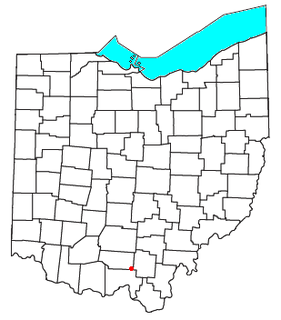
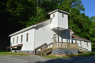
Bower is an extinct town in Braxton County, in the U.S. state of West Virginia. The GNIS classifies it as a populated place. [1]

Braxton County, West Virginia U.S. county in West Virginia

Braxton County is a county in the central part of the U.S. state of West Virginia. As of the 2010 census, the population was 14,523. The county seat is Sutton. The county was formed in 1836 from parts of Lewis, Kanawha, and Nicholas counties and named for Carter Braxton, a Virginia statesman and signer of the Declaration of Independence.

U.S. state constituent political entity of the United States

In the United States, a state is a constituent political entity, of which there are currently 50. Bound together in a political union, each state holds governmental jurisdiction over a separate and defined geographic territory and shares its sovereignty with the federal government. Due to this shared sovereignty, Americans are citizens both of the federal republic and of the state in which they reside. State citizenship and residency are flexible, and no government approval is required to move between states, except for persons restricted by certain types of court orders.

West Virginia U.S. state in the United States

West Virginia is a state located in the Appalachian region of the Southern United States, and is also considered to be a part of the Mid-Atlantic Southeast Region. It is bordered by Pennsylvania to the north, Maryland to the east and northeast, Virginia to the southeast, Kentucky to the southwest, and Ohio to the northwest. West Virginia is the 41st largest state by area, and is ranked 38th in population. The capital and largest city is Charleston.

History

A post office called Bower was established in 1906, and remained in operation until 1941. [2] The community had the name of Henry Bower, a railroad official. [3]

Related Research Articles

Jacksonville, West Virginia Unincorporated community in West Virginia, United States

Jacksonville is an unincorporated community in Lewis County, West Virginia, United States. Its altitude is 1,079 feet (329 m), and it is located at 38°53′27″N80°29′31″W.

Stockdale, Ohio unincorporated community in southern Marion Township, Pike County, Ohio, United States

Stockdale is an unincorporated community and census-designated place in southern Marion Township, Pike County, Ohio, United States. Stockdale has a post office with the ZIP code 45683. Stockdale is served by the Minford Telephone Company and Eastern Local Schools.

Mount Lookout, West Virginia Unincorporated community in West Virginia, United States

Mt. Lookout is a small unincorporated community in Nicholas County, West Virginia, United States, 10 miles (16 km) south of Summersville.

Griminger, California Unincorporated community in California, United States

Griminger is an unincorporated community in El Dorado County, California. It lies at an elevation of 4905 feet.

Blue Spring is an unincorporated community in Randolph County, in the U.S. state of West Virginia.

Clifty is an unincorporated community in Fayette County, in the U.S. state of West Virginia.

Cressmont, West Virginia human settlement in West Virginia, United States of America

Cressmont is an unincorporated community in Clay County, in the U.S. state of West Virginia.

De Kalb is an unincorporated community in Gilmer County, in the U.S. state of West Virginia.

Dutch is an unincorporated community in Braxton County, in the U.S. state of West Virginia.

Elliott is an extinct town in Fayette County, in the U.S. state of West Virginia.

Hyers is an unincorporated community in Braxton County, in the U.S. state of West Virginia.

Kirkwood is an unincorporated community in Nicholas County, in the U.S. state of West Virginia.

Morris is an unincorporated community in Nicholas County, in the U.S. state of West Virginia.

Orton is an unincorporated community in Gilmer County, in the U.S. state of West Virginia.

Palmer is an extinct town in Braxton County, in the U.S. state of West Virginia. The GNIS classifies it as a populated place.

Sleith is an extinct town in Braxton County, in the U.S. state of West Virginia.

Sparks is a ghost town in Nicholas County, in the U.S. state of West Virginia.

Vernon is an unincorporated community in Braxton County, in the U.S. state of West Virginia.

Vinton is a ghost town in Nicholas County, in the U.S. state of West Virginia.

Withers is an unincorporated community in Gilmer County, in the U.S. state of West Virginia.

References

  1. U.S. Geological Survey Geographic Names Information System: Bower, West Virginia
  2. "Post Offices". Jim Forte Postal History. Archived from the original on 6 March 2016. Retrieved 17 February 2015.
  3. Kenny, Hamill (1945). West Virginia Place Names: Their Origin and Meaning, Including the Nomenclature of the Streams and Mountains. Piedmont, WV: The Place Name Press. p. 126.

Coordinates: 38°51′30″N80°43′11″W / 38.85833°N 80.71972°W / 38.85833; -80.71972

Geographic coordinate system Coordinate system

A geographic coordinate system is a coordinate system that enables every location on Earth to be specified by a set of numbers, letters or symbols. The coordinates are often chosen such that one of the numbers represents a vertical position and two or three of the numbers represent a horizontal position; alternatively, a geographic position may be expressed in a combined three-dimensional Cartesian vector. A common choice of coordinates is latitude, longitude and elevation. To specify a location on a plane requires a map projection.