Nokesville is a census-designated place (CDP) in Prince William County, Virginia, United States and Fauquier County, Virginia, United States. The population was 1,619 in the 2020 census.

Mount Jackson is a town in Shenandoah County, Virginia, United States. The population was 1,994 at the 2010 census.

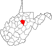
Grafton is a city in and the county seat of Taylor County, West Virginia, United States, along the Tygart Valley River. The population was 4,729 at the 2020 census. It originally developed as a junction point for the Baltimore and Ohio Railroad, serving numerous branches of a network that was vital to the regional coal industry.

The Little Kanawha River is a tributary of the Ohio River, 169 mi (269 km) long, in western West Virginia in the United States. Via the Ohio, it is part of the watershed of the Mississippi River, draining an area of 2,320 mi2 (6,009 km2) on the unglaciated portion of the Allegheny Plateau. It served as an important commercial water route in the early history of West Virginia, particularly in the logging and petroleum industries.

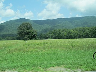
Cades Cove is an isolated valley located in the Tennessee section of the Great Smoky Mountains National Park. The valley was home to numerous settlers before the formation of the national park. Today Cades Cove, the single most popular destination for visitors to the park, attracts more than two million visitors a year because of its well preserved homesteads, scenic mountain views, and abundant display of wildlife. The Cades Cove Historic District is listed on the National Register of Historic Places.

The Coal River is a tributary of the Kanawha River in southern West Virginia. It is formed near the community of Alum Creek by the confluence of the Big and Little Coal Rivers, and flows generally northward through western Kanawha County, past the community of Upper Falls and into the Kanawha River at St. Albans.

Middle Island Creek is a river, 77 miles (124 km) long, in northwestern West Virginia in the United States. It is a tributary of the Ohio River, draining an area of 565 square miles (1,463 km2) on the unglaciated Allegheny Plateau. It was named by late 18th century pioneering travelers on the Ohio River, who noted the location of the Creek's mouth opposite Middle Island in the larger river.
Burlington is a census-designated place (CDP) in Mineral County, West Virginia, United States, located along U.S. Route 50 where it crosses Pattersons Creek. As of the 2020 census, its population was 131. It is part of the Cumberland, MD-WV Metropolitan Statistical Area. The ZIP code for Burlington is 26710.

Cascade Heights is an affluent neighborhood in southwest Atlanta. It is bisected by Cascade Road, which was known as the Sandtown Road in the nineteenth century. The road follows the path of the ancient Sandtown Trail which ran from Stone Mountain to the Creek village of Sandtown on the Chattahoochee River and from there on into Alabama. Ironically, the name lived on even after the Indians were expelled in the 1830s.

Bunker Hill is an unincorporated community in Berkeley County, West Virginia, United States, located in the lower Shenandoah Valley on Winchester Pike at its junction with County Route 26 south of Martinsburg. It is the site of the confluence of Torytown Run and Mill Creek, a tributary of Opequon Creek which flows into Winchester, Virginia. According to the 2000 census, the Bunker Hill community has a population of 5,319.
Triune is an unincorporated community in eastern Williamson County, Tennessee, approximately halfway between Franklin and Murfreesboro. The community is located along the Wilson Branch of the Harpeth River. The intersection of former local roads State Route 96 and the concurrency of U.S. Routes 31A and 41A is here. The community is located just north of these roads interchange with Interstate 840.

The Holly River is a tributary of the Elk River in central West Virginia in the United States. Via the Elk, Kanawha, and Ohio Rivers, it is part of the watershed of the Mississippi River, draining an area of 148 square miles (380 km2) in a rural region of the Allegheny Mountains. It is approximately 3.9 miles (6.3 km) long, or 28 miles (45 km) including its Left Fork. The river was named for the holly bushes along its course.

Spring Creek is a tributary of the Little Kanawha River in western West Virginia in the United States. Via the Little Kanawha and Ohio rivers, it is part of the watershed of the Mississippi River, draining an area of 89 square miles (230 km2) in a rural region on the unglaciated portion of the Allegheny Plateau. It is 25.3 miles (40.7 km) long, or 33.3 miles (53.6 km) long including its Left Fork.
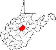
Steer Creek is a tributary of the Little Kanawha River in central West Virginia in the United States. Via the Little Kanawha and Ohio rivers, it is part of the watershed of the Mississippi River, draining an area of 184 square miles (480 km2) in a rural region on the unglaciated portion of the Allegheny Plateau. It is 6.3 miles (10.1 km) long, or 31.7 miles (51.0 km) long including its Right Fork.

The Meathouse Fork is a tributary of Middle Island Creek, 19.7 miles (31.7 km) long, in north-central West Virginia in the United States. Via Middle Island Creek and the Ohio River, it is part of the watershed of the Mississippi River, draining an area of 64.6 square miles (167 km2) in a rural region on the unglaciated portion of the Allegheny Plateau.

Kiah Creek, a shortened version of "Hezekiah's Creek", is a major tributary of the East Fork of Twelvepole Creek in Lincoln and Wayne counties, West Virginia.

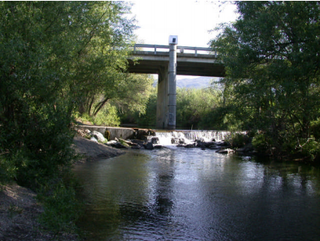
Middle Creek is a creek that drains through Rodman Slough into Clear Lake in Lake County, California. It supplies 21% of the streamflow to Clear Lake. The watershed vegetation has been drastically modified by European settlers through sheep and cattle grazing, logging and farming in the valley floors. The creek once flowed through extensive wetlands at its mouth, but these were mainly drained to create farmland, apart from Rodman Slough on the west side. There are now projects to restore the drained land to its original condition.
Cooks Point is an unincorporated community in Burleson County, Texas, United States. According to the Handbook of Texas, the community had a population of 60 in 2000. It is located within the Bryan-College Station metropolitan area.


