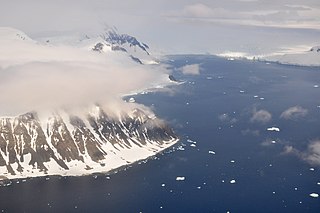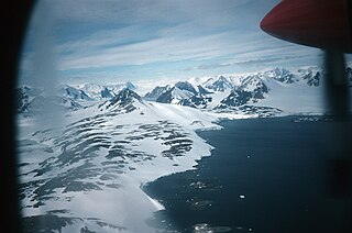
Borchgrevink Glacier is a large glacier in the Victory Mountains, Victoria Land, draining south between Malta Plateau and Daniell Peninsula, and thence projecting into Glacier Strait, Ross Sea, as a floating glacier tongue, the Borchgrevink Glacier Tongue, just south of Cape Jones. It was named by the New Zealand Geological Survey Antarctic Expedition, 1957–58, for Carsten Borchgrevink, leader of the British Antarctic Expedition, 1898–1900. Borchgrevink visited the area in February 1900 and first observed the seaward portion of the glacier.

Adams Glacier, also known as John Quincy Adams Glacier, is a broad channel glacier in Wilkes Land, Antarctica which is over 20 miles (32 km) long. It debouches into the head of Vincennes Bay, just east of Hatch Islands. It was first mapped in 1955 by G.D. Blodgett from aerial photographs taken by U.S. Navy Operation Highjump (1947), and it was named by the Advisory Committee on Antarctic Names (US-ACAN) for John Quincy Adams, sixth President of the United States. Adams was instrumental while later serving as U.S. representative from Massachusetts in gaining congressional authorization of the United States Exploring Expedition (1838–42) under Lieutenant Charles Wilkes, and perpetuating the compilation and publication of the large number of scientific reports based on the work of this expedition.
The Lawson Aiguilles are a line of sharp peaks in the south part of Mount Rivett, in the Gustav Bull Mountains of Mac. Robertson Land, Antarctica. Peaks in this group were included in Australian National Antarctic Research Expedition surveys of 1962 and 1967. The aiguilles were named by the Antarctic Names Committee of Australia for E. J. Lawson, a diesel mechanic at Mawson Station who assisted with the survey work in 1967.
The Eklund Islands are a group of islands which rise through the ice near the southwest end of George VI Sound towards the south of the Antarctic Peninsula.

Posadowsky Glacier is a glacier about 9 nautical miles long, flowing north to Posadowsky Bay immediately east of Gaussberg. Posadowsky Bay is an open embayment, located just east of the West Ice Shelf and fronting on the Davis Sea in Kaiser Wilhelm II Land. Kaiser Wilhelm II Land is the part of East Antarctica lying between Cape Penck, at 87°43'E, and Cape Filchner, at 91°54'E, and is claimed by Australia as part of the Australian Antarctic Territory. Other notable geographic features in this area include Drygalski Island, located 45 mi NNE of Cape Filchner in the Davis Sea, and Mirny Station, a Russian scientific research station.
Willey Glacier is a heavily crevassed glacier north of Creswick Peaks in Palmer Land, flowing west from Creswick Gap into George VI Sound. Named by United Kingdom Antarctic Place-Names Committee (UK-APC) for Lawrence E. Willey, British Antarctic Survey (BAS) geologist at Fossil Bluff and Stonington Island stations, 1966–69 and 1973, and awarded the Polar Medal for services to Antarctic Survey in 1976.

Apollo Glacier is a glacier, 9 nautical miles (17 km) long, flowing northeast and joining the lower part of Aphrodite Glacier 2 nautical miles (4 km) from the east coast of the Antarctic Peninsula. The lower part of this glacier was first plotted by W.L.G. Joerg, from aerial photographs taken by Sir Hubert Wilkins in December 1928 and by Lincoln Ellsworth in November 1935. The glacier was subsequently photographed by the Ronne Antarctic Research Expedition in December 1947 and roughly surveyed by the Falkland Islands Dependencies Survey in November 1960. It was named by the UK Antarctic Place-Names Committee after Apollo, the god of manly youth and beauty in Greek mythology.
Mount Bridgman is a prominent mountain which surmounts the central part of Liard Island in Hanusse Bay, off the west coast of Graham Land. It was mapped from photos obtained by the Ronne Antarctic Research Expedition (1947–48) and the Falkland Islands and Dependencies Aerial Survey Expedition (1956–57). It was named by the UK Antarctic Place-Names Committee for Percy W. Bridgman, an American physicist who discovered the high-pressure forms of ice.

Bucher Glacier is a small glacier draining the west slopes of Rudozem Heights and flowing to Bourgeois Fjord just north of Bottrill Head on the German Peninsula, Fallières Coast on the west side of Graham Land, Antarctica. It was named by the UK Antarctic Place-Names Committee in 1958 for Edwin Bucher, Swiss glaciologist and author of many publications on snow and avalanches.

Bunt Island is an island just east of Bowl Island at the head of Amundsen Bay in Enderby Land. It was sighted in 1956 by an Australian National Antarctic Research Expeditions airborne field party, and named by the Antarctic Names Committee of Australia for J. Bunt, biologist at Mawson Station in 1956.

Cole Channel is a marine channel running north–south between Wright Peninsula, Adelaide Island, and Wyatt Island, Laubeuf Fjord, off the Loubet Coast, Antarctica. It was named by the UK Antarctic Place-Names Committee in 1984 after Captain Maurice John Cole, Senior Master of the British Antarctic Survey ship Bransfield from 1975. Cole did previous Antarctic service as an officer on the John Biscoe and the Shackleton, for several seasons between 1960 and 1972.
The Cook Nunataks are a group of four nunataks at the northeast end of the Schwartz Range, in Enderby Land. They were mapped from Australian National Antarctic Research Expeditions (ANARE) surveys and air photos, 1954–66, and named by the Antarctic Names Committee of Australia for P.J. Cook, a geologist who visited the area with ANARE in 1965.
Vivaldi Glacier is a glacier lying between the Colbert Mountains and the Lully Foothills, flowing south from Purcell Snowfield into the head of Schubert Inlet on the west coast of Alexander Island, Antarctica. The feature appears to be first shown on maps of the United States Antarctic Service (USAS) which photographed Alexander Island from the air in 1940. It was mapped from air photos obtained by the Ronne Antarctic Research Expedition in 1947–48, by Searle of the Falkland Islands Dependencies Survey in 1960. Named "Vivaldi Gap" by the United Kingdom Antarctic Place-Names Committee in 1961, after Antonio Vivaldi (1678–1741), Venetian composer. The name was amended to Vivaldi Glacier following review of Landsat program imagery, 1979, displaying flow lines in the feature.

Gallup Glacier is a broad glacier, about 12 nautical miles (22 km) long, flowing east between Mount Rosenwald and Mount Black to enter Shackleton Glacier, Antarctica, just north of Matador Mountain. It was named by the Advisory Committee on Antarctic Names after Commander F.S. Gallup, Jr., U.S. Navy, Commanding Officer of Squadron VX-6 during Operation Deep Freeze 1965.
Mount Twigg is a large rock outcrop bisected by a north-trending glacier, standing 16 nautical miles (30 km) southeast of Mount Maguire near the head of Lambert Glacier. Mapped from ANARE air photos and surveys, 1956-58. Named by Antarctic Names Committee of Australia (ANCA) for D.R. Twigg, radio supervisor at Mawson Station, 1958.

Reluctant Island is a small island off eastern Horseshoe Island. Surveyed by Falkland Islands Dependencies Survey (FIDS) in 1955–57. So named because of the feature's apparent reluctance to be recognized as an island; it did not appear on maps of the British Graham Land Expedition (BGLE) 1934–37 and was mapped as a peninsula by FIDS in 1948–50.

Lystad Bay is a bay 2.5 nautical miles (5 km) wide which indents the west side of Horseshoe Island, in the northeast part of Marguerite Bay, Antarctica. It was first surveyed in 1936–37 by the British Graham Land Expedition under John Rymill, and was visited by the USMS North Star and USS Bear of the United States Antarctic Service in 1940. The name was proposed by the Advisory Committee on Antarctic Names for Captain Isak Lystad of the North Star.
Renner Peak is the dominant peak on the small mountain mass between Chapman and Naess Glaciers on the west coast of Palmer Land. Named by United Kingdom Antarctic Place-Names Committee (UK-APC) for Robert G.B. Renner, British Antarctic Survey (BAS) geophysicist at Stonington Island, 1963-65.

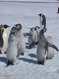
Taylor Rookery is an emperor penguin breeding colony on the Mawson Coast of Mac.Robertson Land in East Antarctica. It is the larger of the two known entirely land-based colonies of the species, most of which are situated on sea ice.


