Indiana County–Jimmy Stewart Airport is a county-owned public airport two miles (3 km) east of the borough of Indiana, in Indiana County, Pennsylvania. The airport is about 65 miles (105 km) northeast of Pittsburgh and is in the Pittsburgh Combined Statistical Area. It is classified as a business service airport by the Pennsylvania Bureau of Aviation.

Porter County Regional Airport is a public use airport one nautical mile (1.8 km) southeast of the central business district of Valparaiso, a city in Porter County, Indiana, United States. The Porter County Municipal Airport Authority owns the airport.

Wakulla County Airport is a county-owned, public-use airport in Wakulla County, Florida, United States. It is located three nautical miles (6 km) south of the central business district of Panacea, Florida.
Shawnee Field is a public use airport in Greene County, Indiana, United States. It is owned by Shawnee Field Inc. and is located three nautical miles (5.56 km) west of the central business district of Bloomfield, Indiana.
Westfield Airport is a public use airport located two nautical miles west of the central business district of Westfield, a city in Hamilton County, Indiana, United States. It is privately owned by Leslie Wheeler.
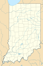
Warsaw Municipal Airport is a public use airport located two miles (3 km) north of the central business district of Warsaw, a city in Kosciusko County, Indiana, United States. It is owned by the Warsaw Board of Aviation Commissioners.

Posey Field is a city-owned public-use airport located three nautical miles northeast of the central business district of Haleyville, a city in Winston County, Alabama, United States.

Roy E. Ray Airport is a privately owned, public-use airport located three nautical miles northeast of the central business district of Bayou La Batre, a city in Mobile County, Alabama, United States.
Miami Homestead General Aviation Airport is a county-owned public-use airport in unincorporated Miami-Dade County, Florida, United States, located four nautical miles (7 km) northwest of the central business district of Homestead.
Deer Park Airport, formerly known as Deer Park Municipal Airport, is a city-owned public-use airport located three nautical miles (6 km) northeast of the central business district of Deer Park, a city in Spokane County, Washington, United States.
Morrison Flight Park is a private use ultralight airport in Greene County, Indiana, United States. It is located two nautical miles (4 km) southwest of the central business district of Linton, Indiana, and was previously a public use airport.

Jackson County Airport is a county-owned, public-use airport located three nautical miles northeast of the central business district of Gainesboro, in Jackson County, Tennessee, United States.
Pam's Place Airport is a public-use airport in Putnam County, Indiana, United States. It is located three nautical miles (6 km) southwest of the central business district of Eminence, an unincorporated town in Adams Township, Morgan County.

Ingersoll Airport is a public use airport located two nautical miles northwest of the central business district of Canton, a city in Fulton County, Illinois, United States. The airport is owned by the Canton Park District. It is included in the FAA's National Plan of Integrated Airport Systems for 2011–2015, which categorized it as a general aviation facility.
Goshen Municipal Airport is a public use airport located three nautical miles (6 km) southeast of the central business district of Goshen, a city in Elkhart County, Indiana, United States. It is owned by the Goshen Board of Aviation Commissioners. This airport is included in the National Plan of Integrated Airport Systems for 2011–2015, which categorized it as a general aviation facility.

Twin Bridges Airport is a public use airport located two nautical miles (4 km) southeast of the central business district of Twin Bridges, a town in Madison County, Montana, United States. It is owned by Madison County and the Town of Twin Bridges. This airport is included in the National Plan of Integrated Airport Systems for 2011–2015, which categorized it as a general aviation facility.
Salem Municipal Airport is a city-owned, public-use airport located two nautical miles (4 km) west of the central business district of Salem, a city in Washington County, Indiana, United States. It is included in the National Plan of Integrated Airport Systems for 2011–2015, which categorized it as a general aviation facility.
New Castle-Henry County Municipal Airport is a public use airport located four nautical miles southeast of the central business district of New Castle, a city in Henry County, Indiana, United States. It is included in the National Plan of Integrated Airport Systems for 2011–2015, which categorized it as a general aviation facility.
Kentland Municipal Airport is a public use airport located one nautical mile (2 km) southeast of the central business district of Kentland, in Newton County, Indiana, United States. It is owned by the Kentland Board of Aviation Commissioners. This airport included in the National Plan of Integrated Airport Systems for 2011–2015, which categorized it as a general aviation facility.
Action Airpark is a privately owned, public use ultralight airport in Dearborn County, Indiana, United States. As per FAA records, it is one nautical mile northeast of the central business district of Hardenstown, Indiana. The airpark is near Hardinsburg, an unincorporated town in Lawrenceburg Township, near the cities of Greendale and Lawrenceburg.