| Boyn Hill | |
|---|---|
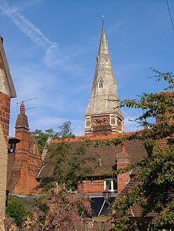 All Saints' Church, Boyn Hill, Maidenhead (September 2005) | |
 Boyn Hill Location within Berkshire | |
| OS grid reference | SU8780 |
| Shire county | |
| Region | |
| Country | England |
| Sovereign state | United Kingdom |
| Police | Thames Valley |
| Fire | Royal Berkshire |
| Ambulance | South Central |
Boyn Hill is a suburb of Maidenhead in the English county of Berkshire. [1] [2]
It is located west of the town centre, between the A4 and the railway.