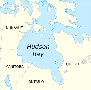
The Pembina River is a tributary of the Red River of the North, approximately 319 miles (513 km) long, in southern Manitoba in Canada and northeastern North Dakota in the United States. It drains an area of the prairie country along the Canada–US border, threading the Manitoba-North Dakota border eastward to the Red River. Via the Red River, Lake Winnipeg and the Nelson River, it is part of the watershed of Hudson Bay.

The Liard River flows through Yukon, British Columbia and the Northwest Territories, Canada. Rising in the Saint Cyr Range of the Pelly Mountains in southeastern Yukon, it flows 1,115 kilometres (693 mi) southeast through British Columbia, marking the northern end of the Rocky Mountains and then curving northeast back into Yukon and Northwest Territories, draining into the Mackenzie River at Fort Simpson, Northwest Territories. The river drains approximately 277,100 square kilometres (107,000 sq mi) of boreal forest and muskeg.

Carman was a provincial electoral division in the Canadian province of Manitoba. It was created by redistribution in 1999, with territory from Lakeside, Morris, and the now-defunct riding of Gladstone.

The Pembina Valley is the name given to the south-central region of the province of Manitoba, Canada. It is named for its major geographical feature, the Pembina Valley, which runs through the southwestern part of the region.

Emerson is an unincorporated community recognized as a local urban district in south central Manitoba, Canada, located within the Municipality of Emerson – Franklin. It has a population of 655.

Carman is a small agricultural town of about 3,000 people in the Pembina Valley Region of southern Manitoba. Carman is at the junction of Highways 3 and 13, 40 minutes southwest of Winnipeg. It is surrounded by the Rural Municipality of Dufferin, in the heart of a rich prairie agricultural belt, 60 kilometres north of the American state of North Dakota.

Morris is a small town in the Pembina Valley region of Manitoba, Canada, located 51 km south of Winnipeg and 42 km north of Emerson. Morris is home to 1,885 people (2016). Named after Alexander Morris, the second Lieutenant Governor of Manitoba.
The Central Plains Region is located in the south central part of the Canadian province of Manitoba, directly west of Winnipeg. It is bounded on the south by the Pembina Valley Region; on the east by the Eastman Region, to the north by the Interlake Region and to the west by the Westman Region.

Division No. 3 is part of the Pembina Valley Region in the south-central region of the province of Manitoba, Canada. Its major service center is the city of Winkler. Other important towns include Morden, Altona, and Carman.
Provincial Highway 13 by the Manitoba Infrastructure and Transportation is a Regional Transportation Advisory Committee RTAC Route of Manitoba. The RTAC route is capable of handling RTAC vehicles such as a truck, a truck and pony trailer, a truck and full trailer, a truck tractor and semi-trailer, an A-train, a B-train, or a C-train. The route extends south to north from its junction with PTH 3 and PR 245 in Carman to its junction with PTH 1 and PR 430 north of Oakville. The northern terminus of PTH 13 is located between Portage la Prairie and Manitoba's capital city Winnipeg. The Central Manitoba Railway (CEMR) shortline rail intersects PTH 13 north of Carman, the Canadian Pacific Railway (CPR) intersects at Elm Creek, and the Canadian National Railway (CNR) at Oakville.
Provincial Highway 14 by the Manitoba Infrastructure and Transportation is a Regional Transportation Advisory Committee RTAC Route of Manitoba. The RTAC route is capable of handling RTAC vehicles such as a truck, a truck and pony trailer, a truck and full trailer, a truck tractor and semi-trailer, an A-train, a B-train, or a C-train. PTH 14 is a 2 lane high-speed rural highway (100 km/h) and carries relatively high traffic volumes of approximately 1800 vehicles per day.
The 2001 Average Annual Daily Traffic
(AADT) in the vicinity of Altona is 2380 taken north of PR 201
and 3050 AADT south of the PTH 14/PR 201 intersection.
BizPaL is a web service for Canadian businesses provided by the federal, and participating provincial/territorial, and municipal governments in Canada.
The Manitoba Conservation District Program is a provincial-municipal partnership directed to the conservation and management of water and soil resources. There are 18 Conservation districts including more than 130 municipalities covering almost all of the agricultural areas of Manitoba, Canada. The Province provides substantial funding and general guidance but the programs are developed and administered locally. The conservation districts spend more than $8 million each year on a wide variety of conservation programs.

Roseisle is an unincorporated community in south central Manitoba, Canada. It is located approximately 96 kilometres southwest of Winnipeg. The town contains a Co-op with a gas bar. Each year, Roseisle hosts thousands of people for its annual Canada Day celebrations which include tractor pulls, lawn mower races and a fireworks show. In the end of June 2015, the town was hit by a very large storm which had softball sized hail. It is also thought that a small tornado touched down. Due to the weather, many had damages so had to make insurance claims. The small town also has several churches and used to have a school but it shut down in the early 1990s or late 1980s in the Rural Municipality of Dufferin.

The Boyne River is a river in Simcoe County and Dufferin County in Central Ontario, Canada. It is part of the Great Lakes Basin, and is a left tributary of the Nottawasaga River. The rivers falls within the jurisdiction of the Nottawasaga Valley Conservation Authority.
Manitoba Provincial Road 353 is a provincial road in southwestern region of the Canadian province of Manitoba.


