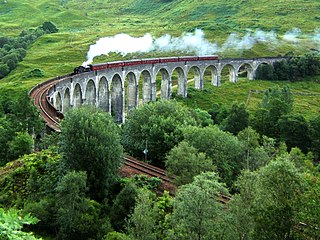
Lochaber is a name applied to areas of the Scottish Highlands. Historically, it consisted of the parishes of Kilmallie and Kilmonivaig, as they were before being reduced in extent by the creation of Quoad Sacra parishes in the 19th century; this Lochaber extended from the Northern shore of Loch Leven, a district called Nether Lochaber, to beyond Spean Bridge and Roybridge, which area is known as Brae Lochaber or Braigh Loch Abar in Gaelic. The town of Fort William is the main town and Lochaber was a distinct Province of Scotland in its own right. Lochaber is now also used to refer to a much wider area, one of the 16 ward management areas of the Highland Council of Scotland and one of eight former local government districts of the two-tier Highland region.

Braemar is a village in Aberdeenshire, Scotland, around 58 miles (93 km) west of Aberdeen in the Highlands. It is the closest significantly-sized settlement to the upper course of the River Dee sitting at an elevation of 339 metres (1,112 ft).

Aberfeldy is a burgh in Perth and Kinross, Scotland, on the River Tay. A small market town, Aberfeldy is located in Highland Perthshire. It is famous for being mentioned in the poem The Birks Of Aberfeldy by Robert Burns.

Drumbrae or Drum Brae is the name of a suburb of west Edinburgh, Scotland generally considered to be part of the neighbouring larger areas of Corstorphine and Clermiston. This is a commuter settlement as many people who live in the area travel to the centre of town to attend work.

Kinloch Rannoch is a village in Perth and Kinross, Scotland, at the eastern end of Loch Rannoch, 18 miles (29 km) west of Pitlochry, on the banks of the River Tummel. The village is a tourist and outdoor pursuits centre. It has a small population and is fairly remote.

Glen Lyon is a glen in the Perth and Kinross region of Scotland. It is the longest enclosed glen in Scotland and runs for 34 miles from Loch Lyon in the west to the village of Fortingall in the east.
Dunalastair is an estate in the southern part of the Highlands, in Perthshire, Scotland. It is 18 miles west of the town of Pitlochry, lying along the River Tummel between Tummel Bridge to the east and Kinloch Rannoch to the west, and incorporates part of Dunalastair Loch/Reservoir.
Mormond Hill is a large hill in Aberdeenshire, Scotland, not far from Fraserburgh. Its peak is 769 feet (234 m). The villages of Strichen and New Leeds can be found at its southern foothills.
Braetongue is an area in northern Sutherland just north of the town of Tongue. Runrig mentions the "hills about Brae Tongue" in the song The Summer Walkers.

Beinn Achaladair is a Scottish mountain situated six kilometres north east of the hamlet of Bridge of Orchy. The mountain stands on the border of the Perth and Kinross and Argyll and Bute council areas.
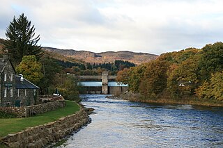
The Tummel hydro-electric power scheme is an interconnected network of dams, power stations, aqueducts and electric power transmission in the Grampian Mountains of Scotland. Roughly bounded by Dalwhinnie in the north, Rannoch Moor in the west and Pitlochry in the east it comprises a water catchment area of around 1,800 square kilometres (690 sq mi) and primary water storage at Loch Ericht, Loch Errochty, Loch Rannoch and Loch Tummel, in Perth and Kinross. Water, depending on where it originates and the path it takes, may pass through as many as five of the schemes nine power stations as it progresses from north-west to south-east. The scheme was constructed in the 1940s and 50s incorporating some earlier sites. It is currently managed by SSE plc.

A shieling, also spelt sheiling, shealing and sheeling, is a hut, or collection of huts, once common in wild or lonely places in the hills and mountains of Scotland and northern England. The word is also used for a mountain pasture for the grazing of cattle in summer, implying transhumance between there and a valley settlement in winter.

Uam is the third music album by Scottish musician Julie Fowlis. It was released on 26 October 2009 in Europe and in March 2010 in Canada and the United States. The album features contributions from Eddi Reader, Phil Cunningham and Sharon Shannon among others. It is the first Fowlis album to contain English lyrics, contributed by Eddi Reader on a bilingual version of folk song Wind And Rain. The title of the album means "From me" in Scottish Gaelic.

The River Garry is a major tributary of the River Tummel, itself a tributary of the River Tay, in the traditional county of Perthshire in the Scottish Highlands. It emerges from the northeastern end of Loch Garry (56.8193°N 4.2311°W), just to the southeast of the Pass of Drumochter, and flows southeastwards and eastwards down Glen Garry to the narrow Pass of Killiecrankie beyond which it joins the Tummel (56.7182°N 3.7790°W).

The River Ericht is a short river which flows generally southwards from the southern end of Loch Ericht for 3 miles / 5 km to enter Loch Rannoch near its western end at Bridge of Ericht.
Dugald Buchanan was a Scottish poet writing in Scots and Scottish Gaelic. He helped the Rev. James Stuart or Stewart of Killin to translate the New Testament into Scottish Gaelic. John Reid called him "the Cowper of the Highlands".
Rannoch Barracks was a military barracks constructed in 1746 at Bridge of Gaur, Perthshire, Scotland, at the western end of Loch Rannoch. The barracks were built in response to the Jacobite uprising of 1745.

Cults is a small parish in the centre of the Kingdom of Fife, Scotland. The name of the village derives from the Scottish Gaelic cùilt meaning a corner or recess. It lies mainly in the Howe of Fife, and about 4+1⁄2 miles (7.2 km) south-west of Cupar. The parish is about 2+1⁄3 miles (3.8 km) long and 1+1⁄3 miles (2.1 km) wide. It contains various villages and hamlets including Cults, Ladybank, Kingskettle, Kettlebridge, Pitlessie, Collessie, Crossgates and Walton. The Church of Scotland has now included Cults in the wider "Howe of Fife Parish" which has the churches of Ladybank, Cults, Kettle and Collessie. The only archaeological site of any importance seems to be a fort on the western slope of Walton Hill.
Rev. Archibald "Archie" Eneas Robertson (1870–1958), was a Church of Scotland minister. He is generally regarded as being the first mountaineer to climb all 282 Munros, the peaks of Scotland over 3,000 ft in height, first listed by Sir Hugh Munro.

The River Gaur is a river in Perthshire which enters Loch Rannoch.
