Branston Water Park

Last updated
Branston Water Park
Branston Water Park, Staffordshire - geograph.org.uk - 1556417.jpg
Looking across the lake
Staffordshire UK location map.svg
Red pog.svg
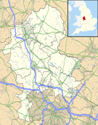
Location in Staffordshire
Location Burton upon Trent
grid reference SK 215 208
Coordinates 52°47′4″N1°41′2″W / 52.78444°N 1.68389°W / 52.78444; -1.68389 Coordinates: 52°47′4″N1°41′2″W / 52.78444°N 1.68389°W / 52.78444; -1.68389
Area23.55 hectares (58.2 acres)
Designation Local nature reserve
Website Branston Water Park

Branston Water Park is a local nature reserve near Burton upon Trent, in Staffordshire, England, next to the village of Branston.

Contents

History

The lake is a former gravel pit, one of several along the Trent Valley. There was gravel extraction here from the 1930s to the 1950s, after which wildlife habitats developed naturally. In the mid 1980s the land was leased by East Staffordshire Borough Council; public access was introduced, and the site was developed as a country park, with pathways, signage and a visitor centre. [1]

The reserve was designated a local nature reserve (LNR) in 2010. As of 2020, it has held the Green Flag Award since 2005. [1] [2]

Description

The Trent and Mersey Canal passes alongside the site to the north-west; to the south- east is the A38 road.

Its area is 23.55 hectares (58.2 acres). [3] It is a notable wetland site, and around the lake is woodland, predominantly of willow and birch, and wildflower meadow. There is a large reed bed, which is a Grade 1 Staffordshire Site of Biological Importance. [1]

There is a flat circular path around the lake, and there are picnic areas and a children's play area. The Burton Mutual Angling Association and the Burton Model Boating Club use the park by agreement with the Council. [1]

Related Research Articles

Staffordshire County of England

Staffordshire is a landlocked county in the West Midlands of England. It borders Cheshire to the northwest, Derbyshire and Leicestershire to the east, Warwickshire to the southeast, the West Midlands County and Worcestershire to the south, and Shropshire to the west.

Burton upon Trent Town in East Staffordshire, England

Burton upon Trent, also known as Burton-on-Trent or simply Burton, is a market town in Staffordshire, England, close to the border with Derbyshire. In 2011, it had a population of 72,299. The demonym for residents of the town is Burtonian. Burton is 11 miles (18 km) southwest of Derby, 27 miles (43 km) northwest of Leicester, 28 miles (45 km) west-southwest of Nottingham and 20 miles (32 km) south of the southern entrance to the Peak District National Park.

Sandwell Valley Country Park

Sandwell Valley Country Park is a country park, run by Sandwell Metropolitan Borough Council, in Sandwell Valley, on the River Tame in the middle of the urban conurbation between Birmingham and West Bromwich in West Midlands, England.

Local nature reserve (LNR) is a designation for nature reserves in Great Britain. The designation has its origin in the recommendations of the Wild Life Conservation Special Committee which established the framework for nature conservation in the United Kingdom and suggested a national suite of protected areas comprising national nature reserves, conservation areas, national parks, geological monuments, local nature reserves and local educational nature reserves.

Cotswold Water Park

The Cotswold Water Park is the United Kingdom's largest marl lake system, straddling the Wiltshire–Gloucestershire border, northwest of Cricklade and south of Cirencester. The lakes were created in the second half of the 20th century by extraction of glacial Jurassic limestone gravel, which had eroded from the Cotswold Hills, and these filled naturally after working began to cease in the early 1970s.

Rainham Marshes Nature Reserve

Rainham Marshes is an RSPB nature reserve in the east of London, adjacent to the Thames Estuary in Purfleet, Thurrock and the London Borough of Havering. In 2000, the area of land was bought from the Ministry of Defence, who used it as a test firing range. With no activity for several years, the nature reserve was officially opened to the public in 2006. It has maintained much of its Medieval landscape, and is the largest area of wetland on the upper parts of the Thames Estuary.

Ingrebourne Valley

Ingrebourne Valley is a local nature reserve (LNR) in Hornchurch in the London Borough of Havering. It is owned and managed by Havering Council, and has a visitor centre managed by the Essex Wildlife Trust. Most of it is in Hornchurch Country Park west of the River Ingrebourne, but there are also areas north and south of the park which are part of the LNR. It has a wide range of habitats, including woodland, grassland, the river and marshes. It is an important site for a range of species of plants, animals and birds, including great crested newts, slow worms, the harvest mouse and the water vole.

Brotherton Park and Dibbinsdale Local Nature Reserve

Brotherton Park and Dibbinsdale Local Nature Reserve informally known as Dibbinsdale is a combined park and local nature reserve managed by the Metropolitan Borough of Wirral and located in Bromborough, Merseyside, England.

Branston, Staffordshire Human settlement in England

Branston is a village and civil parish in Staffordshire, England. At the 2001 census, the population was 6,540, increasing to 6,749 at the 2011 Census.

Cotwall End Valley

Cotwall End Valley is a local nature reserve in West Midlands, England. It is about a mile south of Sedgley, in the Metropolitan Borough of Dudley.

Croxall Lakes

Croxall Lakes is a nature reserve located between the villages of Croxall and Alrewas, Staffordshire, in the United Kingdom. The nature reserve comprises two lakes and grassland between them. The lakes were formed through the quarrying of sand and gravel deposits, these excavations subsequently flooded and were then restored to create the nature reserve. The site is managed by Staffordshire Wildlife Trust and owned by the National Forest Company. The reserve is an important stop off point for a wide variety of migrating birds due to its location at the meeting point of three rivers, the Trent, Tame and Mease.

The Chase Nature Reserve

The Chase is a nature reserve in Dagenham in London. Most of it is in the London Borough of Barking and Dagenham, with a small part in Havering. It is owned by the boroughs, and managed by London Borough of Barking & Dagenham - Parks & Countryside Ranger Service. The boroughs have designated the sections in their respective boroughs as Local Nature Reserves. The Chase, together with the neighbouring Eastbrookend Country Park, is also designated a Site of Metropolitan Importance for Nature Conservation.

Beam Valley Country Park

Beam Valley Country Park is a 74-hectare park in Dagenham in the London Borough of Barking and Dagenham. Most of it is designated as a Local Nature Reserve (LNR) called Beam Valley, but a narrow strip next to the River Beam south from Western Avenue is a separate LNR called Beam Valley. The park is also designated as two Sites of Borough Importance for Nature Conservation, Grade 1, one north and the other south of South Dagenham Road.

Westport Lake, Stoke-on-Trent

Westport Lake is a lake and local nature reserve in Stoke-on-Trent, in Staffordshire, England, about 0.8 miles (1.3 km) south of Tunstall. It is alongside the Trent and Mersey Canal.

Whitfield Valley

Whitfield Valley is a local nature reserve on the northern fringe of Stoke-on-Trent, England.

Forge Mill Lake

Forge Mill Lake is a local nature reserve in Sandwell Valley, near West Bromwich in West Midlands, England. It is within Sandwell Valley Country Park.

References

  1. 1 2 3 4 "Branston Water Park: Management Plan 2018–2021" East Staffordshire Borough Council. Retrieved 10 July 2020.
  2. "Branston Water Park" East Staffordshire Borough Council. Retrieved 9 July 2020.
  3. "Branston Water Park LNR" Natural England . Retrieved 10 July 2020.