Bredevoort

Last updated
Bredevoort
Brevoort  (Achterhoeks)
Bredevoort collage.jpg
Flag Bredevoort.svg
Bredevoort coat2.svg
2010-NL-P05-Gelderland-positiekaart-gemnamen.jpg
Red pog.svg
Bredevoort
Location in the province of Gelderland in the Netherlands
Netherlands location map.svg
Red pog.svg
Bredevoort
Bredevoort (Netherlands)
Coordinates: Coordinates: 51°57′N6°37′E / 51.950°N 6.617°E / 51.950; 6.617
Country Netherlands
Province Gelderland
Municipality Aalten
Area
[1]
  Total6.73 km2 (2.60 sq mi)
Elevation
[2]
35 m (115 ft)
Population
 (2021) [1]
  Total1,660
  Density250/km2 (640/sq mi)
Time zone UTC+1 (CET)
  Summer (DST) UTC+2 (CEST)
Postal code
7121 & 7126 [1]
Dialing code 0543
Website www.bredevoort.nu

Bredevoort (Low Saxon: Brevoort) is a small city with city privileges of about 1600 inhabitants in the municipality of Aalten, Netherlands. It is between the towns of Aalten and Winterswijk.

Contents

Bredevoort has presented itself as Bredevoort boekenstad (Bredevoort book town ), after the examples of Hay-on-Wye in Wales and Redu in Belgium. There are now more than 20 second-hand book shops in the town.

Bredevoort was a Heerlijkheid and a separate municipality until 1818. The villages Aalten, Dinxperlo and Winterswijk included the fiefdom of Bredevoort when it became a part of Aalten in 1818. [3]

History

The name Bredevoort appears for the first time on a list of properties belonging to the archbishop of Cologne in 1188, who owned shares of the castle Bredevoort. When the count of Steinfurt tried to sell his share of the castle to the bishop of Munster and the count of Loon tried to sell his share to the count of Gelderland, a conflict broke out between the bishop and the count of Gelderland. The fight lasted for almost two centuries.

From 1326, after 4 years of battle between Reginald II, Duke of Guelders and Ludwig von Hessen  [ de ] the Prince-Bishopric of Münster Bredevoort was actual part of Gelderland. Between 1326 and 1697 the municipality of Bredevoort repeatedly changed ownership. The former municipality of Bredevoort was composed of the city, the castle Bredevoort, and the villages Aalten, Dinxperlo and Winterswijk. Maurice of Nassau, Prince of Orange conquered Bredevoort in the year 1597 on the Spanish occupation. The Spanish reconquered the city in 1606, but Frederick Henry, Prince of Orange liberated the garrison and citizens who had retreated in the Castle of Bredevoort. In 1646, lightning hit the gunpowder tower of the castle, causing an explosion that destroyed parts of the castle and the town, killing Lord Haersolte of Bredevoort and his family, as well as others. Only one son, Anthonie, who was not home that day, survived. In the rampjaar ("disaster year") 1672 Bernhard von Galen reconquered the city and occupied city and herrschaft for almost two years. In 1697 received William III of England the city and herrschaft from the States of Gelderland. From that day until 1795 the city and herrschaft was a personal belonging to the House of Orange-Nassau. King Willem-Alexander of the Netherlands is still Lord of Bredevoort. After centuries of war, its fortifications were demolished by its inhabitants. [4] In 1818, the municipality of Bredevoort was dissolved to become part of the city Bredevoort under the newly formed municipality Aalten.
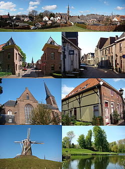
Sights

"Grote Gracht", the town ditch with remains of the former Star fort of Bredevoort Treurniet bredevoort.JPG
"Grote Gracht", the town ditch with remains of the former Star fort of Bredevoort

Transportation

Aalten railway station is the nearest station. There is a half-hourly service between Arnhem and Winterswijk, which stops at this station. Arnhem railway station has half-hourly (or more) services to Amsterdam, Utrecht, Nijmegen, 's-Hertogenbosch, Breda, Tilburg and Alkmaar. If you travel to Winterswijk, you can then change onto a connecting train to Zutphen. From Zutphen you can travel to Apeldoorn, Dieren, Hengelo, Deventer and Zwolle.

To get to the station you can use bus service 191, which travels from Aalten station to Bredevoort and Lichtenvoorde.

Related Research Articles

Arnhem City and municipality in Gelderland, Netherlands

Arnhem is a city and municipality situated in the eastern part of the Netherlands. It is the capital of the province of Gelderland, located on both banks of the rivers Nederrijn and Sint-Jansbeek, which was the source of the city's development. Arnhem had a population of 163.972 on 1 December 2021, which made it one of the larger cities of the Netherlands. The municipality is part of the Arnhem–Nijmegen metropolitan area, which has a combined number of 774,506 inhabitants on 31 January 2022.

Gelderland Province of the Netherlands

Gelderland, also known as Guelders in English, is a province of the Netherlands, occupying the centre-east of the country. With a total area of 5,136 km2 (1,983 sq mi) of which 173 km2 (67 sq mi) is water, it is the largest province of the Netherlands by land area, and second by total area. Gelderland shares borders with six other provinces and the German state of North Rhine-Westphalia.

Zutphen City and municipality in Gelderland, Netherlands

Zutphen is a city and municipality located in the province of Gelderland, Netherlands. It lies some 30 km northeast of Arnhem, on the eastern bank of the river IJssel at the point where it is joined by the Berkel. First mentioned in the 11th century, the place-name appears to mean "south fen". In 2005, the municipality of Zutphen was merged with the municipality of Warnsveld, retaining its name. In 2019, the municipality had a population of 47,609.

Aalten Municipality in Gelderland, Netherlands

Aalten is a municipality and a town in the eastern Netherlands. The former municipalities of Bredevoort (1818) and Dinxperlo (2005) have been merged with Aalten.

Borculo Place in Gelderland, Netherlands

Borculo is a city in the eastern Netherlands, in the municipality of Berkelland, Gelderland. Borculo was an independent municipality until 2005, when it merged with Eibergen, Neede, and Ruurlo. Other population centers in the municipality of Borculo were nearby Geesteren, Gelselaar, and Haarlo.

Dinxperlo Town and former municipality in Gelderland, Netherlands

Dinxperlo is a town and former municipality in the eastern Netherlands, situated directly at the Germany-Netherlands border.

Doetinchem Municipality in Gelderland, Netherlands

Doetinchem is a city and municipality in the east of the Netherlands. It is situated along the Oude IJssel river in a part of the province of Gelderland called the Achterhoek. The municipality had a population of 57,555 in 2019 and consists of an area of 79.66 km2 (30.76 sq mi) of which 0.61 km2 (0.24 sq mi) is water. This makes Doetinchem the largest town in the Achterhoek.

Ruurlo Village in Gelderland, Netherlands

Ruurlo is a village and former municipality in the province of Gelderland in the eastern part of the Netherlands.

Winterswijk Municipality and town in Gelderland, Netherlands

Winterswijk is a municipality and a town in the eastern Netherlands. It has a population of 28,903 and is situated in the Achterhoek, which lies in the easternmost part of the province of Gelderland in the Netherlands.

Arnold van Keppel, 1st Earl of Albemarle

Arnold Joost van Keppel, 1st Earl of Albemarle,, and lord of De Voorst in Guelders (Gelderland), was a Dutch military leader who fought for King William III of England and became the first Earl of Albemarle. He was the son of Oswald van Keppel and his wife Anna Geertruid van Lintelo. De Voorst is a large country house near Zutphen, financed by William III, and not unlike the royal palace Het Loo in Apeldoorn.

Bocholt, Germany Town in North Rhine-Westphalia, Germany

Bocholt is a city in the north-west of North Rhine-Westphalia, Germany, part of the district Borken. It is situated 4 km south of the border with the Netherlands. Suderwick is part of Bocholt and is situated at the border annex to Dinxperlo.

Terborg City in Gelderland, Netherlands

Terborg is a small city in the Dutch province of Gelderland, in the Achterhoek region in the east of the Netherlands. It is located in the municipality of Oude IJsselstreek. The city lies about 7 km southeast of Doetinchem. The population is about 4600 inhabitants.

Varsseveld Village in Gelderland, Netherlands

Varsseveld is a town in the Netherlands, located in the Dutch municipality of Oude IJsselstreek.

Achterhoek Cultural region of Gelderland

The Achterhoek is a cultural region in the Eastern Netherlands. Its name is geographically appropriate because the area lies in the easternmost part of the province of Gelderland and therefore in the east of the Netherlands, protruding into Germany. The Achterhoek lies at the east of the IJssel and Oude IJssel rivers. On the other sides, it borders Germany to the southeast and the province of Overijssel to the northeast.

Usingen Town in Hesse, Germany

Usingen is a small town in the Hochtaunuskreis in Hessen, Germany. Until 1972, this residential and school town was the seat of the former district of Usingen.

Diez, Germany Town in Rhineland-Palatinate, Germany

Diez an der Lahn is a town in Germany's Rhein-Lahn district in Rhineland-Palatinate, on the borders of Hesse. Diez is the administrative seat of the municipality of Diez.

Willem IV van den Bergh

Willem IV, Count van den Bergh (1537-1586) was the Dutch Stadtholder of Guelders and Zutphen from 1581 until his arrest for treason in 1583.

De Heurne Village in Gelderland, Netherlands

De Heurne is a village in the municipality of Aalten, near Dinxperlo, Province of Gelderland, in the east of the Netherlands.

Siege of Bredevoort (1597)

The siege of Bredevoort in 1597 was a siege of Bredevoort by the military forces led by Maurice of Nassau, Prince of Orange, during the Eighty Years War and the Anglo-Spanish War. The siege lasted from 1 October until 9 October; after that day Bredevoort was occupied by the besiegers. The siege was part of a campaign during which Maurice conquered the cities Turnhout, Alphen, Rijnberk, Meurs, Bredevoort, Groenlo, Goor, Enschede, Oldenzaal, Ootmarsum, and Lingen.

Suderwick

Suderwick is a village in the city of Bocholt, Kreis Borken in the German State of North Rhine-Westphalia. Suderwick is situated at the Germany-Netherlands border and forms one urban area with Dinxperlo, a town in Aalten municipality of Gelderland province of the Netherlands.

References

  1. 1 2 3 "Kerncijfers wijken en buurten 2021". Central Bureau of Statistics. Retrieved 13 April 2022. two entries
  2. "Postcodetool for 6961AA". Actueel Hoogtebestand Nederland (in Dutch). Het Waterschapshuis. Retrieved 13 April 2022.
  3. Ad van der Meer and Onno Boonstra, Repertorium van Nederlandse gemeenten , KNAW, 2011.
  4. Staring Instituut: Bredevoort een Heerlijkheid", ISBN   90-900213-5-3 (first edition 1988)