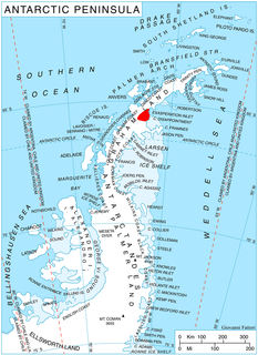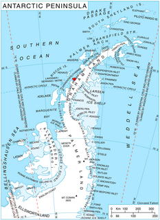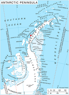
Talev Glacier is the 4 km long and 2.8 km wide glacier on Barison Peninsula, Graham Coast on the west side of Antarctic Peninsula, situated west of Cadman Glacier and southeast of Butamya Glacier. It drains northeastwards, and flows into Beascochea Bay.

Erden Glacier is the 6 km long and 2.8 km wide glacier on Oscar II Coast in Graham Land situated southwest of Lesicheri Glacier. It drains the southeast slopes of Forbidden Plateau, and flows southeastwards to join Jorum Glacier. The feature is named after the settlement of Erden in Northwestern Bulgaria.

Elovdol Glacier is the 8 km long and 3 km wide glacier in Arkovna Ridge, Aristotle Mountains on Oscar II Coast in Graham Land. It flows 6 km eastwards, then turns southeast to join Mapple Glacier. The feature is named after the settlements of Elovdol in Western Bulgaria.

Sandilh Point is the partly ice-free point on the northwest side of the entrance to Durostorum Bay on Oscar II Coast in Graham Land. It is situated at the east extremity of Tepava Ridge, and was formed as a result of the break-up of Larsen Ice Shelf in the area, and the retreat of Pequod Glacier in the early 21st century. Named after the Bulgar ruler Sandilh.

Ranyari Point is the rounded ice-covered point on the southeast side of the entrance to Durostorum Bay on Oscar II Coast in Graham Land. It is situated on the north coast of Akra Peninsula, and was formed as a result of the break-up of Larsen Ice Shelf in the area in the early 21st century. Named after the Bulgar ruler Ranyari.

Vartop Point is the point on the northwest side of the entrance to Finaeus Cove on the northeast coast of Magnier Peninsula, Graham Coast on the Antarctic Peninsula.

Krasava Point is the point on the southeast side of the entrance to Finaeus Cove on the northeast coast of Magnier Peninsula, Graham Coast on the Antarctic Peninsula. It is formed by an offshoot of Orbel Peak.

Kudelin Point is the point on the northeast side of the entrance to Tlachene Cove on Loubet Coast, Antarctic Peninsula. The point is formed by an offshoot of Gaydari Peak, and was shaped as a result of the retreat of Hopkins Glacier during the last two decades of the 20th century.

Gostilya Point is the point on the southwest side of the entrance to Tlachene Cove on Loubet Coast, Antarctic Peninsula. The point was formed as a result of the retreat of Hopkins Glacier during the last two decades of the 20th century.

Plakuder Point is the point on the east side of the entrance to Misionis Bay on the northeast coast of Pickwick Island in the Pitt group of Biscoe Islands, Antarctica.

Zagrade Point is the point on the east side of the entrance to Suregetes Cove on the north coast of Krogh Island in Biscoe Islands, Antarctica.

Mitino Buttress is the rounded ice-covered buttress extending 14 km in south-southeast to north-northwest direction and 7 km wide, rising to 1000 m in the west foothills of Bruce Plateau on Graham Coast in Graham Land, Antarctica. Two offshoots of the feature form Mezzo Buttress on the west and Strelcha Spur on the north respectively. It has steep and partly ice-free northwest, north and northeast slopes, and surmounts Birley Glacier to the northeast and Lawrie Glacier to the west.

Vardun Point is the point projecting 1 km into the head of Barilari Bay on Graham Coast in Graham Land, Antarctica, formed by an offshoot of Mitino Buttress. The point is named after the settlement of Vardun in Northeastern Bulgaria.

Cherkovna Point is the sharp point projecting 1.7 km into the head of Barilari Bay on Graham Coast in Graham Land, Antarctica, formed by an offshoot of Mezzo Buttress. The point is named after the settlements of Cherkovna in Northeastern Bulgaria.

Prestoy Point is the sharp point projecting 800 m into the head of Barilari Bay on Graham Coast in Graham Land, Antarctica, formed by an offshoot of Mount Genecand. The point is named after the settlement of Prestoy in Northern Bulgaria.

Byaga Point is the ice-covered point on the northeast coast of Velingrad Peninsula projecting 1 km into the head of Barilari Bay on Graham Coast in Graham Land, Antarctica, formed by an offshoot of Ilchev Buttress. The point is named after the settlement of Byaga in Southern Bulgaria.

Sokol Point is the narrow hilly point projecting 1.9 km into Darbel Bay on Loubet Coast in Graham Land, Antarctica. It is formed by an offshoot of Sherba Ridge, and separates the glacier termini of Drummond Glacier to the east and Widdowson Glacier to the south.

Kladnitsa Peak is the ice-covered peak of elevation 1000 m on Pernik Peninsula, Loubet Coast in Graham Land, Antarctica. It surmounts McCance Glacier to the south and west, and Darbel Bay to the northeast.

Marmais Point is the ice-covered point on the southeast coast of Trinity Peninsula in Graham Land, Antarctica projecting into Prince Gustav Channel in Weddell Sea. The point is named after the Bulgarian duke and military commander Marmais.


