Thurston Island is a largely ice-covered, glacially dissected island, 135 nautical miles long and 55 nautical miles wide, lying between Amundsen Sea and Bellingshausen Sea a short way off the northwest end of Ellsworth Land, Antarctica. The island is separated from the mainland by Peacock Sound, which is occupied by the west portion of Abbot Ice Shelf.
The Flood Range is a range of large snow-covered mountains extending in an east–west direction for about 60 nautical miles and forming a right angle with the southern end of the Ames Range in Marie Byrd Land, Antarctica.

The Prince Charles Mountains are a major group of mountains in Mac. Robertson Land in Antarctica, including the Athos Range, the Porthos Range, and the Aramis Range. The highest peak is Mount Menzies, with a height of 3,228 m (10,591 ft). Other prominent peaks are Mount Izabelle and Mount Stinear. These mountains, together with other scattered peaks, form an arc about 420 km (260 mi) long, extending from the vicinity of Mount Starlight in the north to Goodspeed Nunataks in the south.
White Island is an island in the Ross Archipelago of Antarctica. It is 15 nautical miles long, protruding through the Ross Ice Shelf immediately east of Black Island. It was discovered by the British National Antarctic Expedition (1901–04) and so named by them because of the mantle of snow that covers it.
Sulzberger Bay is a bay indenting the front of the Sulzberger Ice Shelf between Fisher Island and Vollmer Island, along the coast of Marie Byrd Land, Antarctica.

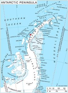
Mount Queequeg is a conspicuous, partly snow-covered mountain with three conical summits, the highest 900 m, situated in eastern Aristotle Mountains between the mouths of Starbuck and Stubb Glaciers on the east coast of Graham Land in Antarctica.
The Porthos Range is the second range south in the Prince Charles Mountains of Antarctica, extending for about 30 miles in an east-to-west direction between Scylla Glacier and Charybdis Glacier. First visited in December 1956 by the Australian National Antarctic Research Expeditions (ANARE) southern party under W.G. Bewsher (1956-57) and named after Porthos, a character in Alexandre Dumas, père's novel The Three Musketeers, the most popular book read on the southern journey.

Wooden Peak is a peak 2 nautical miles (3.7 km) southeast of Black Head on Stresher Peninsula on the west coast of Graham Land. Charted by the British Graham Land Expedition (BGLE) under Rymill, 1934–37. Named by the United Kingdom Antarctic Place-Names Committee (UK-APC) in 1959 for Frederick E. Wooden, Falkland Islands Dependencies Survey (FIDS) surveyor at Danco Island in 1956 and at Prospect Point in 1957. Wooden was also attached to the British Naval Hydrographic Survey Unit which worked in the area in 1957–58.

Bildad Peak is a conspicuous snow-capped peak 5 nautical miles (9 km) west of Spouter Peak on the south side of Flask Glacier in eastern Voden Heights, on Oscar II Coast in Graham Land. It was surveyed by the Falkland Islands Dependencies Survey in 1955, and named by the UK Antarctic Place-Names Committee after the fictional Captain Bildad, part-owner of the whaling ship Pequod in Herman Melville's Moby-Dick.

Cardell Glacier is a glacier draining the north slopes of Roygos Ridge and flowing northwestwards into Darbel Bay between Shanty Point and Panther Cliff, on the west coast of Graham Land, Antarctica.

Coblentz Peak is a peak rising at the north side of the head of Holtedahl Bay, in Chiren Heights, Velingrad Peninsula, on the west coast of Graham Land in Antarctica. It was photographed by Hunting Aerosurveys Ltd in 1956–57 and was mapped from these photos by the Falkland Islands Dependencies Survey. It was named by the UK Antarctic Place-Names Committee in 1959 for William W. Coblentz of the U.S. National Bureau of Standards, whose work on the transmissive properties of tinted glass has contributed to the design of satisfactory snow goggles.
Conway Island lies in Crates Bay to the west of Lens Peak and facing Bregare Point, off the northeast coast of Stresher Peninsula, Graham Land. It was photographed by Hunting Aerosurveys Ltd in 1956–57, and mapped from these photos by the Falkland Islands Dependencies Survey. It was named by the UK Antarctic Place-Names Committee in 1959 for Martin Conway, 1st Baron Conway of Allington, an English mountaineer and a pioneer of polar skiing during his crossing of Vestspitsbergen in 1896.

Swift Peak is a peak that is the highest point of an undulating, mainly snow-covered range of hills rising to about 1,000 m. Located at the north end of Churchill Peninsula on the east coast of Graham Land. Charted by the Falkland Islands Dependencies Survey (FIDS) and photographed from the air by the Ronne Antarctic Research Expedition (RARE) in 1947. Named by United Kingdom Antarctic Place-Names Committee (UK-APC) after Jonathan Swift (1667–1745), English author of Gulliver's Travels, a novel from which several nearby features are named.
Drummond Glacier is a glacier 10 nautical miles (18 km) long and 2 nautical miles (4 km) wide, on the west coast of Graham Land, situated south of Hopkins Glacier and flowing west-northwest between Voit Peak and Sherba Ridge into Darbel Bay east of Sokol Point.

Field Glacier is a glacier on Pernik Peninsula, Loubet Coast in Graham Land, situated south of Salmon Cove, and flowing west into Lallemand Fjord just south of Kanchov Peak. It was mapped from air photos taken by the Falkland Islands and Dependencies Aerial Survey Expedition, 1956–57. In association with the names of glaciologists grouped in this area, it was named by the UK Antarctic Place-Names Committee after William B.O. Field, an American glaciologist and surveyor, sometime Research Fellow of the American Geographical Society.
Flounder Island is the largest of the Fish Islands at the north side of Holtedahl Bay, off the west coast of Graham Land, Antarctica. It was charted by the British Graham Land Expedition under John Rymill, 1934–37, and so named by the UK Antarctic Place-Names Committee in 1959 after the flounder, in association with the Fish Islands.
Hamblin Glacier is a glacier flowing to the southeast side of Widmark Ice Piedmont, in Graham Land, Antarctica. It was photographed by Hunting Aerosurveys Ltd in 1955–57, and mapped from these photos by the Falkland Islands Dependencies Survey. It was named by the UK Antarctic Place-Names Committee in 1959 for Theodore Hamblin (1873–1952), an English optician who in the 1930s helped in the evolution of the first satisfactory snow goggle design.
McCance Glacier is the 30-km long and 5 km wide glacier draining the Hutchison Hill area on the west slopes of Avery Plateau on Loubet Coast in Graham Land, Antarctica. It flows north-northwestwards along the west side of Osikovo Ridge, Kladnitsa Peak and Rubner Peak and enters Darbel Bay.
Mount Lyttleton is a conspicuous, almost entirely snow-covered mountain near the head of Cardell Glacier, on the west coast of Graham Land, Antarctica. It was photographed from the air by the Ronne Antarctic Research Expedition under Finn Ronne, 1947–48, and was named by the UK Antarctic Place-Names Committee in 1960 for Westcote R. Lyttleton (1877–1956), New Zealand Works Director of Triplex Safety Glass, London, who first introduced laminated safety glass for use in goggles in about 1912.
Rugg Peak is a peak on the east side of Widmark Ice Piedmont south of Crookes Peak, on the west coast of Graham Land. Photographed by Hunting Aerosurveys Ltd in 1956–57, it was mapped from these photos by the Falkland Islands Dependencies Survey (FIDS). It was named by the United Kingdom Antarctic Place-Names Committee (UK-APC) in 1959 after Andrew Rugg-Gunn, an English ophthalmic surgeon, who, in 1934, brought together relevant data on radiation and protective glasses to improve the design of snow goggles.