Related Research Articles

Sullom Voe is an inlet of the North Sea between the parishes of Delting and Northmavine in Shetland, Scotland. It is a location of the Sullom Voe oil terminal and Shetland Gas Plant. The word Voe is from the Old Norse vagr and denotes a small bay or narrow creek. The head of the voe makes up the eastern side of Mavis Grind.
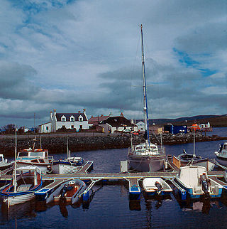
Papa Stour is one of the Shetland Islands in Scotland, with a population of under fifteen people, some of whom immigrated after an appeal for residents in the 1970s. Located to the west of mainland Shetland and with an area of 828 hectares, Papa Stour is the eighth largest island in Shetland. Erosion of the soft volcanic rocks by the sea has created an extraordinary variety of caves, stacks, arches, blowholes, and cliffs. The island and its surrounding seas harbour diverse populations of wildlife. The west side of the island is a Site of Special Scientific Interest and the seas around the island are a Special Area of Conservation.

Gruney is a small, uninhabited island in Shetland, Scotland. It lies north of the Northmavine peninsula of the Shetland Mainland, from which it is separated by the Gruney Sound.
Aith,, is a village on the Northern coast of the West Shetland Mainland, Scotland at the southern end of Aith Voe, some 21 miles west of Lerwick.

Dobrudzha Glacier is situated on the southeast side of Tangra Mountains, Burgas Peninsula, eastern Livingston Island in the South Shetland Islands, northeast of Magura Glacier, southeast of Iskar Glacier and southwest of Ropotamo Glacier. It is bounded by Ruse Peak and Asen Peak to the north and by Kuber Peak to the west and flows southeastward into Bransfield Strait. The glacier is named after the Dobrudzha region in northeastern Bulgaria.

Kardam Buttress is a sloping buttress projecting 1 km northwards from St. Ivan Rilski Col into Huron Glacier on Livingston Island in the South Shetland Islands, Antarctica, and has precipitous and partly ice-free western slopes. Surmounting Huron Glacier to the north. It is named after the Bulgarian ruler Khan Kardam.
Magura Glacier on the southeast side of Tangra Mountains on Livingston Island in the South Shetland Islands, Antarctica is located to the north of M'Kean Point, northeast of Srebarna Glacier, south of Iskar Glacier and southwest of Dobrudzha Glacier. It is bounded by Great Needle Peak to the west, Vitosha Saddle, Vihren Peak and Helmet Peak to the northwest, Plovdiv Peak and Shishman Peak to the north, and Devin Saddle and Kuber Peak to the northeast. The glacier extends 3.5 km in southwest-northeast direction and 1.9 km in northwest-southeast direction, and flows southeastward into Bransfield Strait.

Wulfila Glacier is located on the southern slopes of Breznik Heights, Greenwich Island in the South Shetland Islands, Antarctica, south-southwest of Solis Glacier and west of Zheravna Glacier. It is bounded by Oborishte Ridge to the northwest, Nevlya Peak to the north, Terter Peak and Razgrad Peak to the northeast, and Ephraim Bluff to the southeast. The glacier extends 3 km in northwest-southeast direction and 2 km in northeast-southwest direction. It drains southwestwards into McFarlane Strait between Ephraim Bluff and the base of Provadiya Hook, feeding the head of Doris Cove.
CHON-FM is a Canadian radio station, owned by Northern Native Broadcasting, Yukon which broadcasts at 98.1 FM in Whitehorse, Yukon. A community radio station with a variety of music and information programs for the First Nations population, the radio station serves much of the Yukon, as well as several border communities in British Columbia and the Northwest Territories, through a series of rebroadcasters.

The Ramna Stacks are a group of skerries in the Shetland islands. They are north of the northern tip of Mainland, and along with nearby Gruney they are a special protection area on account of their birdlife.

Haaf Gruney is a small island in the north east of the Shetland Islands.

Enchantress Rocks is a small group of rocks lying off Elephant Point on the south side of western Livingston Island in the South Shetland Islands, Antarctica. The area was visited by early 19th century sealers.
Forewick Holm is a 1-hectare (2.5-acre) island in the Sound of Papa in the Shetland islands, Scotland. Located between Papa Stour and the Sandness peninsula. Since 2008, it has also been referred to as Forvik Island as a result of Stuart "Captain Calamity" Hill's protest around constitutional matters.

Ballester Point is a point forming the south side of the entrance to Johnsons Dock and the northeast side of the entrance to Española Cove in Hurd Peninsula, Livingston Island in the South Shetland Islands, Antarctica. The area was visited by early 19th century sealers operating from Johnsons Dock.

Juan Carlos I Antarctic Base, named after the former king of Spain, Juan Carlos I, is a seasonal scientific station operated by Spain, opened in January 1988. Situated on Hurd Peninsula, Livingston Island in the South Shetland Islands, Antarctica.
Geopark Shetland is the name used by the Geopark formally established in September 2009 on its entry into the European Geoparks Network. The Geopark extends across the entire Shetland archipelago off the north coast of mainland Scotland. It is administered by the Shetland Amenity Trust in partnership with organisations such as Scottish Natural Heritage, the Shetland Islands Council, Highlands and Islands Enterprise and various community and tourism associations.
Mila is an unincorporated community in Northumberland County, in the U.S. state of Virginia. Mila is located at 37°50′32″N76°19′39″W.
Papa is an uninhabited island in the Scalloway Islands, Shetland, Scotland.

Slavotin Point is the low rocky point on the southeast coast of Nelson Island in the South Shetland Islands, Antarctica forming the east side of the entrance to Tuida Cove and the west side of the entrance to Vichina Cove.
References
- ↑ Haswell-Smith, Hamish (2004). The Scottish Islands. Edinburgh: Canongate. ISBN 978-1-84195-454-7.
Coordinates: 60°19′39″N1°39′28″W / 60.32750°N 1.65778°W
| | This Shetland location article is a stub. You can help Wikipedia by expanding it. |