Bremanger (village)

Last updated
Bremanger
Village
Bremanger Froya from southwest IMG 0151.JPG
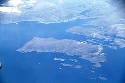
View of the village (on the shoreline in the far background)
Norway Vestland adm location map.svg
Red pog.svg
Bremanger
Location of the village
Norway location map.svg
Red pog.svg
Bremanger
Bremanger (Norway)
Coordinates: 61°50′23″N4°59′22″E / 61.8397°N 4.9894°E / 61.8397; 4.9894
Country Norway
Region Western Norway
County Vestland
District Nordfjord
Municipality Bremanger Municipality
Area
[1]
  Total0.6 km2 (0.2 sq mi)
Elevation
[2]
4 m (13 ft)
Population
 (2018) [1]
  Total407
  Density678/km2 (1,760/sq mi)
Time zone UTC+01:00 (CET)
  Summer (DST) UTC+02:00 (CEST)
Post Code
6727 Bremanger

Bremanger is a village in Bremanger Municipality in Vestland county, Norway. The village is located along the Bremangerpollen bay on the western side of the Bremangerlandet island. [3]

The 0.6-square-kilometre (150-acre) village has a population (2018) of 409 and a population density of 678 inhabitants per square kilometre (1,760/sq mi). [1]

View of the Grotlesanden beach Grotle beach Bremanger.jpg
View of the Grotlesanden beach

The village sits along the shore with steep mountains on one side and the ocean on the other. The lake Dalevatnet sits on the north side of the village. Bremanger Church is located in the village, serving the western part of the island. The village has been home to a church since the Middle Ages. On the western end of the village lies the Grotlesanden beach area, a picturesque white sand beach.

Related Research Articles

<span class="mw-page-title-main">Sogn og Fjordane</span> Former county of Norway

Sogn og Fjordane was, up to 1 January 2020, a county in western Norway, when it was merged to become part of Vestland county. Bordering previous counties Møre og Romsdal, Oppland, Buskerud, and Hordaland, the county administration was in the village of Hermansverk in Leikanger municipality. The largest town in the county was Førde.

<span class="mw-page-title-main">Flora, Norway</span> Former municipality in Sogn og Fjordane, Norway

Flora is a former municipality in Sogn og Fjordane county, Norway. It was located in the traditional district of Sunnfjord. The administrative centre was the town of Florø, which was founded in 1860. Florø has 8,957 inhabitants (2017) and the Eikefjord area in the east has 387 inhabitants (2017). Other village areas in the municipality included Rognaldsvåg, Stavang, Grov, Norddalsfjord, Nyttingnes, Steinhovden, and Brandsøy.

<span class="mw-page-title-main">Bremanger</span> Municipality in Vestland, Norway

Bremanger is a municipality in Vestland county, Norway. The village of Svelgen is the administrative centre of the municipality. Other villages include Bremanger, Berle, Davik, Isane, Kalvåg, Svelgen, Rugsund, and Ålfoten. Bremanger is the only municipality in Vestland, which is located in two districts. The northern and eastern parts comprising the villages of Oldeide, Berle, Rugsund, Davik, Isane, and Ålfoten is located in the Nordfjord region, while the villages of Bremanger, Kalvåg, Svelgen, Sørgulen, and Botnane are located in the Sunnfjord region. Politically, the municipality works with the Nordfjord region in the council of Nordfjord municipalities.

<span class="mw-page-title-main">Vågsøy</span> Former municipality in Sogn og Fjordane, Norway

Vågsøy is a former municipality in the old Sogn og Fjordane county, Norway. It was located in the traditional district of Nordfjord. The municipality's administrative center was the town Måløy. Other population centers in Vågsøy included the villages of Bryggja, Deknepollen, Holvika, Kvalheim, Langeneset, Raudeberg, Refvika, Silda, Tennebø, Totland, Vedvika, and Vågsvåg. The municipality included the island of Vågsøy, several small surrounding islands, and part of the mainland. On 1 January 2020, the municipality was dissolved and divided between Kinn Municipality and Stad Municipality in Vestland county.

<span class="mw-page-title-main">Jørpeland</span> Town in Western Norway, Norway

Jørpeland is the administrative centre of Strand municipality in Rogaland county, Norway. The town is located on the western coast of the mainland, along the shore of the Idsefjorden, about 20 kilometres (12 mi) northeast of the city of Stavanger. It sits along the Norwegian National Road 13 a short distance southeast of the village of Tau where the Ryfast tunnel has its eastern entrance. The name "Jørpeland" is composed of the slightly changed Old Norse word "jarpr", which translates to brown, and the word land ("brownland"). The reason for this name is that historically, the river Jørpelandsånå used to turn brown during times of flood.

<span class="mw-page-title-main">Nordfjord</span> District in Vestland, Norway

Nordfjord is a traditional district of Norway.

<span class="mw-page-title-main">Kalvåg</span> Village in Western Norway, Norway

Kalvåg is a village in Bremanger Municipality in Vestland county, Norway. It is located on the southeast side of the island of Frøya on the coast along the Frøysjøen strait, the southern entrance to the Nordfjorden. The village of Kalvåg was the administrative centre of the old municipality of Bremanger that existed from 1838 until 1964 when the municipality was enlarged and the administration center was moved east to the mainland village of Svelgen. There is a series of bridges that connect Kalvåg to the nearby island of Bremangerlandet.

<span class="mw-page-title-main">Vormedal</span> Village in Western Norway, Norway

Vormedal is a village in Karmøy municipality in Rogaland county, Norway. The village is located about 5 kilometres (3.1 mi) south of the city of Haugesund in Western Norway. It sits on the mainland along the Karmsundet strait, directly across the strait from the village of Avaldsnes on the island of Karmøy. The 1.28-square-kilometre (320-acre) village has a population (2014) of 2738, giving the village a population density of 2,139 inhabitants per square kilometre (5,540/sq mi).

<span class="mw-page-title-main">Davik</span> Former municipality in Sogn og Fjordane, Norway

Davik is a former municipality in the traditional district of Nordfjord in the old Sogn og Fjordane county, Norway. The 654-square-kilometre (253 sq mi) former municipality existed from 1838 until 1964 and it encompassed all the lands surrounding the outer part of the large Nordfjorden on both sides of the fjord. Davik was located in parts of the present-day municipalities of Kinn, Bremanger, and Stad. The administrative center of the former municipality was the village of Davik which is located on the southern shore of the Nordfjorden, although some of the municipal services were based out of the village of Bryggja on the north side of the fjord, since that village was the largest village in Davik municipality.

<span class="mw-page-title-main">Sogndalsfjøra</span> Village in Western Norway, Norway

Sogndalsfjøra is a village in the municipality of Sogndal in Vestland county, Norway. It is located where the river Sogndalselvi runs out in the Sogndalsfjorden, a branch of the large Sognefjorden. The village is located about 3.5 kilometres (2.2 mi) northwest of the village of Kjørnes, about 10 kilometres (6.2 mi) northwest of the village of Kaupanger, and about 31 kilometres (19 mi) southeast of the village of Fjærland. The village sits at the intersection of Norwegian National Road 5 and Norwegian County Road 55.

<span class="mw-page-title-main">Kinn (former municipality)</span> Former municipality in Sogn og Fjordane, Norway

Kinn is a former municipality in the Sunnfjord district of Sogn og Fjordane county, Norway. The parish of Kinn has existed for centuries and in 1838, the large parish was established as a municipality that existed from then until 1964. The municipality was centered around the island of Kinn where the main Kinn Church is located. The municipality encompassed most of the southern part of the present-day municipality of Kinn as well as parts of Askvoll and the southwestern part of Bremanger. Upon its dissolution in 1964, it covered 159 square kilometres (61 sq mi).

<span class="mw-page-title-main">Gravdal, Nordland</span> Village in Northern Norway, Norway

Gravdal is a village in Vestvågøy Municipality in Nordland county, Norway. It is located on the island of Vestvågøya in the central part of the Lofoten archipelago, north of the Arctic Circle. The village is situated along the shore of the Buksnesfjorden, about 3 kilometres (1.9 mi) southwest of the town of Leknes. The village also lies approximately 72 kilometres (45 mi) west of the town of Svolvær and 63 kilometres (39 mi) east of the village of Å in Moskenes. Historically, the village was the administrative centre of the old Buksnes municipality which existed from 1838 until 1963.

<span class="mw-page-title-main">Straumsnes, Fauske</span> Village in Northern Norway, Norway

Straumsnes or Strømsnes is a village in the municipality of Fauske in Nordland county, Norway. It is located in the Valnesfjord area of Fauske. The town of Fauske lies 15 kilometres (9.3 mi) to the east and the town of Bodø lies about 40 kilometres (25 mi) to the west. The village sits just inland of Skjerstad Fjord, along the southern shore of the lake Valnesfjordvatnet.

Stårheim is a village in the municipality of Stad in Vestland county, Norway. Stårheim is located in the central part of Stad Municipality on the north shore of the Nordfjorden, about 12 kilometres (7.5 mi) west of the municipal center of Nordfjordeid and about 8 kilometres (5.0 mi) east of the village of Kjølsdalen. There is a regularly scheduled ferry route from Stårheim to the small village of Isane, located about 4 kilometres (2.5 mi) south across the Nordfjorden.

<span class="mw-page-title-main">Bremangerlandet</span> Island in Norway

Bremangerlandet is an island in Bremanger Municipality in the traditional district of Nordfjord in Vestland county, Norway. The 153-square-kilometre (59 sq mi) island is one of the largest islands in the county. The highest point on the island is the 889-metre (2,917 ft) tall mountain Svartevassegga, however the cliff at Hornelen, located 1 kilometre (0.62 mi) to the east, is more well-known and has an elevation of 860 metres (2,820 ft). The 4-kilometre (2.5 mi) long lake Dalevatnet is located in the central part of the island.

<span class="mw-page-title-main">Hvasser</span> Island in Vestfold, Norway

Hvasser is a populated island in Færder Municipality in Vestfold county, Norway. The 3.6-square-kilometre (1.4 sq mi) island is located in the Oslofjord right between the island of Tjøme to the west and the small island of Sandø to the east. The island sits about 25 kilometres (16 mi) south of the city of Tønsberg and about 8 kilometres (5.0 mi) northwest of the Færder Lighthouse. The name comes from the Norwegian word "hvass", meaning sharp, which is owed to sharp cliffs on the island.

<span class="mw-page-title-main">Frøya, Bremanger</span> Island in Norway

Frøya is an island in the western part of Bremanger Municipality in Vestland county, Norway. The 15-square-kilometre (5.8 sq mi) island is located just to the southwest of the big island of Bremangerlandet and its highest point is Fanneskarvarden at an elevation of 378 metres (1,240 ft).

<span class="mw-page-title-main">Svelgen</span> Village in Western Norway, Norway

Svelgen is the administrative centre of Bremanger Municipality in Vestland county, Norway. The village is located at the eastern end of the Nordgulen fjord and at the mouth of the Svelgselva river. The Bortne Tunnel is located about 8 kilometres (5.0 mi) north of the village, connecting it to the northern parts of the municipality.

Rugsund is a village in Bremanger Municipality in Vestland county, Norway. The village is located on the mainland along the shore of the Nordfjorden. The village is home to Rugsund Church, the local church for this part of the municipality. There has been a church here, serving the Rugsund parish since the Middle Ages. There is a bridge on the south side of the village that connects the mainland to the island of Rugsundøya, just to the west. That island in turn is connected to the island of Bremangerlandet by the Skatestraum Tunnel, so all residents of western Bremanger must pass through Rugsund to get to the mainland.

<span class="mw-page-title-main">Stad, Norway</span> Municipality in Vestland, Norway

Stad is a municipality in Vestland county, Norway. It is located in the traditional district of Nordfjord. The municipality includes much of the northern shore of the Nordfjorden as well as the Stad peninsula. The administrative centre of the municipality is the village of Nordfjordeid. Other villages in the municipality include Selje, Barmen, Ervik, Flatraket, Hoddevik, Hoddevika, Håvik, Leikanger, Mogrenda, Stårheim, Haugen, Kjølsdalen, Heggjabygda, and Lote.

References

  1. 1 2 3 Statistisk sentralbyrå (1 January 2018). "Urban settlements. Population and area, by municipality".
  2. "Bremanger (Sogn og Fjordane)". yr.no . Retrieved 2019-10-17.
  3. Store norske leksikon. "Bremanger tettsted i Bremanger kommune" (in Norwegian). Retrieved 2013-10-30.