
Karabük Province is a landlocked province in the northern part of Anatolia, located about 200 km (124 mi) north of Ankara, 115 km (71 mi) away from Zonguldak and 113 km (70 mi) away from Kastamonu. In 2010 it had a population of 227,610. The main city is Karabük which is located about 100 km (62 mi) south of the Black Sea coast.
Karamenderes is the modern name of the river Scamander, along the lower course of which, according to the Iliad, the battles of the Trojan War were fought. It flows entirely within the Turkish province of Çanakkale.

Gwalior district is one of the 52 districts of Madhya Pradesh state in central India. The historic city of Gwalior is its administrative headquarters. Other cities and towns in this district are Antari, Bhitarwar, Bilaua, Dabra, Morar Cantonment, Pichhore, and Tekanpur.
Sila or Dar Sila was formerly a department in the Ouaddaï region of Chad.

Peabody is an unincorporated community in Washington Township, Whitley County, in the U.S. state of Indiana.
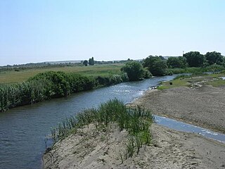
Belaya Kholunitsa is a river in Kirov Oblast in Russia, a left tributary of the Vyatka River. It is 160 kilometres (99 mi) long, and the area of its drainage basin is 2,800 square kilometres (1,100 sq mi).
Czułczyce Małe is a village in the administrative district of Gmina Sawin, within Chełm County, Lublin Voivodeship, in eastern Poland.

Florianów is a village in the administrative district of Gmina Bedlno, within Kutno County, Łódź Voivodeship, in central Poland. It lies approximately 12 kilometres (7 mi) east of Kutno and 50 km (31 mi) north of the regional capital Łódź.

Qanlıkənd is a village in the Kalbajar Rayon of Azerbaijan.
Barycz is a village in the administrative district of Gmina Końskie, within Końskie County, Świętokrzyskie Voivodeship, in south-central Poland. It lies approximately 3 kilometres (2 mi) north of Końskie and 41 km (25 mi) north of the regional capital Kielce.
Ruda Maleniecka is a village in Końskie County, Świętokrzyskie Voivodeship, in south-central Poland. It is the seat of the gmina called Gmina Ruda Maleniecka. It lies approximately 15 kilometres (9 mi) south-west of Końskie and 41 km (25 mi) north-west of the regional capital Kielce.
Brzeście Nowe is a village in the administrative district of Gmina Baboszewo, within Płońsk County, Masovian Voivodeship, in east-central Poland.
Żydowo is a village in the administrative district of Gmina Barlinek, within Myślibórz County, West Pomeranian Voivodeship, in north-western Poland. It lies approximately 4 kilometres (2 mi) north-east of Barlinek, 27 km (17 mi) north-east of Myślibórz, and 61 km (38 mi) south-east of the regional capital Szczecin.

Linkeroever is an area in the city of Antwerp, on the left bank of the Scheldt. Historically it was a neighborhood which belonged to Zwijndrecht, but on March 19, 1923, it was attached to Antwerp. Linkeroever has a population of approximately 15,000. Before receiving its current name the area was known as "Borger Weert Polder".
The Battle of Tashiskari was fought between the Georgians and the Turks at the village of Tashiskari on June 16, 1609. The Georgians, led by Giorgi Saakadze won a victory over the Turks.
Muzeum i Instytut Zoologii PAN is a zoological museum in Warsaw, Poland. It was established in 1819. It is an institute of the Polish Academy of Sciences. It publishes the journal Acta Chiropterologica, a scientific journal on bats.
Moka is a village in Märjamaa Parish, Rapla County in western Estonia.
Rubroek is a neighborhood of Rotterdam, Netherlands.

Akkystau is a town in Atyrau Region, southwest Kazakhstan. It lies at an altitude of 8 m (26 ft) below sea level.

İzzet Paşa Mosque is a mosque in Elazığ, Turkey


