
The Crowsnest Highway is an east-west highway in British Columbia and Alberta, Canada. It stretches 1,161 km (721 mi) across the southern portions of both provinces, from Hope, British Columbia to Medicine Hat, Alberta, providing the shortest highway connection between the Lower Mainland and southeast Alberta through the Canadian Rockies. Mostly two-lane, the highway was officially designated in 1932, mainly following a mid-19th-century gold rush trail originally traced out by an engineer named Edgar Dewdney. It takes its name from the Crowsnest Pass, the location at which the highway crosses the Continental Divide between British Columbia and Alberta.
Penhold is a town in central Alberta, Canada. Penhold is surrounded by Red Deer County, 16 km (9.9 mi) south of Red Deer at the junction of Highway 2A and Highway 42. It is located 128 kilometres (80 mi) north of Calgary, east of the Red Deer River.

Torrington is a hamlet in central Alberta, Canada within Kneehill County. It is located approximately 160 kilometres (99 mi) northeast of Calgary at the junction of Highway 27 and Highway 805.

Ponoka is a town in central Alberta, Canada. It is located at the junction of Highway 2A and Highway 53, 59 kilometres (37 mi) north of Red Deer and 95 kilometres (59 mi) south of Edmonton.

Innisfail is a town in central Alberta, Canada. It is located in the Calgary-Edmonton Corridor, south of Red Deer at the junction of Highway 2 and Highway 54.
Pipestone Creek is a waterway that runs through central Alberta, Canada. For example, over 100 acres (0.40 km2) of Pipestone Creek parkland is situated in Millet, Alberta, with a combination of meadows and urban forest.
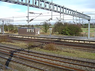
Norton Bridge railway station was a railway station located on the West Coast Main Line and served both the village of Norton Bridge and the town of Eccleshall in Staffordshire, England.

The Edinburgh–Dundee line is a railway line linking Edinburgh with Dundee via the Forth Bridge and the Tay Bridge. A branch runs to Perth. Passenger services are operated by ScotRail, Caledonian Sleeper, CrossCountry and London North Eastern Railway.
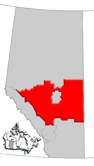
Central Alberta is a region located in the Canadian province of Alberta.
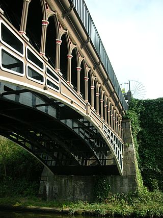
The Horseley Ironworks was a major ironworks in the Tipton area in the county of Staffordshire, now the West Midlands, England.
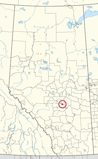
Samson Indian Reserve No. 137, also known as Samson No. 137 and Samson 137, and as the Samson Reserve, is an Indian reserve in Maskwacis, Alberta, Canada.
The Edinburgh and Northern Railway was a railway company authorised in 1845 to connect Edinburgh to both Perth and Dundee. It relied on ferry crossings of the Firth of Forth and the Firth of Tay, but despite those disadvantages it proved extremely successful. It took over a short railway on the southern shore of the Forth giving a direct connection to Edinburgh, and it changed its name to the Edinburgh, Perth and Dundee Railway.

Newton Road railway station was a station of the London and North Western Railway in Sandwell between West Bromwich and Great Barr, England. It lay between Hamstead and the later Tame Bridge Parkway stations on what is now known as the Chase Line.

Helmdon Village railway station on the Stratford-upon-Avon and Midland Junction Railway (SMJ) served the Northamptonshire village of Helmdon between 1872 and 1951. It was one of two stations serving the lightly populated rural area, the other being Helmdon railway station on the Great Central Main Line, and its closure marked the beginning of the years of decline for the SMJ line.

The Alberta Central Railway Museum is a railway museum located south-east of the City of Wetaskiwin, in Central Alberta, Canada. The main building was designed as a scaled-down version of the City's 1907 Canadian Pacific Railway depot. The depot includes a waiting room, baggage room and telegraph office, as well as exhibits and railroad artifacts. Railroad equipment includes locomotives, a sleeper car, passenger coach, freight equipment, cabooses, freight cars and a snowplough. Attractions include a model train layout of the original Wetaskiwin railyard. The museum also features a 1906 Alberta Grain Co. grain elevator which was moved from Hobbema. The elevator is known to be Alberta's second-oldest grain elevator in the Province. Rides are given on a one-mile loop of track.

Gartly is a locality in Alberta, Canada. It is located in the southern section of Starland County. The settlement was built near to a now defunct railway.
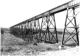
The Mintlaw Trestle is an abandoned steel and wooden railway trestle that was built over the Red Deer River by the Alberta Central Railway near Mintlaw, Alberta, in 1912. The last train to cross the bridge was in 1981, and the line and bridge was abandoned in 1983. The bridge is the second longest Canadian Pacific Railway bridge of its kind in Alberta. It is the longest and the highest bridge in Central Alberta. It is located west of Tuttle, northwest of Penhold, southwest of Red Deer, northwest of Red Deer Airport, and near the intersection of the C & E Trail and McKenzie Road.
The Railways of Kinross were a local network of three rural railways which made the town of Kinross in Scotland their objective in the 1850s.


