
Brighton is a seaside resort and one of the two main areas of the city of Brighton and Hove in the county of East Sussex, England. It is located 47 miles (76 km) south of London. Archaeological evidence of settlement in the area dates back to the Bronze Age, Roman and Anglo-Saxon periods. The ancient settlement of "Brighthelmstone" was documented in the Domesday Book (1086). The town's importance grew in the Middle Ages as the Old Town developed, but it languished in the early modern period, affected by foreign attacks, storms, a suffering economy and a declining population. Brighton began to attract more visitors following improved road transport to London and becoming a boarding point for boats travelling to France. The town also developed in popularity as a health resort for sea bathing as a purported cure for illnesses.

East Sussex is a ceremonial county in South East England. It is bordered by Kent to the north-east, West Sussex to the west, Surrey to the north-west, and the English Channel to the south. The largest settlement is the city of Brighton and Hove, and the county town is Lewes.
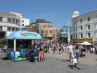
Brighton and Hove is a unitary authority with city status in East Sussex, England. There are multiple villages alongside the seaside resorts of Brighton and Hove in the district. It is administered by Brighton and Hove City Council, which is currently under Labour majority control.

The A23 road is a major road in the United Kingdom between London and Brighton, East Sussex, England. It is managed by Transport for London for the section inside the Greater London boundary, Surrey County Council and West Sussex County Council for the section shadowed by the M23 motorway, National Highways between the M23 and Patcham, and by Brighton and Hove Council from the A27 to the centre of Brighton.

Ditchling is a village and civil parish in the Lewes District of East Sussex, England. The village is contained within the boundaries of the South Downs National Park; the order confirming the establishment of the park was signed in Ditchling.

Brighton & Hove Bus and Coach Company Limited, trading as Brighton & Hove, is a bus company operating most bus services in the city of Brighton and Hove in southern England. It is a subsidiary of the Go-Ahead Group.
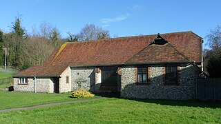
Coldean is a suburb of the English city of Brighton and Hove. Located in the northeast corner of the urban area, it was developed by Brighton Corporation in the 1950s as one of several postwar council estates necessitated by the acute housing shortage in the area after World War II.

Hangleton is a suburb of Brighton and Hove, in the ceremonial county of East Sussex, England. The area was developed in the 1930s after it was incorporated into the Borough of Hove, but has ancient origins: its parish church was founded in the 11th century and retains 12th-century fabric; the medieval manor house is Hove's oldest secular building. The village became depopulated in the medieval era and the church fell into ruins, and the population in the isolated hilltop parish only reached 100 in the early 20th century; but rapid 20th-century development resulted in more than 6,000 people living in Hangleton in 1951 and over 9,000 in 1961. By 2013, the population exceeded 14,000.
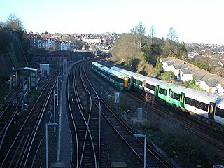
Public transport in Brighton and Hove, a city on the south coast of England, dates back to 1840. Brighton and Hove has a major railway station, an extensive bus service, many taxis, coach services, and it has previously had trolley buses, ferries, trams, auto rickshaws and hydrofoils.

Southdown Motor Services was a bus and coach operator in East and West Sussex and parts of Hampshire, in southern England. It was formed in 1915 and had various owners throughout its history, being purchased by the National Bus Company (NBC) in 1969. The company fleet name was lost when it was acquired by the Stagecoach Group in 1989 but buses operated under that legal name until 2015 when the operating licence was transferred to another company within the Stagecoach Group and 1915 company became dormant but still owned by the Stagecoach Group.

Patcham is a suburb in the city of Brighton and Hove, in the ceremonial county of East Sussex, England. It is about 3 miles (5 km) north of the city centre. It is bounded by the A27 to the north, Hollingbury to the east and southeast, Withdean to the south and the Brighton Main Line to the west. The A23 passes through the area.

Hollingdean is a district in the city of Brighton & Hove. The Ward is called Hollingdean and Stanmer with a population of 15,681 at the 2011 Census. Hollingdean is in effect the older part of Hollingbury. It is bounded by Ditchling Road to the west, the Round Hill area to the south, and Lewes Road and Moulsecoomb to the east. It is a mainly residential area, with many council houses to the east and low-rise flats in the central part, with late 19th and early 20th-century terraced houses towards Fiveways, and some railway land, light industry, and warehousing.

Ditchling Beacon is the highest point in East Sussex, England, with an elevation of 248 m (814 ft). It is south of Ditchling and to the north-east of Brighton. It is a large chalk hill with a particularly steep northern face, covered with open grassland and sheep-grazing areas. It is the third-highest point on the South Downs, behind Butser Hill and Crown Tegleaze.

Stanmer is a village on the northern edge of the city of Brighton and Hove, in the ceremonial county of East Sussex, England. It was formerly a civil parish until 1952 when it was split between Brighton and Falmer. In 1951 the parish had a population of 1097.
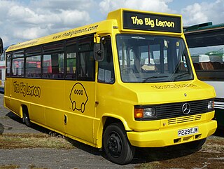
The Big Lemon is a bus and coach operator in Brighton, East Sussex, Bristol and Bath. It is registered as a Community Interest Company.

Round Hill is an inner suburban area of Brighton, part of the coastal city of Brighton and Hove in England. The area contains a mix of privately owned and privately rented terraced housing, much of which has been converted for multiple occupancies, and small-scale commercial development. It was developed mostly in the late 19th century on an area of high land overlooking central Brighton and with good views in all directions, the area became a desirable middle-class suburb—particularly the large terraced houses of Roundhill Crescent and Richmond Road, and the exclusive Park Crescent—and within a few decades the whole of the hill had been built up with smaller terraces and some large villas.
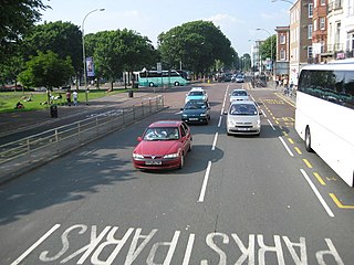
The Old Steine is a thoroughfare in Brighton city centre, East Sussex, and is the southern terminus of the A23. The southern end leads to Marine Parade, the Brighton seafront and the Palace Pier. The Old Steine is also the site of a number of City Centre bus stops for Brighton buses. The Royal Pavilion is located immediately to the north of the Old Steine.

Brighton Corporation Tramways operated an electric tramway service in Brighton between 1901 and 1939.

Prestonville is a largely residential area in the northwest of Brighton, part of the English city of Brighton and Hove. It covers a long, narrow and steeply sloping ridge of land between the Brighton Main Line and Dyke Road, two major transport corridors which run north-northwestwards from the centre of Brighton. Residential development started in the 1860s and spread northwards, further from central Brighton, over the next six decades. The area is characterised by middle-class and upper-middle-class housing in various styles, small-scale commercial development and long eastward views across the city. Two Anglican churches serve Prestonville—one at each end of the area—and there are several listed buildings.
As of February 2001, there were 1,124 listed buildings with Grade II status in the English city of Brighton and Hove. The total at 2009 was similar. The city, on the English Channel coast approximately 52 miles (84 km) south of London, was formed as a unitary authority in 1997 by the merger of the neighbouring towns of Brighton and Hove. Queen Elizabeth II granted city status in 2000.


