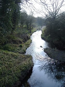
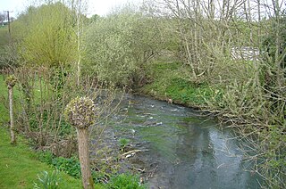
The River Avon is an English river in the south west of the country. To distinguish it from a number of other rivers of the same name, this river is often also known as the Bristol Avon. The name 'Avon' is a cognate of the Welsh word afon, meaning 'river'.

North Wiltshire is a constituency represented in the House of Commons of the UK Parliament since 1997 by James Gray, a Conservative. In the period 1832–1983, this was an alternative name for Chippenham or the Northern Division of Wiltshire and as Chippenham dates to the original countrywide Parliament, the Model Parliament, this period is covered in more detail in that article. In 2016 it was announced that the North Wiltshire constituency would be scrapped as part of the planned 2018 Constituency Reforms.
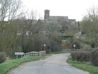
Brinkworth is a village and civil parish in northern Wiltshire, England. The village lies between Royal Wootton Bassett and Malmesbury, about 1 mile (1.6 km) north of the M4 motorway and 9 miles (14 km) west of Swindon.

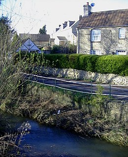
Christian Malford is a village and civil parish in the county of Wiltshire, England. The village lies about 4+1⁄2 miles (7 km) northeast of the town of Chippenham. The Bristol Avon forms most of the northern and eastern boundaries of the parish. The hamlets of Thornend and Upper Town lie within the parish.
Dauntsey is a small village and civil parish in the county of Wiltshire, England. It gives its name to the Dauntsey Vale in which it lies and takes its name from Saxon for Dantes- eig, or Dante's island. It is set on slightly higher ground in the flood plain of the upper Bristol Avon.

The Wiltshire Victoria County History, properly called The Victoria History of the County of Wiltshire but commonly referred to as VCH Wiltshire, is an encyclopaedic history of the county of Wiltshire in England. It forms part of the overall Victoria County History of England founded in 1899 in honour of Queen Victoria. With eighteen volumes published in the series, it is now the most substantial of the Victoria County Histories.
The Dauntsey Vale is a geographical feature in the north of the English county of Wiltshire.
Great Somerford is a village and civil parish within Dauntsey Vale, Wiltshire, England, near the south bank of the river Avon. It lies approximately 3+1⁄4 miles (5.2 km) southeast of Malmesbury and 12 miles (19 km) west of Swindon. The hamlet of Startley and the location of Seagry Heath are within the bounds of the parish.
The Bybrook, also known as the By Brook, is a small river in England. It is a tributary of the Bristol Avon and is some 12 miles (19 km) long. Its sources are the Burton Brook and the Broadmead Brook, which rise in South Gloucestershire at Tormarton and Cold Ashton respectively, and join just north of Castle Combe in Wiltshire. The river has a mean flow rate of 57.25 cubic feet per second (1.621 m3/s) as recorded at Middlehill near Box. A variety of flora and fauna is supported by the river including the endangered white-clawed crayfish. Twenty watermill sites have been identified on the river but none now remain in use.

Siston Brook rises in two separate streams which issue from a ridge just north of the village of Siston, South Gloucestershire, England. The brook is approximately 6 miles (9.7 km) long and is a tributary of the Bristol Avon. Much of its course is through the eastern suburbs of Bristol, although it remains outside the city boundaries. Tributaries include the Warmley Brook and an unnamed tributary from Bridgeyate.

The River Boyd is a river of some 7 miles (11 km) in length which rises near Dodington in South Gloucestershire, England. It is a tributary of the Bristol Avon, running in a southerly direction and joining near Bitton. The flow rate at Bitton is an average 19.8 cubic feet per second (0.56 m3/s). It was immortalised in the 1613 poem by John Dennys of Pucklechurch The Secrets of Angling, the earliest English poetical tract on fishing:
And thou sweet Boyd that with thy watry sway
Dost wash the cliffes of Deington and of Weeke
And through their Rockes with crooked winding way
Thy mother Avon runnest soft to seeke
In whose fayre streames the speckled Trout doth play
The Roche the Dace the Gudgin and the Bleeke
Teach me the skill with slender Line and Hooke
To take each Fish of River Pond and Brooke.
The Gauze Brook is a stream in South West England, which rises near the village of Littleton Drew in Wiltshire and flows in a northeasterly direction for approximately 9.1 miles (15 km) before joining the Bristol Avon near the village of Little Somerford.

The Tetbury Avon, also known as the Little Avon or the Ingleburn, is a tributary of the Bristol Avon. It is also referred to as the River Avon . It rises at Tetbury in Gloucestershire in the West Country of England, and flows in a generally south easterly direction, joining the Sherston Avon at Malmesbury in Wiltshire. The water flow has been reduced by public water extraction from its source aquifer in the Cotswold Hills. In the past watermills were used for fulling wool and grinding corn. One working mill survives.
The Woodbridge Brook is a tributary of the Bristol Avon. It rises near Lydiard Millicent in Wiltshire in the west of England and flows in a generally westerly direction, joining the Avon below Malmesbury. The brook has a mean flow of 20.5 cubic feet per second (0.58 m3/s) and the waters were used in the past to power watermills.
The Cocklemore Brook is a short tributary of the Bristol Avon, some 2.5 miles (4.0 km) long. It rises near Studley in Wiltshire in the West Country of England, and flows in a north and then westerly direction, passing underneath the former Wilts & Berks Canal before joining the Bristol Avon near Lackham House, now home to Lackham College. An alternate name of Pewe Brook is recorded in the 14th century.

Little Somerford is a village and civil parish in Wiltshire, England, 3 miles (4.8 km) southeast of Malmesbury and 7.5 miles (12.1 km) northeast of Chippenham.