
The Brooker Highway is a highway in the Australian state of Tasmania. As one of Hobart's three major radials, the highway connects traffic from the city centre with the northern suburbs and is the major road connection to the cities and towns of northern Tasmania. With an annual average daily traffic of 48,000, the highway is one of the busiest in Tasmania. The Brooker Highway has recently been declared part of the National Highway.
Port Wakefield Highway is an important South Australian highway, connecting Adelaide to the Yorke Peninsula, Port Augusta, northern and western South Australia, the Northern Territory and Western Australia. It is designated National Highway A1 and a part of the National Highway. It is named after Port Wakefield, the first government town north of Adelaide.

North Terrace is one of the four terraces that bound the central business and residential district of Adelaide, the capital city of South Australia. It runs east–west, along the northern edge of "the square mile". The western end continues on to Port Road, and the eastern end continues across the Adelaide Parklands as Botanic Road.

Norwood is a suburb of Adelaide, about 4 km (2.5 mi) east of the Adelaide city centre. The suburb is in the City of Norwood Payneham & St Peters, whose predecessor was the oldest South Australian local government municipality.

Gepps Cross is a suburb and major road intersection in the north of Adelaide, South Australia. Gepps Cross is traditionally seen as the end of the inner suburbs and the start of the outer northern suburbs, as it was home to a major abattoir with holding yards and other open space. It is the first significant open space encountered after the North Parklands. It retains the open nature, even with warehouses, a velodrome, hockey stadium, Adelaide Raiders – a Croatian soccer club, and karate training facilities.
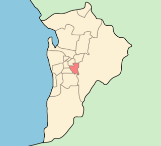
The City of Burnside is a local government area in the South Australian city of Adelaide stretching from the Adelaide Parklands into the Adelaide foothills with an area of 2,753 hectares. It was founded in August 1856 as the District Council of Burnside, the name of a property of an early settler, and was classed as a city in 1943. The LGA is bounded by Adelaide, Adelaide Hills Council, Campbelltown, Mitcham, Norwood Payneham and St Peters and Unley.

Port Wakefield is a town at the mouth of the River Wakefield, at the head of the Gulf St Vincent in South Australia. It was the first government town to be established north of the state capital, Adelaide. Port Wakefield is situated 98.7 kilometres from the Adelaide city centre on the Port Wakefield Highway section of the A1 National Highway.
South Road and its southern section as Main South Road outside of Adelaide is a major north–south conduit connecting Adelaide and the Fleurieu Peninsula, in South Australia. It is one of Adelaide's most important arterial and bypass roads. As South Road, it is designated part of route A2 within suburban Adelaide. As Main South Road, it is designated part of routes A13 and B23.
Fullarton Road is a main road in the South Australian capital city of Adelaide.

Pulteney Street is a main road which runs north-south through the middle of the eastern half of the Adelaide city centre, in Adelaide, South Australia. It runs north-south from North Terrace, through Hindmarsh and Hurtle Squares, to South Terrace, where it becomes Unley Road. It is the only one of the city centre's major north-south thoroughfares that does not continue northwards over North Terrace.

Until 1958, trams formed a network spanning most of Adelaide, with a history dating back to 1878. Adelaide ran horse trams from 1878 to 1914 and electric trams from 1909, but has primarily relied on buses for public transport since the mid-20th century. Electric trams, and later trolleybuses, were Adelaide's main method of public transport throughout the life of the electric tram network. The tram network was progressively closed down through the 1950s with the last lines closing in 1958; the Glenelg tram line was the only line to survive these closures and has remained in operation ever since and has been progressively upgraded and extended since 2005.

Rose Park Primary School is a coeducational R–6 school located in the Adelaide inner suburb of Rose Park. The school is located at 54 Alexandra Avenue and occupies the land between Alexandra and Grant Avenues. It is one of South Australia's earliest established Primary Schools and currently has an enrolment of approximately 580 students who come from different cultural backgrounds.
Adelaide has two city ring routes, that loop around the Adelaide city centre and North Adelaide, known as the Inner and Outer Ring Routes.

Hutt Street is the easternmost of the five major north–south roads running through the City of Adelaide. It runs from Pirie Street to South Terrace, from where it continues south as Hutt Road. Flanked by leafy side streets with many late 19th-century dwellings, it is home to a wide range of restaurants, two pubs, shops, offices and professional and medical suites.

The North–South Motorway is a partially complete motorway traversing the inner western suburbs of Adelaide, from Waterloo Corner in the north to Bedford Park in the south. Progressively constructed in stages since 2010, once complete it will replace the adjacent South Road as Adelaide's main north–south roadway. It will form the central section of the North–South Corridor, being flanked north and south by the Northern Expressway and Southern Expressway, respectively. It is designated part of route M2.

Virginia is a town on the rural outskirts of Adelaide, the capital city of South Australia. Port Wakefield Road, the main highway taking traffic to the north of Adelaide, passes through the area and used to pass straight through Virginia. Market gardening is the main activity there.

Wakefield Street is a main thoroughfare intersecting the centre of the South Australian capital, Adelaide, from east to west at its midpoint. It crosses Victoria Square in the centre of the city, which has a grid street plan. It continues as Wakefield Road on its eastern side, through the eastern Adelaide Park Lands.
Copper Coast Highway is a highway in South Australia which branches off from the Augusta and Port Wakefield Highways 2 km north of Port Wakefield, and heads northwest across the top of Yorke Peninsula to Kadina, ending at the Spencer Gulf town of Wallaroo.
The City of Kensington and Norwood, originally the Corporate Town of Kensington and Norwood, was a local government area in South Australia from 1853 to 1997, centred on the inner eastern Adelaide suburbs of Kensington and Norwood. In November 1997 it amalgamated with the City of Payneham and the Town of St Peters to form the City of Norwood Payneham & St Peters.

Gawler Place is a single-lane thoroughfare in the city centre of Adelaide, the capital of South Australia. Somewhat narrower than other busy streets in the Central Business District, it runs north to south from North Terrace to Wakefield Street, parallel to and approximately midway between King William and Pulteney streets.
