Osmania University is a collegiate public state university located in Hyderabad, Telangana, India. The university was founded by and named after Mir Osman Ali Khan, the 7th Nizam of Hyderabad in 1918. It is the third oldest university in southern India, and the first to be established in the erstwhile Kingdom of Hyderabad. It is the first Indian university to have Urdu as a medium of instruction. As of 2012, the university hosts 3,700 international students from more than 80 nations.

Madhya Bharat, also known as Malwa Union, was an Indian state in west-central India, created on 28 May 1948 from twenty-five princely states which until 1947 had been part of the Central India Agency, with Jiwajirao Scindia as its Rajpramukh.

Connemara Public Library at Egmore in Chennai, Tamil Nadu, India, is one of the four National Depository Libraries which receive a copy of all books, newspapers and periodicals published in India. Established in 1890, the library is a repository of centuries-old publications, wherein lie some of the most respected works and collections in the country. It also serves as a depository library for the UN. It is located in the Government Museum Complex on Pantheon Road, Egmore, which also houses the Government Museum and the National Art Gallery.

Jhansi is a historic city in the Indian state of Uttar Pradesh. It lies in the region of Bundelkhand on the banks of the Pahuj River, in the extreme south of Uttar Pradesh. Jhansi is the administrative headquarters of Jhansi district and Jhansi division. Also called the Gateway to Bundelkhand, Jhansi is situated near and around the rivers Pahuj and Betwa at an average elevation of 285 m (935 ft). It is about 420 kilometres (261 mi) from New Delhi and 102 kilometres (63 mi) south of Gwalior.

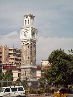
Secunderabad is the twin city of Hyderabad in the Indian state of Telangana. Named after Sikandar Jah, the third Nizam of the Asaf Jahi dynasty, Secunderabad was established in 1806 as a British cantonment. Although both the cities are together referred to as the twin cities, Hyderabad and Secunderabad have different histories and cultures, with Secunderabad having developed directly under British rule until 1948, and Hyderabad as the capital of the Nizams' princely state of Hyderabad.

The Salar Jung Museum is an art museum located at Dar-ul-Shifa, on the southern bank of the Musi River in the city of Hyderabad, Telangana, India. It is one of the three National Museums of India. Originally a private art collection of the Salar Jung family, it was endowed to the nation after the death of Salar Jung III. It was inaugurated on 16 December 1951.

Kurnool is a city and the judicial capital of Andhra Pradesh, India. It formerly served as the capital of Andhra State (1953–1956). The city is often referred to as "The Gateway of Rayalaseema". It also serves as the district headquarters of its Kurnool district. As of 2011 census, it is the fifth most populous city in the state with a population of 484,327. It is located on the banks of the Tungabhadra river. Although the area has been inhabited for thousands of years, modern Kurnool was founded in the 16th century CE with the construction of the Konda Reddy Fort.

Manilal Mohandas Gandhi was the second son of Mohandas Gandhi and Kasturba Gandhi.

Musi River or Musinuru or Muchukunda or moosa River is a tributary of the Krishna River in the Deccan Plateau flowing through Telangana state in India. Hyderabad stands on the banks of Musi river, which divides the historic old city and the new city. Himayat Sagar and Osman Sagar are dams built on it which used to act as source of water for Hyderabad. The river was known as Nerva during Qutub Shahi period. The river originates in Ananthagiri Hills near Vikarabad. It generally flows in easterly direction, turning South at Chittaloor. It flows into the Krishna River at Vadapally, near Miryalaguda in Nalgonda district.

The Archaeological Survey of India is an Indian government agency attached to the Ministry of Culture that is responsible for archaeological research and the conservation and preservation of cultural monuments in the country. It was founded in 1861 by Alexander Cunningham who also became its first Director-General.

Hapur is a city in, as well as the headquarters of, Hapur district, in Uttar Pradesh, India. Located about 60 kilometres (37 mi) east of New Delhi, the city is part of the Delhi National Capital Region (NCR). National Highway 9 passes through the city, connecting it to Delhi.

Budaun district is one of the districts of Uttar Pradesh state of India, and Budaun town is the district headquarters. Budaun district is a part of Bareilly division. The district covers an area of 5168 km². According to the mythological stories, Budaun was named after Ahir prince Budh.

Amroha district is one of the 75 districts of Uttar Pradesh state in northern India. Amroha town is the district headquarters. According to the Government of India, the district is one of the Minority Concentrated Districts on the basis of the 2001 census data on population, socio-economic indicators and basic amenities indicators.

The National Academy of Legal Studies and Research (NALSAR), is a National Law University located in Shamirpet, Hyderabad, Telangana, India. It is established in 1998. The university offers undergraduate and postgraduate programs in law and postgraduate programs in business administration. It is one of the autonomous law schools in India.

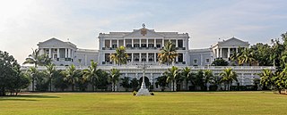
Falaknuma is a palace in Hyderabad, Telangana, India. It originally belonged to the Paigah family, and was later owned by the Nizam of Hyderabad. It is on a hillock and covers a 13-hectare (32-acre) area in Falaknuma, 5 kilometres (3.1 mi) from Charminar.

Gandhi Medical College is a medical college in Hyderabad, India affiliated with Kaloji Narayana Rao University of Health Sciences. The college was originally affiliated to NTR University of Health Sciences.

Basheer Bagh Palace or Bashir Bagh Palace was a palace located in Hyderabad, Telangana, India. It was constructed by Sir Asman Jah, a Paigah noble and Prime Minister of Hyderabad state (1887–1894).
Rasipuram is a state assembly constituency in Namakkal district of Tamil Nadu, India. It comprises a portion of Rasipuram taluk and is a part of the wider Namakkal constituency for national elections to the Parliament of India. The seat is reserved for candidates from the Scheduled Castes. Elections and winners in the constituency are listed below.

Orchha State was a kingdom situated in the Bundelkhand region and later a princely state in British India. It was located within what is now the state of Madhya Pradesh.
Toopran is a revenue division in the Medak district of Telangana, India.


