
Mount Stuart is a mountain in the Cascade Range, in the U.S. state of Washington. It is the second highest non-volcanic peak in the state, after Bonanza Peak and seventh-highest overall. Mount Stuart is the highest peak in the Stuart Range, and it is located in the central part of the Washington Cascades, south of Stevens Pass and east of Snoqualmie Pass in the Alpine Lakes Wilderness.

Mount Nebo is the southernmost and highest mountain in the Wasatch Range of Utah, in the United States, and the centerpiece of the Mount Nebo Wilderness, inside the Uinta National Forest. It is named after the biblical Mount Nebo in Jordan, overlooking Israel from the east of the Jordan River, which is said to be the place of Moses' death.

La Plata Peak is the fifth-highest summit of the Rocky Mountains of North America and the U.S. state of Colorado. The prominent 14,343-foot (4,372 m) fourteener is located in the Collegiate Peaks Wilderness of San Isabel National Forest, 22.7 miles (36.5 km) northwest by west of the Town of Buena Vista in Chaffee County, Colorado, United States.

Mount Abraham is a mountain in the Green Mountains in the U.S. state of Vermont. Located in the Green Mountain National Forest, its summit is in the town of Lincoln in Addison County, but its eastern slopes extend into the town of Warren in Washington County. The mountain is named after Abraham Lincoln, former president of the United States. It is one of five peaks in Vermont's Presidential Range.

Lone Peak is a mountain summit in the Wasatch Range southeast of Salt Lake City, Utah, United States, and the center of the Lone Peak Wilderness, established in 1978. With an elevation of 11,260 feet (3,430 m), it is one of the highest peaks in the range and among the most prominent of the Wasatch Front, towering over the Salt Lake City suburb of Draper and easily visible from most of the valley, which makes it a popular destination for hiking and rock climbing.

Bald Mountain is a 11,949-foot (3,642 m) peak in the western Uinta Mountain Range in the Uinta-Wasatch-Cache National Forest on the border between Summit and Wasatch counties in northeastern Utah, United States.

Mount Agassiz is a peak in the Uinta Mountains of northeastern Utah with an elevation of 12,433 feet (3,790 m). It is located in the High Uintas Wilderness and the Uinta-Wasatch-Cache National Forest. The summit is named in honor of Louis Agassiz, a well-known paleontologist, glaciologist and geologist.

Freel Peak is a mountain located in the Carson Range, a spur of the Sierra Nevada, near Lake Tahoe in California.
Escudilla Mountain is located in Apache County, Arizona, United States, and is part of the White Mountains. The peak is approximately 3.5 miles from the Arizona-New Mexico border. The summit is the highest point in the Escudilla Wilderness which is administered as part of the Apache-Sitgreaves National Forest. It is also the third-highest mountain peak in Arizona.

Sacajawea Peak is a peak in the Wallowa Mountains, in the U.S. state of Oregon. It is in the Eagle Cap Wilderness and the Wallowa–Whitman National Forest.

The Swan Range is a mountain range in western Montana in the United States. Its peaks typically rise to around 8,000 to 9,000 feet. The range is bounded by the South Fork Flathead River to the east, the Flathead River to the north and northwest, the Swan River to the west, and lie to the southwest of Glacier National Park, just south of the Canada–US border. It runs about 99 miles (159 km) from north-northwest to south-southeast. Major cities near the Swan Range include Kalispell and Bigfork to the northwest, and Seeley Lake on the south.

Long Knife Peak is located in the Clark Range, Glacier National Park in the U.S. state of Montana. Though much of the mountain slopes extend into the Canadian Province of British Columbia, the main summit is in the U.S. Long Knife Peak rises more than a vertical 1 mile (1.6 km) above Upper Kintla Lake. It is also the most northerly peak and land area in the contiguous United States above 9,000 feet (2,743 m). Long Knife Peak is on an east west ridgeline identified as the "Boundary Mountains" on the USGS 7.5 minute topo quad and this extended ridge, with peak 8864, also contains the most northerly named (numbered) peak and land area in the contiguous United States above 8,000 feet (2,438 m).
The Sierra Madre Range is a mountain range in the western United States, located in south-central Wyoming and north-central Colorado. Geologically, it may be considered an extension of the Park Range of Colorado. South of the Great Divide Basin, the US Continental Divide runs along the Sierre Madre high points. Its western basins drain into the Colorado River and its eastern into the North Platte River. Buck Mountain, elevation 11,396 feet, is the highest peak in the range and lies within Colorado. Bridger Peak, elevation 11,004 feet, is the range's highest elevation in Wyoming.

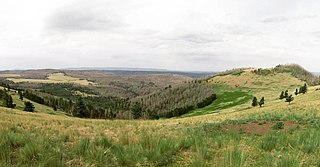
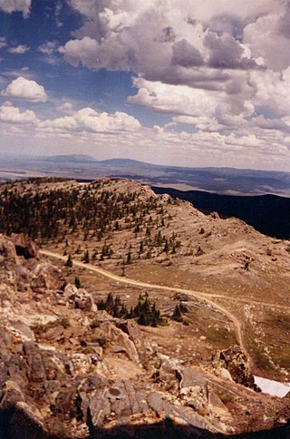
Bull Mountain, an officially unnamed summit in northern Utah, United States, has an elevation of 9,938 feet (3,029 m). It is the highest point in the Raft River Mountains and Box Elder County.
USGS Peak, at 11,982 feet (3,652 m) above sea level, is the tenth-highest peak in the U.S. state of Idaho and the eighth-highest in the Lost River Range. The peak is located in Salmon-Challis National Forest in Custer County. It is 1.6 miles (2.6 km) northeast of Mount McCaleb and 4.15 miles (6.68 km) southeast of Lost River Peak, its line parent.

Flat Top Mountain is a 10,624-foot (3,238 m) peak in Utah and Tooele Counties, Utah in the United States, about 15 miles (24 km) to the east of Rush Valley.
White Mountain, or White Mountain West, is the highest peak in the Salmon River Mountains in Idaho, USA, with an elevation of 10,442 feet (3,183 m).

The Twin Peaks are a set of mountain high points located on the Alpine Ridge within the Wasatch Range in Utah, United States, on the border between Salt Lake and Utah County. They are usually referred to as the American Fork Twin Peaks, to distinguish them from the nearby Broads Fork Twin Peaks and Avenues Twin Peaks. Consisting of several sub-peaks, only one has the prominence to be considered a true summit. The summit has an elevation of 11,461 feet (3,493 m), making it the highest point in Salt Lake County. The peak is also the most prominent in Salt Lake County, and one of the most prominent in the Wasatch Range.

Ostler Peak is a 12,718-foot elevation (3,876 m) mountain summit located in Summit County, Utah, United States.

Sugarloaf Mountain is an 11,051-foot-elevation (3,368-meter) summit on the boundary that Salt Lake County shares with Utah County, in Utah, United States.


