Whaddon may refer to several places in England:

Painswick is a town and civil parish in the Stroud District in Gloucestershire, England. Originally the town grew from the wool trade, but it is now best known for its parish church's yew trees and the local Rococo Garden. The village is mainly constructed of locally quarried Cotswold stone. Many of the buildings feature south-facing attic rooms once used as weavers' workshops.

Mangotsfield is a village and former civil parish in the unitary authority area of South Gloucestershire, in the ceremonial county of Gloucestershire, England, to the north-east of Bristol.

Barnwood is a suburb and former civil parish in the city of Gloucester, in the county of Gloucestershire, England. It lies about 1.8 miles (2.9 km) east of the centre of the city.

Bisley is a village and former civil parish, now in the parish of Bisley-with-Lypiatt, in the Stroud district, in Gloucestershire, England, about 4 miles (6 km) east of Stroud. The once-extensive manor included Stroud and Chalford, Thrupp, Oakridge, Bussage, Througham and Eastcombe. In 1891 the parish had a population of 5171.

Stow Bedon is a village and former civil parish, now in the parish of Stow Bedon and Breckles, in the Breckland district of the English county of Norfolk. Stow Bedon adjoins the hamlet of Lower Stow Bedon, although the two are often considered to be one village. In the south of the parish is the village of Breckles. In 2011 the merged parish had a population of 290.

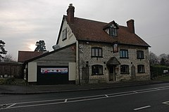
Brookthorpe-with-Whaddon, formerly just Brookthorpe, is a civil parish in the Stroud district of Gloucestershire, England. According to the 2001 census it had a population of 308, increasing to 322 at the 2011 census. In 2019 the population was estimated at 395. It consists of the small villages of Brookthorpe and Whaddon, both to the south of Gloucester.

Wotton is a suburb of Gloucester, in the county of Gloucestershire, England. It is situated close to the city centre, the Royal Hospital, the city's railway station and to London Road.

Matson is a suburb of Gloucester, in the county of Gloucestershire, England. In 1931 the parish had a population of 40.

Shenington is a village and former civil parish, now in the parish of Shenington with Alkerton, in the Cherwell district, in the county of Oxfordshire, England. It is about 5 miles (8 km) west of Banbury, it was an exclave of Gloucestershire until the Counties Act 1844 transferred it to Oxfordshire. Shenington is on Oxfordshire's boundary with Warwickshire. Shenington was an ancient parish of 1,628 acres (659 ha). In 1961 the parish had a population of 232. On 1 April 1970 the parish was abolished and merged with Alkerton to form "Shenington with Alkerton".

Saul is a village and former civil parish, now in the parish of Fretherne with Saul, in the Stroud district, in the county of Gloucestershire, England. In 1881 the parish had a population of 597. On 24 March 1884 the parish was abolished to form Fretherne with Saul; part also went to Moreton Valance and Standish.

Hempsted is a suburban village and former civil parish, on the edge of Gloucester in the county of Gloucestershire, England. The parish was abolished in 1966 and absorbed into the parish and city of Gloucester. In 1961 the parish had a population of 508. The current estimated population based on small area data of the 2021 ONS census is 2715.

Fretherne is a small village and former civil parish, now in the parish of Fretherne with Saul, in the Stroud district, in Gloucestershire, England, situated between the larger villages of Frampton-on-Severn and Arlingham. In 1881 the parish had a population of 239. In the Domesday Book of 1086 it is recorded as held by Turstin FitzRolf. The village name probably originates from Old English 'Frithorne,' meaning 'Freo's thorn.'

Oldbury-on-the-Hill is a small village and former civil parish, now in the parish of Didmarton, in the Cotswold district, in Gloucestershire, England, ninety-three miles west of London and less than one-mile (1.6 km) north of the village of Didmarton. In 1881 the parish had a population of 386.

Rudford is a village and former civil parish, now in the parish of Rudford and Highleadon, in the Forest of Dean district, in the county of Gloucestershire, England. It is located approximately 4 miles (6 km) north-west of Gloucester and 5 miles (8 km) south-east of Newent. The local church is dedicated to St Mary. In 1931 the parish had a population of 114.

Miserden is a village and civil parish in Stroud District, Gloucestershire, England, 4 miles north east of Stroud. The parish includes Whiteway Colony and the hamlets of Sudgrove and The Camp. In the 2001 census the parish had a population of 420, increasing to 449 at the 2011 census.

Tuffley is a suburb in the city of Gloucester in Gloucestershire, England. The ward is unparished and situated near Robinswood Hill.

Widford is a deserted medieval village in the civil parish of Swinbrook and Widford, in the West Oxfordshire district, in the county of Oxfordshire, England. It is on the River Windrush about 1.5 miles (2.4 km) east of Burford. The village was an exclave of Gloucestershire until 1844.

Gloucester Services are a pair of Motorway Service Areas (MSA) serving the northbound and southbound carriageways of the M5 between Junction 11A and Junction 12, near Whaddon, Gloucester. It specialises in selling artisanal food, and does not offer outlets for popular chain food brands. Fuel is provided by Esso and electric vehicle charging facilities are available.

Stratton is a village, ward and former civil parish about 22 miles from Gloucester, now in the parish of Cirencester, in the Cotswold district, in the county of Gloucestershire, England. In 2018 the built up area and ward had an estimated population of 2584. In 1931 the parish had a population of 963. Stratton was on the A417, construction of the Cirencester and Stratton bypass was due to be started in 1994 and was complete in December 1997.