Broomloan Road Primary School

Last updated

The original 1875 Broomloan Road School building designed by Alexander Watt Derelict school buildings, Broomloan Road, Govan - geograph.org.uk - 1735131.jpg
The original 1875 Broomloan Road School building designed by Alexander Watt
The later 1894 Broomloan Road School building designed by H&D Barclay Broomloan Road School 2013.jpg
The later 1894 Broomloan Road School building designed by H&D Barclay

Broomloan Road Primary School was a primary school situated in Govan, Glasgow, Scotland.

It was the largest School in Govan built by Govan School Board, and comprised two separate buildings. The first, designed by Alexander Watt, opened in 1875. In 1894 a red sandstone extension was built, designed by H&D Barclay. Broomloan Road Primary School closed in the late 1960s.

After closure the red sandstone building was used by St. Saviour's Infants throughout the 1970s and as St. Gerards annexe after St. Saviour's Infants moved to a new school in Dunsmuir Street. In the early 1980s the building became the Summertown Community Centre before closing in the early 1990s. The older yellow sandstone building became Broomloan Road Nursery School in the late 1970s and was closed in the early 1990s after the nursery moved to St. Gerards Secondary School. [1]

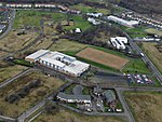
Both buildings were closed in the mid-2000s, boarded up and left in a derelict condition for many years. They were protected as a category B listed building. [2]

The yellow sandstone building designed by Alexander Watt was almost completely destroyed by a fire in May 2014. [3] The 1894 building went on fire later in 2014. [4] Both buildings have been subsequently demolished entirely.

It is most notable for being the first school of Sir Alex Ferguson, the former manager of Manchester United Football Club. He attended Broomloan Road and later Govan High School. [5]

Related Research Articles

<span class="mw-page-title-main">Govan</span> Area of Glasgow, Scotland

Govan is a district, parish, and former burgh now part of south-west Glasgow, Scotland. It is situated 2+12 miles west of Glasgow city centre, on the south bank of the River Clyde, opposite the mouth of the River Kelvin and the district of Partick. Historically it was part of the County of Lanark.

<span class="mw-page-title-main">Ibrox Stadium</span> Football stadium in Glasgow

Ibrox Stadium is a football stadium on the south side of the River Clyde in the Ibrox area of Glasgow, Scotland. The home of Scottish Premiership team Rangers Football Club, Ibrox is the third largest football stadium in Scotland, with an all-seated capacity of 50,817. The stadium was designed by renowned football stadium architect Archibald Leitch, with renovations to the stadium between 1978 and 1981, as well as 1990 and 1991, being designed by The Miller Partnership and Gareth Hutchison respectively.

<span class="mw-page-title-main">Pollokshields</span> Human settlement in Scotland

Pollokshields is an area in the Southside of Glasgow, Scotland. Its modern boundaries are largely man-made, being formed by the M77 motorway to the west and northwest with the open land of Pollok Country Park and the Dumbreck neighbourhood beyond, by the Inverclyde Line railway and other branches which separate its territory from the largely industrial areas of Kinning Park, Kingston and Port Eglinton, and by the Glasgow South Western Line running from the east to south, bordering Govanhill, Strathbungo, Crossmyloof and Shawlands residential areas. There is also a suburban railway running through the area.

<span class="mw-page-title-main">Shettleston</span> Human settlement in Scotland

Shettleston is an area in the east end of Glasgow in Scotland.

Cranhill is an inner city district and housing scheme in the north east of Glasgow, Scotland. Cranhill was developed from public funding in the early 1950s and was originally, chiefly composed of four-storey tenement blocks surrounding a patch of grassland, which became Cranhill Park. Later development saw the building of three tower blocks, surrounded by rows of terraced maisonettes. In more recent years, a number of semi-detached and detached homes have been built. The area also hosts some shops, two primary schools and nurseries, a community centre and the Cranhill water tower.

Dalmarnock is a district in the Scottish city of Glasgow. It is situated east of the city centre, directly north of the River Clyde opposite the town of Rutherglen. It is also bounded by the Glasgow neighbourhoods of Parkhead to the north-east and Bridgeton to the north-west.

<span class="mw-page-title-main">Sandyhills</span> Human settlement in Scotland

Sandyhills is an area of the Scottish city of Glasgow. It is situated north of the River Clyde and has fallen within the Shettleston ward of Glasgow City Council since 2007.

<span class="mw-page-title-main">Govanhill</span> Area of Glasgow, Scotland

Govanhill is an area of Glasgow, Scotland, situated south of the River Clyde between Pollokshields, the Gorbals, Strathbungo, Crosshill, Polmadie and Queen's Park. Historically part of Renfrewshire, Govanhill had the status of a police burgh between 1877 and 1891 before becoming part of the City of Glasgow. Since 2007, it has fallen under the Southside Central ward of Glasgow City Council. A previous smaller ward named Govanhill had boundaries of Dixon Avenue and Dixon Road to the south, Victoria Road to the west, Butterbiggins Road to the north and Aikenhead Road to the east.

<span class="mw-page-title-main">Oatlands, Glasgow</span> Human settlement in Scotland

Oatlands is an area in the city of Glasgow, Scotland. It is situated south of the River Clyde, falls within the Southside Central ward under Glasgow City Council, and is part of the Gorbals historic area. Its boundaries are Hutchesontown and the Southern Necropolis cemetery to the west, Polmadie to the south, Shawfield to the east, and Glasgow Green public park to the north.

<span class="mw-page-title-main">Kinning Park</span> Suburb of Glasgow, Scotland

Kinning Park is a southern suburb of Glasgow, Scotland. It was formerly a separate police burgh between 1871 and 1905 before being absorbed by the city. In 1897, it had a population of 14,326.

<span class="mw-page-title-main">Burnside, South Lanarkshire</span> Human settlement in Scotland

Burnside is a mostly residential area in the town of Rutherglen in South Lanarkshire, Scotland. Including the neighbourhoods of High Burnside and High Crosshill, respectively south and north-west of its main street, it borders Overtoun Park in Rutherglen plus several other residential areas of the town, as well as western parts of neighbouring Cambuslang.

<span class="mw-page-title-main">Martyrs' Public School</span>

The Martyrs’ Public School, in Parson Street in the Townhead area of Glasgow, Scotland, is one of the earlier works of architect Charles Rennie Mackintosh. Until recently, an arts centre run by Glasgow Museums, it is now home to Glasgow City Council's Social Work Leaving Care Services. It is protected as a category A listed building. Stranded above the main road it was once set in the middle of a densely populated area of tenement buildings. It was built following the Education (Scotland) Act 1872 which provided for increased public expenditure on education. Commissioned by the School Board of Glasgow and built between 1895 and 1898, the architects were Honeyman and Keppie.

This article provides brief details of primary schools in the borough of Watford in Hertfordshire, England, United Kingdom. Some Watford children attend schools in the neighbouring boroughs of Three Rivers and Hertsmere.

<span class="mw-page-title-main">Craigholme School</span> Private day school in Pollokshields, Glasgow, Scotland

Craigholme School was a private school for girls situated in the Pollokshields area of the South Side of Glasgow, Scotland. It was founded in 1894 and closed in 2020.

Education in the Bailiwick of Guernsey is the combined education systems of Guernsey, Alderney and Sark. In Guernsey, it is overseen by the Education Section of the Committee for Education, Sport and Culture, part of the States of Guernsey. The States manage a number of island schools, including three comprehensive secondary schools and one grammar school, as well as the island's higher education facility, the Guernsey Institute. There are also a number of private schools on the island.

<span class="mw-page-title-main">Glasgow Harbour Tunnel Rotundas</span>

The Glasgow Harbour Tunnel Rotundas are two red brick stone rotundas which flank the River Clyde in Glasgow, Scotland. The North Rotunda is located on Tunnel Street in the Finnieston area of Glasgow with the South Rotunda at Plantation Place in Govan.

St Gerard's RC Secondary was a secondary school in Govan, Glasgow, Scotland, formerly known as St Gerard's Senior Secondary School.

Govandale Park was a football ground in the burgh of Govan, Scotland. It was the home ground of Linthouse F.C. between 1894 and their disbandment in 1900.

<span class="mw-page-title-main">David Richmond (Lord Provost of Glasgow)</span> Scottish businessman (1843–1908)

Sir David Richmond was a Scottish businessman who served as Lord Provost of Glasgow from 1896 to 1899. He was Director of David Richmond and Co., tube makers.

<span class="mw-page-title-main">Moorepark, Glasgow</span> Area of Glasgow, Scotland

Moorepark is a small area in the Scottish city of Glasgow. Situated south of the River Clyde and part of the former Burgh of Govan, it was colloquially referred to as 'Wine Alley' during the mid-to-late 20th century when a housing scheme with a rough reputation was sited there. It is now an industrial estate.

References

  1. "Broomloan Road Public School on acumfaegovan". acumfaegovan.com. Retrieved 28 May 2014.
  2. "Broomloan Road Public School: Listed Building Report". Historic Scotland. Retrieved 25 November 2011.
  3. "Firefighters tackle blaze at Sir Alex Ferguson's former primary school". Glasgow Evening Times. Retrieved 28 May 2014.
  4. "Fire guts derelict school in Govan area of Glasgow". BBC News. 17 September 2014. Retrieved 7 July 2018.
  5. "Glasgow Caledonian University, Research Collections, Archives". TheGlasgowStory.com. 2009. Archived from the original on 3 July 2011. Retrieved 12 July 2011.

55°51′25″N4°18′32″W / 55.857°N 4.309°W / 55.857; -4.309