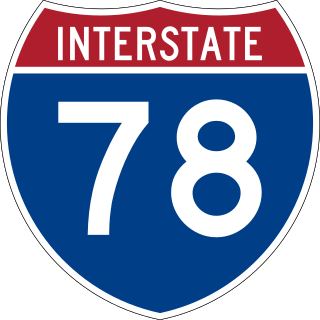
Interstate 78 (I-78) is an east–west Interstate Highway in the Northeastern United States that runs 144 miles (232 km) from I-81 northeast of Harrisburg, Pennsylvania, through Allentown to western and North Jersey, terminating at the Holland Tunnel entrance to Lower Manhattan in New York City. Major metropolitan areas along I-78 include the Lehigh Valley in Pennsylvania, the Gateway Region in New Jersey, and the New York metropolitan area.
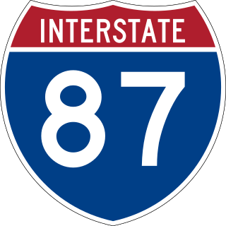
Interstate 87 (I-87) is a 333.49-mile-long (536.70 km) north–south Interstate Highway located entirely within the US state of New York. I-87 is the main highway that connects New York City and Montreal. The highway begins at exit 47 off I-278 in the New York City borough of the Bronx, just north of the Robert F. Kennedy Bridge. From there, the route runs northward through the Hudson Valley, the Capital District, and the easternmost part of the North Country to the Canada–United States border in the town of Champlain. At its north end, I-87 continues into Quebec as Autoroute 15 (A-15). I-87 connects with several regionally important roads: I-95 in New York City, New York State Route 17 near Harriman, I-84 near Newburgh, and I-90 in Albany. The highway is not contiguous with I-87 in North Carolina.
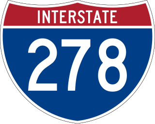
Interstate 278 (I-278) is an auxiliary Interstate Highway in New Jersey and New York in the United States. The road runs 35.62 miles (57.32 km) from US Route 1/9 (US 1/9) in Linden, New Jersey, northeast to the Bruckner Interchange in the New York City borough of the Bronx. The majority of I-278 is in New York City, where it serves as a partial beltway and passes through all five of the city's boroughs. I-278 follows several freeways, including the Union Freeway in Union County, New Jersey; the Staten Island Expressway (SIE) across Staten Island; the Gowanus Expressway in southern Brooklyn; the Brooklyn–Queens Expressway (BQE) across Northern Brooklyn and Queens; a small part of the Grand Central Parkway in Queens; and a part of the Bruckner Expressway in the Bronx. I-278 also crosses multiple bridges, including the Goethals, Verrazzano-Narrows, Kosciuszko, and Robert F. Kennedy bridges.

New York State Route 440 (NY 440) is a freeway located entirely on Staten Island in New York City. The route acts as a connector between the two segments of New Jersey Route 440, running from the Staten Island community of Charleston in the south to Port Richmond in the north. NY 440 is connected to the two New Jersey segments by the Outerbridge Crossing to the south and the Bayonne Bridge to the north. It is one of several signed New York State routes that are not connected to any others in the state, and one of only two NYS routes that is the middle section of another state's highway bearing the same number. From the Korean War Veterans Parkway to Interstate 278 (I-278), it is known as the West Shore Expressway. North of I-278, it is named the Dr. Martin Luther King Jr. Expressway. NY 440 is the southernmost state route in the state of New York.

The Hutchinson River Parkway is a controlled-access parkway in southern New York in the United States. It extends for 18.71 miles (30.11 km) from the Bruckner Interchange in the Throggs Neck section of the Bronx to the New York–Connecticut state line at Rye Brook. The parkway continues south from the Bruckner Interchange as the Hutchinson River Expressway (Interstate 678) and north into Greenwich, Connecticut, as the Merritt Parkway. The roadway is named for the Hutchinson River, a 10-mile-long (16 km) stream in southern Westchester County that the road follows alongside. The river, in turn, was named for English colonial religious leader Anne Hutchinson.

The Belt Parkway is the name given to a series of controlled-access parkways that form a belt-like circle around the New York City boroughs of Brooklyn and Queens. The Belt Parkway comprises three of the four parkways in what is known as the Belt System: the Shore Parkway, the Southern Parkway, and the Laurelton Parkway. The three parkways in the Belt Parkway are a combined 25.29 miles (40.70 km) in length. The Cross Island Parkway makes up the fourth parkway in the system, but is signed separately.
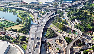
Spaghetti junction is a nickname sometimes given to a complex or massively intertwined road traffic interchange that is said to resemble a plate of spaghetti. Such interchanges may incorporate a variety of interchange design elements in order to maximize connectivity.

Interstate 495 (I-495) is an auxiliary Interstate Highway in southeastern New York state. It is jointly maintained by the New York State Department of Transportation (NYSDOT), the New York City Department of Transportation (NYCDOT), MTA Bridges and Tunnels (TBTA), and the Port Authority of New York and New Jersey (PANYNJ). East of the Queens–Midtown Tunnel, I-495 is known as the Long Island Expressway (LIE).

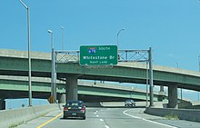
The Bronx–Whitestone Bridge is a suspension bridge in New York City, carrying six lanes of Interstate 678 over the East River. The bridge connects Throggs Neck and Ferry Point Park in the Bronx, on the East River's northern shore, with the Whitestone neighborhood of Queens on the southern shore.

The Cross Bronx Expressway is a major freeway in the New York City borough of the Bronx. It is mainly designated as part of Interstate 95 (I-95), but also includes portions of I-295 and U.S. Route 1 (US 1). The Cross Bronx begins at the eastern approach to the Alexander Hamilton Bridge over the Harlem River. While I-95 leaves at the Bruckner Interchange in Throgs Neck, following the Bruckner Expressway and New England Thruway to Connecticut, the Cross Bronx Expressway continues east, carrying I-295 to the merge with the Throgs Neck Expressway near the Throgs Neck Bridge. Though the road goes primarily northwest-to-southeast, the nominal directions of all route numbers west of the Bruckner Interchange are aligned with the northbound route number going southeast, and the southbound route number going northwest.

Interstate 295 (I-295) is an auxiliary Interstate Highway within New York City. Measuring 7.7 miles (12.4 km) in length, I-295 originates at NY 25 in Queens, running north across Queens and over the tolled Throgs Neck Bridge, to Bruckner Interchange, a junction with I-95, I-278, I-678, and the Hutchinson River Parkway in the Bronx. From south to north, I-295 intersects the Grand Central Parkway, I-495, and the Cross Island Parkway in Queens before crossing the Throgs Neck Bridge and splitting with I-695. In Queens, I-295 is also known as the Clearview Expressway, and in the Bronx, parts are known as the Throgs Neck Expressway and the Cross Bronx Expressway Extension.
The Bruckner Expressway is a freeway in the borough of the Bronx in New York City. It carries Interstate 278 (I-278) and I-95 from the Triborough Bridge to the south end of the New England Thruway at the Pelham Parkway interchange. The highway follows a mostly northeast–southwest alignment through the southern portion of the borough, loosely paralleling the course of the East River. It connects to several major freeways including the Bronx River Parkway, and at the Bruckner Interchange, it connects to the Cross Bronx Expressway, the Hutchinson River Expressway, and the Hutchinson River Parkway.

Interstate 678 (I-678) is a north–south auxiliary Interstate Highway that extends for 14 miles (23 km) through two boroughs of New York City. The route begins at John F. Kennedy International Airport on Jamaica Bay and travels north through Queens and across the East River to the Bruckner Interchange in the Bronx, where I-678 ends and the Hutchinson River Parkway begins.

New York State Route 895 (NY 895), known locally as Sheridan Boulevard, is a state highway in the New York City borough of The Bronx. Its south end is at a merge with the Bruckner Expressway (I-278) in the Hunts Point neighborhood, and its north end is at the Cross Bronx Expressway (I-95), where the road connects with local streets in the West Farms neighborhood.

New York State Route 878 (NY 878) is an expressway on Long Island in New York state. The route exists in two sections, which both form the Nassau Expressway. NY 878's western terminus is the Belt Parkway and Conduit Avenue (NY 27) in Ozone Park, within southern Queens in New York City. Its southern terminus is at the Atlantic Beach Bridge in Lawrence, within southwestern Nassau County. NY 878 is discontinuous between Farmers Boulevard in Queens and the town of Inwood in Nassau County. The two sections are connected to each other by Rockaway Boulevard and Rockaway Turnpike.

New York State Route 1A (NY 1A) was a north–south state highway mostly located within New York City. It extended for just under 18 miles (29 km) from an intersection with NY 27 near the Holland Tunnel in Lower Manhattan to an interchange with U.S. Route 1 (US 1) just north of the New York City line in the Westchester County village of Pelham Manor. In Manhattan and the South Bronx, NY 1A used several surface streets to traverse the boroughs, including a handful of one-way roads. At the Bronx River, it began to follow limited-access highways, specifically the Bruckner Expressway and the Hutchinson River Parkway.

Interstate 95 (I-95) is part of the Interstate Highway System and runs from Miami, Florida, to the Canada–United States border near Houlton, Maine. In the US state of New York, I-95 extends 23.50 miles (37.82 km) from the George Washington Bridge in New York City to the Connecticut state line at Port Chester. The George Washington Bridge carries I-95 across the Hudson River from New Jersey into New York City. There, I-95 runs across Upper Manhattan on the Trans-Manhattan Expressway for 0.81 miles (1.30 km) through Washington Heights. It continues east across the Harlem River on the Alexander Hamilton Bridge and onto the Cross Bronx Expressway. In the Bronx, I-95 leaves the Cross Bronx at the Bruckner Interchange, joining the Bruckner Expressway to its end. North of the interchange with Pelham Parkway, it then continues northeast via the New England Thruway out of New York City into Westchester County and to the Connecticut state line, where I-95 continues on the Connecticut Turnpike.

New York State Route 24 (NY 24) is a 30.84-mile-long (49.63 km) east–west state highway on Long Island in the U.S. state of New York. The highway is split into two segments, with the longer and westernmost of the two extending 18.68 miles (30.06 km) from an interchange with Interstate 295 and NY 25 in the Queens Village section of the New York City borough of Queens to an intersection with NY 110 in East Farmingdale in the Suffolk County town of Babylon. The shorter eastern section, located in eastern Suffolk County, extends 12.16 miles (19.57 km) from an interchange with I-495 in Calverton to an intersection with County Route 80 (CR 80) in Hampton Bays.

U.S. Route 1 (US 1) is a part of the U.S. Highway System that extends from Key West, Florida, to the Canada–United States border at Fort Kent, Maine. In the U.S. state of New York, US 1 extends 21.54 miles (34.67 km) from the George Washington Bridge in Manhattan to the Connecticut state line at Port Chester. It closely parallels Interstate 95 (I-95) for much of its course and does not serve as a major trunk road within the state. It is not concurrent with any other highways besides I-95 and (briefly) US 9, and few other state highways intersect it.

New York State Route 164 (NY 164) was a state highway in the New York City Metropolitan Area. It extended for 5 miles (8 km) from U.S. Route 9 (US 9) and NY 9A in Yonkers to US 1 in the New York City borough of the Bronx. The route ran mostly along the New York City line and indirectly met both the Saw Mill River Parkway and the New York State Thruway in Yonkers. NY 164 followed McLean Avenue in Yonkers and Nereid and Baychester Avenues in the Bronx.