Schuylerville, Bronx

Last updated

Schuylerville
Herbert Lehman High School over Hutch Pkwy.jpg
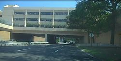
The Herbert H. Lehman High School over the Hutchinson River Parkway in Schuylerville
Schuylerville, Bronx
Location in New York City
Coordinates: 40°50′06″N73°49′59″W / 40.835°N 73.833°W / 40.835; -73.833 Coordinates: 40°50′06″N73°49′59″W / 40.835°N 73.833°W / 40.835; -73.833
Country Flag of the United States.svg  United States
State Flag of New York.svg  New York
City Flag of New York City.svg New York City
Borough Flag of Bronx County, New York.svg The Bronx
Community District Bronx 10 [1]
Area
[2]
  Total1.77 km2 (0.682 sq mi)
Population
 (2011) [2]
  Total12,025
  Density6,800/km2 (18,000/sq mi)
Economics
   Median income $87,253
ZIP Codes
10461, 10465
Area code 718, 347, 929, and 917
Website www.schuylerville.nyc

Schuylerville (nicknamed "Skyville") is a middle-class neighborhood located in the East Bronx area of New York City. Housing is mostly single-family and two-family houses. It is located next to other middle-to-upper-class residential neighborhoods of Country Club and Pelham Bay.

Contents

Schuylerville is a small enclave situated between the Bruckner Expressway and the Hutchinson River Parkway, with suburban style. It is a predominantly Italian neighborhood, with small Hispanic and black populations. Saint Raymond's Cemetery is in the southwestern part. Since the rise of the housing market the neighborhood has seen various luxury developments, including condos and newly built two-family houses.

Officially, it is considered part of the Throggs Neck section of the East Bronx. However, it is closer to and associated with the Pelham Bay and Country Club sections of the Bronx. One of the largest public parks in New York City, Pelham Bay Park, is located nearby, as well as Orchard Beach.

Demographics

Schuylerville has a population of around 10,121 people, and according to 2012 figures it had a median household income of $68,943 compared to $32,893 for the whole Bronx borough. The population is around 45% white and 45% Hispanic, the rest being a mix of blacks and Asians. [3]

Transportation

The following MTA Regional Bus Operations bus routes serve Schuylerville: [4]

The IRT Pelham Line of the New York City Subway ( 6 and <6> trains) serves Schuylerville via the Pelham Bay Park, Buhre Avenue, and Middletown Road stations. [5]

Related Research Articles

Throggs Neck Neighborhood of the Bronx in New York City

Throggs Neck is a neighborhood and peninsula in the southeastern portion of the borough of the Bronx in New York City. It is bounded by the East River and Long Island Sound to the south and east, Westchester Creek on the west, and Baisley Avenue and the Bruckner Expressway on the north.

Pelham Bay (neighborhood), Bronx Neighborhood of the Bronx in New York City

Pelham Bay is a middle class residential neighborhood in the borough of the Bronx, in New York City. It is named for Pelham Bay Park, New York City's largest park, which lies on the neighborhood's northeastern border; and for Pelham Bay, a body of water in that park. The neighborhood is bounded roughly by Pelham Parkway on the north, the New England Thruway (I-95) on the east, the Bruckner Expressway (I-95) on the south, and the Hutchinson River Parkway on the west.

Baychester is a neighborhood geographically located in the northeast part of the Bronx, New York City. Its boundaries are East 222nd Street to the northeast, the New England Thruway (I-95) to the east, Gun Hill Road to the southwest, and Boston Road to the northwest. Eastchester Road is the primary thoroughfare through Baychester.

Pelham Gardens is a neighborhood located in the Northeast section of the Bronx, New York City. Its boundaries, starting from the north and moving clockwise are East Gun Hill Road to the north and east, Pelham Parkway to the south, and the Dyre Avenue subway to the west. Eastchester Road is the primary thoroughfare through Pelham Gardens.

Allerton is a working-class neighborhood geographically located in the East Bronx section of the Bronx, New York City. It is named in honor of Daniel Allerton, an early Bronx settler who purchased and farmed this area with his wife Hustace. It consists of two subsections called Bronxwood and Laconia. Its boundaries, starting from the north and moving clockwise, are Adee Avenue, Boston Road, and Gun Hill Road to the northeast; the IRT Dyre Avenue Line to the east; Waring Avenue to the south; and Bronx River Parkway to the west. White Plains Road and Boston Road are the primary thoroughfares through Allerton.

Williamsbridge, Bronx Neighborhood of the Bronx in New York City

Williamsbridge is a neighborhood geographically located in the north-central portion of the Bronx in New York City. Its boundaries, starting from the north and moving clockwise are East 222nd Street to the north, Boston Road to the east, East Gun Hill Road to the south, and the Bronx River to the west. White Plains Road is the primary thoroughfare through Williamsbridge.

Country Club, Bronx Neighborhood of the Bronx in New York City

Country Club is a residential neighborhood located in the East Bronx in New York City. The neighborhood's boundaries are Middletown Road and Watt Avenue to the north, Eastchester Bay to the east, Layton Avenue and the Throggs Neck neighborhood to the south, and the New England Thruway and Pelham Bay neighborhood to the west. Pelham Bay Park, the largest public park in New York City, is located just north of Country Club.

East Tremont, Bronx Neighborhood of the Bronx in New York City

East Tremont is a residential neighborhood located in the West Bronx, New York City. From the north and moving clockwise, it is bounded by East 180th Street, Southern Boulevard, the Cross-Bronx Expressway and Third Avenue. East Tremont Avenue is the primary thoroughfare through the neighborhood.

University Heights, Bronx Neighborhood of the Bronx in New York City

University Heights is a neighborhood of the West Bronx in New York City. Its boundaries, starting from the north and moving clockwise, are: West Fordham Road to the north, Jerome Avenue to the east, West Burnside Avenue to the south and the Harlem River to the west. University Avenue is the primary thoroughfare in University Heights.

Kingsbridge Heights is a working class residential neighborhood geographically located in the northwest Bronx, New York City. Its boundaries are Van Cortlandt Park to the north, Jerome Avenue to the east, Kingsbridge Road to the south, and the Major Deegan Expressway to the west. Sedgwick Avenue is the primary thoroughfare through Kingsbridge Heights.

Morris Park, Bronx Neighborhood of the Bronx in New York City

Morris Park is a neighborhood in the New York City borough of the Bronx. Its approximate boundaries, starting from the north and moving clockwise, are Neill Avenue and Pelham Parkway to the north, Eastchester Road to the East, the Amtrak Northeast Corridor tracks and Sackett Avenue to the east and south, and Bronxdale Avenue or White Plains Road to the west. It borders the neighborhoods of Van Nest to its southwest and Pelham Parkway to its northeast. Williamsbridge Road and Morris Park Avenue are the primary thoroughfares.

Parkchester is a planned community originally developed by the Metropolitan Life Insurance Company and located in the central Bronx, New York City. The immediate surrounding area also takes its name from the complex. Its boundaries, starting from the north and moving clockwise, are East Tremont Avenue to the north, Castle Hill Avenue to the east, Westchester Avenue to the south, East 177th Street/Cross Bronx Expressway to the southwest, and the Bronx River Parkway to the west. Metropolitan Avenue, Unionport Road, and White Plains Road are the primary thoroughfares through Parkchester.

Morris Heights, Bronx Neighborhood of the Bronx in New York City

Morris Heights is a residential neighborhood located in the West Bronx. Its boundaries, starting from the north and moving clockwise are: West Burnside Avenue to the north, Jerome Avenue to the east, the Cross-Bronx Expressway to the south, and the Harlem River to the west. University Avenue is the primary thoroughfare through Morris Heights.

Pelham Parkway (neighborhood), Bronx Neighborhood of the Bronx in New York City

Pelham Parkway is a working- and middle-class residential neighborhood geographically located in the center of the Bronx, a borough of New York City in the United States. Its boundaries, starting from the north and moving clockwise are: Waring Avenue to the north, the IRT Dyre Avenue Line tracks to the east, Neill Avenue to the South, and Bronx River Parkway to the west. White Plains Road is the primary commercial thoroughfare through Pelham Parkway. The neighborhood is named after Pelham Parkway, a major west-east parkway that travels through the East Bronx.

West Farms, Bronx Neighborhood of the Bronx in New York City

West Farms is a residential neighborhood in The Bronx, New York City. Its boundaries, are: Bronx Park to the north, the Bronx River Parkway to the east, the Cross-Bronx Expressway to the south, and Southern Boulevard to the west. East Tremont Avenue is the primary thoroughfare through West Farms.

Castle Hill, Bronx Neighborhood of the Bronx in New York City

Castle Hill is a neighborhood located in the southeast section of the borough of the Bronx in New York City. Its boundaries are: Waterbury and Westchester Avenues to the north, Westchester Creek to the east, the East River to the south, and White Plains Road to the west.

Bx12 bus Bus route in the Bronx, New York

The Bx12 is a public transit line in New York City running along the 207th Street Crosstown Line, within the boroughs of Manhattan and the Bronx. The line runs along 207th Street in Upper Manhattan and along the continuous Fordham Road and Pelham Parkway in the Bronx.

Tremont Avenue Avenue in the Bronx, New York

Tremont Avenue is a street in the Bronx, New York City. Its west end is at Sedgwick Avenue in Morris Heights, and its east end is at Harding Avenue in Throggs Neck, running almost the entire width of the Bronx. Around 2009, part of East Tremont Avenue renamed to Hector Lavoe Avenue, in honor of the late salsa musician.

Westchester Square, Bronx Neighborhood of the Bronx in New York City

Westchester Square is a residential neighborhood geographically located in the eastern section of the New York City borough of the Bronx. Its boundaries, starting from the north and moving clockwise are: East Tremont Avenue and Silver Street, Blondell Avenue and Westchester Creek to the east, Waterbury Avenue to the south and Castle Hill Avenue to the west. The main roadways through Westchester Square are East Tremont Avenue, Westchester Avenue and Williamsbridge Road.

Bx23 and Q50 buses Bus routes in Queens and the Bronx, New York

The Bx23 and Q50 bus routes constitute a public transit corridor in New York City, running from the Flushing neighborhood in Queens to the Pelham Bay and Co-op City neighborhoods in the Bronx. The Bx23 provides local service in Pelham Bay and Co-op City, while the Q50 provides limited-stop service between Co-op City and subway hubs in Pelham Bay and Flushing. Both routes are city-operated under the MTA Bus Company brand of MTA Regional Bus Operations, and are the only two local routes in the Bronx to operate under the MTA Bus brand.

References

  1. "NYC Planning | Community Profiles". communityprofiles.planning.nyc.gov. New York City Department of City Planning. Retrieved March 3, 2018.
  2. 1 2 "Schuylerville neighborhood in New York" . Retrieved October 17, 2015.
  3. "Mapping the 2010 U.S. Census". The New York Times . Retrieved October 17, 2015.
  4. "Bronx Bus Map" (PDF). Metropolitan Transportation Authority. September 2017. Retrieved April 24, 2018.
  5. "Subway Map" (PDF). Metropolitan Transportation Authority. October 21, 2019. Retrieved January 18, 2018.