Tremont, Bronx

Last updated
Tremont
Mounthopebx.JPG
The Grand Concourse runs through the neighborhood.
Tremont, Bronx
Location in New York City
Coordinates: 40°51′00″N73°54′22″W / 40.85°N 73.906°W / 40.85; -73.906
Country Flag of the United States.svg  United States
State Flag of New York.svg  New York
City Flag of New York City.svg New York City
Borough Flag of Bronx County, New York.svg The Bronx
Area
[1]
  Total0.78 km2 (0.301 sq mi)
Population
 (2011) [1]
  Total24,739
  Density32,000/km2 (82,000/sq mi)
Economics
   Median income $26,290
Ethnicity [2]
  Hispanic67.5%
  Black27.1%
  White1.3%
  Asian2%
  Others2.1%
ZIP Codes
10453, 10457
Area code 718, 347, 929, and 917

Tremont is a residential neighborhood in the West Bronx, New York City. Its boundaries are East 181st Street to the north, Third Avenue to the east, the Cross-Bronx Expressway to the south, and the Grand Concourse to the west. East Tremont Avenue is the primary thoroughfare through Tremont.

Contents

The neighborhood is part of Bronx Community Board 6, and its ZIP Codes include 10453 and 10457. The local subway is the IND Concourse Line ( B and D trains), operating along the Grand Concourse. The area is patrolled by the NYPD's 48th and 46th Precincts. [3]

Demographics

Tremont has a population of around 24,739. The neighborhood is now predominantly Dominican, with a significant longstanding Puerto Rican and African American population. [1] [4]

The entirety of Community District 6, which comprises Tremont and Belmont, had 87,476 inhabitants as of NYC Health's 2018 Community Health Profile, with an average life expectancy of 77.7 years. [5] :2,20 This is lower than the median life expectancy of 81.2 for all New York City neighborhoods. [6] :53 (PDF p. 84) [7] Most inhabitants are youth and middle-aged adults: 29% are between the ages of between 0–17, 28% between 25–44, and 20% between 45–64. The ratio of college-aged and elderly residents was lower, at 14% and 9% respectively. [5] :2

As of 2017, the median household income in Community Districts 3 and 6, including Crotona Park East and Morrisania, was $25,972. [8] In 2018, an estimated 31% of Tremont and Belmont residents lived in poverty, compared to 25% in all of the Bronx and 20% in all of New York City. One in six residents (16%) were unemployed, compared to 13% in the Bronx and 9% in New York City. Rent burden, or the percentage of residents who have difficulty paying their rent, is 60% in Tremont and Belmont, compared to the boroughwide and citywide rates of 58% and 51% respectively. Based on this calculation, as of 2018, Tremont and Belmont are gentrifying. [5] :7

Etymology

Rather than having come from a colonial settlement, the name "Tremont" was invented by a postmaster in the 1800s, derived from the three ("tre") neighborhoods of Mount Eden, Mount Hope, and Fairmount in the west-central Bronx. [9]

Land use and terrain

Looking east across Grand Concourse at former Tremont Temple, now First Union Baptist Church Tremont Temple FUBC jeh.JPG
Looking east across Grand Concourse at former Tremont Temple, now First Union Baptist Church

Tremont is dominated by 5 and 6-story apartment houses. The total land area is less than 1-square-mile (2.6 km2). The area is elevated above adjacent areas and is very hilly. Stair streets connect areas located at different elevations.

Morris Avenue Historic District

The Morris Avenue Historic District, designated by the New York City Landmarks Preservation Commission, lines Morris Avenue between East Tremont and East 179th Street. [10] The district consists of attached brownstones. [11]

Police and crime

Tremont and Belmont are patrolled by the 48th Precinct of the NYPD, located at 450 Cross Bronx Expressway. [3] The 48th Precinct ranked 56th safest out of 69 patrol areas for per-capita crime in 2010. [12] As of 2018, with a non-fatal assault rate of 152 per 100,000 people, Tremont and Belmont's rate of violent crimes per capita is greater than that of the city as a whole. The incarceration rate of 1,015 per 100,000 people is higher than that of the city as a whole. [5] :8

The 48th Precinct has a lower crime rate than in the 1990s, with crimes across all categories having decreased by 60.9% between 1990 and 2022. The precinct reported 14 murders, 26 rapes, 447 robberies, 646 felony assaults, 252 burglaries, 467 grand larcenies, and 304 grand larcenies auto in 2022. [13]

Fire safety

Tremont contains two New York City Fire Department (FDNY) fire stations: [14]

Health

As of 2018, preterm births and births to teenage mothers are more common in Tremont and Belmont than in other places citywide. In Tremont and Belmont, there were 113 preterm births per 1,000 live births (compared to 87 per 1,000 citywide), and 30.4 births to teenage mothers per 1,000 live births (compared to 19.3 per 1,000 citywide). [5] :11 Tremont and Belmont has a relatively average population of residents who are uninsured. In 2018, this population of uninsured residents was estimated to be 12%, equal to the citywide rate of 12%. [5] :14

The concentration of fine particulate matter, the deadliest type of air pollutant, in Tremont and Belmont is 0.008 milligrams per cubic metre (8.0×10⁻⁹ oz/cu ft), more than the city average. [5] :9 Sixteen percent of Tremont and Belmont residents are smokers, which is higher than the city average of 14% of residents being smokers. [5] :13 In Tremont and Belmont, 36% of residents are obese, 22% are diabetic, and 32% have high blood pressure—compared to the citywide averages of 24%, 11%, and 28% respectively. [5] :16 In addition, 20% of children are obese, compared to the citywide average of 20%. [5] :12

Eighty-one percent of residents eat some fruits and vegetables every day, which is less than the city's average of 87%. In 2018, 69% of residents described their health as "good", "very good", or "excellent", lower than the city's average of 78%. [5] :13 For every supermarket in Tremont and Belmont, there are 37 bodegas. [5] :10

The nearest hospitals are St Barnabas Hospital in Belmont and Bronx-Lebanon Hospital Center in Claremont. [17]

Post office and ZIP Code

Post office USPS 10457 Tremont jeh.jpg
Post office

Tremont is covered by the ZIP Code 10457. [18] The United States Postal Service operates the Tremont Station at 757 East Tremont Avenue. [19]

Education

Tremont and Belmont generally have a lower rate of college-educated residents than the rest of the city as of 2018. While 19% of residents age 25 and older have a college education or higher, 36% have less than a high school education and 45% are high school graduates or have some college education. By contrast, 26% of Bronx residents and 43% of city residents have a college education or higher. [5] :6 The percentage of Tremont and Belmont students excelling in math rose from 19% in 2000 to 44% in 2011, and reading achievement increased from 25% to 30% during the same time period. [20]

Tremont and Belmont's rate of elementary school student absenteeism is more than the rest of New York City. In Tremont and Belmont, 35% of elementary school students missed twenty or more days per school year, higher than the citywide average of 20%. [6] :24 (PDF p. 55) [5] :6 Additionally, 61% of high school students in Tremont and Belmont graduate on time, lower than the citywide average of 75%. [5] :6

Schools

Public:

Parochial: The Roman Catholic Archdiocese of New York operates Bronx Catholic schools

St. Joseph Catholic School closed in 2019. [22]

Libraries

The New York Public Library operates the Tremont branch at 1866 Washington Avenue. The branch, a Carnegie library designed by Carrère and Hastings in the Italian Renaissance style, was opened in 1905. [23] Another branch, the Grand Concourse branch, is located at 155 East 173rd Street. The branch is a two-story structure that opened in 1959. [24]

Transportation

The following MTA Regional Bus Operations bus routes serve Tremont: [25]

The following New York City Subway stations serve Tremont: [26]

The Metro-North Railroad's Harlem Line also serves Tremont at the Tremont station.

Related Research Articles

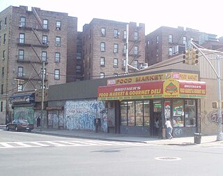
Morrisania is a residential neighborhood in the southwestern Bronx, New York City, New York. Its boundaries are the Cross-Bronx Expressway to the north, Crotona-Prospect Avenue to the east, East 162nd Street to the south, and Webster Avenue to the west. Third Avenue is the primary thoroughfare through Morrisania.

<span class="mw-page-title-main">Throggs Neck</span> Neighborhood of the Bronx in New York City

Throggs Neck is a neighborhood and peninsula in the south-eastern portion of the borough of the Bronx in New York City. It is bounded by the East River and Long Island Sound to the south and east, Westchester Creek on the west, and Baisley Avenue and the Bruckner Expressway on the north.

Baychester is a neighborhood geographically located in the northeast part of the Bronx, New York City. Its boundaries are East 222nd Street to the northeast, the New England Thruway (I-95) to the east, Gun Hill Road to the southwest, and Boston Road to the northwest. Eastchester Road is the primary thoroughfare through Baychester.

<span class="mw-page-title-main">Highbridge, Bronx</span> Neighborhood of the Bronx in New York City

Highbridge is a residential neighborhood geographically located in the central-west section of the Bronx, New York City. Its boundaries, starting from the north and moving clockwise, are the Cross-Bronx Expressway to the north, Jerome Avenue to the east, Macombs Dam Bridge to the south, and the Harlem River to the west. Ogden Avenue is the primary thoroughfare through Highbridge.

Allerton is a working-class neighborhood geographically located in the East Bronx section of the Bronx, New York City. It is named in honor of Daniel Allerton, an early Bronx settler who purchased and farmed this area with his wife Hustace. It consists of two subsections called Bronxwood and Laconia. Its boundaries, starting from the north and moving clockwise, are Adee Avenue, Boston Road, and Gun Hill Road to the northeast; the IRT Dyre Avenue Line to the east; Waring Avenue to the south; and Bronx River Parkway to the west. White Plains Road and Boston Road are the primary thoroughfares through Allerton.

<span class="mw-page-title-main">Fordham, Bronx</span> Neighborhood of the Bronx in New York City

Fordham Manor is a neighborhood located in the western Bronx, New York City. Fordham is roughly bordered by East 196th Street to the north, the Harlem River to the west, Fordham Road to the south, and Southern Boulevard to the east. The neighborhood's primary thoroughfares are Fordham Road and Grand Concourse.

<span class="mw-page-title-main">Kingsbridge, Bronx</span> Neighborhood of the Bronx in New York City

Kingsbridge is a residential neighborhood in the northwest portion of the Bronx, New York City. Kingsbridge's boundaries are Manhattan College Parkway to the north, the Major Deegan Expressway or Bailey Avenue to the east, West 230th Street to the south, and Irwin Avenue to the west.

<span class="mw-page-title-main">Melrose, Bronx</span> Neighborhood of the Bronx in New York City

Melrose is a mostly residential neighborhood in the southwestern section of the New York City borough of the Bronx. It adjoins the business and one-time theater area known as The Hub. Melrose is rectangular-shaped, being bordered by Saint Anns Avenue on the east, 149th Street on the south, Park Avenue on the west, and 163rd Street to the north. Melrose Avenue and Third Avenue are the primary thoroughfares through Melrose.

<span class="mw-page-title-main">Mott Haven, Bronx</span> Neighborhood of the Bronx in New York City

Mott Haven is a primarily residential neighborhood in the southwestern section of the New York City borough of the Bronx. It is generally bounded by East 149th Street to the north, the Bruckner Expressway to the east and south, and the Harlem River to the west, although these boundaries are not precise. East 138th Street is the primary east–west thoroughfare through Mott Haven.

<span class="mw-page-title-main">Country Club, Bronx</span> Neighborhood of the Bronx in New York City

Country Club is a residential neighborhood located in the East Bronx in New York City. The neighborhood's boundaries are Middletown Road and Watt Avenue to the north, Eastchester Bay to the east, Layton Avenue and the Throggs Neck neighborhood to the south, and the New England Thruway and Pelham Bay neighborhood to the west. Pelham Bay Park, the largest public park in New York City, is located just north of Country Club.

<span class="mw-page-title-main">Bedford Park, Bronx</span> Neighborhood of the Bronx in New York City

Bedford Park is a residential neighborhood in the northwest Bronx, New York City, adjacent to the New York Botanical Garden. Its boundaries, starting from the north and moving clockwise are: Mosholu Parkway to the north, Webster Avenue to the east, East 196th Street to the south, and Jerome Avenue to the west.

<span class="mw-page-title-main">East Tremont, Bronx</span> Neighborhood of the Bronx in New York City

East Tremont is a residential neighborhood located in the West Bronx, New York City. From the north and moving clockwise, it is bounded by East 180th Street, Southern Boulevard, the Cross-Bronx Expressway and Third Avenue. East Tremont Avenue is the primary thoroughfare through the neighborhood.

<span class="mw-page-title-main">University Heights, Bronx</span> Neighborhood of the Bronx in New York City

University Heights is a neighborhood of the West Bronx in New York City. Its boundaries, starting from the north and moving clockwise, are: West Fordham Road to the north, Jerome Avenue to the east, West Burnside Avenue to the south and the Harlem River to the west. University Avenue is the primary thoroughfare in University Heights.

<span class="mw-page-title-main">Morris Park, Bronx</span> Neighborhood of the Bronx in New York City

Morris Park is a neighborhood in the New York City borough of the Bronx. Its approximate boundaries, starting from the north and moving clockwise, are Neill Avenue and Pelham Parkway to the north, Eastchester Road to the east, the Amtrak Northeast Corridor tracks and Sackett Avenue to the east and south, and Bronxdale Avenue and White Plains Road to the west. It borders the neighborhoods of Van Nest to its southwest and Pelham Parkway to its northeast. Williamsbridge Road and Morris Park Avenue are the primary thoroughfares.

<span class="mw-page-title-main">Parkchester, Bronx</span> Neighborhood of the Bronx in New York City

Parkchester is a planned community and neighborhood originally developed by the Metropolitan Life Insurance Company and located in the central Bronx, New York City. The immediate surrounding area also takes its name from the complex. Its boundaries, starting from the north and moving clockwise, are East Tremont Avenue to the north, Castle Hill Avenue to the east, Westchester Avenue to the south, East 177th Street/Cross Bronx Expressway to the southwest, and White Plains Road to the west. Metropolitan Avenue, Unionport Road, and White Plains Road are the primary thoroughfares through Parkchester.

<span class="mw-page-title-main">Crotona Park East, Bronx</span> Neighborhood of the Bronx in New York City

Crotona Park East, also known as Crotona or East Morrisania, is a residential neighborhood geographically located in the southwest Bronx in New York City. Crotona Park East is considered part of the South Bronx. Its boundaries, starting from the north and moving clockwise are the Cross-Bronx Expressway to the north, the Bronx River to the east, East 167th Street to the south, and Crotona/Prospect Avenues to the west. Southern Boulevard is the primary thoroughfare through the area. The neighborhood is adjacent to, but distinct from, the nearby park named Crotona Park.

<span class="mw-page-title-main">Morris Heights, Bronx</span> Neighborhood of the Bronx in New York City

Morris Heights is a residential neighborhood located in the West Bronx. Its boundaries, starting from the north and moving clockwise are: West Burnside Avenue to the north, Jerome Avenue to the east, the Cross-Bronx Expressway to the south, and the Harlem River to the west. University Avenue is the primary thoroughfare through Morris Heights.

<span class="mw-page-title-main">West Farms, Bronx</span> Neighborhood of the Bronx in New York City

West Farms is a residential neighborhood in The Bronx, New York City. Its boundaries, are: Bronx Park to the north, the Bronx River Parkway to the east, the Cross-Bronx Expressway to the south, and Southern Boulevard to the west. East Tremont Avenue is the primary thoroughfare through West Farms.

<span class="mw-page-title-main">Belmont, Bronx</span> Neighborhood of the Bronx in New York City

Belmont is a primarily residential neighborhood in the Bronx in New York City. Its boundaries are Fordham Road to the north, Bronx Park to the east, East 181st Street to the south, and Third Avenue to the west. These boundaries give the neighborhood a crescent-like shape. The neighborhood is noted for its "close-knit community" and "small-town feel", and as a result of its cultural history and wide array of Italian businesses, is widely known as the "Little Italy of the Bronx". Arthur Avenue, noted for its local restaurants and markets, is its primary thoroughfare.

<span class="mw-page-title-main">Concourse, Bronx</span> Neighborhood of the Bronx in New York City

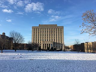
Concourse is a neighborhood in the southwestern section of the New York City borough of the Bronx which includes the Bronx County Courthouse, the Bronx Museum of the Arts, and Yankee Stadium. Its boundaries, starting from the north and moving clockwise, are East 169th Street to the north, Webster Avenue to the east, East 149th Street to the south, and Jerome Avenue and Harlem River to the west. The neighborhood is divided into three subsections: West Concourse, East Concourse, and Concourse Village with the Grand Concourse being its main thoroughfare.

References

  1. 1 2 3 "Mount Hope neighborhood in New York" . Retrieved 13 September 2015.
  2. "Center for Urban Research". Archived from the original on 13 October 2015. Retrieved 14 September 2015.
  3. 1 2 "NYPD – 48th Precinct". www.nyc.gov. New York City Police Department . Retrieved October 3, 2016.
  4. "Bronx Community District 5" (PDF). Archived from the original (PDF) on 4 March 2016. Retrieved 14 September 2015.
  5. 1 2 3 4 5 6 7 8 9 10 11 12 13 14 15 "Belmont and East Tremont (Including Bathgate, Belmont, Bronx Park South, East Tremont and West Farms)" (PDF). nyc.gov. NYC Health. 2018. Retrieved March 2, 2019.
  6. 1 2 "2016-2018 Community Health Assessment and Community Health Improvement Plan: Take Care New York 2020" (PDF). nyc.gov . New York City Department of Health and Mental Hygiene. 2016. Retrieved September 8, 2017.
  7. "New Yorkers are living longer, happier and healthier lives". New York Post. June 4, 2017. Retrieved March 1, 2019.
  8. "NYC-Bronx Community District 3 & 6--Belmont, Crotona Park East & East Tremont PUMA, NY". Census Reporter. Retrieved July 17, 2018.
  9. "Tremont Park" . Retrieved 14 September 2015.
  10. Morris Avenue Historic District
  11. "Morris Avenue Historic District Designation Report" (PDF). Retrieved 14 September 2015.
  12. "Belmont and Bathgate, East Tremont – DNAinfo.com Crime and Safety Report". www.dnainfo.com. Retrieved October 6, 2016.
  13. "48th Precinct CompStat Report" (PDF). www.nyc.gov. New York City Police Department . Retrieved July 22, 2018.
  14. "FDNY Firehouse Listing – Location of Firehouses and companies". NYC Open Data; Socrata . New York City Fire Department. September 10, 2018. Retrieved March 14, 2019.
  15. "Engine Company 42". FDNYtrucks.com. Retrieved March 14, 2019.
  16. "Engine Company 46/Ladder Company 27". FDNYtrucks.com. Retrieved March 14, 2019.
  17. "Best 30 Hospitals in Bronx, NY with Reviews". Yellow Pages. Retrieved March 14, 2019.
  18. "Tremont, New York City-Bronx, New York Zip Code Boundary Map (NY)". United States ZIP Code Boundary Map (USA). Retrieved March 14, 2019.
  19. "Location Details: Tremont". USPS.com. Retrieved March 7, 2019.
  20. "Tremont and Belmont – BX 06" (PDF). Furman Center for Real Estate and Urban Policy. 2011. Retrieved October 5, 2016.
  21. "St. Margaret Mary" . Retrieved 14 September 2015.
  22. Annese, Paul (2019-02-06). "5 NYC Catholic schools set to close at end of school year in June". New York Daily News . Retrieved 2020-05-05.
  23. "About the Tremont Library". The New York Public Library. Retrieved March 14, 2019.
  24. "About the Grand Concourse Library". The New York Public Library. Retrieved March 14, 2019.
  25. "Bronx Bus Map" (PDF). Metropolitan Transportation Authority. October 2018. Retrieved December 1, 2020.
  26. "Subway Map" (PDF). Metropolitan Transportation Authority. September 2021. Retrieved September 17, 2021.