
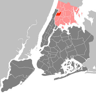
The Bronx is a borough of New York City, coextensive with Bronx County, in the U.S. state of New York. It is south of Westchester County; north and east of the New York City borough of Manhattan, across the Harlem River; and north of the New York City borough of Queens, across the East River. The Bronx has a land area of 42 square miles (109 km2) and a population of 1,472,654 in the 2020 census. If each borough were ranked as a city, the Bronx would rank as the ninth-most-populous in the U.S. Of the five boroughs, it has the fourth-largest area, fourth-highest population, and third-highest population density. It is the only borough of New York City not primarily on an island. With a population that is 54.8% Hispanic as of 2020, it is the only majority-Hispanic county in the Northeastern United States and the fourth-most-populous nationwide.
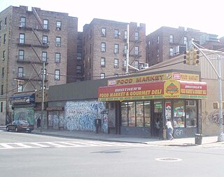
Morrisania is a residential neighborhood in the southwestern Bronx, New York City, New York. Its boundaries are the Cross-Bronx Expressway to the north, Crotona-Prospect Avenue to the east, East 161st Street to the south, and Webster Avenue to the west. Third Avenue is the primary thoroughfare through Morrisania. Its name derives from the Manor of Morrisania, once the entire South Bronx.
East Tremont is a residential neighborhood located in the West Bronx, New York City. From the north and moving clockwise, it is bounded by East 180th Street, Southern Boulevard, the Cross-Bronx Expressway and Third Avenue. East Tremont Avenue is the primary thoroughfare through the neighborhood.

Bronx Community Board 1 is a local government unit of the city of New York, encompassing the neighborhoods of Mott Haven, Melrose, and Port Morris in the borough of the Bronx. It is delimited by the East River, East 149th Street, and Prospect Avenue on the east, East 161st Street, East 159th Street, and East 149th Street on the north, and the Harlem River and Bronx Kill on the west and south.

Bronx Community Board 2 is a local government unit of the city of New York, encompassing the neighborhoods of Hunts Point and Longwood in the borough of the Bronx. It is delimited by the Bronx River on the east, Westchester Avenue, East 167th Street, and East 169th Street on the north, Prospect Avenue and East 149th Street to the west, and the East River on the south.

Bronx Community Board 4 is a local government unit of the City of New York, encompassing the neighborhoods of Mount Eden, Highbridge and Concourse. It is delimited by Webster Avenue and Park Avenue to the east, Washington Bridge and the Cross Bronx Expressway to the north, the Harlem River to the west, and East 149th Street to the south.

Bronx Community Board 6 is a local government unit of the city of New York, encompassing the neighborhoods of Bathgate, Belmont, East Tremont, and West Farms as Bronx Community District 6. It is delimited by Bronx Park to the east and north, Webster Avenue to the west, and Crotona Park North and the Cross Bronx Expressway to the south.

Bronx Community Board 7 the governing body of Bronx Community District 7, a local government unit of the city of New York. The Community District encompasses the neighborhoods of Bedford Park, Fordham, Jerome Park, Kingsbridge Heights, Norwood, and University Heights. It is delimited by the New York-New Haven Railroad, Webster Avenue, East Fordham Road, Jerome Avenue, and West 183rd Street to the east, Jerome Avenue, West Gun Hill Road, Goulden Avenue, Kingsbridge Road, West 225th Street, and the Harlem River to the west, West Gun Hill Road, Jerome Avenue, Bainbridge Avenue, and East 211th Street to the north and Hall of Fame Terrace to the south.
Bronx Community Board 9 is a local government unit of the city of New York, encompassing the neighborhoods of Castle Hill, Parkchester, Soundview, Harding Park, Bronx River, Clason Point and Unionport. It is delimited by Westchester Creek to the east, Sheridan Boulevard to the west, the Cross Bronx Expressway and East Tremont Avenue to the north and the Bronx River and the East River to the south.

Bronx Community Board 10 is a local government unit of the New York City borough of the Bronx, encompassing the neighborhoods of City Island, Co-op City, Pelham Bay, Throggs Neck and Westchester Square. It is delimited by the Hutchinson River and Pelham Bay Park to the east, New England Thruway, Hutchinson River Parkway, and Westchester Creek to the west, the Bronx/Westchester County Line to the north and the East River to the south.

Bronx Community Board 12 is a local government unit of the New York City borough of the Bronx, encompassing the neighborhoods of Edenwald, Wakefield, Williamsbridge, Woodlawn Heights, Fish Bay, Eastchester, Olinville and Baychester.

Crotona Park East, also known as Crotona or East Morrisania, is a residential neighborhood geographically located in the southwest Bronx in New York City. Crotona Park East is considered part of the South Bronx. Its boundaries, starting from the north and moving clockwise are the Cross-Bronx Expressway to the north, the Bronx River to the east, East 167th Street to the south, and Crotona/Prospect Avenues to the west. Southern Boulevard is the primary thoroughfare through the area. The neighborhood is adjacent to, but distinct from, the nearby park named Crotona Park.

Bronx Community Board 11 (CB11) is a small unit of the City of New York (NYC), whose district encompasses the neighborhoods of Allerton, Indian Village, Morris Park, Pelham Gardens, Pelham Parkway (neighborhood), Van Nest and other areas in the borough of the Bronx. Coterminous with the 49th NYPD Precinct, its district is delimited by Bronx Park East and the Bronx River Parkway to the west, Adee Avenue, Boston Road and East Gun Hill Road to the north, the Hutchinson River Parkway to the east, and East Tremont Avenue to the south.

Community boards of Manhattan are New York City community boards in the borough of Manhattan, which are the appointed advisory groups of the community districts that advise on land use and zoning, participate in the city budget process, and address service delivery in their district.

Belmont is a primarily residential neighborhood in the Bronx in New York City. Its boundaries are Fordham Road to the north, Bronx Park to the east, East 181st Street to the south, and Third Avenue to the west. These boundaries give the neighborhood a crescent-like shape. The neighborhood is noted for its "close-knit community" and "small-town feel", and as a result of its cultural history and wide array of Italian businesses, is widely known as the "Little Italy of the Bronx". Arthur Avenue, noted for its local restaurants and markets, is its primary thoroughfare.
The Queens Community Board 7 is a local governmental advisory board in New York City, encompassing the neighborhoods of Flushing, Bay Terrace, College Point, Whitestone, Malba, Murray Hill, Linden Hill, Beechhurst, Queensboro Hill and Willets Point, in the borough of Queens. It is delimited by the Flushing Bay to the west, the East River to the north, Utopia Parkway and Little Neck Bay on the east, and Reeves Avenue on the south. CB7 is the biggest community board in Queens.
Community boards of Queens are New York City community boards in the borough of Queens, which are the appointed advisory groups of the community districts that advise on land use and zoning, participate in the city budget process, and address service delivery in their district.
Community boards of the Bronx are New York City community boards in the borough of the Bronx, which are the appointed advisory groups of the community districts that advise on land use and zoning, participate in the city budget process, and address service delivery in their district.
Rafael "Ralph" Salamanca Jr. is the Council member for the 17th district of the New York City Council. He is a Democrat. The district includes portions of Concourse Village, East Tremont, Hunts Point, Longwood, Melrose, Morrisania, Port Morris, and West Farms in The Bronx.

New York City's 17th City Council district is one of 51 districts in the New York City Council. It has been represented by Democrat Rafael Salamanca since a 2016 special election to succeed fellow Democrat Maria del Carmen Arroyo.


