2 (New York City Subway service)

Last updated

NYCS-bull-trans-2-Std.svg
Seventh Avenue Express
NYCSubway6476.jpg
NYCS map 2.svg
Note: Dashed pink line shows limited rush hour service to/from New Lots Avenue.
Northern end
Southern end
Stations49
52 (limited service)
61 (late night service)
Rolling stock360 R142s (36 trains, a.m. rush), 350 R142s (35 trains, p.m. rush) [1] [2]
(Rolling stock assignments subject to change)
Depot 239th Street Yard (fleet interchangeable with NYCS-bull-trans-5-Std.svg at East 180th Street Yard)
Started serviceNovember 26, 1904;119 years ago (1904-11-26)
Route map

Contents

Arrow Blue Down 001.svg  2  
BSicon uvKBHFa-.svg
Wakefield–241st Street
BSicon uevSHI2gl-.svg
Arrow Blue Down 001.svg  5   (limited rush)
BSicon udHST.svg
BSicon uexdSTR.svg
Nereid Avenue
BSicon udHSTACC.svg
BSicon uexdSTR.svg
233rd Street
BSicon udHST.svg
BSicon uexdSTR.svg
225th Street
BSicon udHST.svg
BSicon uexdSTR.svg
219th Street
BSicon lxACC.svg
BSicon udBHF-L.svg
BSicon uexdBHF-R.svg
Gun Hill Road
BSicon udHST.svg
BSicon uexdSTR.svg
Burke Avenue
BSicon udHST.svg
BSicon uexdSTR.svg
Allerton Avenue
BSicon udHSTACC.svg
BSicon uexdSTR.svg
Pelham Parkway
BSicon udHST.svg
BSicon uexdSTR.svg
Bronx Park East
BSicon udSTR.svg
BSicon uexdSTR.svg
BSicon CONTg.svg
BSicon uxvKRWl.svg
BSicon v-SHI3+l.svg
BSicon uxvKRW+r.svg
BSicon SHI3r.svg
BSicon lvACC.svg
BSicon umvSTR.svg
East 180th Street
BSicon uvSTR-.svg
BSicon vUST.svg
Arrow Blue Up 001.svg  5  
(late nights)
BSicon udHST.svg
BSicon dSTR.svg
West Farms Square–East Tremont Avenue
BSicon udHST.svg
BSicon dSTR.svg
174th Street
BSicon udHST.svg
BSicon dSTR.svg
Freeman Street
BSicon udHSTACC.svg
BSicon dSTR.svg
Simpson Street
BSicon udHST.svg
BSicon dSTR.svg
Intervale Avenue
BSicon udHST.svg
BSicon dSTR.svg
Prospect Avenue
BSicon udHST.svg
BSicon dSTR.svg
Jackson Avenue
BSicon uvSTR-.svg
BSicon v-SHI2r.svg
BSicon udHSTACC.svg
Third Avenue–149th Street
BSicon udHST.svg
149th Street–Grand Concourse
BSicon uvSTR-.svg
BSicon vSHI2l-.svg
BSicon uSTR+GRZq.svg
BSicon ldCONTf@G.svg
The Bronx
Manhattan
BSicon dCONTgq.svg
BSicon uSTR.svg
BSicon STR+r.svg
NYCS-bull-trans-3-Std.svg to via Lenox Avenue
BSicon uHSTACC.svg
135th Street
BSicon uHST.svg
125th Street
BSicon uHST.svg
116th Street
BSicon uHST.svg
Central Park North–110th Street
BSicon dCONTgq.svg
BSicon uSHI2gl.svg
BSicon STR+r.svg
BSicon uBS2c3.svg
BSicon udSTR.svg
BSicon udSTR.svg
switches to local tracks
during late nights
BSicon uvACC.svg
96th Street
BSicon uedHST.svg
BSicon udSTR.svg
BSicon udHST.svg
BSicon udSTR.svg
86th Street
BSicon udHST.svg
BSicon udSTR.svg
79th Street
BSicon uvACC.svg
72nd Street
BSicon udHSTACC.svg
BSicon udSTR.svg
66th Street–Lincoln Center
BSicon udHSTACC.svg
BSicon udSTR.svg
59th Street–Columbus Circle
BSicon udHST.svg
BSicon udSTR.svg
50th Street
BSicon uvACC.svg
Times Square–42nd Street
BSicon uvSTR.svg
BSicon v-SHI2r.svg
Arrow Blue Up 001.svg  3   (late nights)
BSicon udINTACC.svg
BSicon udINTACC.svg
34th Street–Penn Station MTA NYC logo.svg NJT logo.svg BSicon LOGO Amtrak2.svg
BSicon udHST.svg
BSicon udSTR.svg
28th Street
BSicon udHST.svg
BSicon udSTR.svg
23rd Street
BSicon udHST.svg
BSicon udSTR.svg
18th Street
BSicon uvINT.svg
14th Street PATH logo.svg
BSicon udHST.svg
BSicon udSTR.svg
Christopher Street–Sheridan Square
BSicon udHST.svg
BSicon udSTR.svg
Houston Street
BSicon udHST.svg
BSicon udSTR.svg
Canal Street
BSicon udHST.svg
BSicon udSTR.svg
Franklin Street
BSicon uv-SHI2g+r.svg
BSicon vSTR-.svg
BSicon lvACC.svg
BSicon mvSTR.svg
Chambers Street
BSicon dCONTgq.svg
BSicon dSTRr.svg
BSicon udLSTR.svg
BSicon udHST.svg
Park Place
BSicon udHSTACC.svg
Fulton Street
BSicon udHST.svg
Wall Street
BSicon uSTR+GRZq.svg
BSicon udHST.svg
Clark Street
BSicon dCONTg.svg
BSicon udSTR.svg
BSicon lxACC.svg
BSicon mvBHF.svg
Borough Hall
Wheelchair symbol.svg
northbound only
for 4 and 5 services
BSicon dSTR.svg
BSicon udHST.svg
Hoyt Street
BSicon mvBHF.svg
Nevins Street
BSicon vSHI2gl-.svg
BSicon uv-STR.svg
BSicon exv-SHI2r.svg
BSicon lvINTACC.svg
BSicon mvBHF.svg
Atlantic Avenue–Barclays Center MTA NYC logo.svg
BSicon dSTR.svg
BSicon udHST.svg
Bergen Street
BSicon dSTR.svg
BSicon udHST.svg
Grand Army Plaza
BSicon dSTR.svg
BSicon udHSTACC.svg
Eastern Parkway–Brooklyn Museum
BSicon mvBHF.svg
Franklin Avenue–Medgar Evers College
BSicon uv-SHI2r.svg
BSicon vSHI2gl-.svg
BSicon uSHI3+l.svg
BSicon uvSHI3r-.svg
BSicon umvKRWl.svg
BSicon umvKRW+r.svg
BSicon uLSTR.svg
BSicon udHST.svg
BSicon dSTR.svg
Nostrand Avenue
BSicon uLSTR.svg
BSicon udHST.svg
BSicon dSTR.svg
Kingston Avenue
BSicon uLSTR.svg
BSicon v-SHI2gr.svg
BSicon uvSTR-.svg
BSicon exvSHI2l-.svg
BSicon uLSTR.svg
BSicon lxACC.svg
BSicon umvBHF.svg
Crown Heights–Utica Avenue
BSicon uLSTR.svg
BSicon udSTR.svg
BSicon ldENDE@G.svg
Arrow Blue Up 001.svg  4   (  5   limited)
BSicon uLSTR.svg
BSicon udHST.svg
Sutter Avenue–Rutland Road
BSicon uLSTR.svg
BSicon udHST.svg
Saratoga Avenue
BSicon uLSTR.svg
BSicon udHST.svg
Rockaway Avenue
BSicon uLSTR.svg
BSicon udHST.svg
Junius Street
BSicon uLSTR.svg
BSicon udHST.svg
Pennsylvania Avenue
BSicon uLSTR.svg
BSicon udHST.svg
Van Siclen Avenue
BSicon uLSTR.svg
BSicon udHST.svg
New Lots Avenue
BSicon uLSTR.svg
BSicon ldENDE@G.svg
Arrow Blue Up 001.svg  3   (  2    4    5   limited)
BSicon uLSTRl.svg
BSicon uLSTR+r.svg
BSicon uHST.svg
President Street–Medgar Evers College
BSicon uHST.svg
Sterling Street
BSicon uHST.svg
Winthrop Street
BSicon uHSTACC.svg
Church Avenue
BSicon uHST.svg
Beverly Road
BSicon uHST.svg
Newkirk Avenue–Little Haiti
BSicon uKHSTACCe.svg
Flatbush Avenue–Brooklyn College
Arrow Blue Up 001.svg  2  
(  5   weekdays)
Legend

BSicon uSTRq.svg
Lines used by the NYCS-bull-trans-2-Std.svg
BSicon STRq.svg
Other services sharingtracks with the NYCS-bull-trans-2-Std.svg
BSicon uexcdSTRq.svg
BSicon excdSTRq.svg
Unused lines, connections,or service patterns
  2  
Termini of services

BSicon umvBHF.svg
Cross-platform interchange

BSicon dBHF.svg
BSicon udBHF.svg
Platforms on different levels

The 2 Seventh Avenue Express [3] is a rapid transit service in the A Division of the New York City Subway. Its route emblem, or "bullet", is colored red since it uses the IRT Broadway–Seventh Avenue Line through most of Manhattan.

The 2 operates at all times between 241st Street in Wakefield, Bronx, and Flatbush Avenue–Brooklyn College in Flatbush, Brooklyn; limited rush hour service in the reverse-peak direction originates and terminates at New Lots Avenue in East New York, Brooklyn instead of Flatbush Avenue. [4] [5] [lower-alpha 1] Daytime service makes express stops in Manhattan and all stops elsewhere; late night service makes all stops.

Historically, 2 trains have also run to Crown Heights–Utica Avenue or New Lots Avenue. They ran exclusively on the IRT New Lots Line until 1983, when the 2 was routed to Flatbush Avenue. This is still the case with some rush-hour trains, albeit just to New Lots Avenue.

Service history

Early history

The first section of what became the current 2 entered service on November 26, 1904, from the temporary 180th Street–Bronx Park terminal via the West Farms El to 149th Street–3rd Avenue. On July 10, 1905, the connection between the IRT Lenox Avenue Line and IRT White Plains Road Line (which was previously served by the Third Avenue El) opened, allowing subway service from Manhattan to the Bronx. [7] [8] [9]

On January 9, 1908, the Joralemon Street Tunnel opened, connecting the current IRT Lexington Avenue Line to Brooklyn. At this time, trains ran from East 180th Street to Borough Hall. [10] On May 1, 1908, trains were extended to Nevins Street and Atlantic Avenue. [11] [12]

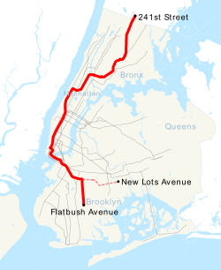
The IRT White Plains Road Line was extended to 219th Street on March 3, 1917, [13] [14] to 238th Street–Nereid Avenue on March 31, 1917, [15] and to Wakefield–241st Street on December 13, 1920. [16] [17] On August 1, 1918, the entire IRT Broadway–Seventh Avenue Line was completed. [18] On April 15, 1919, the Clark Street Tunnel opened, connecting the line to Brooklyn as well. [19]

Beginning on December 19, 1919, trains ran to South Ferry with some rush hour trains to Atlantic Avenue. [16] In 1923, during rush hours, 2 trains alternated between South Ferry and Utica Avenue. [16] Beginning December 1, 1924, 2 trains that had previously ended at South Ferry were extended to New Lots Avenue. [16]

On January 16, 1928, the New York State Transit Commission announced that it had reached an agreement with the IRT to increase service on its lines by 8,000,000 car miles a year; the greatest increase since 1922. As part of the changes, on January 30, all West Farms trains were extended from Atlantic Avenue to Flatbush Avenue during middays. [20]

As of 1934, 2 trains ran from 180th Street-Bronx Park to Flatbush Avenue weekdays and Saturday during daytime and to South Ferry evenings and Sundays, running express in Manhattan. Late-night service was from 241st St to South Ferry, making all stops. There were occasional lay-up/put-ins from New Lots Avenue, and four weekday evening trains turned at Atlantic Avenue. [16] On September 5, 1937, some evening rush hour trains started running to Flatbush Avenue. [16]

As of July 1, 1938, weekday and Saturday evening service was extended to Flatbush Avenue from South Ferry. [21]

Sunday service was extended to Flatbush Avenue on March 5, 1950.

Beginning on December 26, 1950, alternate weekday rush trains were extended to 241st Street in the peak direction, but PM rush service to 241st Street was discontinued on June 26, 1952. Beginning on August 4, 1952, the 180th Street—Bronx Park station was closed, with trains rerouted to East 180th Street.

Under the New York City Transit Authority

Morning rush hour service to 241st Street was cut back to Gun Hill Road on October 2, 1953. On March 19, 1954, weekend service was rerouted to New Lots Avenue at all times except late nights. On May 4, 1957, a track connection to the IRT Dyre Avenue Line was completed and daytime 2 trains were rerouted to Dyre Avenue. [16] Evening service remained a shuttle between Dyre Avenue and East 180th Street, and morning rush service from Gun Hill Road was discontinued.

On December 20, 1957, weekday trains were rerouted to New Lots Avenue at all times except late nights. On June 26, 1958, late night service began between Dyre Avenue and East 180th Street. Beginning on December 12, 1958, late night service was extended to Flatbush Avenue and the 2 began running express at all times. Beginning February 6, 1959, trains ran between Wakefield–241st Street and Flatbush Avenue at all times except late nights, when they ran between East 180th Street and New Lots Avenue. [16]

Beginning on April 8, 1960, daytime service was rerouted from Dyre Avenue to 241st Street and service in Brooklyn was rerouted from New Lots Avenue to Flatbush Avenue. At the same time, late night service was rerouted from Flatbush Avenue to New Lots Avenue.

Better Subway Service For Bronx IRT Riders Better Subway Service For Bronx IRT Riders.gif
Better Subway Service For Bronx IRT Riders

Beginning on April 18, 1965, evening service was extended from East 180th Street to 241st Street and daytime service was rerouted from Flatbush Avenue to New Lots Avenue.

On July 10, 1983, the 2 and 3 trains swapped terminals in Brooklyn, with 2 trains terminating at Flatbush Avenue and 3 trains terminating at New Lots Avenue. These changes were made to reduce non-revenue subway car mileage, to provide a dedicated fleet for each service, and to provide an easily accessible inspection yard for each service. The change allowed the 2 to be dedicated to 239th Street Yard and allowed the 3 to be assigned to Livonia Yard. With the rerouting of 3 trains, train lengths along the New Lots Line were reduced from 10 cars to 9 cars, within acceptable crowding levels, and train lengths along the Nostrand Avenue Line were increased from 9 to 10 cars, reducing crowding. [22] [23]

In Spring 1995, rush hour 5 service to 241st Street was cut back to Nereid Avenue. 241st Street had insufficient capacity to terminate all 2 and 5 trains during rush hours, requiring some 2 and 5 trips to terminate at Nereid Avenue. To ease passenger confusion regarding which trips terminate where and to provide more reliable service, it was decided to have all 2 trips terminate at 241st Street and have all 5 trains terminate at Nereid Avenue. This recommendation was made in response to comments made as part of the Northeast Bronx Comprehensive Study. [24]

Recent history

From March 2 [25] to October 12, 1998, the IRT Lenox Avenue Line was rehabilitated. On weekdays, 2 trains ran via the IRT Lexington Avenue Line between 149th Street–Grand Concourse and Nevins Street uptown from 5:00 a.m. to midnight and downtown from midnight to 5:00 a.m. [26] On October 3, 1999, the 2 began running local in Manhattan during late night hours so local stations would receive service every ten minutes. [27]

On December 9, 1999, New York City Transit released a proposal revising 2 and 5 service in the Bronx to eliminate a merge north of the East 180th Street station, increasing capacity and reducing delays, to the Metropolitan Transportation Authority (MTA) Board. Dyre Avenue-bound 5 trains would start running local along the White Plains Road Line while 2 trains would run express. Nereid Avenue-bound 5 trains would continue to run express in the Bronx. As part of the change, the frequency of service at White Plains Road Line local stations would decrease from 12 trains per hour to 7 trains per hour. Market research showed that riders at these stations preferred Lexington Avenue Line service. In addition, riders on the line north of East 180th Street would gain express service. This change would have been revenue neutral. [28]

Shortly after the proposal was more widely announced in April 2000, Assemblyman Jeffrey Klein collected 2,000 signatures for a petition opposing the change. [29] The MTA delayed the change's planned implementation by a month after receiving the petition. [30] Opponents of the change also argued that it would have increased subway crowding on the 2 train, especially at the 72nd Street station on the IRT Broadway–Seventh Avenue Line. The change was also opposed by State Senator Eric Schneiderman, Assemblyman Scott Stringer, and Public Advocate Mark Green. New York City Transit expected the passenger volume of downtown 2 trains in the morning rush hour to increase from 92% of capacity to 108% at 72nd Street. [31] After Assembly Speaker Sheldon Silver put pressure on the MTA, the change was pushed back for an additional three months in May 2000. [32] On September 24, 2000, a spokesperson for New York City Transit said that MTA Chairman E. Virgil Conway told planners to drop the change until service on the 5 was increased with the arrival of new R142 subway cars by early 2002. [33]

After September 11, 2001, 2 trains ran local in Manhattan at all times so they would not be delayed behind 3 trains terminating at 14th Street. Daytime express service resumed on September 15, 2002. [16]

Due to repairs to Hurricane Sandy-related damage on the Clark Street Tube, on weekends between June 17, 2017, and June 24, 2018, the 2 ran between Eastchester–Dyre Avenue in the Bronx and South Ferry in Lower Manhattan, with 5 trains replacing it in Brooklyn and the Bronx north of East 180th Street. Trains ran express only between 96th Street and Times Square–42nd Street during the daytime. [34] [35]

Route

Service pattern

The following table shows the lines used by the 2, with shaded boxes indicating the route at the specified times: [36] [4] [5] [6]

LineFromToTracksTimes
all ex. nightslate nightsrush hours
IRT White Plains Road Line (full line) Wakefield–241st Street 149th Street–Grand Concourse local   
IRT Lenox Avenue Line 135th Street Central Park North–110th Street all
IRT Broadway–Seventh Avenue Line 96th Street Chambers Street express 
local   
IRT Broadway-Seventh Avenue Line,
Brooklyn branch
Park Place Borough Hall all  
IRT Eastern Parkway Line Hoyt Street Franklin Avenue–Medgar Evers College local
IRT Nostrand Avenue Line (full line) President Street–Medgar Evers College Flatbush Avenue–Brooklyn College allMost trains
IRT Eastern Parkway Line Nostrand Avenue Crown Heights–Utica Avenue local  Limited service
IRT New Lots Line (full line) Sutter Avenue–Rutland Road New Lots Avenue all

Stations

For a more detailed station listing, see the articles on the lines listed above. [3]

Station service legend
NYCS-SSI-alltimes.svg Stops all times
NYCS-SSI-allexceptnights.svg Stops all times except late nights
NYCS-SSI-nightsonly.svg Stops late nights only
NYCS-SSI-weekdaysonly.svg Stops weekdays during the day
NYCS-SSI-weekendsonly.svg Stops weekends during the day
NYCS-SSI-allexceptrush.svg Stops all times except nights and rush hours in the peak direction
NYCS-SSI-rushonly.svg Stops rush hours only
NYCS-SSI-rushpeak.svg Stops rush hours in the peak direction only
NYCS-SSI-closed.svg Station closed
NYCS-SSI-rushreversepeak.svg Stops rush hours in the reverse-peak direction only (limited service)
Time period details
Wheelchair symbol.svg Station is compliant with the Americans with Disabilities Act
Wheelchair symbol.svg  Station is compliant with the Americans with Disabilities Act
in the indicated direction only
Wheelchair symbol.svg  
Aiga elevator.svg Elevator access to mezzanine only
NYCS-bull-trans-2-Std.svg
Flat.
NYCS-bull-trans-2-Std.svg
NL
Stations Wheelchair symbol.svg Subway transfersConnections
The Bronx
White Plains Road Line
NYCS-SSI-alltimes.svg NYCS-SSI-rushreversepeak.svg Wakefield–241st Street Metro-North Railroad Harlem Line at Wakefield
NYCS-SSI-alltimes.svg NYCS-SSI-rushreversepeak.svg Nereid Avenue 5   NYCS-SSI-rushpeak.svg Originating point for some southbound a.m. rush hour trains
NYCS-SSI-alltimes.svg NYCS-SSI-rushreversepeak.svg 233rd Street Wheelchair symbol.svg 5   NYCS-SSI-rushpeak.svg Metro-North Railroad Harlem Line at Woodlawn
NYCS-SSI-alltimes.svg NYCS-SSI-rushreversepeak.svg 225th Street 5   NYCS-SSI-rushpeak.svg
NYCS-SSI-alltimes.svg NYCS-SSI-rushreversepeak.svg 219th Street 5   NYCS-SSI-rushpeak.svg
NYCS-SSI-alltimes.svg NYCS-SSI-rushreversepeak.svg Gun Hill Road Wheelchair symbol.svg 5   NYCS-SSI-rushpeak.svg Bx41 Select Bus Service
Metro-North Railroad Harlem Line at Williams Bridge
NYCS-SSI-alltimes.svg NYCS-SSI-rushreversepeak.svg Burke Avenue 5   NYCS-SSI-rushpeak.svg
NYCS-SSI-alltimes.svg NYCS-SSI-rushreversepeak.svg Allerton Avenue 5   NYCS-SSI-rushpeak.svg
NYCS-SSI-alltimes.svg NYCS-SSI-rushreversepeak.svg Pelham Parkway Wheelchair symbol.svg 5   NYCS-SSI-rushpeak.svg Bx12 Select Bus Service
NYCS-SSI-alltimes.svg NYCS-SSI-rushreversepeak.svg Bronx Park East 5   NYCS-SSI-rushpeak.svg
NYCS-SSI-alltimes.svg NYCS-SSI-rushreversepeak.svg East 180th Street Wheelchair symbol.svg 5   NYCS-SSI-alltimes.svg
NYCS-SSI-alltimes.svg NYCS-SSI-rushreversepeak.svg West Farms Square–East Tremont Avenue 5   NYCS-SSI-allexceptrush.svg Q44 Select Bus Service
NYCS-SSI-alltimes.svg NYCS-SSI-rushreversepeak.svg 174th Street 5   NYCS-SSI-allexceptrush.svg
NYCS-SSI-alltimes.svg NYCS-SSI-rushreversepeak.svg Freeman Street 5   NYCS-SSI-allexceptrush.svg
NYCS-SSI-alltimes.svg NYCS-SSI-rushreversepeak.svg Simpson Street Wheelchair symbol.svg 5   NYCS-SSI-allexceptrush.svg
NYCS-SSI-alltimes.svg NYCS-SSI-rushreversepeak.svg Intervale Avenue 5   NYCS-SSI-allexceptrush.svg Bx6 Select Bus Service
NYCS-SSI-alltimes.svg NYCS-SSI-rushreversepeak.svg Prospect Avenue 5   NYCS-SSI-allexceptrush.svg
NYCS-SSI-alltimes.svg NYCS-SSI-rushreversepeak.svg Jackson Avenue 5   NYCS-SSI-allexceptrush.svg
NYCS-SSI-alltimes.svg NYCS-SSI-rushreversepeak.svg Third Avenue–149th Street Wheelchair symbol.svg 5   NYCS-SSI-allexceptnights.svg Bx41 Select Bus Service
NYCS-SSI-alltimes.svg NYCS-SSI-rushreversepeak.svg 149th Street–Grand Concourse 5   NYCS-SSI-allexceptnights.svg
4   NYCS-SSI-alltimes.svg (IRT Jerome Avenue Line)
Manhattan
Lenox Avenue Line
NYCS-SSI-alltimes.svg NYCS-SSI-rushreversepeak.svg 135th Street Wheelchair symbol.svg 3   NYCS-SSI-alltimes.svg
NYCS-SSI-alltimes.svg NYCS-SSI-rushreversepeak.svg 125th Street 3   NYCS-SSI-alltimes.svg M60 Select Bus Service to LaGuardia Airport
NYCS-SSI-alltimes.svg NYCS-SSI-rushreversepeak.svg 116th Street 3   NYCS-SSI-alltimes.svg
NYCS-SSI-alltimes.svg NYCS-SSI-rushreversepeak.svg Central Park North–110th Street 3   NYCS-SSI-alltimes.svg
Broadway–Seventh Avenue Line
NYCS-SSI-alltimes.svg NYCS-SSI-rushreversepeak.svg 96th Street Wheelchair symbol.svg 1   NYCS-SSI-alltimes.svg 3   NYCS-SSI-alltimes.svg
NYCS-SSI-nightsonly.svg | 86th Street 1   NYCS-SSI-alltimes.svg M86 Select Bus Service
NYCS-SSI-nightsonly.svg | 79th Street 1   NYCS-SSI-alltimes.svg M79 Select Bus Service
NYCS-SSI-alltimes.svg NYCS-SSI-rushreversepeak.svg 72nd Street Wheelchair symbol.svg 1   NYCS-SSI-alltimes.svg 3   NYCS-SSI-alltimes.svg
NYCS-SSI-nightsonly.svg | 66th Street–Lincoln Center Wheelchair symbol.svg 1   NYCS-SSI-alltimes.svg
NYCS-SSI-nightsonly.svg | 59th Street–Columbus Circle Wheelchair symbol.svg 1   NYCS-SSI-alltimes.svg
A   NYCS-SSI-alltimes.svg D   NYCS-SSI-alltimes.svg (IND Eighth Avenue Line)
NYCS-SSI-nightsonly.svg | 50th Street 1   NYCS-SSI-alltimes.svg
NYCS-SSI-alltimes.svg NYCS-SSI-rushreversepeak.svg Times Square–42nd Street Wheelchair symbol.svg 1   NYCS-SSI-alltimes.svg 3   NYCS-SSI-alltimes.svg
7   NYCS-SSI-alltimes.svg <7> NYCS-SSI-rushpeak.svg (IRT Flushing Line)
A   NYCS-SSI-alltimes.svg C   NYCS-SSI-allexceptnights.svg E   NYCS-SSI-alltimes.svg (IND Eighth Avenue Line at 42nd Street–Port Authority Bus Terminal)
N   NYCS-SSI-alltimes.svg Q   NYCS-SSI-alltimes.svg R   NYCS-SSI-allexceptnights.svg W   NYCS-SSI-weekdaysonly.svg (BMT Broadway Line)
S   NYCS-SSI-allexceptnights.svg (42nd Street Shuttle)
B   NYCS-SSI-weekdaysonly.svg D   NYCS-SSI-alltimes.svg F   NYCS-SSI-alltimes.svg <F> NYCS-SSI-rushpeak.svg M   NYCS-SSI-weekdaysonly.svg (IND Sixth Avenue Line at 42nd Street–Bryant Park, daytime only)
Port Authority Bus Terminal
M34A Select Bus Service
NYCS-SSI-alltimes.svg NYCS-SSI-rushreversepeak.svg 34th Street–Penn Station Wheelchair symbol.svg 1   NYCS-SSI-alltimes.svg 3   NYCS-SSI-allexceptnights.svg M34 / M34A Select Bus Service
Amtrak, LIRR and NJ Transit at Pennsylvania Station
NYCS-SSI-nightsonly.svg | 28th Street 1   NYCS-SSI-alltimes.svg
NYCS-SSI-nightsonly.svg | 23rd Street 1   NYCS-SSI-alltimes.svg M23 Select Bus Service
NYCS-SSI-nightsonly.svg | 18th Street 1   NYCS-SSI-alltimes.svg
NYCS-SSI-alltimes.svg NYCS-SSI-rushreversepeak.svg 14th Street 1   NYCS-SSI-alltimes.svg 3   NYCS-SSI-allexceptnights.svg
Out-of-system transfers with MetroCard/OMNY:
F   NYCS-SSI-alltimes.svg <F> NYCS-SSI-rushpeak.svg M   NYCS-SSI-weekdaysonly.svg (IND Sixth Avenue Line at 14th Street)
L   NYCS-SSI-alltimes.svg (BMT Canarsie Line at Sixth Avenue)
PATH at 14th Street
M14A/D Select Bus Service
NYCS-SSI-nightsonly.svg | Christopher Street–Sheridan Square 1   NYCS-SSI-alltimes.svg PATH at Christopher Street
NYCS-SSI-nightsonly.svg | Houston Street 1   NYCS-SSI-alltimes.svg
NYCS-SSI-nightsonly.svg | Canal Street 1   NYCS-SSI-alltimes.svg
NYCS-SSI-nightsonly.svg | Franklin Street 1   NYCS-SSI-alltimes.svg
NYCS-SSI-alltimes.svg NYCS-SSI-rushreversepeak.svg Chambers Street Wheelchair symbol.svg 1   NYCS-SSI-alltimes.svg 3   NYCS-SSI-allexceptnights.svg
Brooklyn Branch
NYCS-SSI-alltimes.svg NYCS-SSI-rushreversepeak.svg Park Place Aiga elevator.svg 3   NYCS-SSI-allexceptnights.svg
A   NYCS-SSI-alltimes.svg C   NYCS-SSI-allexceptnights.svg (IND Eighth Avenue Line at Chambers Street)
E   NYCS-SSI-alltimes.svg (IND Eighth Avenue Line at World Trade Center)
N   NYCS-SSI-nightsonly.svg R   NYCS-SSI-allexceptnights.svg W   NYCS-SSI-weekdaysonly.svg (BMT Broadway Line at Cortlandt Street)
PATH at World Trade Center
NYCS-SSI-alltimes.svg NYCS-SSI-rushreversepeak.svg Fulton Street Wheelchair symbol.svg 3   NYCS-SSI-allexceptnights.svg
4   NYCS-SSI-alltimes.svg 5   NYCS-SSI-allexceptnights.svg (IRT Lexington Avenue Line)
A   NYCS-SSI-alltimes.svg C   NYCS-SSI-allexceptnights.svg (IND Eighth Avenue Line)
J   NYCS-SSI-alltimes.svg Z   NYCS-SSI-rushpeak.svg (BMT Nassau Street Line)
PATH at World Trade Center
NYCS-SSI-alltimes.svg NYCS-SSI-rushreversepeak.svg Wall Street 3   NYCS-SSI-allexceptnights.svg M15 Select Bus Service
Staten Island Ferry at Whitehall Terminal
Brooklyn
NYCS-SSI-alltimes.svg NYCS-SSI-rushreversepeak.svg Clark Street Aiga elevator.svg 3   NYCS-SSI-allexceptnights.svg Maki7-ferry.svg NYC Ferry : East River and South Brooklyn routes (at Old Fulton Street and Furman Street)
NYCS-SSI-alltimes.svg NYCS-SSI-rushreversepeak.svg Borough Hall Wheelchair symbol.svg 3   NYCS-SSI-allexceptnights.svg
4   NYCS-SSI-alltimes.svg 5   NYCS-SSI-weekdaysonly.svg (IRT Eastern Parkway Line)
N   NYCS-SSI-nightsonly.svg R   NYCS-SSI-alltimes.svg W   NYCS-SSI-rushonly.svg (BMT Fourth Avenue Line at Court Street)
Eastern Parkway Line
NYCS-SSI-alltimes.svg NYCS-SSI-rushreversepeak.svg Hoyt Street Wheelchair symbol.svg   3   NYCS-SSI-allexceptnights.svg Station is ADA-accessible in the southbound direction only. [37]
NYCS-SSI-alltimes.svg NYCS-SSI-rushreversepeak.svg Nevins Street 3   NYCS-SSI-allexceptnights.svg 4   NYCS-SSI-alltimes.svg 5   NYCS-SSI-weekdaysonly.svg
NYCS-SSI-alltimes.svg NYCS-SSI-rushreversepeak.svg Atlantic Avenue–Barclays Center Wheelchair symbol.svg 3   NYCS-SSI-allexceptnights.svg 4   NYCS-SSI-alltimes.svg 5   NYCS-SSI-weekdaysonly.svg
B   NYCS-SSI-weekdaysonly.svg Q   NYCS-SSI-alltimes.svg (BMT Brighton Line)
D   NYCS-SSI-alltimes.svg N   NYCS-SSI-alltimes.svg R   NYCS-SSI-alltimes.svg W   NYCS-SSI-rushonly.svg (BMT Fourth Avenue Line)
LIRR Atlantic Branch at Atlantic Terminal
NYCS-SSI-alltimes.svg NYCS-SSI-rushreversepeak.svg Bergen Street 3   NYCS-SSI-allexceptnights.svg 4   NYCS-SSI-nightsonly.svg
NYCS-SSI-alltimes.svg NYCS-SSI-rushreversepeak.svg Grand Army Plaza 3   NYCS-SSI-allexceptnights.svg 4   NYCS-SSI-nightsonly.svg
NYCS-SSI-alltimes.svg NYCS-SSI-rushreversepeak.svg Eastern Parkway–Brooklyn Museum Wheelchair symbol.svg 3   NYCS-SSI-allexceptnights.svg 4   NYCS-SSI-nightsonly.svg
NYCS-SSI-alltimes.svg NYCS-SSI-rushreversepeak.svg Franklin Avenue–Medgar Evers College 3   NYCS-SSI-allexceptnights.svg 4   NYCS-SSI-alltimes.svg 5   NYCS-SSI-weekdaysonly.svg
S   NYCS-SSI-alltimes.svg (BMT Franklin Avenue Line at Botanic Garden)
Services to Flatbush Avenue and New Lots Avenue split
Nostrand Avenue Line
NYCS-SSI-alltimes.svg President Street–Medgar Evers College 5   NYCS-SSI-weekdaysonly.svg
NYCS-SSI-alltimes.svg Sterling Street 5   NYCS-SSI-weekdaysonly.svg B44 Select Bus Service
NYCS-SSI-alltimes.svg Winthrop Street 5   NYCS-SSI-weekdaysonly.svg B44 Select Bus Service
NYCS-SSI-alltimes.svg Church Avenue Wheelchair symbol.svg 5   NYCS-SSI-weekdaysonly.svg B44 Select Bus Service
NYCS-SSI-alltimes.svg Beverly Road 5   NYCS-SSI-weekdaysonly.svg
NYCS-SSI-alltimes.svg Newkirk Avenue–Little Haiti 5   NYCS-SSI-weekdaysonly.svg B44 Select Bus Service
NYCS-SSI-alltimes.svg Flatbush Avenue–Brooklyn College Wheelchair symbol.svg 5   NYCS-SSI-weekdaysonly.svg B44 Select Bus Service
Eastern Parkway Line (limited rush hour service only)
NYCS-SSI-rushreversepeak.svg Nostrand Avenue 3   NYCS-SSI-allexceptnights.svg 4   NYCS-SSI-rushonly.svg 5   NYCS-SSI-rushpeak.svg B44 Select Bus Service
NYCS-SSI-rushreversepeak.svg Kingston Avenue 3   NYCS-SSI-allexceptnights.svg 4   NYCS-SSI-rushonly.svg 5   NYCS-SSI-rushpeak.svg
NYCS-SSI-rushreversepeak.svg Crown Heights–Utica Avenue Wheelchair symbol.svg 3   NYCS-SSI-allexceptnights.svg 4   NYCS-SSI-alltimes.svg 5   NYCS-SSI-rushonly.svg B46 Select Bus Service
New Lots Line (limited rush hour service only)
NYCS-SSI-rushreversepeak.svg Sutter Avenue–Rutland Road 3   NYCS-SSI-allexceptnights.svg 4   NYCS-SSI-rushpeak.svg 5   NYCS-SSI-rushpeak.svg B15 bus to JFK Int'l Airport
NYCS-SSI-rushreversepeak.svg Saratoga Avenue 3   NYCS-SSI-allexceptnights.svg 4   NYCS-SSI-rushpeak.svg 5   NYCS-SSI-rushpeak.svg
NYCS-SSI-rushreversepeak.svg Rockaway Avenue 3   NYCS-SSI-allexceptnights.svg 4   NYCS-SSI-rushpeak.svg 5   NYCS-SSI-rushpeak.svg
NYCS-SSI-rushreversepeak.svg Junius Street 3   NYCS-SSI-allexceptnights.svg 4   NYCS-SSI-rushpeak.svg 5   NYCS-SSI-rushpeak.svg
Out-of-system transfer with MetroCard:
L   NYCS-SSI-alltimes.svg (BMT Canarsie Line at Livonia Avenue)
NYCS-SSI-rushreversepeak.svg Pennsylvania Avenue 3   NYCS-SSI-allexceptnights.svg 4   NYCS-SSI-rushpeak.svg 5   NYCS-SSI-rushpeak.svg
NYCS-SSI-rushreversepeak.svg Van Siclen Avenue 3   NYCS-SSI-allexceptnights.svg 4   NYCS-SSI-rushpeak.svg 5   NYCS-SSI-rushpeak.svg
NYCS-SSI-rushreversepeak.svg New Lots Avenue 3   NYCS-SSI-allexceptnights.svg 4   NYCS-SSI-rushpeak.svg 5   NYCS-SSI-rushpeak.svg B15 bus to JFK Int'l Airport

Notes

  1. Only one 2 train with this service pattern operates in the peak direction, during the AM rush hour. [6]

Related Research Articles

<span class="mw-page-title-main">1 (New York City Subway service)</span> New York City Subway service

The 1 Broadway–Seventh Avenue Local is a rapid transit service in the A Division of the New York City Subway. Its route emblem, or "bullet", is colored red, since it uses the IRT Broadway–Seventh Avenue Line for its entire route.

<span class="mw-page-title-main">6 (New York City Subway service)</span> New York City Subway service

The 6 Lexington Avenue Local and <6> Pelham Bay Park Express are two rapid transit services in the A Division of the New York City Subway. Their route emblems, or "bullets", are colored forest green since they use the IRT Lexington Avenue Line in Manhattan. Local service is denoted by a (6) in a circular bullet, and express service is denoted by a <6> in a diamond-shaped bullet. On the R62A rolling stock, this is often indicated by LEDs around the service logo to indicate local or express service to riders. The LEDs illuminate in a green circle pattern for 6 local trains and in a red diamond pattern for <6> trains.

<span class="mw-page-title-main">4 (New York City Subway service)</span> New York City Subway service

The 4 Lexington Avenue Express is a rapid transit service in the A Division of the New York City Subway in New York City, United States. Its route emblem, or "bullet", is colored forest green since it uses the IRT Lexington Avenue Line in Manhattan.

<span class="mw-page-title-main">3 (New York City Subway service)</span> New York City Subway service

The 3 Seventh Avenue Express is a rapid transit service in the A Division of the New York City Subway. Its route emblem, or "bullet", is colored red since it uses the IRT Broadway–Seventh Avenue Line through most of Manhattan.

<span class="mw-page-title-main">5 (New York City Subway service)</span> New York City Subway service

The 5 Lexington Avenue Express is a rapid transit service in the A Division of the New York City Subway. Its route emblem, or "bullet", is colored forest green since it uses the IRT Lexington Avenue Line in Manhattan.

<span class="mw-page-title-main">Interborough Rapid Transit Company</span> Defunct subway operator in New York City (1904–1940)

The Interborough Rapid Transit Company (IRT) was the private operator of New York City's original underground subway line that opened in 1904, as well as earlier elevated railways and additional rapid transit lines in New York City. The IRT was purchased by the city in June 1940, along with the younger BMT and IND systems, to form the modern New York City Subway. The former IRT lines are now the A Division or IRT Division of the Subway.

<span class="mw-page-title-main">Burnside Avenue station</span> New York City Subway station in the Bronx

The Burnside Avenue station is an express station on the IRT Jerome Avenue Line of the New York City Subway. Located at the intersection of Burnside and Jerome Avenues in the Bronx, it is served by the 4 train at all times. It also serves as a rush hour short turn northern terminal for select 4 trains from Crown Heights–Utica Avenue.

<span class="mw-page-title-main">East 180th Street station</span> New York City Subway station in the Bronx

The East 180th Street station is an elevated express station on the IRT White Plains Road Line of the New York City Subway. Located at the intersection of East 180th Street and Morris Park Avenue in the Bronx, it is served by the 2 and 5 trains at all times.

<span class="mw-page-title-main">9 (New York City Subway service)</span> Former New York City Subway service

The 9 Broadway–Seventh Avenue Local was a rapid transit service in the A Division of the New York City Subway. Its route emblem, or "bullet", was colored red, since it used the Interborough Rapid Transit Company (IRT)'s Broadway–Seventh Avenue Line for its entire route.

The IRT Dyre Avenue Line is a New York City Subway rapid transit line, part of the A Division. It is a branch of the IRT White Plains Road Line in the northeastern section of the Bronx, north of East 180th Street. As of 2013, it has a daily ridership of 34,802.

<span class="mw-page-title-main">IRT White Plains Road Line</span> New York City Subway line

The White Plains Road Line is a rapid transit line of the A Division of the New York City Subway serving the central Bronx. It is mostly elevated and served both subway and elevated trains until 1952. The original part of the line, the part opened as part of the first subway was called the West Farms Division, and the extension north to 241st Street as part of the Dual Contracts was called the White Plains Road Line. Eventually, however, the two parts came to be known as the White Plains Road Line.

<span class="mw-page-title-main">Baychester Avenue station</span> New York City Subway station in the Bronx

The Baychester Avenue station is a station on the IRT Dyre Avenue Line of the New York City Subway, located at the intersection of Baychester and Tillotson Avenues in the Bronx. It is served by the 5 train at all times.

<span class="mw-page-title-main">Gun Hill Road station (IRT Dyre Avenue Line)</span> New York City Subway station in the Bronx

The Gun Hill Road station is a station on the IRT Dyre Avenue Line of the New York City Subway, located at the intersection of Gun Hill Road and Seymour Avenue in the northeast Bronx. It is served by the 5 train at all times.

<span class="mw-page-title-main">Pelham Parkway station (IRT Dyre Avenue Line)</span> New York City Subway station in the Bronx

The Pelham Parkway station is a station on the IRT Dyre Avenue Line of the New York City Subway. Located at the intersection of Pelham Parkway North and the Esplanade in the Bronx, it is served by the 5 train at all times. This station was built as part of the New York, Westchester and Boston Railway (NYW&B), and opened in 1912. This station closed in 1937 with the NYW&B, but reopened in 1941 as a subway station after the portion of the line in the Bronx was purchased by New York City.

<span class="mw-page-title-main">Morris Park station</span> New York City Subway station in the Bronx

The Morris Park station is a station on the IRT Dyre Avenue Line of the New York City Subway served by the 5 train at all times. It is located at Paulding Avenue and the Esplanade in Morris Park, Bronx.

<span class="mw-page-title-main">Bronx Park East station</span> New York City Subway station in the Bronx

The Bronx Park East station is a local station on the IRT White Plains Road Line of the New York City Subway. Located in the Bronx on Birchall Avenue at Sagamore Street, it is served by the 2 train at all times and by the 5 train during rush hours in the peak direction.

<span class="mw-page-title-main">180th Street–Bronx Park station</span> New York City Subway station in the Bronx from 1904 to 1952

The 180th Street–Bronx Park station was the former terminal station for the IRT White Plains Road Line of the New York City Subway, in the West Farms neighborhood of the Bronx.

References

  1. 'Subdivision 'A' Car Assignment Effective December 19, 2021'. New York City Transit, Operations Planning. December 17, 2021.
  2. "Subdivision 'A' Car Assignments: Cars Required June 27, 2021" (PDF). The Bulletin. Electric Railroaders' Association. 64 (7): 2. July 2021. Retrieved December 3, 2021.
  3. 1 2 "2Subway Timetable, Effective June 26, 2022". Metropolitan Transportation Authority . Retrieved August 26, 2023.
  4. 1 2 "7:40 AM – 9:35 AM New Lots Av – OpenMobilityData". transitfeeds.com. August 8, 2021. Archived from the original on August 8, 2021. Retrieved August 8, 2021.
  5. 1 2 "3:42 PM – 5:30 PM Wakefield-241 St – OpenMobilityData". transitfeeds.com. August 8, 2021. Archived from the original on August 8, 2021. Retrieved August 8, 2021.
  6. 1 2 "7:21 AM – 9:07 AM Wakefield-241 St – OpenMobilityData". transitfeeds.com. August 8, 2021. Archived from the original on August 8, 2021. Retrieved August 8, 2021.
  7. "Discuss Subway Signs in 18th St. Station – Engineer Parsons and Mr. Hedley Inspect Advertising Scheme – Bronx Viaduct Works Well – Delays There Only Those of Newness – Lenox Avenue Service Makes Fuss Below Ninety-sixth Street" (PDF). New York Times. November 27, 1904. Archived (PDF) from the original on March 24, 2020. Retrieved September 4, 2016.
  8. Kahn, Alan Paul (January 1, 1973). Tracks of New York /. New York: Electric Railroaders' Association.
  9. "Subway Trains Running from Bronx to Battery – West Farms and South Ferry Stations Open at Midnight – Start Without a Hitch – Bowling Green Station Also Opened – Lenox Avenue Locals Take City Hall Loop Hereafter" (PDF). New York Times. July 10, 1905. Archived (PDF) from the original on December 17, 2021. Retrieved September 4, 2016.
  10. "Brooklyn Tunnel to be Opened for Operation to Borough Hall Thursday". The Wall Street Journal. January 7, 1908. Archived from the original on September 14, 2020. Retrieved March 12, 2020.
  11. "Bronx to Montauk; One Change of Cars — This Trip Made Possible by the Opening of Brooklyn Subway Extension Friday — Official Opening Trip — And the Public Can Go Through to Long Island Railroad Station To-night After Midnight" (PDF). The New York Times. April 30, 1908. p. 4. ISSN   0362-4331. Archived (PDF) from the original on August 31, 2021. Retrieved November 6, 2016.
  12. "Trains To Atlantic Ave.: New Subway Schedule For Extension Announced". New-York Tribune. April 30, 1908. Archived from the original on September 14, 2020. Retrieved March 12, 2020.
  13. "Annual report. 1916-1917". HathiTrust. Interborough Rapid Transit Company. December 12, 2013. hdl:2027/mdp.39015016416920 . Retrieved September 5, 2016.
  14. "White Plains Road Extension of Subway Opened to the Public – New Branch, Which Runs from 177th to 219th Street, Gives the Williamsbridge and Wakefield Sections of the East Bronx Rapid Transit for the First Time" (PDF). The New York Times. March 4, 1917. Archived (PDF) from the original on March 23, 2020. Retrieved June 11, 2018.
  15. "New Subway Line Opened: White Plains Extension is Now Running to 238th Street" (PDF). New York Times. April 1, 1917. Archived (PDF) from the original on March 24, 2020. Retrieved August 17, 2015.
  16. 1 2 3 4 5 6 7 8 9 "Line by Line History: White Plains-7th Av. Express". erictb.info. Archived from the original on March 4, 2016. Retrieved January 16, 2016.
  17. "Subway Line Extended: White Plains Avenue Branch Opens to 241st Street Tomorrow" (PDF). New York Times. December 12, 1920. Archived (PDF) from the original on May 14, 2021. Retrieved December 20, 2015.
  18. Whitney, Travis (Public Service Commissioner) (March 10, 1918). "The Seventh and Lexington Avenue Subways Will Revive Dormant Sections – Change in Operation That Will Transform Original Four-Tracked Subway Into Two Four-Tracked Systems and Double Present Capacity of the Interborough" (PDF). Archived (PDF) from the original on December 12, 2019. Retrieved August 26, 2016.
  19. "New Subway Service Between Brooklyn and Manhattan Boroughs". The New York Times. April 13, 1919. Archived from the original on June 12, 2018. Retrieved September 5, 2009.
  20. "IRT Adds More Cars And Extends Lines: Delays at Atlantic Ave. Reduced—South Ferry Trains to Run to Brooklyn". The Brooklyn Citizen. January 16, 1928. Archived from the original on May 5, 2020. Retrieved March 6, 2020.
  21. "IRT Brooklyn Line Opened 90 Years Ago". New York Division Bulletin. New York Division, Electric Railroaders' Association. 53 (9). September 2010. Archived from the original on April 8, 2016. Retrieved August 31, 2016 via Issu.
  22. "New IRT Schedules – Increased Service to Flatbush Avenue". New York Division Bulletin. July 1983.
  23. "Notice of Public Hearing". New York Amsterdam News. February 26, 1983. Archived from the original on January 25, 2023. Retrieved January 13, 2020.
  24. Christian, Nichole M. (March 3, 1998). "Subway Line Repairs Start With Confusion". The New York Times. ISSN   0362-4331. Archived from the original on September 17, 2020. Retrieved September 23, 2016.
  25. "About NYC Transit – History". October 19, 2002. Archived from the original on October 19, 2002. Retrieved September 18, 2016.
  26. "No. 5 express still a go: Dyre Ave. line shift to local service nixed". New York Daily News. September 26, 2000. p. 535. Archived from the original on June 24, 2020. Retrieved March 15, 2020.
  27. Critchell, David (May 28, 2000). "Neighborhood Report: Bronx Up Close; Our Trip's Long Enough as It Is, Commuters Tell M.T.A." The New York Times. ISSN   0362-4331. Archived from the original on June 25, 2020. Retrieved March 15, 2020.
  28. Kennedy, Randy (June 17, 2000). "Trouble Down the Line in Rerouting Train". The New York Times. ISSN   0362-4331. Archived from the original on June 22, 2020. Retrieved March 15, 2020.
  29. Kappstatter, Bob (May 30, 2000). "No. 5 express run saved". New York Daily News. p. 89. Archived from the original on June 22, 2020. Retrieved March 15, 2020.
  30. Kennedy, Randy (September 25, 2000). "Plan to Shift No. 5 Train Is Abandoned". The New York Times. ISSN   0362-4331. Archived from the original on June 24, 2020. Retrieved March 15, 2020.
  31. "Transit & Bus Committee Meeting December 2016" (PDF). mta.info. Metropolitan Transportation Authority. December 12, 2016. pp. PDF-169 to PDF-175. Archived from the original (PDF) on December 10, 2016. Retrieved December 9, 2016.
  32. "Clark St Tunnel Reconstruction Weekend Service Changes". web.mta.info. Metropolitan Transportation Authority. June 8, 2017. Archived from the original on August 25, 2017. Retrieved May 9, 2018.
  33. "Subway Service Guide" (PDF). Metropolitan Transportation Authority. September 2019. Retrieved September 22, 2019.
  34. "MTA announces new station elevator paid in full by Macy's". News 12 - The Bronx. September 21, 2023. Archived from the original on September 30, 2023. Retrieved September 22, 2023.