N (New York City Subway service)

Last updated

NYCS-bull-trans-N-Std.svg
Broadway Express
R46 N train leaving 30th Avenue.jpg
An Astoria–Ditmars Boulevard-bound N train of R46s leaving 30th Avenue
NYCS map N.svg
Note: Dashed red line shows late night service via the Montague Street Tunnel. Dashed pink line shows limited rush hour service to/from 96th Street.
Northern end
Southern end Coney Island–Stillwell Avenue
Stations28 (weekdays)
32 (weekends)
45 (late night service)
22 (limited service)
Rolling stock176 R46s (22 trains)
72 R68s (9 trains)
16 R68As (2 trains)
(Fleet shared with the NYCS-bull-trans-W-Std.svg ) [1] [2]
(Rolling stock assignments subject to change)
Depot Coney Island Yard
Started serviceJune 22, 1915;108 years ago (1915-06-22)
Route map

Contents

Arrow Blue Down 001.svg  N    W  
BSicon uKBHFa.svg
Astoria–Ditmars Boulevard
BSicon uxSPLa.svg
BSicon lxACC.svg
BSicon uvBHF-exBHF.svg
Astoria Boulevard
BSicon udHST.svg
BSicon uexdSTR.svg
30th Avenue
BSicon udHST.svg
BSicon uexdSTR.svg
Broadway
BSicon udHST.svg
BSicon uexdSTR.svg
36th Avenue
BSicon udHST.svg
BSicon uexdSTR.svg
39th Avenue
BSicon uedSHI2g+l.svg
BSicon ldCONTg@F.svg
BSicon uexdSHI2r.svg
BSicon umvSTR.svg
BSicon exvUSTx.svg
BSicon umvBHF.svg
Queensboro Plaza
BSicon udSTR.svg
BSicon ldCONTg@F.svg
BSicon ldCONTf@G.svg
BSicon uvSTR-.svg
BSicon v-SHI2r.svg
BSicon uSTR+GRZq.svg
BSicon udHST.svg
Lexington Avenue–59th Street
BSicon udHST.svg
Fifth Avenue–59th Street
BSicon udLSTR.svg
BSicon uexdCONTg.svg
BSicon udLSTR.svg
BSicon uexdSTR.svg
BSicon udLSTR.svg
Arrow Blue Down 001.svg  Q  
(  N    R   limited rush)
BSicon ldHSTACC.svg
BSicon udKHSTxa.svg
BSicon udLSTR.svg
96th Street
BSicon udHSTACC.svg
BSicon udLSTR.svg
86th Street
BSicon udHSTACC.svg
BSicon udLSTR.svg
72nd Street
BSicon uvSTR-.svg
BSicon exvSHI2l-.svg
BSicon udLSTR.svg
BSicon udSTR.svg
BSicon ldCONTg@F.svg
BSicon exldCONTf@G.svg
BSicon udLSTR.svg
BSicon lxACC.svg
BSicon umvBHF.svg
BSicon uLSTR.svg
Lexington Avenue–63rd Street
BSicon umvSTR.svg
BSicon exvUSTx.svg
BSicon udLSTR.svg
BSicon uvSTR2-.svg
BSicon ldCONTf@G.svg
BSicon uSTRc23.svg
BSicon udSTR3.svg
BSicon uSTRc1.svg
BSicon uvSTR+1-.svg
BSicon uv-STR+4.svg
BSicon uSTRc4.svg
BSicon uvSTR-.svg
BSicon uev-SHI2g+r.svg
BSicon uvACC.svg
57th Street–Seventh Avenue
BSicon uvSTR.svg
BSicon v-SHI2r.svg
BSicon udHSTACC.svg
BSicon udSTR.svg
49th Street
( Wheelchair symbol.svg northbound)
BSicon uvACC.svg
Times Square–42nd Street
BSicon uvUSTl.svg
NYCS-bull-trans-N-Std.svg
switches to express tracks
during weekdays
BSicon uvINTACC.svg
34th Street–Herald Square PATH logo.svg
BSicon udHST.svg
BSicon udSTR.svg
28th Street
BSicon udHST.svg
BSicon udSTR.svg
23rd Street
BSicon uvACC.svg
14th Street–Union Square
BSicon udHST.svg
BSicon udSTR.svg
Eighth Street–New York University
BSicon udHST.svg
BSicon udSTR.svg
Prince Street
BSicon uvUSTl.svg
NYCS-bull-trans-N-Std.svg
daytime via Manhattan Bridge
late nights via Lower Manhattan
BSicon udHST.svg
BSicon udHST.svg
Canal Street
BSicon uSHI3+l.svg
BSicon uv-SHI2l.svg
BSicon uvSHI3r-.svg
BSicon udSHI2+r.svg
BSicon dCONTg.svg
BSicon uHST.svg
BSicon umvSTR.svg
City Hall
BSicon uHSTACC.svg
BSicon umvSTR.svg
Cortlandt Street
BSicon uHST.svg
BSicon umvSTR.svg
Rector Street
BSicon uINT.svg
BSicon umvSTR.svg
Whitehall Street–South Ferry Ferry symbol.svg
BSicon uSTR.svg
BSicon umvSTR.svg
Arrow Blue Up 001.svg  W   weekdays
(Arrow Blue Down 001.svg  R   late nights)
BSicon uSTR.svg
BSicon uemABZg+l.svg
BSicon exSTR+l.svg
BSicon exdCONTfq.svg
BSicon umvSTR.svg
no regular service via Nassau Street
BSicon uSTR+GRZq.svg
BSicon GRZq.svg
BSicon GRZq.svg
BSicon umvSTR.svg
Montague Tunnel
BSicon uHST.svg
BSicon uvSHI2l-.svg
BSicon vUSTr.svg
Court Street
BSicon uHSTACC.svg
BSicon dSTR.svg
BSicon udSTR.svg
Jay Street–MetroTech
BSicon uSTR.svg
BSicon edHST.svg
BSicon udSTR.svg
BSicon uBS2l.svg
BSicon SHI3+l.svg
BSicon uSHI3c2.svg
BSicon uBS2c3.svg
BSicon uv-SHI3r.svg
BSicon vSHI3r-.svg
BSicon lxACC.svg
BSicon udBHF-L.svg
BSicon dBHF-R.svg
BSicon udSTR.svg
DeKalb Avenue
BSicon umvSTR.svg
BSicon vUST.svg
BSicon udSTR.svg
BSicon udSTR.svg
BSicon uv-SHI2r.svg
BSicon vSHI2l-.svg
BSicon uvSHI1l.svg
BSicon MFADEf.svg
BSicon uSHI1c3.svg
BSicon dLSTRe.svg
BSicon lvINTACC.svg
BSicon udBHF-L.svg
BSicon udBHF-R.svg
Atlantic Avenue–Barclays Center MTA NYC logo.svg
BSicon udHST.svg
BSicon udSTR.svg
Union Street
BSicon udHST.svg
BSicon udSTR.svg
Ninth Street
BSicon udHST.svg
BSicon udSTR.svg
Prospect Avenue
BSicon udHST.svg
BSicon udSTR.svg
25th Street
BSicon uvBHF.svg
36th Street
BSicon uSHI1c2.svg
BSicon uvSHI1r-.svg
BSicon uv-SHI1l.svg
BSicon SPLe.svg
BSicon uSHI1c3.svg
BSicon uSHI1c1.svg
BSicon MFADEf.svg
BSicon uvSHI1+r-.svg
BSicon uv-SHI1+l.svg
BSicon LSTRe.svg
BSicon uSHI1c4.svg
BSicon udHST.svg
BSicon udSTR.svg
45th Street
BSicon udHST.svg
BSicon udSTR.svg
53rd Street
BSicon uvACC.svg
59th Street
BSicon uv-SHI2g+r.svg
BSicon evSHI2g+l-.svg
BSicon ldCONTf@G.svg
BSicon uexdSHI2+l.svg
BSicon uedSHI2gr.svg
BSicon uexdSTR.svg
BSicon udHSTACC.svg
Eighth Avenue
BSicon uexdSTR.svg
BSicon udHST.svg
Fort Hamilton Parkway
BSicon uexdSTR.svg
BSicon udHSTACC.svg
New Utrecht Avenue
BSicon uexdSTR.svg
BSicon udHST.svg
18th Avenue
BSicon uexdSTR.svg
BSicon udHST.svg
20th Avenue
BSicon uexdSTR.svg
BSicon udHST.svg
Bay Parkway
BSicon uexdSTR.svg
BSicon udHST.svg
Kings Highway
BSicon uexdSTR.svg
BSicon udHST.svg
Avenue U
BSicon uexdSTR.svg
BSicon udHST.svg
86th Street
BSicon uexdSTR.svg
BSicon udSTR.svg
Arrow Blue Up 001.svg  W  
(limited rush hours)
BSicon uSTRc2.svg
BSicon ueSPLg+3.svg
BSicon dLSTRa.svg
BSicon udSTR+1.svg
BSicon uSTRc4.svg
BSicon uv-STR.svg
BSicon vUSTx.svg
BSicon dCONTg.svg
BSicon dLSTRa.svg
BSicon dSTR2.svg
BSicon xmvSPLal-.svg
BSicon STRc3.svg
BSicon lvBHF-Rq.svg
BSicon ulBHF-.svg
BSicon lACC~F.svg
BSicon STRc2.svg
BSicon ev-SPLar.svg
BSicon dSTR3.svg
Coney Island–Stillwell Avenue
BSicon dSTRc1.svg
BSicon exSTRl+4-.svg
BSicon -STRl+4.svg
BSicon lvBHF-Lq.svg
BSicon ulvBHF~Lq.svg
BSicon lACC~G.svg
BSicon STRr+1-.svg
BSicon dSTRc4.svg
Arrow Blue Up 001.svg
  N  
  D    F    <F>    Q  
Legend

BSicon uSTRq.svg
Lines used by the NYCS-bull-trans-N-Std.svg and NYCS-bull-trans-W-Std.svg
BSicon STRq.svg
Other services sharingtracks with the NYCS-bull-trans-N-Std.svg and NYCS-bull-trans-W-Std.svg
BSicon uexcdSTRq.svg
BSicon excdSTRq.svg
Unused lines, connections,or service patterns
  N  
Termini of services

BSicon umvBHF.svg
Cross-platform interchange

BSicon dBHF.svg
BSicon udBHF.svg
Platforms on different levels

The N Broadway Express [3] is a rapid transit service in the B Division of the New York City Subway. Its route emblem, or "bullet," is colored yellow, since it uses the BMT Broadway Line in Manhattan. [4]

The N operates at all times between Ditmars Boulevard in Astoria, Queens, and Stillwell Avenue in Coney Island, Brooklyn, via the BMT Astoria Line in Queens, the Broadway Line in Manhattan, the south side of the Manhattan Bridge, and the BMT Fourth Avenue and Sea Beach Lines in Brooklyn. North of 57th Street, limited rush hour service operates via the Second Avenue Subway, originating and terminating at 96th Street on the Upper East Side of Manhattan instead of Ditmars Boulevard. [5] [3] [6]

During the daytime on weekdays, the N runs express between 34th Street–Herald Square in Manhattan and 59th Street in Brooklyn and local elsewhere. Local service in Manhattan is provided by the R and W, the latter of which is internally staffed and scheduled as part of the N. [7] Weekend daytime service is the same as weekday service, except that the N makes all stops in Manhattan between Herald Square and Canal Street. During late nights, the N makes all stops along its entire route and uses the Montague Street Tunnel to travel between Manhattan and Brooklyn. [lower-alpha 1]

The N was originally the Brooklyn–Manhattan Transit Corporation's 4 service, running along the BMT Sea Beach Line to the Manhattan Bridge. The 4 used the BMT Nassau Street Line in Lower Manhattan from 1915 to 1917, after which it ran express on the BMT Broadway Line. The 4 became the N in 1961. The N ran local in Queens along the IND Queens Boulevard Line to Forest Hills–71st Avenue from 1976 until 1987, when it switched terminals with the R. From 1986 to 2004, reconstruction on the Manhattan Bridge forced the N to run local on the Broadway Line via the Montague Street Tunnel.

Service history

R1 BMT 4.gif
Original designation for the Sea Beach Line

Before 1970

N Train (1967-1979).svg

1967–1979 bullet
NX Train (1967-1968).svg
NX bullet, used in 1967–1968
NYCS-bull-trans-Nd.svg
Diamond N bullet, used in 1979–1986 to note local service to Whitehall Street

The route that is now the N was originally BMT service 4, known as the Sea Beach Line or Sea Beach Express. [9]

On June 22, 1915, the current BMT Sea Beach Line opened, replacing a street level "el" that branched off of the Fifth Avenue El with the former BMT West End Line. Originally, it used the south tracks of the Manhattan Bridge, which at that time connected to the BMT Nassau Street Line. [10] [11] Trains began running express between Pacific Street and 59th Street with the extension of the Fourth Avenue Line to 86th Street. [12]

On September 4, 1917, the first part of the BMT Broadway Line and the north side tracks of the Manhattan Bridge opened. Trains ran from 14th Street–Union Square to Coney Island–Stillwell Avenue, now using the bridge's northern tracks. [10] [13] On January 15, 1918, service was extended to Times Square–42nd Street. [12]

Weekday and Saturday summer trains leaving Coney Island between 6:37 a.m. and 8:37 p.m. began running non-stop between Kings Highway and 59th Street on August 1, 1920. Trains that started at Kings Highway made local stops. On November 14, 1920, weekday rush hour trains, and Saturday AM rush hour trains began skipping Myrtle Avenue and DeKalb Avenue. [12]

Between 1924 and 1926, trains skipped Myrtle Avenue and DeKalb Avenue during weekday rush hours, and on Saturday southbound between 12:01 p.m. and 6:57 p.m. Between 4:30 p.m. and 7:30 p.m. weekdays, and 12:01 p.m. to 6:57 p.m. Southbound on Saturdays, the rear two cars at Canal Street were restricted to boarding only (no exiting the train). In June 1931, trains skipped Myrtle Avenue and DeKalb Avenue between 7 a.m. and 12:30 a.m. weekdays, and between 10:30 a.m. Sunday to 12:30 a.m. Monday. Trains skipped 36th Street during the morning rush hour in the northbound direction. Between 1933 and 1937, the hours in which trains skipped Myrtle Avenue and DeKalb Avenue were 7 a.m. and 12:00 a.m. weekdays. [12]

On June 29, 1950, trains began running express in Brooklyn during late nights. As of June 28, 1951, every other morning rush hour train no longer terminated at Kings Highway. [12]

On May 2, 1957, service was extended north via the express tracks from Times Square to 57th Street–Seventh Avenue, and trains stopped bypassing 36th Street during the AM rush hour. In fall 1959, trains began stopping at DeKalb Avenue during midday hours. Previously, they bypassed DeKalb Avenue at all times except late nights. Beginning on January 1, 1961, trains bypassed DeKalb Avenue during rush hours only. In addition, on weekday and Saturday evenings, late nights, and all day Sundays, they ran local on the BMT Fourth Avenue Line. [12]

The N designation began to appear when R27 subway cars were moved to the service in April 1961. [9] [10]

Poster advertising a new NX service NX A New Service.gif
Poster advertising a new NX service
Poster advertising the NX service's discontinuation The NX joins the N.gif
Poster advertising the NX service's discontinuation

The NX designation was used for a rush hour peak-direction "super-express" service along the express tracks of the Sea Beach Line, beginning in the AM rush hour at Brighton Beach on the BMT Brighton Line, running through Coney Island, and then following the N route to 57th Street–Seventh Avenue. (Reverse in the PM rush hour.) This short-lived service began on November 27, 1967 (with the opening of the Chrystie Street Connection) [14] and ended April 12, 1968, due to low ridership. Starting on Monday, April 15, 1968, the five NX trips instead ran as N trips. [9] [10] [15] [12]

On December 31, 1972, all late night trains began running local in Brooklyn. Late weekday evening trains, weekend southbound trains, and northbound early weekday trains began stopping at 53rd Street and 45th Street. [12]

1970–1980

On August 30, 1976, weekday N service was extended north over the BMT 60th Street Tunnel Connection to Forest Hills–71st Avenue to replace the discontinued EE. While many N trains ran the full route from Coney Island to 71st Avenue, via the Manhattan Bridge and Broadway Express, some trains ran local during the rush hours only (southbound in the AM rush hour, and northbound in the PM rush hour) between Whitehall Street–South Ferry in Lower Manhattan and Forest Hills–71st Avenue, which had been the former EE route; [16] these trains were noted with diamond N bullets from 1979. Trains stopped terminating at Kings Highway in the AM rush hour. [12]

On January 24, 1977, as part of a series of NYCTA service cuts to save $13 million, many subway lines began running shorter trains during middays. As part of the change, N trains began running with four cars between 9:30 a.m. and 2:15 p.m. [17] On August 27, 1977, N service was cut back during late nights, only operating between 36th Street and Coney Island. [18] Northbound trains ran express between 59th Street and 36th Street while southbound trains ran local. [12]

1980–1990

On November 26, 1984, evening rush hour trains that terminated at Kings Highway were extended to Coney Island. [19]

Reconstruction of the Manhattan Bridge between 1986 and 2004 disrupted N service, usually rerouting it via the Montague Street Tunnel. On April 26, 1986, the north side tracks (leading to the IND Sixth Avenue Line) were closed and services that normally ran on them were moved to the south side, running via the BMT Broadway Line. Because of the large amount of train traffic now running on those tracks, rush hour and midday N service was rerouted via the Montague Street Tunnel, making local stops in Manhattan and Brooklyn, though evening, night and weekend trains continued to use the bridge and express tracks in Brooklyn. [9] [10] Late evening trains that ran via the bridge also ran local in Brooklyn heading southbound. Six trains only ran between Continental Avenue and Whitehall Street in the AM rush hour, while six trains only ran between Canal Street and Continental Avenue in the PM rush hour. [19] The M, which was rerouted from the BMT Brighton Line to the BMT West End Line, replaced the N as the weekday express on the Fourth Avenue Line. [10] [20] Starting on April 28, 1986, one Q train ran to Continental Avenue at 7:05 a.m., and returned in service as an N train, and an N train arriving at Continental Avenue at 3:25 p.m. began returning in service as a B train. These special B and Q trips no longer ran after May 23, 1987. [19]

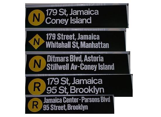
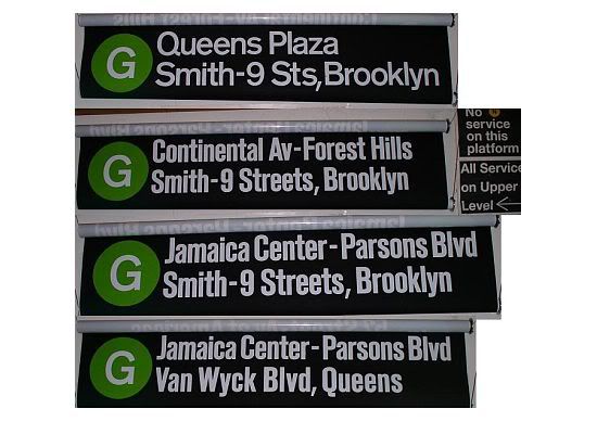
As part of the New York City Transit Authority's proposed service plan to serve the new Archer Avenue Line upper level, the N would have been extended to Jamaica Center during weekdays. When N trains terminated at 71st Avenue or 57th Street–Seventh Avenue during weekends and evenings, G trains would have been extended to Jamaica Center, and during late nights a G train shuttle would have run between Jamaica Center and Van Wyck Boulevard. This service plan would have allowed E and F trains to remain on the Queens Boulevard mainline toward 179th Street. [21] [22] [23] The final service plan, which took effect on December 11, 1988, had the extension served by E trains, with R trains extended to 179th Street. [24]

On May 24, 1987, the N swapped northern terminals with the R. The N was switched to Astoria–Ditmars Boulevard, while the R went to Forest Hills–71st Avenue. [25] :16 This was done to give the R direct access to Jamaica Yard; previously, the N had direct access to both Jamaica Yard and Coney Island Yard, and the R, running from Bay Ridge to Astoria, lacked direct access to any yard. [26] This change was intended to improve the appearance and reliability of service on the R, since all trains on the Astoria and Broadway Lines were part of the graffiti-free program. [25] :16 Trains ran via the Manhattan Bridge during late nights and weekends. Some trains went into service at 86th Street during the AM rush hour put-ins. [19] Between November 23, 1987, and May 13, 1988, one D train arrived at Ditmars Boulevard at 7:12 a.m. and returned in service as an N train. [19]

When the north side of the Manhattan Bridge reopened and the south side was closed on December 11, 1988, the N began running local in Manhattan and via the Montague Tunnel at all times. In order to replace B service [lower-alpha 2] to Ditmars Boulevard, additional N service was provided during rush hours. Trains continued to run express in Brooklyn between Pacific Street and 59th Street/Fourth Avenue evenings and weekends. [28] [29] [19]

On June 11, 1990, trains that were put into service at Queensboro Plaza in the PM rush hour were discontinued. Between June 10, 1990, and July 25, 1992, due to construction work in the 60th Street Tunnel, trains had to use a single track. Trains operated either between Ditmars Boulevard and Canal Street, or between 57th Street and Coney Island. [19]

The Transit Authority and politicians pressured the New York State Department of Transportation to resume N train service on the bridge's south side on September 30, 1990, despite warnings from engineers that the structure was unsafe and major repairs still had to be made. Trains ran express on Broadway in Manhattan (stopping at 49th Street) and Fourth Avenue in Brooklyn at all times except late nights (10 p.m. to 5 a.m.). Southbound Brooklyn expresses ran until late evenings on Saturday, not running on Sunday morning any more. Between early morning and early evenings, trains skipped DeKalb Avenue. Several trains after the AM rush hour went out of service at Kings Highway. [19] On December 27, state inspectors forced N service to be rerouted via the Montague Street Tunnel again after discovery of corroded support beams and missing steel plates, running local on its entire route at all times. [30] [10]

1990–2000

An N train of R68s at Broadway R68 2880 on the N.jpg
An N train of R68s at Broadway
An N train of R68As at 36th Avenue MTA NYC Subway N train arriving at 36th Ave.jpg
An N train of R68As at 36th Avenue

In November 1993, before the Manhattan Bridge's renovation was completed, the MTA proposed restoring express N service along the Fourth Avenue Line for a six-month trial period, with the M making local stops between Pacific Street and 36th Street. Some residents of Sunset Park, Brooklyn, opposed the proposal, which they claimed would negatively impact about 7,000 daily riders at the 45th Street and 53rd Street stations. [31] On May 31, 1994, the N began running express in Brooklyn between Pacific Street and 59th Street–Fourth Avenue during weekday midday and rush hours, with the M running local during those times. [32] [10] [33] From 1994 to May 22, 1995, the southern terminal of the N was 86th Street due to rehabilitation work at Coney Island–Stillwell Avenue. [34] [35] On November 4, 2001, it was cut back again as the terminal's reconstruction project continued. [10]

From April 30, 1995, to November 12, 1995, the north side of the Manhattan Bridge was closed during weekday midday and weekends for structural repairs. Midday N service ran local in Brooklyn, replacing the M, which was cut back from 9th Avenue to Chambers Street. The N continued to run express during rush hours. [36] [37] [38]

2001–2010

After the September 11, 2001, attacks, Broadway Line service through Lower Manhattan was suspended; N service was also suspended and replaced by the W in Manhattan and Queens and the M in Brooklyn. On October 28, N service was restored, but Cortlandt Street remained closed until September 15, 2002. [39]

On September 8, 2002, because of the ongoing reconstruction of Coney Island terminal, weekend and late night N service was reduced to a shuttle between 86th and Pacific Streets, running express on the BMT Fourth Avenue Line. In its place, the W was extended to Manhattan and Astoria, Queens at all times; this was because the W was the only route still serving Stillwell Avenue during this part of the reconstruction. [10] [40] [41]

On February 22, 2004, the Manhattan Bridge work was finally completed. The N returned to its full route in Manhattan and Queens at all times, and returned to using the Manhattan Bridge at all times except nights (via Fourth Avenue express, bypassing DeKalb Avenue). On weekdays, N trains ran express between 34th Street in Manhattan and 59th Street/Fourth Avenue in Brooklyn via the Manhattan Bridge, and local elsewhere; several trains ran express on the entire Broadway Line and short-turned at 57th Street–Seventh Avenue or Times Square during the morning rush hour. On weekends, it made local stops in Manhattan, but ran express in Brooklyn, using the Bridge. During late nights, it ran local along its entire route via the Montague Street Tunnel, replacing the R train. [9] [10] [42] [43]

On May 29, 2005, the new Stillwell Avenue terminal was completed, and N service between 86th Street and Coney Island was restored. [10] [44]

On June 28, 2010, the N began running local in Manhattan north of Canal Street at all times, replacing the W on weekdays which was discontinued due to budget problems, effectively adopting the weekend service pattern. [45] [46] However, the handful of short-turn N trains continued to run express in Manhattan. [47] [48] [49] [50]

2011–present

From August 2, 2013, to September 14, 2014, the Montague Street Tunnel was closed for Hurricane Sandy-related repairs. During this time, overnight N service was rerouted via the Manhattan Bridge, skipping six stations it normally served. [9] [51]

On November 7, 2016, the MTA restored the BMT Broadway Line services to their 2004–2010 service pattern in preparation for the rerouting of the Q train to the Second Avenue Subway. As a result, the N train once again became a weekday express between 34th Street–Herald Square and Canal Street, with local service replaced by the restored W train. [52] [53] [54] The MTA approved the service change on May 23, 2016. [55] [56] All short-turn N trains that originally terminated at 57th Street–Seventh Avenue were extended to 96th Street–Second Avenue on January 3, 2017, following the opening of the Second Avenue Subway. [7] [57] [58] [59]

In January 2017, the MTA revealed plans to rehabilitate the tunnel structure above the BMT Fourth Avenue Line's express tracks between 36th Street and 59th Street. As a result, from July 30, 2018, to July 29, 2019, N trains ran local along that section at all times. [60] [61] [62] [63] Between October 21, 2019, and May 4, 2020, N trains terminated at 86th Street so work could be completed to protect Coney Island Yard from flooding. An out-of-system transfer was available between the N at 86th Street and the F at Avenue X station. [64] [65]

The N began running local in Manhattan in March 2020 after the W was temporarily suspended due to the COVID-19 pandemic; [66] regular N and W service was restored in June. [67] [68] In May 2020, the N began operating local along Fourth Avenue on most weekends to provide a transfer to the F at Fourth Avenue–Ninth Street, since the F was suspended south of Church Avenue due to construction on the IND Culver Line. [69] In 2021, the northbound trips to 96th Street-Second Avenue were officially reclassified as Q trains via Sea Beach; the southbound trips from 96th Street-Second Avenue remained unchanged. [70] In August 2023, midday headways on the N were reduced to eight minutes. [71] [72]

Route

Service pattern

The following table shows the lines used by the N, with shaded boxes indicating the route at the specified times: [73] [5] [6] [74] [75] [8]

LineFromToTracksTimes
rush hoursweek­daysweek­endslate nights
IND Second Avenue Line 96th Street 72nd Street allLimited service
BMT 63rd Street Line (full line) Lexington Avenue–63rd Street all
BMT Astoria Line (full line) Astoria–Ditmars Boulevard Queensboro Plaza localMost trains 
60th Street Tunnel all
BMT Broadway Line (full line) Lexington Avenue/59th Street Times Square–42nd Street local
57th Street–Seventh Avenue expressLimited service   
34th Street–Herald Square Canal Street   
local    
City Hall Whitehall Street–South Ferry all Most trains
Manhattan Bridge south   Very limited service [lower-alpha 1]
Montague Street Tunnel all   Most trains
BMT Fourth Avenue Line Court Street Jay Street–MetroTech all
DeKalb Avenue tunnelLimited service [lower-alpha 3]  
bypassMost trains 
Atlantic Avenue–Barclays Center 59th Street/Fourth Avenue express
localLimited service [lower-alpha 3]   
BMT Sea Beach Line (full line) Eighth Avenue Coney Island–Stillwell Avenue local   

Stations

For a more detailed station listing, see the articles on the lines listed above. [3]

Station service legend
NYCS-SSI-alltimes.svg Stops all times
NYCS-SSI-allexceptnights.svg Stops all times except late nights
NYCS-SSI-nightsonly.svg Stops late nights only
NYCS-SSI-nightsweekends.svg Stops late nights and weekends only
NYCS-SSI-weekdaysonly.svg Stops weekdays during the day
NYCS-SSI-rushpeak.svg Stops rush hours in the peak direction only
NYCS-SSI-closed.svg Station closed
NYCS-SSI-rushonly.svg Stops rush hours only (limited service)
NYCS-SSI-rushreversepeak.svg Stops rush hours in the reverse-peak direction only (limited service)
Time period details
Wheelchair symbol.svg Station is compliant with the Americans with Disabilities Act
Wheelchair symbol.svg  Station is compliant with the Americans with Disabilities Act
in the indicated direction only
Wheelchair symbol.svg  
Aiga elevator.svg Elevator access to mezzanine only
NYCS-bull-trans-N-Std.svg
Ast.
NYCS-bull-trans-N-Std.svg
96th
Stations Wheelchair symbol.svg Subway transfersConnections and notes
Manhattan
Second Avenue Line (limited rush hour service only) [57] [77]
NYCS-SSI-rushonly.svg 96th Street Wheelchair symbol.svg Q   NYCS-SSI-alltimes.svg M15 Select Bus Service
NYCS-SSI-rushonly.svg 86th Street Wheelchair symbol.svg Q   NYCS-SSI-alltimes.svg R   NYCS-SSI-rushpeak.svg M15 Select Bus Service
M86 Select Bus Service
NYCS-SSI-rushonly.svg 72nd Street Wheelchair symbol.svg Q   NYCS-SSI-alltimes.svg R   NYCS-SSI-rushpeak.svg M15 Select Bus Service
63rd Street Line (limited rush hour service only) [77]
NYCS-SSI-rushonly.svg Lexington Avenue–63rd Street Wheelchair symbol.svg F   NYCS-SSI-allexceptnights.svg Q   NYCS-SSI-alltimes.svg R   NYCS-SSI-rushpeak.svg
Out-of-system transfers with MetroCard/OMNY:
4   NYCS-SSI-alltimes.svg 5   NYCS-SSI-allexceptnights.svg 6   NYCS-SSI-alltimes.svg <6> NYCS-SSI-rushpeak.svg (IRT Lexington Avenue Line at 59th Street)
N   NYCS-SSI-alltimes.svg R   NYCS-SSI-allexceptnights.svg W   NYCS-SSI-weekdaysonly.svg (BMT Broadway Line at Lexington Avenue–59th Street)
Queens
Astoria Line
NYCS-SSI-alltimes.svg Astoria–Ditmars Boulevard W   NYCS-SSI-weekdaysonly.svg
NYCS-SSI-alltimes.svg Astoria Boulevard Wheelchair symbol.svg W   NYCS-SSI-weekdaysonly.svg M60 Select Bus Service to LaGuardia Airport
Columbia Transportation: Queens-Riverdale Commuter Route
NYCS-SSI-alltimes.svg 30th Avenue W   NYCS-SSI-weekdaysonly.svg
NYCS-SSI-alltimes.svg Broadway W   NYCS-SSI-weekdaysonly.svg
NYCS-SSI-alltimes.svg 36th Avenue W   NYCS-SSI-weekdaysonly.svg
NYCS-SSI-alltimes.svg 39th Avenue W   NYCS-SSI-weekdaysonly.svg
NYCS-SSI-alltimes.svg Queensboro Plaza W   NYCS-SSI-weekdaysonly.svg
7   NYCS-SSI-alltimes.svg <7> NYCS-SSI-rushpeak.svg (IRT Flushing Line)
Manhattan
Broadway Line
NYCS-SSI-alltimes.svg Lexington Avenue–59th Street R   NYCS-SSI-allexceptnights.svg W   NYCS-SSI-weekdaysonly.svg
4   NYCS-SSI-alltimes.svg 5   NYCS-SSI-allexceptnights.svg 6   NYCS-SSI-alltimes.svg <6> NYCS-SSI-rushpeak.svg (IRT Lexington Avenue Line at 59th Street)
Out-of-system transfer with MetroCard/OMNY:
F   NYCS-SSI-allexceptnights.svg N   NYCS-SSI-rushonly.svg Q   NYCS-SSI-alltimes.svg R   NYCS-SSI-rushpeak.svg (63rd Street Lines at Lexington Avenue–63rd Street)
Roosevelt Island Tramway
NYCS-SSI-alltimes.svg Fifth Avenue–59th Street R   NYCS-SSI-allexceptnights.svg W   NYCS-SSI-weekdaysonly.svg
Services to 96th Street (Manhattan) and Astoria–Ditmars Boulevard (Queens) split
Broadway Line (Astoria and Second Avenue branches merge)
NYCS-SSI-alltimes.svg NYCS-SSI-rushonly.svg 57th Street–Seventh Avenue Wheelchair symbol.svg Q   NYCS-SSI-alltimes.svg R   NYCS-SSI-allexceptnights.svg W   NYCS-SSI-weekdaysonly.svg
NYCS-SSI-alltimes.svg | 49th Street Wheelchair symbol.svg   Q   NYCS-SSI-nightsonly.svg R   NYCS-SSI-allexceptnights.svg W   NYCS-SSI-weekdaysonly.svg Station is ADA-accessible in the northbound direction only.
NYCS-SSI-alltimes.svg NYCS-SSI-rushonly.svg Times Square–42nd Street Wheelchair symbol.svg Q   NYCS-SSI-alltimes.svg R   NYCS-SSI-allexceptnights.svg W   NYCS-SSI-weekdaysonly.svg
1   NYCS-SSI-alltimes.svg 2   NYCS-SSI-alltimes.svg 3   NYCS-SSI-alltimes.svg (IRT Broadway–Seventh Avenue Line)
7   NYCS-SSI-alltimes.svg <7> NYCS-SSI-rushpeak.svg (IRT Flushing Line)
A   NYCS-SSI-alltimes.svg C   NYCS-SSI-allexceptnights.svg E   NYCS-SSI-alltimes.svg (IND Eighth Avenue Line at 42nd Street–Port Authority Bus Terminal)
S   NYCS-SSI-allexceptnights.svg (42nd Street Shuttle)
B   NYCS-SSI-weekdaysonly.svg D   NYCS-SSI-alltimes.svg F   NYCS-SSI-alltimes.svg <F> NYCS-SSI-rushpeak.svg M   NYCS-SSI-weekdaysonly.svg (IND Sixth Avenue Line at 42nd Street–Bryant Park, daytime only)
Port Authority Bus Terminal
M34A Select Bus Service
NYCS-SSI-alltimes.svg NYCS-SSI-rushonly.svg 34th Street–Herald Square Wheelchair symbol.svg Q   NYCS-SSI-alltimes.svg R   NYCS-SSI-allexceptnights.svg W   NYCS-SSI-weekdaysonly.svg
B   NYCS-SSI-weekdaysonly.svg D   NYCS-SSI-alltimes.svg F   NYCS-SSI-alltimes.svg <F> NYCS-SSI-rushpeak.svg M   NYCS-SSI-weekdaysonly.svg (IND Sixth Avenue Line)
M34 / M34A Select Bus Service
PATH at 33rd Street
Amtrak, LIRR, NJ Transit at Pennsylvania Station
NYCS-SSI-nightsweekends.svg | 28th Street Q   NYCS-SSI-nightsonly.svg R   NYCS-SSI-allexceptnights.svg
NYCS-SSI-nightsweekends.svg | 23rd Street Q   NYCS-SSI-nightsonly.svg R   NYCS-SSI-allexceptnights.svg M23 Select Bus Service
NYCS-SSI-alltimes.svg NYCS-SSI-rushonly.svg 14th Street–Union Square Wheelchair symbol.svg Q   NYCS-SSI-alltimes.svg R   NYCS-SSI-allexceptnights.svg W   NYCS-SSI-weekdaysonly.svg
L   NYCS-SSI-alltimes.svg (BMT Canarsie Line)
4   NYCS-SSI-alltimes.svg 5   NYCS-SSI-allexceptnights.svg 6   NYCS-SSI-alltimes.svg <6> NYCS-SSI-rushpeak.svg (IRT Lexington Avenue Line)
M14A / M14D Select Bus Service
NYCS-SSI-nightsweekends.svg | Eighth Street–New York University Q   NYCS-SSI-nightsonly.svg R   NYCS-SSI-allexceptnights.svg
NYCS-SSI-nightsweekends.svg | Prince Street Q   NYCS-SSI-nightsonly.svg R   NYCS-SSI-allexceptnights.svg
Manhattan Bridge branch
NYCS-SSI-allexceptnights.svg NYCS-SSI-rushonly.svg Canal Street Aiga elevator.svg Q   NYCS-SSI-alltimes.svg R   NYCS-SSI-allexceptnights.svg W   NYCS-SSI-weekdaysonly.svg
6   NYCS-SSI-alltimes.svg <6> NYCS-SSI-rushpeak.svg (IRT Lexington Avenue Line)
J   NYCS-SSI-alltimes.svg Z   NYCS-SSI-rushpeak.svg (BMT Nassau Street Line)
Stops on the lower level, under Canal Street.
Lower Manhattan branch (night service only)
NYCS-SSI-nightsonly.svg Canal Street Aiga elevator.svg Q   NYCS-SSI-alltimes.svg
4   NYCS-SSI-nightsonly.svg 6   NYCS-SSI-alltimes.svg (IRT Lexington Avenue Line)
J   NYCS-SSI-alltimes.svg (BMT Nassau Street Line)
Stops on the upper level, under Broadway. [lower-alpha 4]
NYCS-SSI-nightsonly.svg City Hall
NYCS-SSI-nightsonly.svg Cortlandt Street Wheelchair symbol.svg 2   NYCS-SSI-alltimes.svg (IRT Broadway–Seventh Avenue Line at Park Place)
A   NYCS-SSI-alltimes.svg (IND Eighth Avenue Line at Chambers Street)
E   NYCS-SSI-alltimes.svg (IND Eighth Avenue Line at World Trade Center)
PATH at World Trade Center
NYCS-SSI-nightsonly.svg Rector Street
NYCS-SSI-nightsonly.svg Whitehall Street–South Ferry Aiga elevator.svg R   NYCS-SSI-alltimes.svg
1   NYCS-SSI-alltimes.svg (IRT Broadway–Seventh Avenue Line at South Ferry)
Staten Island Ferry at Whitehall Terminal
Brooklyn
Montague Street branch
NYCS-SSI-nightsonly.svg Court Street Aiga elevator.svg R   NYCS-SSI-alltimes.svg
2   NYCS-SSI-alltimes.svg (IRT Broadway–Seventh Avenue Line at Borough Hall)
4   NYCS-SSI-alltimes.svg (IRT Eastern Parkway Line at Borough Hall)
NYCS-SSI-nightsonly.svg Jay Street–MetroTech Wheelchair symbol.svg R   NYCS-SSI-alltimes.svg
A   NYCS-SSI-alltimes.svg F   NYCS-SSI-alltimes.svg (IND Fulton Street and Culver Lines)
Fourth Avenue Line (tunnel and bridge branches merge)
NYCS-SSI-rushreversepeak.svg NYCS-SSI-nightsonly.svg | DeKalb Avenue Wheelchair symbol.svg B   NYCS-SSI-weekdaysonly.svg D   NYCS-SSI-nightsonly.svg Q   NYCS-SSI-alltimes.svg R   NYCS-SSI-alltimes.svg W   NYCS-SSI-rushonly.svg
NYCS-SSI-alltimes.svg NYCS-SSI-rushonly.svg Atlantic Avenue–Barclays Center Wheelchair symbol.svg D   NYCS-SSI-alltimes.svg R   NYCS-SSI-alltimes.svg W   NYCS-SSI-rushonly.svg
B   NYCS-SSI-weekdaysonly.svg Q   NYCS-SSI-alltimes.svg (BMT Brighton Line)
2   NYCS-SSI-alltimes.svg 3   NYCS-SSI-allexceptnights.svg 4   NYCS-SSI-alltimes.svg 5   NYCS-SSI-weekdaysonly.svg (IRT Eastern Parkway Line)
LIRR Atlantic Branch at Atlantic Terminal
NYCS-SSI-rushreversepeak.svg NYCS-SSI-nightsonly.svg | Union Street D   NYCS-SSI-nightsonly.svg R   NYCS-SSI-alltimes.svg W   NYCS-SSI-rushonly.svg
NYCS-SSI-rushreversepeak.svg NYCS-SSI-nightsonly.svg | Ninth Street D   NYCS-SSI-nightsonly.svg R   NYCS-SSI-alltimes.svg W   NYCS-SSI-rushonly.svg
F   NYCS-SSI-alltimes.svg G   NYCS-SSI-alltimes.svg (IND Culver Line at Fourth Avenue)
NYCS-SSI-rushreversepeak.svg NYCS-SSI-nightsonly.svg | Prospect Avenue D   NYCS-SSI-nightsonly.svg R   NYCS-SSI-alltimes.svg W   NYCS-SSI-rushonly.svg
NYCS-SSI-rushreversepeak.svg NYCS-SSI-nightsonly.svg | 25th Street D   NYCS-SSI-nightsonly.svg R   NYCS-SSI-alltimes.svg W   NYCS-SSI-rushonly.svg
NYCS-SSI-alltimes.svg NYCS-SSI-rushonly.svg 36th Street D   NYCS-SSI-alltimes.svg R   NYCS-SSI-alltimes.svg W   NYCS-SSI-rushonly.svg
NYCS-SSI-rushreversepeak.svg NYCS-SSI-nightsonly.svg | 45th Street R   NYCS-SSI-alltimes.svg W   NYCS-SSI-rushonly.svg
NYCS-SSI-rushreversepeak.svg NYCS-SSI-nightsonly.svg | 53rd Street R   NYCS-SSI-alltimes.svg W   NYCS-SSI-rushonly.svg
NYCS-SSI-alltimes.svg NYCS-SSI-rushonly.svg 59th Street Wheelchair symbol.svg R   NYCS-SSI-alltimes.svg W   NYCS-SSI-rushonly.svg
Sea Beach Line
NYCS-SSI-alltimes.svg NYCS-SSI-rushonly.svg Eighth Avenue Wheelchair symbol.svg W   NYCS-SSI-rushonly.svg
NYCS-SSI-alltimes.svg NYCS-SSI-rushonly.svg Fort Hamilton Parkway W   NYCS-SSI-rushonly.svg
NYCS-SSI-alltimes.svg NYCS-SSI-rushonly.svg New Utrecht Avenue Wheelchair symbol.svg W   NYCS-SSI-rushonly.svg
D   NYCS-SSI-alltimes.svg (BMT West End Line at 62nd Street)
NYCS-SSI-alltimes.svg NYCS-SSI-rushonly.svg 18th Avenue W   NYCS-SSI-rushonly.svg
NYCS-SSI-alltimes.svg NYCS-SSI-rushonly.svg 20th Avenue W   NYCS-SSI-rushonly.svg
NYCS-SSI-alltimes.svg NYCS-SSI-rushonly.svg Bay Parkway W   NYCS-SSI-rushonly.svg
NYCS-SSI-alltimes.svg NYCS-SSI-rushonly.svg Kings Highway W   NYCS-SSI-rushonly.svg B82 Select Bus Service
NYCS-SSI-alltimes.svg NYCS-SSI-rushonly.svg Avenue U W   NYCS-SSI-rushonly.svg
NYCS-SSI-alltimes.svg NYCS-SSI-rushonly.svg 86th Street W   NYCS-SSI-rushonly.svg Southern terminal for select rush-hour trains [lower-alpha 5]
NYCS-SSI-alltimes.svg NYCS-SSI-rushonly.svg Coney Island–Stillwell Avenue Wheelchair symbol.svg D   NYCS-SSI-alltimes.svg (BMT West End Line)
F   NYCS-SSI-alltimes.svg <F> NYCS-SSI-rushpeak.svg (IND Culver Line)
Q   NYCS-SSI-alltimes.svg (BMT Brighton Line)

Notes

  1. 1 2 One late-night N train travels north via the Manhattan Bridge instead, making local stops above Canal Street. [8]
  2. Due to construction on the Manhattan Bridge, the B had been split into two services in 1986: the "orange B" on the Sixth Avenue Line from Herald Square to the Bronx, and the "yellow B" on the Broadway Line from Brooklyn to Ditmars Boulevard. [27]
  3. 1 2 Select rush-hour N trains in the reverse-peak direction provide regular express service in Manhattan but stop at DeKalb Avenue and operate local on the Fourth Avenue Line in Brooklyn. [74] [75] Only one N train with this service pattern provides peak-direction service, roughly an hour before the a.m. rush begins. [76]
  4. One late-night N train via the Manhattan Bridge stops on the lower level. [8]
  5. Eight trains in the a.m. rush and two trains in the p.m. rush originate from this station; two trains in the a.m. rush terminate here.

Related Research Articles

<span class="mw-page-title-main">4 (New York City Subway service)</span> New York City Subway service

The 4 Lexington Avenue Express is a rapid transit service in the A Division of the New York City Subway in New York City, United States. Its route emblem, or "bullet", is colored forest green since it uses the IRT Lexington Avenue Line in Manhattan.

<span class="mw-page-title-main">Q (New York City Subway service)</span> New York City Subway service

The Q Second Avenue/Broadway Express/Brighton Local is a rapid transit service in the B Division of the New York City Subway. Its route emblem, or "bullet", is colored yellow since it is a part of the BMT Broadway Line in Manhattan.

The BMT Brighton Line, also known as the Brighton Beach Line, is a rapid transit line in the B Division of the New York City Subway in Brooklyn, New York City, United States. Local service is provided at all times by the Q train, but is joined by the B express train on weekdays. The Q train runs the length of the entire line from Coney Island–Stillwell Avenue to the Manhattan Bridge south tracks. The B begins at Brighton Beach and runs via the bridge's north tracks.

<span class="mw-page-title-main">J/Z (New York City Subway service)</span> New York City Subway services

The J Nassau Street Local and Z Nassau Street Express are two rapid transit services in the B Division of the New York City Subway. Their route emblems, or "bullets", are colored brown since they use the BMT Nassau Street Line in Lower Manhattan.

<span class="mw-page-title-main">W (New York City Subway service)</span> New York City Subway service

The W Broadway Local is a rapid transit service of the New York City Subway's B Division. Its route emblem, or "bullet", is colored yellow since it uses the BMT Broadway Line in Manhattan.

The BMT West End Line is a line of the New York City Subway, serving the Brooklyn communities of Sunset Park, Borough Park, New Utrecht, Bensonhurst, Bath Beach and Coney Island. The D train operates local on the entire line at all times. Although there is a center express track and three express stations along the line, there is no regular express service.

<span class="mw-page-title-main">B (New York City Subway service)</span> New York City Subway service

The B Sixth Avenue Express is a rapid transit service in the B Division of the New York City Subway. Its route emblem, or "bullet", is colored orange, since it uses the IND Sixth Avenue Line in Manhattan.

<span class="mw-page-title-main">Chrystie Street Connection</span> New York City Subway track connections

The Chrystie Street Connection is a set of New York City Subway tunnels running the length of Chrystie Street on the Lower East Side of Manhattan. It is one of the few track connections between lines of the former Brooklyn–Manhattan Transit Corporation (BMT) and Independent Subway System (IND) divisions, which together constitute the system's B Division. A major branch of the IND Sixth Avenue Line, it connects the Sixth Avenue Line to the BMT Brighton Line and BMT Fourth Avenue Line via the north side of the Manhattan Bridge and to the BMT Jamaica Line over the Williamsburg Bridge. The project, opened in 1967 and 1968, also includes the Sixth Avenue Line's Grand Street and 57th Street stations, the latter of which is not part of the connection itself.

<span class="mw-page-title-main">New York City Subway nomenclature</span> Terminology of the New York City Subway

New York City Subway nomenclature is the terminology used in the New York City Subway system as derived from railroading practice, historical origins of the system, and engineering, publicity, and legal usage. Important terms include lines, or individual sections of subway, like the BMT Brighton Line; services, like the B, which is a single train route along several lines; and stations, such as Coney Island–Stillwell Avenue, which connects multiple lines and services.

<span class="mw-page-title-main">R (New York City Subway service)</span> New York City Subway service

The R Broadway Local is a rapid transit service in the B Division of the New York City Subway. Its route emblem, or "bullet", is colored yellow since it uses the BMT Broadway Line in Manhattan.

The IND Culver Line is a rapid transit line of the B Division of the New York City Subway, extending from Downtown Brooklyn south to Coney Island, Brooklyn, New York City, United States. The local tracks of the Culver Line are served by the F service, as well as the G between Bergen Street and Church Avenue. The express tracks north of Church Avenue are used by the <F> train during rush hours in the peak direction. The peak-direction express track between Ditmas Avenue and Avenue X has not seen regular service since 1987.

<span class="mw-page-title-main">D (New York City Subway service)</span> New York City Subway service

The D Sixth Avenue Express is a rapid transit service in the B Division of the New York City Subway. Its route emblem, or "bullet", is colored orange, since it uses the IND Sixth Avenue Line in Manhattan.

<span class="mw-page-title-main">F (New York City Subway service)</span> New York City Subway service

The F and <F> Queens Boulevard Express/Sixth Avenue Local are two rapid transit services in the B Division of the New York City Subway. Their route bullets are colored orange, since they use and are part of the IND Sixth Avenue Line in Manhattan.

<span class="mw-page-title-main">M (New York City Subway service)</span> New York City Subway service

The M Sixth Avenue Local is a rapid transit service in the B Division of the New York City Subway. Its route emblem, or "bullet", is colored orange since it uses the IND Sixth Avenue Line in Manhattan.

The T Second Avenue Local is a prospective rapid transit service in the B Division of the New York City Subway. It is proposed to run on the Second Avenue Subway in Manhattan and its route symbol will be turquoise.

The BMT Sea Beach Line is a rapid transit line of the BMT division of the New York City Subway, connecting the BMT Fourth Avenue Line at 59th Street via a four-track wide open cut to Coney Island in Brooklyn. It has at times hosted the fastest express service between Manhattan and Coney Island, since there are no express stations along the entire stretch, but now carries only local trains on the N service, which serves the entire line at all times. During rush hours, several W trains serve the line north of 86th Street.

<span class="mw-page-title-main">Culver Shuttle</span> New York City Subway service

The Culver Shuttle was a New York City Subway shuttle, running along a remnant of the BMT Culver Line, most of which is now the IND Culver Line. The shuttle was originally part of the Brooklyn-Manhattan Transit Corporation (BMT)'s 5 service, providing through service on the Culver Line between Coney Island and Manhattan. The F train is the current successor to Culver Line service. The line had 1,000 riders a day during its final month of service in 1975.

<span class="mw-page-title-main">Eighth Street–New York University station</span> New York City Subway station in Manhattan

The Eighth Street–New York University station is a local station on the New York City Subway's BMT Broadway Line. Located at the intersection of Eighth Street and Broadway in Greenwich Village, Manhattan, it is served by the R train at all times except late nights, the W train on weekdays, the N train during late nights and weekends, and the Q train during late nights. It serves the main campus of New York University.

<span class="mw-page-title-main">28th Street station (BMT Broadway Line)</span> New York City Subway station in Manhattan

The 28th Street station is a local station on the BMT Broadway Line of the New York City Subway, located at 28th Street and Broadway in Manhattan. It is served by the R train at all times except late nights, the W train on weekdays, the N train during late nights and weekends and the Q train during late nights.

<span class="mw-page-title-main">62nd Street/New Utrecht Avenue station</span> New York City Subway station complex in Brooklyn

The 62nd Street/New Utrecht Avenue station is a New York City Subway station complex shared by the open-cut BMT Sea Beach Line and the elevated BMT West End Line. It is located at New Utrecht Avenue and 62nd Street in Borough Park and Bensonhurst, Brooklyn, and is served by the D and N trains at all times. During rush hours, several W trains also serve this station.

References

  1. 'Subdivision 'B' Car Assignment Effective December 19, 2021'. New York City Transit, Operations Planning. December 17, 2021.
  2. "Subdivision 'B' Car Assignments: Cars Required November 1, 2021" (PDF). The Bulletin. Electric Railroaders' Association. 64 (12): 3. December 2021. Retrieved December 3, 2021.
  3. 1 2 3 "NSubway Timetable, Effective August 28, 2023". Metropolitan Transportation Authority . Retrieved August 26, 2023.
  4. "mta.info – Line Colors". mta.info. Metropolitan Transportation Authority. Retrieved October 30, 2016.
  5. 1 2 "8:45 AM – 9:47 AM Coney Island-Stillwell Av – OpenMobilityData". transitfeeds.com. July 29, 2021. Archived from the original on July 29, 2021. Retrieved July 29, 2021.
  6. 1 2 "7:36 AM – 8:40 AM 96 St – OpenMobilityData". transitfeeds.com. July 19, 2021. Archived from the original on July 19, 2021. Retrieved July 19, 2021.
  7. 1 2 "SUB-DIVISION B TRAIN OPERATOR/CONDUCTOR ROAD & NON-ROAD WORK PROGRAMS IN EFFECT: NOVEMBER 6, 2016" (PDF). progressiveaction.info. New York City Transit. July 29, 2016. Retrieved August 19, 2016.
  8. 1 2 3 "10:18 PM – 11:37 PM Astoria-Ditmars Blvd – OpenMobilityData". transitfeeds.com. August 7, 2021. Archived from the original on August 7, 2021. Retrieved August 7, 2021.
  9. 1 2 3 4 5 6 Korman, Joseph D. "SUBWAY LINE NAMES". www.thejoekorner.com. Retrieved October 23, 2016.
  10. 1 2 3 4 5 6 7 8 9 10 11 12 Bolden, Eric. "NYCT Line by Line History". erictb.info. Retrieved October 30, 2016.
  11. "Two Anniversaries–Sea Beach and Steinway Tunnel". New York Division Bulletin. New York Division, Electric Railroaders' Association. 58 (8). August 2015. Retrieved August 31, 2016 via Issu.
  12. 1 2 3 4 5 6 7 8 9 10 "Sea Beach Line" (PDF). New York Division Bulletin. Electric Railroaders' Association. 44 (3): 2–3, 17. March 2001.
  13. "OPEN FIRST SECTION OF BROADWAY LINE; Train Carrying 1,000 Passengers Runs from Fourteenth Street to Coney Island. REGULAR SERVICE BEGINS New Road Is Expected to Relieve Old System of 15,000 Persons Daily in Rush Hours. Service Commissioners Jubliant. Schedule Not Fully Arranged". The New York Times. September 5, 1917. ISSN   0362-4331 . Retrieved November 5, 2016.
  14. service notice, effective November 27, 1967. Archived from the original on September 24, 2020.
  15. service notice, effective April 15, 1968. Archived from the original on November 20, 2019.
  16. "Service Adjustment on BMT and IND Lines Effective 1 A.M. Monday, Aug. 30". Flickr. New York City Transit Authority. August 1976. Retrieved October 23, 2016.
  17. Cosgrove, Vincent (January 28, 1977). "Straphangers: Mini-Train Idea Comes Up Short". New York Daily News. Retrieved December 27, 2021.
  18. "Service Adjustments on the BMT and IND Lines Effective Midnight, Saturday, August 27 New York City Transit Authority (1977)". Flickr – Photo Sharing!. New York City Transit Authority. August 1977. Retrieved June 9, 2016.
  19. 1 2 3 4 5 6 7 8 Linder, Bernard (April 2001). "Sea Beach Line Schedule Changes" (PDF). New York Division Bulletin. Electric Railroaders' Association. 44 (4): 2–4.
  20. "If You Ride These Subway Lines, You Know Something Drastic Has To Be Done". TheJoeKorNer.com. New York City Transit Authority. 1986. Retrieved October 30, 2016.
  21. "R46 Subway Car Rollsign". Photobucket. Metropolitan Transportation Authority. Retrieved September 8, 2019.
  22. "R46 Subway Car Rollsign". Photobucket. Metropolitan Transportation Authority. Retrieved September 8, 2019.
  23. "A view of the western car dropoff/pickup area. A sign outlining the proposed services following the opening of the Archer Avenue Subway can be seen – N trains, which served the Queens Boulevard Line until 1987, would have run to Jamaica Center, along with the G, which served the Queens Boulevard Line until 2010. In addition, a sealed passage to the northwestern of Union Turnpike upper level and Queens Boulevard can be made out by the arched ceiling to the right of the subway sign". indsecondsystem.weebly.com. March 8, 2020. Retrieved March 13, 2020.
  24. Polsky, Carol (December 11, 1988). "New Subway Line Finally Rolling Through Queens". Newsday.
  25. 1 2 Annual Report on ... Rapid Routes Schedules and Service Planning. New York City Transit Authority. 1989.
  26. "Announcing Service Changes On The N and R Routes Beginning May 24, 1987 New Routes Mean Better Service". subwaynut.com. New York City Transit Authority. May 1987. Retrieved August 31, 2016.
  27. Washington Heights, Central Park West And Grand Concourse Riders Your Guide To Service Changes On The B D During Rehabilitation Work April 26 Through October 26, 1986. New York City Transit Authority. April 1986.
  28. "System-Wide Changes In Subway Service Effective Sunday, December 11, 1988". Flickr. New York City Transit Authority. 1988. Retrieved October 30, 2016.
  29. Johnson, Kirk (December 9, 1988). "Big Changes For Subways Are to Begin". The New York Times. ISSN   0362-4331 . Retrieved October 30, 2016.
  30. "Service Changes September 30, 1990" (PDF). subwaynut.com. New York City Transit Authority. September 30, 1990. Retrieved May 1, 2016.
  31. Holloway, Lynette (November 14, 1993). "Neighborhood Report: Sunset Park; Subway Express Battle". The New York Times. ISSN   0362-4331 . Retrieved September 30, 2022.
  32. A customer timetable for New York City Subway Services on the N Train. New York City Transit. May 29, 1994.
  33. "May 1994 Subway Map". Flickr. New York City Transit. May 1994. Retrieved October 7, 2018.
  34. Archived 26 December 2022 at the Wayback Machine [ dead link ]
  35. Special timetable for New York City subway services on the N train; Service between the Kings Hwy and Stillwell Av/Coney Island stations in Brooklyn. New York City Transit. May 22, 1995.
  36. A customer timetable for New York City subway services on the N Train; Includes Manhattan Bridge Service Information. New York City Transit. April 30, 1995.
  37. A customer timetable for New York City subway services on the N Train. New York City Transit. November 12, 1995.
  38. Sullivan, Ronald (March 26, 1995). "Bridge Repairs to Disrupt Off-Peak Subway Service". The New York Times. Retrieved October 4, 2018.
  39. Korman, Joseph D. "Subway Line Names World Trade Center Terror – 9-11-2001". www.thejoekorner.com. Retrieved October 23, 2016.
  40. N Train Timetable. New York City Transit. September 2002.
  41. "F N W Q Q Changes Sun, Sept 8, 2002 to Spring 2004 Reconstruction of Stillwell Avenue Terminal changes service in Brooklyn, Manhattan and Queens". The Subway Nut. New York City Transit. July 2002. Retrieved August 5, 2010.
  42. "B D M N Q R W Weekday Service Manhattan Bridge Map" (PDF). mta.info. Metropolitan Transportation Authority. February 2004. Archived from the original (PDF) on February 5, 2004. Retrieved September 18, 2016.
  43. "MTA NYC Transit Manhattan Bridge Information". mta.info. Metropolitan Transportation Authority. February 5, 2004. Archived from the original on February 5, 2004. Retrieved September 18, 2016.
  44. "Noteworthy – N restored to Coney Island". mta.info. Metropolitan Transportation Authority. May 7, 2005. Archived from the original on May 7, 2005. Retrieved September 18, 2016.
  45. "MTA | Press Release | NYC Transit | Major Subway Changes Set for Monday". www.mta.info. Metropolitan Transportation Authority. June 24, 2010. Retrieved October 20, 2016.
  46. "Evaluation of 2010 Service Reductions" (PDF). mta.info. New York City Transit. September 23, 2011. Retrieved October 20, 2016.
  47. "N train timetable 6:41 Coney Island". boreumhillscott.com. June 2016. Archived from the original on September 21, 2016. Retrieved November 6, 2016.
  48. "N train timetable 7:47 86th Street". boreumhillscott.com. June 2016. Archived from the original on November 7, 2016. Retrieved November 6, 2016.
  49. "N train timetable 8:06 Coney Island". boreumhillscott.com. June 2016. Archived from the original on November 7, 2016. Retrieved November 6, 2016.
  50. "N train timetable 8:27 Coney Island". boreumhillscott.com. June 2016. Archived from the original on November 7, 2016. Retrieved November 6, 2016.
  51. "R Train To Resume Service Between Brooklyn And Manhattan Monday". cbslocal.com. CBS Local Media. September 24, 2014. Retrieved October 30, 2016.
  52. Kabak, Benjamin (February 19, 2016). "Ahead of 2nd Ave. Subway opening, MTA officially set to restore W service to Astoria". Second Ave. Sagas. Retrieved February 19, 2016.
  53. Martinez, Jose (February 19, 2016). "MTA Confirms W Train is Coming Back". TWC News NY1. Retrieved February 19, 2016.
  54. Venugopal, Nikhita (May 25, 2016). "W Train's Return Is Now Official With Approval From MTA Board". DNAinfo New York. Archived from the original on August 5, 2016. Retrieved May 26, 2016.
  55. Lam, Katherine (October 23, 2016). "MTA flyers spotted for W train's return in November". PIX11. Retrieved October 24, 2016.
  56. 1 2 "NSubway Timetable, Effective August 28, 2023". Metropolitan Transportation Authority . Retrieved August 26, 2023.
  57. Siff, Andrew (December 19, 2016). "2nd Avenue Subway Service to Begin New Year's Day: Gov. Cuomo". NBC New York. NBC Universal Media. Retrieved December 19, 2016.
  58. Rivoli, Dan; Sandoval, Edgar; Greene, Leonard (December 18, 2016). "Cuomo promises Second Ave. subway will open Jan. 1". NY Daily News. Retrieved December 19, 2016.
  59. "MTA Reveals Plans to Shut Down Part of N Subway Tunnel in Brooklyn Next Year". TWC News. January 21, 2017. Retrieved January 22, 2017.
  60. Spivack, Caroline (January 20, 2017). "Express N tunnel will shut for one year of emergency repairs". Brooklyn Paper. Retrieved January 22, 2017.
  61. Gordon, Aaron (July 30, 2019). "Monday Morning's Subway Mess Was Caused by an MTA Typo". The Village Voice. Retrieved July 11, 2019.
  62. "Planned Service Changes for: Monday, July 29, 2019". mta.info. July 2019. Archived from the original on July 11, 2019. Retrieved July 11, 2019.
  63. "Preparing for Climate Change: Protecting the Coney Island Yard". mta.info. Metropolitan Transportation Authority. September 16, 2019. Retrieved September 17, 2019.
  64. "N Line – Planned Service Change Update". mymtaalerts.com. Metropolitan Transportation Authority. May 4, 2020. Retrieved May 5, 2020.
  65. Guse, Clayton (March 24, 2020). "Coronavirus forces MTA to implement big cuts to NYC's mass transit". nydailynews.com. Retrieved June 9, 2020.
  66. Bascome, Erik (June 2, 2020). "Full service on MTA buses, subways set to return by June 8". silive. Retrieved June 8, 2020.
  67. Siff, Andrew (June 5, 2020). "MTA Resumes Regular Weekday Service; Overnight 4-Hour Closure Stays". NBC New York. Retrieved June 8, 2020.
  68. "Culver Line Signal Modernization: Alternate Service Options". mta.info. Metropolitan Transportation Authority. February 27, 2020. Retrieved February 28, 2020.
  69. "Subway Timetable New York City Transit". Metropolitan Transportation Authority.
  70. Simko-Bednarski, Evan (August 22, 2023). "MTA adding more N, R trains on NYC subway starting Monday". New York Daily News. Retrieved August 31, 2023.
  71. "MTA expanding service on N and R trains; no more 'rarely' or 'never' trains, officials say". ABC7 New York. August 22, 2023. Retrieved August 31, 2023.
  72. "Subway Service Guide" (PDF). Metropolitan Transportation Authority. September 2019. Retrieved September 22, 2019.
  73. 1 2 "6:07 AM – 7:23 AM Coney Island-Stillwell Av – OpenMobilityData". transitfeeds.com. August 7, 2021. Archived from the original on August 7, 2021. Retrieved August 7, 2021.
  74. 1 2 "9:22 PM – 10:39 PM Astoria-Ditmars Blvd – OpenMobilityData". transitfeeds.com. August 7, 2021. Archived from the original on August 7, 2021. Retrieved August 7, 2021.
  75. "5:19 AM – 6:35 AM Astoria-Ditmars Blvd – OpenMobilityData". transitfeeds.com. August 7, 2021. Archived from the original on August 8, 2021. Retrieved August 7, 2021.
  76. 1 2 "GTFS Schedule Data – New York City Transit Subway" (ZIP). New York, NY: Metropolitan Transportation Authority. May 13, 2011. Retrieved June 1, 2011.