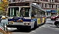
M34 and M34A buses

Last updated

m34, m34a
34th Street Crosstown Line
NYC Transit logo.svg
34th St 5th 6th Avs Mid 18.jpg
An eastbound M34A bus with Select Bus Service livery
Overview
System MTA Regional Bus Operations
Operator New York City Transit Authority
Garage Michael J. Quill Depot
Vehicle Nova Bus LFS articulated
New Flyer Xcelsior XD60
New Flyer Xcelsior XE60
Livery Select Bus Service
Route
Locale Manhattan, New York, U.S.
Communities served Hudson Yards, Hell's Kitchen, Midtown, Murray Hill, Kips Bay, Waterside Plaza
StartM34: 34th Street and 12th Avenue
M34A: 43rd Street and 8th Avenue
Via 34th Street
EndM34: FDR Drive and 35th Street
M34A: Waterside Plaza
LengthM34: 2 miles (3.2 km)
M34A: 2.5 miles (4.0 km)
Service
Operates5 a.m. (weekdays) or 6:30 a.m. (weekends) to 12:30 a.m. [1]
Ridership2,596,788 (2022) [2]
TransfersYes
Timetable M34/M34A SBS
  M31
M23 SBS (by borough)
M23 SBS (by route number)
 {{{system_nav}}}  M35
Bx41 SBS
M60 SBS  

The 34th Street Crosstown Line is a surface transit line on 34th Street in Manhattan, New York City, United States. It currently hosts the M34/M34A SBS routes of MTA's Regional Bus Operations. The M34 runs from 12th Avenue to FDR Drive via 34th Street, while the M34A runs from Port Authority Bus Terminal to Waterside Plaza.

Route

For most of its length, the M34 uses 34th Street to travel crosstown. There is a one-block stretch of the westbound route, between 11th and 12th Avenues, that runs along 33rd Street; this is because the M34 needs to terminate along the northbound West Side Highway. [1] [3] At its eastern end, the M34 turns north onto the service road under FDR Drive to terminate at the East 34th Street Ferry Landing, which requires the M34 to make a U-turn at 35th Street and down southbound FDR Drive for one block. [1] [3]

The M34A uses a different route than the M34 at its western and eastern ends. It travels along Eighth Avenue northbound and Ninth Avenue southbound between 34th Street and 43rd Street (using 43rd Street to terminate westbound), thereby serving the Port Authority Bus Terminal. [1] [3] It also uses Second Avenue southbound and the FDR Drive service road northbound between 23rd Street and 34th Street in order to serve its Waterside Plaza terminus as well as Peter Cooper Village. The eastbound segment of the M34A between Second Avenue and FDR Drive uses 23rd Street. [1] [3]

Stops

Station
Street traveled
RouteDirectionConnections
M34 only
Twelfth Avenue
West 34th Street
M34Westbound terminal,
Eastbound stop
NYC Bus: M12 (northbound only)
Eleventh Avenue / Javits Center
West 34th Street
BidirectionalNYC Bus: M12 (southbound only)
NYC Subway: NYCS-bull-trans-7-Std.svg NYCS-bull-trans-7d-Std.svg trains at 34th Street–Hudson Yards
Hudson Park Boulevard
West 34th Street
Westbound
Tenth Avenue
West 34th Street
EastboundNYC Bus: M11 (northbound only)
Dyer Avenue
West 34th Street
Westbound
M34A only
43rd Street / Port Authority Bus Terminal
Eighth Avenue
M34AWestbound terminalNYC Bus: M20, M104 (all buses northbound only); (M42 at 42nd St)
Port Authority Bus Terminal
NYC Subway: NYCS-bull-trans-1-Std.svg NYCS-bull-trans-2-Std.svg NYCS-bull-trans-3-Std.svg NYCS-bull-trans-7-Std.svg NYCS-bull-trans-7d-Std.svg NYCS-bull-trans-A-Std.svg NYCS-bull-trans-C-Std.svg NYCS-bull-trans-E-Std.svg NYCS-bull-trans-N-Std.svg NYCS-bull-trans-Q-Std.svg NYCS-bull-trans-R-Std.svg NYCS-bull-trans-W-Std.svg NYCS-bull-trans-S-Std.svg trains at Times Square–42nd Street/Port Authority Bus Terminal
42nd Street
Ninth Avenue
Eastbound stationNYC Bus: M11 (southbound only); M42
40th Street
Eighth Avenue
WestboundNYC Bus: M20, M104 (all buses northbound only); (M42 at 42nd St)
Port Authority Bus Terminal
NYC Subway: NYCS-bull-trans-1-Std.svg NYCS-bull-trans-2-Std.svg NYCS-bull-trans-3-Std.svg NYCS-bull-trans-7-Std.svg NYCS-bull-trans-7d-Std.svg NYCS-bull-trans-A-Std.svg NYCS-bull-trans-C-Std.svg NYCS-bull-trans-E-Std.svg NYCS-bull-trans-N-Std.svg NYCS-bull-trans-Q-Std.svg NYCS-bull-trans-R-Std.svg NYCS-bull-trans-W-Std.svg NYCS-bull-trans-S-Std.svg trains at Times Square–42nd Street/Port Authority Bus Terminal
39th Street
Ninth Avenue
EastboundNYC Bus: M11 (southbound only)
37th Street
Eighth Avenue
WestboundNYC Bus: M20, M104 (all buses northbound only)
Common Stops
Ninth Avenue
West 34th Street
Both routes (EB)
M34 (WB)
BidirectionalNYC Bus: M11 (southbound only)
Eighth Avenue / Penn Station  / MSG
West 34th Street
Both routesNYC Bus: M20 (northbound only)
NYC Subway: NYCS-bull-trans-A-Std.svg NYCS-bull-trans-C-Std.svg NYCS-bull-trans-E-Std.svg trains at 34th Street–Penn Station
Penn Station: Amtrak, LIRR and NJ Transit
Seventh Avenue / Penn Station  / MSG
West 34th Street
NYC Bus: M7, M20 (all buses southbound only)
NYC Subway: NYCS-bull-trans-1-Std.svg NYCS-bull-trans-2-Std.svg NYCS-bull-trans-3-Std.svg trains at 34th Street–Penn Station
Penn Station: Amtrak, LIRR and NJ Transit
Sixth Avenue / Broadway / Herald Square
West 34th Street
NYC Bus: M5, M7, M55 (all buses northbound only)
NYC Subway: NYCS-bull-trans-B-Std.svg NYCS-bull-trans-D-Std.svg NYCS-bull-trans-F-Std.svg NYCS-bull-trans-Fd-Std.svg NYCS-bull-trans-M-Std.svg NYCS-bull-trans-N-Std.svg NYCS-bull-trans-Q-Std.svg NYCS-bull-trans-R-Std.svg NYCS-bull-trans-W-Std.svg trains at 34th Street–Herald Square
PATH: HOB – 33, JSQ – 33, JSQ – 33 (via HOB) trains at 33rd Street
Fifth Avenue / Empire State Building
East 34th Street
NYC Bus: M1, M2, M3, M4, M5, M55, Q32 (all buses southbound only)
Park Avenue
East 34th Street
NYC Bus: M1, M2, M3, M4, Q32 (all buses northbound only) at Madison Avenue
NYC Subway: NYCS-bull-trans-6-Std.svg NYCS-bull-trans-6d-Std.svg train at 33rd Street
NYC Bus: M101, M102, M103 (all buses southbound only) at Lexington Avenue
Third Avenue
East 34th Street
NYC Bus: M101, M102, M103 (all buses northbound only)
Second Avenue
East 34th Street
NYC Bus: M15, M15 SBS (all buses southbound only)
First Avenue
East 34th Street
Both routes westbound
M34 eastbound
NYC Bus: M15, M15 SBS (all buses northbound only)
29th Street
FDR Drive
Both routesWestbound
28th Street
Second Avenue
EastboundNYC Bus: M9, M15, M15 SBS (all buses southbound only)
Waterside Plaza
25th Street
Eastbound terminus,
Westbound stop
23rd Street
Second Avenue
EastboundNYC Bus: M9, M15, M15 SBS (all buses southbound only); M23 SBS
First Avenue
VA Hospital
NYC Bus: M15, M15 SBS (all buses northbound only); M9, M23 SBS
Avenue C
23rd Street
M34 only
Marginal Street
East River Ferry Terminal
M34Eastbound terminal,
Westbound stop
NY Waterway: East River Ferry

History

The 34th Street Crosstown Line as a streetcar at Broadway in the early 20th Century. Traffic stopped, 34th & Broadway LCCN2014699928.jpg
The 34th Street Crosstown Line as a streetcar at Broadway in the early 20th Century.

Streetcar line

The Thirty-Fourth Street Crosstown Railway was chartered on March 18, 1896, being a consolidation of the Thirty-Fourth Street Railroad Company and the Thirty-Fourth Street Ferry & Eleventh Avenue Railroad. The stock of the company was owned by the Metropolitan Street Railway. The streetcar line was previously a horsecar line, and in July 1900 the line began running via storage batteries, but in September 1903 it was changed to using an underground third rail. [4]

Local bus service

New York City Omnibus Corporation bus route (M19 - 16) replaced New York Railways' 34th Street Crosstown Line streetcar on April 1, 1936. [5] [6] [7]

On July 14, 1965, the directors of the Manhattan and Bronx Surface Transit Operating Authority passed a resolution approving the extension of the route from the terminal of the route at First Avenue and East 34th Street to First Avenue and East 27th Street to serve Bellevue Hospital during late evenings. Buses would run via 34th Street, FDR Drive Service Road, East 25th Street, and First Avenue. [8] [9]

In January 1970, the United States Department of Transportation initiated the Urban Corridor Demonstration Program to test transportation demand management strategies to reduce traffic congestion on radial corridors in large urban areas. Grants were awarded to eleven metropolitan areas to conduct detailed planning for projects in July 1970, and projects in eight of them, including New York, were selected. The New York program would consist of eight projects, including traffic system management of New Jersey Route 3, a study of automatic vehicle identification, joint-use park and ride facilities, a contraflow bus lane along Interstate 495, and the rerouting of portions of two crosstown bus routes in midtown Manhattan with low ridership to better connect high-density job areas with the Port Authority Bus Terminal by eliminating transfers. [10] [11] :7,14 [12] :14 The first of the two bus reroutings was the rerouting of half of M3 49th/50th Street crosstown buses to the bus terminal in October 1971. The second was the rerouting on June 26, 1972, of some westbound M16 buses from 10th Avenue to 8th Avenue to improve access to the Port Authority Bus Terminal from the east side of Manhattan afternoon. [13]

This new branch of the M16 would run on weekdays between 7 a.m. and 11 p.m.. Eastbound buses would start at 12th Avenue and 42nd Street, head east on 42nd Street, south on Ninth Avenue, and east on 34th Street to First Avenue. Buses would return in westbound service, running north on First Avenue, west on 37th Street, south on Second Avenue, west on 34th Street, north on Eighth Avenue, west on 43rd Street, and south on 12th Avenue to the terminal at 42nd Street. [14] [15] By 1975, the reroute of the M16 branch and the addition of two bus trips increased operating costs, though the tripling of ridership on the Eighth Avenue segment of the route, increasing by 1,300, outweighing the increased costs. [11] :15 [12] :15

In 1974, buses were extended to serve the new Waterside Plaza housing development. [16] On April 1, 1986, with the opening of the Jacob K. Javits Center at 34th Street and 11th Avenue, the branch to 12th Avenue and 34th Street was renamed the M34. [17] The change had been approved by the New York City Transit Authority Committee of the MTA Board on February 19, 1986. [18]

In April 2001, the Metropolitan Transportation Authority (MTA) announced a planned reroute of the M34 to serve the 34th Street Ferry Terminal. Buses, at the time, eastbound buses had traveled north via First Avenue and turned east onto East 36th Street, where the route terminated, and westbound buses headed east along East 36th Street, south via FDR Drive West Service Road, and west along East 34th Street. To serve the ferry terminal, eastbound service would run east along East 34th Street, over the FDR Drive Service Roads, and turn north into the bus staging area at the pier, and westbound service would leave from the northern end of the terminal area at East 35th Street, turn south on the FDR Drive West Service Road and head west on East 34th Street. The change was to be implemented in April 2001. [19]

In 2010, it was one of seven local bus routes in Manhattan to participate in a PayPass smart card program. This program was a pilot program meant to find a suitable smart card technology to replace the MetroCard. [20] [21]

In August 2010, a program was implemented along the M16 and M34 routes, in which riders could track arriving buses. This later became MTA Bus Time. [22]

Select Bus Service

MTA New York City Bus 3817-Manhattan.jpg
Front of an Orion hybrid bus in New York.JPG
An M34 (left) and M16 (right) prior to SBS implementation.

The M34 SBS and M34A SBS routes began on November 13, 2011. [23] Like other Select Bus Service corridors, off-board fare payment is used, as well as all-door boarding. [24] These are considered by the MTA as two SBS services, the M34 34th Street Crosstown and the former M16 route, which was renamed the M34A; the routes share a single corridor. [25] [23] The stops are listed below from west to east. Red-painted bus lanes were installed on 34th Street between First Avenue and Eleventh Avenue. [26] The stops at Madison Avenue and Lexington Avenue were eliminated, the westbound stop at Tenth Avenue was moved to Dyer Avenue, and a stop at West 43rd Street near Ninth Avenue was moved consolidated with a stop at 42nd Street near that avenue. A part-time stop at West 38th Street and Ninth Avenue was moved to West 39th Street. [27] [28]

On April 8, 2012, as part of a pilot program that expanded on the 2010 pilot, MTA Bus Time was phased into this route. [29] In April 2012, weekend service on the route was increased. [30]

Starting in early 2013, bus bulbs were installed at twelve locations along 34th Street, allowing buses to stay in the bus lane while stopping. [26] In November 2015, the section between Lexington Avenue and Seventh Avenue was completed with the installation of four new bus bulbs, resurfaced streets, new parking spaces, and newly painted bus lanes. The portion between 12th Avenue and Lexington Avenue included the construction of eight bus bulbs at bus stops and one curb extension. The remaining segment, between Lexington Avenue and the FDR Drive Service Road is expected to be completed by December 2016. The remaining portion would install three bus bulbs at bus stops and would build two curb extensions. [31] The entire cost of the project is $27 million. In its first year of operation, there has been 23 percent time savings. Since 2011, there has been 12 percent ridership growth on the route, while overall, bus ridership has been decreasing in Manhattan. [32] [33] Alternate trips on the M34 to and from Waterside Plaza were added on September 3, 2017. [34]

Related Research Articles

<span class="mw-page-title-main">M23 (New York City bus)</span> Bus route in Manhattan, New York

The 23rd Street Crosstown is a surface transit line on 23rd Street in Manhattan, New York City. It currently hosts the M23 SBS bus route of the Metropolitan Transportation Authority (MTA)'s Regional Bus Operations. The M23 runs between Chelsea Piers, along the West Side Highway near 22nd Street, via 23rd Street, to Avenue C and 20th Street in Stuyvesant Town–Peter Cooper Village.

<span class="mw-page-title-main">34th Street (Manhattan)</span> West-east street in Manhattan, New York

34th Street is a major crosstown street in the New York City borough of Manhattan. It runs the width of Manhattan Island from West Side Highway on the West Side to the FDR Drive on the East Side. 34th Street is used as a crosstown artery between New Jersey to the west and Queens to the east, connecting the Lincoln Tunnel to New Jersey with the Queens–Midtown Tunnel to Long Island.

<span class="mw-page-title-main">Third and Lexington Avenues Line</span> Bus routes in Manhattan, New York

The Third and Lexington Avenues Line, also known as the Third Avenue Line, is a public transit line in Manhattan, New York City, running from Lower Manhattan to Fort George in Washington Heights. Originally a streetcar line, it now consists of the M98, M101, M102, and M103 bus routes, operated by the New York City Transit Authority. The M98 bus route operates on Third Avenue between East 65th Street and East 127th Street, although it previously continued to 32nd Street. The M101, M102 and M103 bus routes run southbound on Lexington Avenue north of East 24th Street.

<span class="mw-page-title-main">M10 and M20 buses</span> Bus routes in Manhattan, New York

The Eighth Avenue Line is a public transit line in Manhattan, New York City, running mostly along Eighth Avenue from Lower Manhattan to Harlem. Originally a streetcar line, it is now the M10 bus route and the M20 bus route, operated by the New York City Transit Authority. The M10 bus now only runs north of 57th Street, and the M20 runs south of 66th Street. The whole line was a single route, the M10, until 2000 when the M20 was created.

<span class="mw-page-title-main">M5 and M55 buses</span> Bus routes in Manhattan, New York

The M5 and M55 bus routes constitute a public transit corridor in Manhattan, New York City, running along the Fifth / Sixth Avenues / Riverside Drive Line as well as the southern portion of the Broadway Line after the discontinuation of the M6. The routes primarily run along Broadway, Fifth and Sixth Avenues, and Riverside Drive from South Ferry, Lower Manhattan to Washington Heights. The M5 covers the northern portion of the route north of 31st Street, while the M55 operates along the southern portion of the route south of 44th Street. The two routes overlap in Midtown Manhattan. The portion along Broadway south of East 8th Street was originally a streetcar line.

<span class="mw-page-title-main">M14 (New York City bus)</span> Bus routes in Manhattan, New York

The 14th Street Crosstown Line is a public transit line in Manhattan, New York City, running primarily along 14th Street from Chelsea or the West Village to the Lower East Side. Originally a streetcar line, it is now the M14 bus route, operated by the New York City Transit Authority. The line's two variants, the M14A SBS and M14D SBS, use Avenue A and Avenue D respectively from 14th Street south into the Lower East Side.

<span class="mw-page-title-main">M9 (New York City bus)</span> Bus route in Manhattan, New York

The M9 is a local bus route that operates along the Avenue C Line, in Manhattan, New York City. The route runs mostly along Essex Street and Avenue C from Battery Park City to Kips Bay. Originally a streetcar line, the Avenue C Line is now part of the M9 route, as well as the M21, which operates on the Houston Street Line. Both the Avenue C and Houston Street segments were served by a single route, the M21, until June 2010. The M9 and M21 are operated by the New York City Transit Authority, and based out of the Michael J. Quill Depot.

<span class="mw-page-title-main">B61 and B62 buses</span> Bus routes in Brooklyn, New York

The Crosstown Line is a public transit line in Brooklyn, New York City, running along Van Brunt Street and Manhattan Avenue between Red Hook and Long Island City, Queens. Originally a streetcar line, it is now the B61 and the B62 bus routes. The northern section, the B62, is operated by MTA New York City Bus' Grand Avenue Depot in Maspeth, Queens, and the southern section is the B61, operated by MTA New York City Bus' Jackie Gleason Depot in Sunset Park. The entire route was a single line, the B61, until January 3, 2010; the B62 was previously a separate, parallel route between Downtown Brooklyn and Greenpoint, now part of the B43 route. The streetcar line, B61 and the original B62 previously operated from the now-closed Crosstown Depot in Greenpoint.

<span class="mw-page-title-main">M21 (New York City bus)</span> Bus route in Manhattan, New York

The M21 bus route constitutes a public transit line in Manhattan, New York City. The M21 operates between the West Village and the Lower East Side, serving as a Houston Street crosstown.

<span class="mw-page-title-main">M60 (New York City bus)</span> Bus route in Manhattan and Queens, New York

The M60 Select Bus Service is a bus route in New York City. It is part of MTA Regional Bus Operations, operated by the Manhattan and Bronx Surface Transit Operating Authority (MaBSTOA) under the New York City Transit brand. The M60 provides service between the Upper West Side of Manhattan and LaGuardia Airport in East Elmhurst, Queens, traveling between boroughs via the RFK-Triborough Bridge. It is the only direct public transit option between Manhattan and LaGuardia Airport.

<span class="mw-page-title-main">M1, M2, M3, and M4 buses</span> Bus routes in Manhattan, New York

The M1, M2, M3, and M4 are four local bus routes that operate the Fifth and Madison Avenues Lines – along the one-way pair of Madison and Fifth Avenues in the Manhattan borough of New York City. Though the routes also run along other major avenues, the majority of their route is along Madison and Fifth Avenues between Greenwich Village and Harlem.

<span class="mw-page-title-main">Select Bus Service</span> Bus service in New York City

Select Bus Service is a brand used by the Metropolitan Transportation Authority (MTA)'s Regional Bus Operations for limited-stop bus routes with some bus rapid transit features in New York City. The first SBS route was implemented in 2008 to improve speed and reliability on long, busy corridors.

<span class="mw-page-title-main">Bus lanes in New York City</span> Bus priority system

Since 1963, New York City has been using a system of bus lanes that are intended to give priority to buses, which contain more occupants than passenger and commercial vehicles. Most of these lanes are restricted to buses only at certain days and times, but some bus lanes are restricted 24/7. As of May 2021, there are 138.4 miles (222.7 km) of bus lanes within New York City.

<span class="mw-page-title-main">MTA Bus Time</span> Vehicle location app for New York City buses

MTA Bus Time, stylized as BusTime, is a Service Interface for Real Time Information, automatic vehicle location (AVL), and passenger information system provided by the Metropolitan Transportation Authority (MTA) of New York City for customers of its bus operations under the New York City Bus and MTA Bus Company brands. First tested in late 2010 and officially launched in early 2011, MTA Bus Time was installed in all MTA bus routes in New York City by 2014.

<span class="mw-page-title-main">Bx15 and M125 buses</span> Bus routes in Manhattan and the Bronx, New York

The Bx15 and M125 bus routes constitute the Third Avenue/125th Street Line, a public transit line in New York City. The Bx15 runs between Fordham Plaza and the Hub in the Bronx, running primarily along Third Avenue. The M125 runs between the Hub in the Bronx and Manhattanville in Manhattan, running along Willis Avenue in the South Bronx and along 125th Street in Harlem, Manhattan.

<span class="mw-page-title-main">M86 (New York City bus)</span> Bus route in Manhattan, New York

The 86th Street Crosstown Line is a bus line in Manhattan, New York City, running mostly along 86th Street on the Upper West and Upper East Sides of Manhattan. Originally a streetcar line, it now comprises the M86 Select Bus Service bus line.

<span class="mw-page-title-main">Union Turnpike express buses</span> Express bus routes in Queens and Manhattan, New York

The QM1, QM5, QM6, QM7, QM8, QM31, QM35, and QM36 bus routes constitute a public transit line in New York City, operating express between Northeast Queens and Midtown or Downtown Manhattan. The routes operate primarily on Union Turnpike in Queens, and travel non-stop via Queens Boulevard, the Long Island Expressway, and the Midtown Tunnel or Queensboro Bridge between Queens and Manhattan.

<span class="mw-page-title-main">M79 (New York City bus)</span> Bus route in Manhattan, New York

The M79 Select Bus Service, formerly the 79th Street Crosstown Line, is a bus line in Manhattan, New York City, running mostly along 79th Street on the Upper West and Upper East Sides of Manhattan. The route was previously owned by the private Green Bus Lines, and is now operated by MTA Regional Bus Operations under the New York City Transit brand.

<span class="mw-page-title-main">Bx6 (New York City bus)</span> Bus route in New York City

The Bx6 is a public transit line in New York City running along the 163rd Street Crosstown Line, within the boroughs of Manhattan and the Bronx.

References

  1. 1 2 3 4 5 MTA Regional Bus Operations. "M34 bus schedule" (PDF).
  2. "Subway and bus ridership for 2022". mta.info. August 3, 2023. Retrieved March 29, 2024.
  3. 1 2 3 4 "Manhattan Bus Map" (PDF). Metropolitan Transportation Authority. 2016. Retrieved September 22, 2016.
  4. Street Railway Section of the Commercial & Financial Chronicle. Wm. B. Dana Company. January 1, 1902.
  5. "NEW YORK CITY TRANSIT ROUTES". www.chicagorailfan.com. Retrieved October 2, 2016.
  6. "BUS LINE REPLACES 34TH ST. TROLLEY; Ceremony With Smith in Brown Derby Marks Passing of Outmoded System. TRACK REMOVAL PROMISED Mayor Says It Will Follow End of Litigation -- 116th Street Also Gets Motor Transit". The New York Times. April 2, 1936. ISSN   0362-4331 . Retrieved October 2, 2016.
  7. "STREET CARS' KNELL SOUNDED BY COURT; Last Obstacle to Motorizing Rest of Manhattan Lines Is Removed by Manton. BOND DEAL IS APPROVED Fifth Av. Coach Unit Is Upheld in Purchase -- Trolleys to Go on 34th St. Wednesday". The New York Times. March 29, 1936. ISSN   0362-4331 . Retrieved October 2, 2016.
  8. Proceedings: Relating to Matters Other Than Operation and Control. Manhattan and Bronx Surface Transit Operating Authority. 1965. pp. 76, 133.
  9. "Manhattan bus map". Flickr.com. New York City Transit Authority. 1969. Retrieved February 22, 2024.
  10. Urban Mass Transportation Abstracts Cumulative Biography 1974-1980 Volume 1: Abstracts April 1982, Transportation Research Board Urban Mass Transportation Research Information Service, March 8, 1982, p. 260
  11. 1 2 Status of the Urban Corridor Demonstration Program : November 1975 / prepared for the U.S. Department of Transportation, Office of the Secretary, Federal Highway Administration, Urban Mass Transportation Administration DOT P 6500.2. Alan M. Voorhees & Associates, Inc. 1975.
  12. 1 2 Status of the Urban Corridor Demonstration Program Augut 1977: Washington, New York, Dallas, Cincinnati, Philadelphia, Louisville, Minneapolis Final Summary Report. Alan M. Voorhees & Associates, Inc. 1977.
  13. Status of the Urban Corridor Demonstration Program, July 1974. Prepared for U.S. Dept. of Transportation, Office of the Secretary, Federal Highway Administration; Urban Mass Transportation Administration DOT P 6500.2. Alan M. Voorhees & Associates, Inc. 1974. pp. 1–2, 45–51.
  14. "Manhattan Bus Guide". nycsubway.org. New York City Transit Authority. 1974. Retrieved February 22, 2024.
  15. "Metropolitan Briefs". The New York Times. June 25, 1972. ISSN   0362-4331 . Retrieved February 22, 2024.
  16. "We've made Manhattan a better place to move back to". The Journal News. White Plains, New York. March 29, 1974. Retrieved February 22, 2024.
  17. Brooke, James (February 28, 1986). "CITY ALTERING TRAFFIC FLOW TOWARD JAVITS CENTER". The New York Times. ISSN   0362-4331 . Retrieved February 22, 2024.
  18. Transit Authority Committee Agenda Wednesday, February 19, 1986. New York City Transit Authority. February 19, 1986. pp.  H-1, H-2, H-3, H-4, H-5, H-6.
  19. April 2001 NYC Transit Committee Agenda. New York City Transit Authority. July 19, 2001. pp.  93, 94, 95, 96.
  20. "MTA Launches Smart Card Pilot Program". MTA. May 28, 2010. Retrieved September 22, 2016.
  21. Kaminer, Ariel (June 11, 2010). "Testing PayPass on New York's Buses and Trains". The New York Times. ISSN   0362-4331 . Retrieved September 22, 2016.
  22. Kazis, Noah (October 15, 2010). "Track 34th Street Buses From Your Computer or Phone". Streetsblog New York City. Archived from the original on September 19, 2019. Retrieved October 15, 2016.
  23. 1 2 "Select Bus Service Arrives at 34th Street". www.mta.info. November 14, 2011. Archived from the original on September 19, 2016. Retrieved October 2, 2016.
  24. "Introducing 34 St Select Bus Service". MTA.info (YouTube). November 14, 2011. Retrieved November 15, 2011.
  25. "34th Street Select Bus Service Newsletter 1/July 2011" (PDF). nyc.gov. New York City Department of Transportation. July 2011. Archived from the original (PDF) on February 3, 2012. Retrieved July 28, 2011.
  26. 1 2 "MTA Select Bus Service | M34/M34A 34th Street". web.mta.info. Retrieved October 2, 2016.
  27. Colvin, Jill (November 14, 2011). "Launch of 34th Street Select Bus Service Confounds Some Commuters". DNAinfo New York. Retrieved October 2, 2016.
  28. "Select Bus Service Coming to 34th Street". www.mta.info. October 7, 2011. Archived from the original on August 16, 2016. Retrieved October 2, 2016.
  29. "MTA Bus Time to Debut Sunday on the M34/M34A SBS Crosstown". www.mta.info (Press release). Archived from the original on August 22, 2016. Retrieved October 2, 2016.
  30. "34th Street Select Bus Service Newsletter 2/August 2012" (PDF). nyc.gov. New York City Department of Transportation. August 2012. Archived from the original (PDF) on August 31, 2012. Retrieved October 2, 2016.
  31. "34th Street Select Bus Service Newsletter 3/Winter 2016" (PDF). nyc.gov. New York City Department of Transportation. 2016. Archived from the original (PDF) on February 8, 2017. Retrieved October 2, 2016.
  32. "Select Bus Service Report" (PDF). nyc.gov. New York City Transit, New York City Department of Transportation. 2013. Retrieved October 2, 2016.
  33. Kazis, Noah (May 8, 2012). "Off-Board Fare Payment Means MTA Can Run 24 More 34th St. Buses a Day". Streetsblog New York City. Archived from the original on September 19, 2019. Retrieved October 2, 2016.
  34. Hurowitz, Noah (December 13, 2016). "Plaza Locals Ask City to Boost Bus Service".