M15 (New York City bus)

Last updated

m15
m15
First and Second Avenues Line
South Ferry td (2018-08-02) 01 - Bus Loop.jpg
A 2010 Nova Bus LFS Articulated (1248) on the M15 SBS at South Ferry, waiting to leave for 125th Street in August 2018. This wrap has been removed.
Overview
System MTA Regional Bus Operations
Operator New York City Transit Authority
Garage Tuskegee Airmen Depot (local)
Mother Clara Hale Depot (SBS)
Vehicle Nova Bus LFS articulated
New Flyer Xcelsior XD60 (main vehicles)
Nova Bus LFS HEV (local supplemental service)
New Flyer Xcelsior XDE40 (SBS supplemental service)
Livery M15 SBS: Select Bus Service
Route
Locale Manhattan, New York, U.S.
Communities served East Harlem, Upper East Side, Yorkville, Lenox Hill, Turtle Bay, Murray Hill, Kips Bay, Gramercy Park, East Village, Lower East Side, Chinatown, Financial District
Landmarks served Manhattan Bridge, Brooklyn Bridge, United Nations
Start East Harlem  126th Street
Via First Avenue (northbound)
Second Avenue (southbound)
Allen Street
Water Street
End Pike Street  / Cherry Street (local only)
South Ferry (both variants)
Length8.6 miles (13.8 km) [1] (southbound)
Service
Operates24 hours; no SBS or Cherry Street service at night [2] [3]
Annual patronage10,468,682 (2023) [4]
TransfersYes
Timetable M15 M15 SBS
  M14 SBS
B82 SBS (by borough)
Bx12 SBS (by route number)
 {{{system_nav}}}  M20
M23 SBS
M23 SBS  

The First and Second Avenues Line, also known as the Second Avenue Line, is a bus route in Manhattan, New York City, running mostly along Second Avenue (and northbound on First Avenue since 1951) from Lower Manhattan to East Harlem. Originally a streetcar line along Second Avenue, it is now the M15 bus route, the busiest bus route in the city and United States, carrying 16.4 million riders annually. [5] MTA Regional Bus Operations, under the New York City Bus and Select Bus Service brands, operates the local out of the Tuskegee Airmen Bus Depot and the SBS from the Mother Clara Hale Bus Depot. Service is operated with articulated buses, unless supplemental service is needed.

History

A 2010 Nova Bus LFS Articulated (1289) and a New Flyer D60HF on the M15 stop at VA Hospital, heading to East Harlem. MTA New York City Bus Nova Bus LFS articulated (2010 - non-Select Bus Service).jpg
A 2010 Nova Bus LFS Articulated (1289) and a New Flyer D60HF on the M15 stop at VA Hospital, heading to East Harlem.
Two 2010 Nova Bus LFS Articulates (1249 & 1237) on the M15 SBS approaching South Ferry MTA NYC Bus M15 Select Bus Service bus at South Ferry.jpg
Two 2010 Nova Bus LFS Articulates (1249 & 1237) on the M15 SBS approaching South Ferry

The Second Avenue Railroad opened the line in 1853 and 1854, from Peck Slip on the East River north along Pearl Street, Bowery (shared with the Third Avenue Line), Grand Street, Chrystie Street, and Second Avenue to East Harlem. A short branch was later built along Stuyvesant Street and Astor Place to end at Broadway in NoHo. The Metropolitan Street Railway leased the line in January 1898, and on April 3 the line from Astor Place to Manhattan was electrified. The original line was later electrified to the Bowery, where streetcars used the Third Avenue Line to City Hall, and the line to Peck Slip was abandoned.

Buses were substituted for streetcars by the East Side Omnibus Corporation on June 25, 1933. The New York City Board of Transportation took over operations in 1948, with the New York City Transit Authority (NYCTA) replacing it in 1953.

Limited-stop service began on September 13, 1976, with buses making only 15 stops, spaced every eight blocks, between 126th Street and Houston Street, saving riders up to 23 minutes. Limited-stop service ran every six minutes on weekdays, heading southbound in the morning, between 7:12 and 9:21 a.m., and northbound in the afternoon, between 4:12 and 6:11 p.m. [6] These buses were identified by signs on the lower right side of the windshield. [7] As part of the project, new dedicated bus lanes were installed.

On September 7, 1987, a public hearing was held to discuss the NYCTA's plan to reduce the span of weekend evening M15 service to City Hall and Park Row from ending at 12:40 a.m. to ending at 8:10 p.m.. In addition, the hours of weekday service were to be lengthened slightly. The changes were to be made to provide a more uniform service frequency and service pattern. [8]

On January 13, 1997, 108 more limited-stop trips were added on weekdays. [9] In June 2002 as part of an outside study, the First/Second Avenues corridor was identified for the implementation of bus rapid transit (BRT) service, due to heavy ridership and slow travel speeds on the corridor. [10] [11] In November 2002, the MTA Board voted to lengthen the span of weekday evening southbound service by one hour to 7:50 p.m., weekday northbound service by 1.5 hours to 9:45 p.m., the span of northbound evening Saturday service by one hour to 8:25 p.m., and the span of northbound Sunday service to 8:10 p.m.. The service increase was expected to result in no change in costs initially. Though the change was initially expected to take effect in March 2003, [12] it was implemented on April 14, 2003. [13]

A 2010 Nova Bus LFS Articulated (1284) on the M15 SBS laying over at South Ferry LFS1284 at South Ferry.jpg
A 2010 Nova Bus LFS Articulated (1284) on the M15 SBS laying over at South Ferry

In late 2004, the Metropolitan Transportation Authority (MTA) and the New York City Department of Transportation selected the route as one of the candidates for bus rapid transit service, along with Fordham Road (since implemented), Nostrand Avenue, Merrick Boulevard, and Hylan Boulevard. This evolved into Phase I of the Select Bus Service (SBS) program in 2006. [10] [14] [15] [16] On October 10, 2010, service began on the M15 Select Bus Service, replacing limited stop service. [16] [17] [18] [19] Due to the construction of the Second Avenue Subway, the M15 SBS initially had no stop at 72nd Street, even though that was a major street that had been served by limited-stop buses. [20] Both the M15 local and M15 SBS were previously assigned to the 126th Street Depot until January 4, 2015. [21]

A D60HF leaving 126th Street Depot onto the M15 Limited, plus four RTSs outside the depot 126st Bus Depot jeh.JPG
A D60HF leaving 126th Street Depot onto the M15 Limited, plus four RTSs outside the depot

Route description

NYCB 6314 (8140123195).jpg
Two 2010 Nova Bus LFS Articulates on the M15 SBS: 1257 to South Ferry, during the discontinued blue light era, and 1269 to 125th St at East 62nd Street/1st Avenue, during the current blue signage era 1 Av E 62 St 01.jpg
Two 2010 Nova Bus LFS Articulates on the M15 SBS: 1257 to South Ferry, during the discontinued blue light era, and 1269 to 125th St at East 62nd Street/1st Avenue, during the current blue signage era

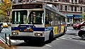
The M15 runs between South Ferry in the Financial District and 126th Street in East Harlem. [22] Southbound service uses Second Avenue from East 125th to Houston Streets, then uses First Avenue, Madison Street, Water Street and South Ferry. Limited buses made all stops south of Houston Street. Prior to the implementation of the M15 SBS, previous M15 Limited stops were eliminated at St Mark's Place and East 72nd Street north of Houston Street. Several stops south of Houston Street were also eliminated. [23] [24] During the daytime and evening hours, local service alternates between Whitehall Street and Pike Street / Cherry Street. During AM Rush Hour, some Select Bus Service trips terminate/originate at Houston St. [25] Overnight service is provided by local buses only, serving Whitehall Street-South Ferry. Select Bus Service trips terminate at the South Ferry bus loop. By then, the MTA had discontinued service to City Hall due to budget cuts. [26]

Two 2017 XD60s (6102 & 6103) on the M15 SBS laying over in the South Ferry Bus Loop at South Street/Peter Minuit Place in Lower Manhattan in June 2023, after terminated. South Ferry td (2023-06-17) 012 - Bus Loop.jpg
Two 2017 XD60s (6102 & 6103) on the M15 SBS laying over in the South Ferry Bus Loop at South Street/Peter Minuit Place in Lower Manhattan in June 2023, after terminated.
A 2017 XD60 (6039; regular wrap) on the Harlem-bound M15 local at 1st Avenue/23rd Street in Kips Bay, Manhattan. 23rd St 1st Av 13.jpg
A 2017 XD60 (6039; regular wrap) on the Harlem-bound M15 local at 1st Avenue/23rd Street in Kips Bay, Manhattan.

Select Bus Service Stops

A geographically correct map of the M15 Select Bus Service, showing all stations and connections. The route is shown in turquoise. M15-SBS-Map.png
A geographically correct map of the M15 Select Bus Service, showing all stations and connections. The route is shown in turquoise.
Station
Street traveled
DirectionConnections
126th Street Northbound terminus,
southbound station

NYC Bus: M15 Local

125th Street Bidirectional

NYC Bus: M15 Local, M35, M60 SBS, M125

115th  / 116th Streets

NYC Bus: M15 Local, M116 (at 116th Street)

106th Street

NYC Bus: M15 Local, M106

95th / 97th Streets
Metropolitan Hospital

NYC Bus: M15 Local, M96
NYC Subway: NYCS-bull-trans-N-Std.svg NYCS-bull-trans-Q-Std.svg NYCS-bull-trans-R-Std.svg at 96th Street

86th Street

NYC Bus: M15 Local, M86 SBS
NYC Subway: NYCS-bull-trans-N-Std.svg NYCS-bull-trans-Q-Std.svg NYCS-bull-trans-R-Std.svg at 86th Street

79th Street

NYC Bus: M15 Local, M79 SBS

67th / 68th Streets

NYC Bus: M15 Local, M66

57th  / 58th Streets

NYC Bus M15 Local, and MTA Bus: M31, M57, Q32, Q60, Q101

50th Street

NYC Bus: M15 Local, M50

42nd  / 44th Streets
United Nations

NYC Bus: M15 Local, M42

34th Street
NYU Langone Medical Center

NYC Bus: M15 Local, M34/M34A SBS (M34A westbound only on First Avenue)

28th  / 29th Streets
Bellevue Hospital

NYC Bus: M15 Local, M9, M34A SBS

23rd  / 25th Streets
VA Hospital

NYC Bus: M15 Local, M9, M23 SBS, M34A SBS

14th Street

NYC Bus: M14A SBS, M14D SBS, M15 Local
NYC Subway: NYCS-bull-trans-L-Std.svg train at First Avenue (northbound only)

First Street Northbound only

NYC Bus: M15 Local, M21
NYC Subway: NYCS-bull-trans-F-Std.svg NYCS-bull-trans-Fd-Std.svg trains at Second Avenue

Northbound service uses First Avenue, southbound service uses Second Avenue
Houston Street Southbound only

NYC Bus: M15 Local, M21
NYC Subway: NYCS-bull-trans-F-Std.svg NYCS-bull-trans-Fd-Std.svg trains at Second Avenue

Hester  / Grand Streets Bidirectional

NYC Bus: M15 Local
NYC Subway: NYCS-bull-trans-B-Std.svg NYCS-bull-trans-D-Std.svg trains at Grand Street

Catherine Street
Madison Street

NYC Bus: M15 Local, M22 (eastbound only

Fulton Street
South Street Seaport

NYC Bus: M15 Local
Downtown Connection: Downtown Loop

Wall Street
Water Street
South Ferry
Whitehall Terminal
Southbound terminal,
northbound station

NYC Bus: M15 Local, M20, M55
NYC Subway: NYCS-bull-trans-1-Std.svg NYCS-bull-trans-N-Std.svg NYCS-bull-trans-R-Std.svg NYCS-bull-trans-W-Std.svg trains at South Ferry/Whitehall Street
Staten Island Ferry

Related Research Articles

<span class="mw-page-title-main">5 (New York City Subway service)</span> New York City Subway service

The 5 Lexington Avenue Express is a rapid transit service in the A Division of the New York City Subway. Its route emblem, or "bullet", is colored forest green since it uses the IRT Lexington Avenue Line in Manhattan.

<span class="mw-page-title-main">M (New York City Subway service)</span> New York City Subway service

The M Queens Boulevard/Sixth Avenue Local is a rapid transit service in the B Division of the New York City Subway. Its route emblem, or "bullet", is colored orange since it is a part of the IND Sixth Avenue Line in Manhattan.

<span class="mw-page-title-main">M23 (New York City bus)</span> Bus route in Manhattan, New York

The 23rd Street Crosstown is a surface transit line on 23rd Street in Manhattan, New York City. It currently hosts the M23 SBS bus route of the Metropolitan Transportation Authority (MTA)'s Regional Bus Operations. The M23 runs between Chelsea Piers, along the West Side Highway near 22nd Street, via 23rd Street, to Avenue C and 20th Street in Stuyvesant Town–Peter Cooper Village.

<span class="mw-page-title-main">IRT Second Avenue Line</span> Former New York City rapid transit line

The IRT Second Avenue Line, also known as the Second Avenue Elevated or Second Avenue El, was an elevated railway in Manhattan, New York City, United States, from 1878 to 1942. It was operated by the Interborough Rapid Transit Company until 1940, when the city took over the IRT. Service north of the 57th Street station ended on June 11, 1940; the rest of the line closed on June 13, 1942.

<span class="mw-page-title-main">B44 (New York City bus)</span> Bus route in Brooklyn, New York

The B44 is a public transit line in Brooklyn, New York City, running mostly along Nostrand Avenue, as well as northbound on Rogers Avenue or New York Avenue and Bedford Avenue, between Sheepshead Bay and Williamsburg. Originally a streetcar line, it is now the B44 bus route, operated by the New York City Transit Authority.

<span class="mw-page-title-main">M10 and M20 buses</span> Bus routes in Manhattan, New York

The Eighth Avenue Line is a public transit line in Manhattan, New York City, running mostly along Eighth Avenue from Lower Manhattan to Harlem. Originally a streetcar line, it is now the M10 bus route and the M20 bus route, operated by the New York City Transit Authority. The M10 bus now only runs north of 57th Street, and the M20 runs south of 66th Street. The whole line was a single route, the M10, until 2000 when the M20 was created.

<span class="mw-page-title-main">M5 and M55 buses</span> Bus routes in Manhattan, New York

The M5 and M55 bus routes constitute a public transit corridor in Manhattan, New York City, running along the Fifth / Sixth Avenues / Riverside Drive Line as well as the southern portion of the Broadway Line after the discontinuation of the M6. The routes primarily run along Broadway, Fifth and Sixth Avenues, and Riverside Drive from South Ferry, Lower Manhattan to Washington Heights. The M5 covers the northern portion of the route north of 31st Street, while the M55 operates along the southern portion of the route south of 44th Street. The two routes overlap in Midtown Manhattan. The portion along Broadway south of East 8th Street was originally a streetcar line.

<span class="mw-page-title-main">M14 (New York City bus)</span> Bus routes in Manhattan, New York

The 14th Street Crosstown Line is a public transit line in Manhattan, New York City, running primarily along 14th Street from Chelsea or the West Village to the Lower East Side. Originally a streetcar line, it is now the M14 bus route, operated by the New York City Transit Authority. The line's two variants, the M14A SBS and M14D SBS, use Avenue A and Avenue D respectively from 14th Street south into the Lower East Side.

<span class="mw-page-title-main">B82 (New York City bus)</span> Bus route in Brooklyn, New York

The B82 bus route constitutes a public transit line in central Brooklyn, New York City. It connects Starrett City in southeast Brooklyn with Coney Island on Brooklyn's southwestern coast. The B82 operates primarily via Kings Highway and Flatlands Avenue in southern Brooklyn. The route is operated by MTA Regional Bus Operations, under the New York City Bus and Select Bus Service brands.

<span class="mw-page-title-main">Bx41 (New York City bus)</span> Bus route in the Bronx and Manhattan

The Bx41 is a public transit line in New York City. It runs within the borough of the Bronx, operating along Melrose and Webster Avenue.

<span class="mw-page-title-main">M1, M2, M3, and M4 buses</span> Bus routes in Manhattan, New York

The M1, M2, M3, and M4 are four local bus routes that operate the Fifth and Madison Avenues Lines – along the one-way pair of Madison and Fifth Avenues in the Manhattan borough of New York City. Though the routes also run along other major avenues, the majority of their route is along Madison and Fifth Avenues between Greenwich Village and Harlem.

<span class="mw-page-title-main">Bx12 bus</span> Bus route in New York City

The Bx12 is a public transit line in New York City running along the 207th Street Crosstown Line, within the boroughs of Manhattan and the Bronx. The line runs along 207th Street in Upper Manhattan and along the continuous Fordham Road and Pelham Parkway in the Bronx.

<span class="mw-page-title-main">Select Bus Service</span> Bus service in New York City

Select Bus Service is a brand used by the Metropolitan Transportation Authority (MTA)'s Regional Bus Operations for limited-stop bus routes with some bus rapid transit features in New York City. The first SBS route was implemented in 2008 to improve speed and reliability on long, busy corridors.

<span class="mw-page-title-main">Bus lanes in New York City</span> Bus priority system

Since 1963, New York City has been using a system of bus lanes that are intended to give priority to buses, which contain more occupants than passenger and commercial vehicles. Most of these lanes are restricted to buses only at certain days and times, but some bus lanes are restricted 24/7. As of May 2021, there are 138.4 miles (222.7 km) of bus lanes within New York City.

<span class="mw-page-title-main">Bx15 and M125 buses</span> Bus routes in Manhattan and the Bronx, New York

The Bx15 and M125 bus routes constitute the Third Avenue/125th Street Line, a public transit line in New York City. The Bx15 runs between Fordham Plaza and the Hub in the Bronx, running primarily along Third Avenue. The M125 runs between the Hub in the Bronx and Manhattanville in Manhattan, running along Willis Avenue in the South Bronx and along 125th Street in Harlem, Manhattan.

<span class="mw-page-title-main">Woodhaven and Cross Bay Boulevards buses</span> Bus routes in Queens, New York

The Q11, Q21, Q52, and Q53 bus routes constitute a public transit corridor running along Woodhaven and Cross Bay Boulevards in Queens, New York City. The corridor extends primarily along the length of the two boulevards through "mainland" Queens, a distance of 6 miles (9.7 km) between Elmhurst and the Jamaica Bay shore in Howard Beach. The Q52 and Q53 buses, which provide Select Bus Service along the corridor, continue south across Jamaica Bay to the Rockaway peninsula, one of the few public transit options between the peninsula and the rest of the city.

<span class="mw-page-title-main">Q25 and Q34 buses</span> Bus routes in Queens, New York City

The Q25 and Q34 bus routes constitute a public transit line in Queens, New York City. The south-to-north route runs primarily on Parsons Boulevard and Kissena Boulevard, serving two major bus-subway hubs: Sutphin Boulevard–Archer Avenue–Jamaica and Flushing–Main Street. The Q25 terminates in College Point, and the Q34 in Whitestone, both in northern Queens.

<span class="mw-page-title-main">Q20 and Q44 buses</span> Bus routes in Queens and the Bronx, New York

The Q20A and Q20B and Q44 bus routes constitute the Main Street Line, a public transit line in Queens, New York City, running primarily along Main Street between two major bus-subway hubs in the neighborhoods of Jamaica and Flushing. The Q20A/B terminates in College Point at the north end of Queens. The Q44 continues north into the borough of the Bronx, terminating in the West Farms neighborhood near the Bronx Zoo. The Q44 is one of two Queens bus routes to operate between the two boroughs.

<span class="mw-page-title-main">M34 and M34A buses</span> Bus routes in Manhattan, New York

The 34th Street Crosstown Line is a surface transit line on 34th Street in Manhattan, New York City, United States. It currently hosts the M34/M34A SBS routes of MTA's Regional Bus Operations. The M34 runs from 12th Avenue to FDR Drive via 34th Street, while the M34A runs from Port Authority Bus Terminal to Waterside Plaza.

References

  1. Google (May 8, 2017). "M15" (Map). Google Maps . Google. Retrieved May 8, 2017.
  2. MTA Regional Bus Operations. "M15 bus schedule".
  3. MTA Regional Bus Operations. "M15 SBS bus schedule" (PDF).
  4. "Subway and bus ridership for 2023". mta.info. April 29, 2024. Retrieved May 2, 2024.
  5. "MTA By the Numbers in 2023". MTA. Retrieved February 17, 2024.
  6. "To Speed You On Your Way..." Flickr. New York City Transit Authority. 1976. Retrieved January 13, 2020.
  7. "Metropolitan Briefs". The New York Times . September 13, 1976. ISSN   0362-4331 . Retrieved January 13, 2020.
  8. "M15 Public Hearing Handout on Span of Service to City Hall" (PDF). www.laguardiawagnerarchive.lagcc.cuny.edu. New York City Transit Authority. August 27, 1987. Retrieved March 4, 2019.
  9. "Bus Service Notices". mta.info. Metropolitan Transportation Authority. June 24, 1997. Archived from the original on July 4, 1997. Retrieved June 15, 2023.
  10. 1 2 "First Avenue/Second Avenue SBS Community Advisory Committee Meeting" (PDF). nyc.gov . Metropolitan Transportation Authority, New York City Department of Transportation. September 23, 2009. Retrieved March 7, 2016.
  11. "Bus Rapid Transit For New York City" (PDF). Schaller Consulting, Transportation Alternatives, New York Public Interest Research Group. June 2002. Retrieved December 24, 2015.
  12. November 2002 NYC Transit Committee Agenda. New York City Transit Authority. November 19, 2002. pp.  97, 98, 99-100.
  13. "Bus Service Notice". mta.info. Metropolitan Transportation Authority. Archived from the original on April 16, 2003. Retrieved June 15, 2023.
  14. "Bus Rapid Transit: NYCBRT Study" (PDF). Metropolitan Transportation Authority, New York City Department of Transportation, New York State Department of Transportation. 2004. Archived from the original (PDF) on May 12, 2005. Retrieved February 15, 2016.
  15. "Select Bus Service on the Bx12: A BRT Partnership Between the New York City DOT and MTA New York City Transit" (PDF). Metropolitan Transportation Authority, New York City Department of Transportation. January 12, 2009. Retrieved March 4, 2016.
  16. 1 2 "+selectbusservice M15 on First and Second Avenues: Progress Report" (PDF). nyc.gov. Metropolitan Transportation Authority, New York City Department of Transportation. November 2011. Retrieved March 7, 2016.
  17. "MTA Bus Company Committee Meeting Materials, July 2010" (PDF). p. 76. Archived from the original (PDF) on November 25, 2010. Retrieved August 13, 2010.
  18. "Select Bus Service - First Avenue/Second Avenue" (PDF). New York City Department of Transportation. Archived from the original (PDF) on October 21, 2012. Retrieved April 4, 2010.
  19. Grynbaum, Michael M. (October 10, 2010). "Rolling Out Speedier Bus System, to Glitches and Grumbles". The New York Times. Retrieved July 20, 2011.
  20. Chen, Jackson (January 12, 2017). "Seniors Demand Second Ave Select Bus Service at East 72nd". amNewYork. Retrieved February 3, 2024.
  21. Gartland, Michael (June 22, 2014). "Bus depot to become memorial for slaves found buried there". New York Post .
  22. Hobbs, Allegra (February 15, 2017). "Lower East Side Needs More Select Bus Service, Locals and Officials Say". DNAinfo.
  23. Krueger, Liz; Maloney, Carolyn; Quart, Dan; Seawright, Rebecca; Menin, Julie; Powers, Keith (February 16, 2022). "We write to urge the MTA to restore M15 Select Bus Service at 72nd Street" (PDF). Letter to Janno Lieber.
  24. Kattalia, Kathryn (February 7, 2011). "Riders Question Number Of M15 Stops". The Local East Village.
  25. "Select Bus Service In-Depth: M15".
  26. "Arriving into the Chatham Square stop along the City Hall Branch of the M15 MTA New York City Bus 2010 NovaBus LFS Articulated 1243".
Template:Attached KML/M15 (New York City bus)
KML is not from Wikidata
External videos
Nuvola apps kaboodle.svg SBS Bus Wrapping, Metropolitan Transportation Authority; October 12, 2010; 1:48 YouTube video clip
Nuvola apps kaboodle.svg How to Ride the M15 Select Bus Service, Metropolitan Transportation Authority; October 20, 2010; 2:10 YouTube video clip