
Houston Street is a major east–west thoroughfare in Lower Manhattan in New York City, United States. It runs the full width of the island of Manhattan, from FDR Drive along the East River in the east to the West Side Highway along the Hudson River in the west. The street is divided into west and east sections by Broadway.
Hester Street is a street in the Lower East Side of the New York City borough of Manhattan. It stretches from Essex Street to Centre Street, with a discontinuity between Chrystie Street and Forsyth Street for Sara Delano Roosevelt Park. There is also a discontinuity at Allen Street, which was created in 2009 with the rebuilding of the Allen Street Mall. At Centre Street, Hester Street shifts about 100 feet (30 m) to the north and is called Howard Street to its far western terminus at Mercer Street.

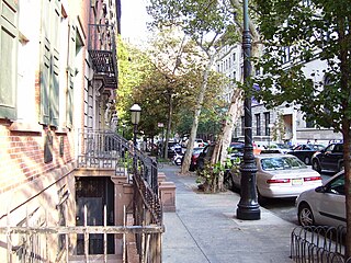
The Lower East Side, sometimes abbreviated as LES, is a historic neighborhood in the southeastern part of Manhattan in New York City. It is located roughly between the Bowery and the East River from Canal to Houston streets. Historically, it was understood to encompass a much larger area, from Broadway to the East River and from East 14th Street to Fulton and Franklin Streets.

Delancey Street is one of the main thoroughfares of New York City's Lower East Side in Manhattan, running from the street's western terminus at the Bowery to its eastern end at FDR Drive, connecting to the Williamsburg Bridge and Brooklyn at Clinton Street. It is an eight-lane, median-divided street, which is west of Clinton Street, and a service road for the Williamsburg Bridge east of Clinton Street. West of Bowery, Delancey Street becomes Kenmare Street, which continues as a four-lane, undivided street to Lafayette Street.

Rivington Street is a street in the New York City borough of Manhattan, which runs across the Lower East Side neighborhood, between the Bowery and Pitt Street, with a break between Chrystie and Forsyth for Sara D. Roosevelt Park. Vehicular traffic runs west on this one-way street.
Stuyvesant Street is one of the oldest streets in the New York City borough of Manhattan. It runs diagonally from 9th Street at Third Avenue to 10th Street near Second Avenue, all within the East Village, Manhattan, neighborhood. The majority of the street is included in the St. Mark's Historic District.
125th Street, co-named Martin Luther King Jr., Boulevard is a two-way street that runs east–west in the New York City borough of Manhattan, from First Avenue on the east to Marginal Street, a service road for the Henry Hudson Parkway along the Hudson River in the west. It is often considered to be the "Main Street" of Harlem.
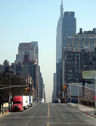
34th Street is a major crosstown street in the New York City borough of Manhattan. It runs the width of Manhattan Island from the West Side Highway on the West Side to FDR Drive on the East Side. 34th Street is used as a crosstown artery between New Jersey to the west and Queens to the east, connecting the Lincoln Tunnel to New Jersey with the Queens–Midtown Tunnel to Long Island.

The M9 is a local bus route that operates along the Avenue C Line, in Manhattan, New York City. The M9 and M21 are operated by the New York City Transit Authority, and based out of the Michael J. Quill Depot.

The M21 bus route constitutes a public transit line in Manhattan, New York City. The M21 operates between the West Village and the Lower East Side, serving as a Houston Street crosstown. The M9 and M21 are operated by the New York City Transit Authority, and based out of the Michael J. Quill Depot.

The M22 bus route constitutes a public transit line in Manhattan, New York City. The M22 operates between Battery Park City and the Lower East Side, serving as a crosstown route along Madison Street and Chambers Street.

Henry Street is a street in the Lower East Side of the New York City borough of Manhattan that runs one-way eastbound, except for two small two-way segments west of Pike Street and east of Montgomery Street. It spans from Oliver Street in the west, passing underneath the Manhattan Bridge and on to Grand Street in the east ("north"). The street is named for Henry Rutgers, a hero of the American Revolutionary War, and prominent philanthropist. Rutgers Street, which intersects with Henry Street, is also named for him.

Thomas Henry Poole was English-born architect who designed numerous churches and schools in New York City.

Chrystie Street is a street on Manhattan's Lower East Side and Chinatown, running as a continuation of Second Avenue from Houston Street, for seven blocks south to Canal Street. It is bounded on the east for its entirety by Sara D. Roosevelt Park, for the creation of which the formerly built-up east side of Chrystie Street was razed, eliminating among other structures three small synagogues. Originally called First Street, it was renamed for Col. John Chrystie, a veteran of the War of 1812 and a member of the Philolexian Society of Columbia University, and a new First Street was laid out above Houston Street.

St. Augustine's Church is located at 290 Henry Street between Montgomery and Jackson Streets on the Lower East Side of Manhattan, New York City.

St. Ann’s Church was the name of a former Roman Catholic parish church at 110-120 East 12th Street between Fourth and Third Avenues in the East Village neighborhood of Manhattan, New York City.

The Church of St. Mary is a parish church in the Roman Catholic Archdiocese of New York, located at 438–440 Grand Street between Pitt and Attorney Streets in the Lower East Side neighborhood of Manhattan, New York City. Established in 1826 to serve Irish immigrants living in the neighborhood, it is the third oldest Catholic parish in New York. St. Mary’s will celebrate its bicentennial as a parish in 2026.

14th Street is a major crosstown street in the New York City borough of Manhattan, traveling between Eleventh Avenue on Manhattan's West Side and Avenue C on Manhattan's East Side. It forms a boundary between several neighborhoods and is sometimes considered the border between Lower Manhattan and Midtown Manhattan.
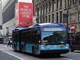
The 34th Street Crosstown Line is a surface transit line on 34th Street in Manhattan, New York City, United States. It currently hosts the M34/M34A SBS routes of MTA's Regional Bus Operations. The M34 runs from 12th Avenue to FDR Drive via 34th Street, while the M34A runs from Port Authority Bus Terminal to Waterside Plaza.


